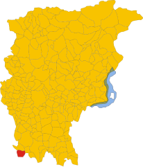
Вайлате (Vailate, Vailate)
.svg)
- коммуна Италии
 Hiking in Вайлате
Vailate, a charming village located in the Lombardy region of Italy, offers unique hiking opportunities that take advantage of its beautiful natural surroundings. While the village itself may not boast extensive hiking trails, it is situated near various natural attractions and paths in the wider area of the province of Cremona and beyond.
Hiking Opportunities Near Vailate:
-
Parco Regionale dell’Adda Nord: This regional park is not far from Vailate and features a variety of trails alongside the Adda River. You can enjoy scenic views, diverse flora, and fauna, as well as historical sites.
-
Monte Isola: A little further afield, this beautiful lake island in Lake Iseo is renowned for its trails. It offers a mix of easy and moderately challenging hikes that showcase stunning lake views and quaint villages.
-
Bergamasque Pre-Alps: The nearby pre-Alpine region has many hiking trails, from gentle walks to more challenging routes. You’ll find lush landscapes, mountain views, and the opportunity to explore charming mountain villages.
-
Nature Reserves: Look for smaller nature reserves and park areas around Vailate where you can enjoy peaceful trails away from the bustle of urban life.
Tips for Hiking in the Area:
-
Check Weather Conditions: Be sure to check the weather before heading out, as conditions can change quickly, especially in mountainous regions.
-
Wear Proper Footwear: Sturdy hiking boots are essential for stability and comfort. Make sure to dress in layers to adjust to changing temperatures.
-
Stay Hydrated and Pack Snacks: Always carry enough water and some light snacks for energy, especially on longer hikes.
-
Navigation: While some paths may be well-marked, having a map or a GPS app can help ensure that you stay on track.
-
Respect Nature: Follow Leave No Trace principles to help preserve the natural beauty of the area for future hikers.
If you plan a hiking trip near Vailate, make sure to explore all the natural beauty and enjoy the rich cultural heritage of Northern Italy!
- Страна:

- Почтовый код: 26019
- Телефонный код: 0363
- Код автомобильного номера: CR
- Координаты: 45° 28' 0" N, 9° 36' 0" E


- GPS треки (wikiloc): [Ссылка]
- Высота над уровнем моря: 105 м m
- Площадь: 9.69 кв.км
- Население: 4574
- Веб сайт: http://www.comune.vailate.cr.it/
- Википедия русская: wiki(ru)
- Википедия английская: wiki(en)
- Википедия национальная: wiki(it)
- Хранилище Wikidata: Wikidata: Q42875
- Катеория в википедии: [Ссылка]
- код Freebase: [/m/0gj_dv]
- код GeoNames: Альт: [6537228]
- код VIAF: Альт: [245390536]
- ID отношения в OpenStreetMap: [45029]
- UN/LOCODE: [ITIAE]
- код ISTAT: 019112
- кадастровый код Италии: L539
Граничит с регионами:


Кальвенцано
- коммуна Италии
Hiking in Кальвенцано
Calvenzano, located in the province of Bergamo in northern Italy, is a charming area that offers beautiful landscapes and several hiking opportunities. While it's not as well-known as some of the larger national parks in Italy, it does provide a peaceful escape into nature and a chance to explore the surrounding countryside....
- Страна:
- Почтовый код: 24040
- Телефонный код: 0363
- Код автомобильного номера: BG
- Координаты: 45° 29' 42" N, 9° 35' 58" E
- GPS треки (wikiloc): [Ссылка]
- Высота над уровнем моря: 114 м m
- Площадь: 6.72 кв.км
- Население: 4240
- Веб сайт: [Ссылка]


Мизано-ди-Джера-д'Адда
- коммуна Италии
Hiking in Мизано-ди-Джера-д'Адда
Misano di Gera d'Adda is a charming town located in the Lombardy region of Italy, not far from the Adda River. While it may not be as widely recognized for hiking as some other areas in Italy, there are still opportunities for outdoor enthusiasts to explore the natural beauty and picturesque landscapes of the surrounding countryside....
- Страна:
- Почтовый код: 24040
- Телефонный код: 0363
- Код автомобильного номера: BG
- Координаты: 45° 28' 10" N, 9° 37' 15" E
- GPS треки (wikiloc): [Ссылка]
- Высота над уровнем моря: 104 м m
- Площадь: 6.11 кв.км
- Население: 2957
- Веб сайт: [Ссылка]


Торлино-Вимеркати
- коммуна Италии
Hiking in Торлино-Вимеркати
Torlino Vimercati, located in the Lombardy region of Italy, offers a picturesque setting for hiking enthusiasts. The surrounding landscapes are characterized by rolling hills, lush greenery, and scenic views, making it an inviting spot for outdoor activities....
- Страна:
- Почтовый код: 26017
- Телефонный код: 0373
- Код автомобильного номера: CR
- Координаты: 45° 25' 0" N, 9° 36' 0" E
- GPS треки (wikiloc): [Ссылка]
- Высота над уровнем моря: 88 м m
- Площадь: 5.77 кв.км
- Население: 475
- Веб сайт: [Ссылка]
Капральба
- коммуна Италии
Hiking in Капральба
Capralba, located in the Lombardy region of Italy, is known for its serene landscapes and opportunities for outdoor activities, including hiking. While it may not be as famous as some larger hiking destinations in Italy, it offers beautiful rural scenery, charming villages, and a chance to experience nature away from the crowds....
- Страна:
- Почтовый код: 26010
- Телефонный код: 0373
- Код автомобильного номера: CR
- Координаты: 45° 27' 0" N, 9° 39' 0" E
- GPS треки (wikiloc): [Ссылка]
- Высота над уровнем моря: 93 м m
- Площадь: 13.45 кв.км
- Население: 2347
- Веб сайт: [Ссылка]
Аньаделло
- коммуна Италии
Hiking in Аньаделло
Agnadello, a small town in the Lombardy region of northern Italy, is not traditionally known as a hiking destination. However, that doesn't mean you can't enjoy nature and some outdoor activities in and around the area. Here are a few things to consider when hiking near Agnadello:...
- Страна:
- Почтовый код: 26020
- Телефонный код: 0373
- Код автомобильного номера: CR
- Координаты: 45° 27' 0" N, 9° 34' 0" E
- GPS треки (wikiloc): [Ссылка]
- Высота над уровнем моря: 94 м m
- Площадь: 12.08 кв.км
- Население: 3872
- Веб сайт: [Ссылка]

Арцаго д'Адда
- коммуна Италии
Hiking in Арцаго д'Адда
Arzago d'Adda is a small town in the Lombardy region of Italy, located along the Adda River. While it may not be one of the most widely recognized hiking destinations, it can offer some lovely outdoor experiences, especially for those looking to explore the scenic countryside and the riverbanks....
- Страна:
- Почтовый код: 24040
- Телефонный код: 0363
- Код автомобильного номера: BG
- Координаты: 45° 28' 55" N, 9° 33' 48" E
- GPS треки (wikiloc): [Ссылка]
- Высота над уровнем моря: 106 м m
- Площадь: 9.31 кв.км
- Население: 2715
- Веб сайт: [Ссылка]