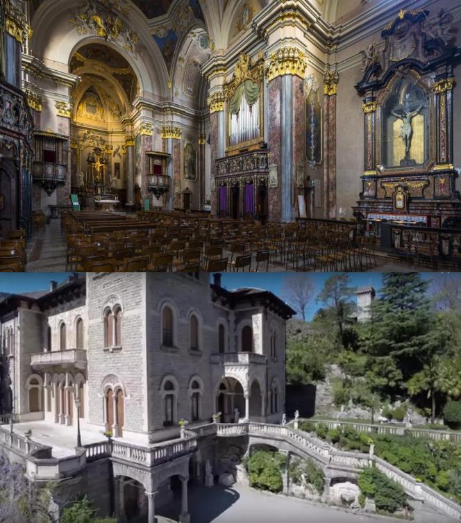
Вальброна (Valbrona, Valbrona)

- коммуна Италии
 Hiking in Вальброна
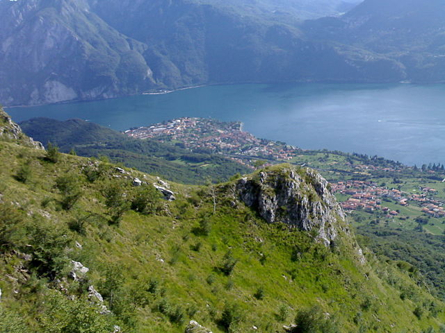
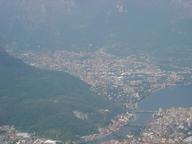
Valbrona, located in the Lombardy region of Italy, is a picturesque area near Lake Como, offering stunning landscapes and a variety of hiking opportunities. Here are some insights into hiking in Valbrona:
Scenic Trails
-
Sentiero del Viandante: This historical path runs along the eastern shore of Lake Como, offering beautiful views of the lake and mountains. Parts of this trail can be accessed from Valbrona and are suitable for various skill levels.
-
Monte Nurone: Ascending Monte Nurone is a rewarding hike that provides breathtaking panoramic views of Lake Como and the surrounding peaks. The trail offers a moderate challenge and is typically well-marked.
-
Sentiero dei Faggi: This trail features enchanting beech tree forests and gentle elevations. It’s excellent for a leisurely walk and particularly lovely in the fall when the foliage changes.
Trail Conditions
-
Well-Marked Paths: Many trails in Valbrona are well-marked and accessible, making it ideal for both beginners and experienced hikers. Both local maps and digital apps can assist with navigation.
-
Varying Difficulty Levels: Trails range from easy walks to challenging hikes, allowing for a range of experiences. Always check trail conditions before heading out.
Tips for Hiking in Valbrona
-
Weather Considerations: The weather can change rapidly in the mountains. Dress in layers and be prepared for varying conditions.
-
Footwear and Gear: Proper hiking boots are essential for comfort and safety, especially on rocky or uneven terrain. Additionally, consider bringing a trekking pole for extra stability.
-
Hydration and Snacks: Always carry enough water and snacks, as some trails may not have access to food or drinking water.
-
Local Wildlife: While hiking, keep an eye out for local wildlife, including various bird species and small mammals.
Local Attractions
-
Charming Villages: After hiking, explore the quaint villages around Valbrona, such as the town itself which offers dining and local culture.
-
Lake Como Activities: Take advantage of the proximity to Lake Como for additional activities such as sailing, swimming, or relaxing by the lakeside.
Conclusion
Hiking in Valbrona provides a perfect mix of natural beauty and cultural experience. Whether you are seeking a rigorous trek or a gentle walk through stunning scenery, Valbrona's trails offer something for everyone. Always remember to follow Leave No Trace principles and respect the environment while you enjoy the outdoors!
- Страна:

- Почтовый код: 22039
- Телефонный код: 031
- Код автомобильного номера: CO
- Координаты: 45° 52' 0" N, 9° 18' 0" E


- GPS треки (wikiloc): [Ссылка]
- Высота над уровнем моря: 494 м m
- Площадь: 13.65 кв.км
- Население: 2652
- Веб сайт: http://www.comune.valbrona.co.it
- Википедия русская: wiki(ru)
- Википедия английская: wiki(en)
- Википедия национальная: wiki(it)
- Хранилище Wikidata: Wikidata: Q47644
- Катеория в википедии: [Ссылка]
- код Freebase: [/m/0gj22d]
- код GeoNames: Альт: [6542545]
- код VIAF: Альт: [137405347]
- ID отношения в OpenStreetMap: [46359]
- идентификатор местоположения ArchINFORM: [3922]
- код ISTAT: 013229
- кадастровый код Италии: L547
Граничит с регионами:


Ассо
- коммуна Италии
Hiking in Ассо
Asso, a picturesque village located in the province of Como, Lombardy, Italy, offers a stunning backdrop for hiking enthusiasts. Nestled in the foothills of the Alps, Asso is surrounded by beautiful landscapes, characterized by lush green valleys, charming forests, and breathtaking mountain views....
- Страна:
- Почтовый код: 22033
- Телефонный код: 031
- Код автомобильного номера: CO
- Координаты: 45° 52' 0" N, 9° 16' 0" E
- GPS треки (wikiloc): [Ссылка]
- Высота над уровнем моря: 427 м m
- Площадь: 6.51 кв.км
- Население: 3579
- Веб сайт: [Ссылка]

Канцо
- коммуна Италии
Hiking in Канцо
Canzo, located in the Lombardy region of Italy, is a fantastic destination for hiking enthusiasts. Nestled in the foothills of the Italian Alps, it offers stunning landscapes, varied terrains, and plenty of trails suitable for different skill levels. Here are some highlights about hiking in Canzo:...
- Страна:
- Почтовый код: 22035
- Телефонный код: 031
- Код автомобильного номера: CO
- Координаты: 45° 51' 0" N, 9° 16' 0" E
- GPS треки (wikiloc): [Ссылка]
- Высота над уровнем моря: 402 м m
- Площадь: 11.11 кв.км
- Население: 5081
- Веб сайт: [Ссылка]
Оливето-Ларио
- коммуна Италии
Hiking in Оливето-Ларио
Oliveto Lario, located on the eastern shore of Lake Como in Italy, offers stunning landscapes and a rich assortment of hiking trails. The area is characterized by its picturesque views of the lake, charming villages, lush vegetation, and the surrounding mountains. Here are some highlights and tips for hiking in Oliveto Lario:...
- Страна:
- Почтовый код: 23865
- Телефонный код: 031
- Код автомобильного номера: LC
- Координаты: 45° 57' 0" N, 9° 16' 0" E
- GPS треки (wikiloc): [Ссылка]
- Высота над уровнем моря: 208 м m
- Площадь: 15.7 кв.км
- Население: 1227
- Веб сайт: [Ссылка]

Аббадия Лариана
- коммуна Италии
Hiking in Аббадия Лариана
Abbadia Lariana is a charming village located on the eastern shore of Lake Como in Italy, and it offers a variety of hiking opportunities ranging from easy walks to more challenging trails. The region is characterized by its stunning natural scenery, including lush forests, rugged mountains, and beautiful lake views....
- Страна:
- Почтовый код: 23821
- Телефонный код: 0341
- Код автомобильного номера: LC
- Координаты: 45° 54' 0" N, 9° 20' 0" E
- GPS треки (wikiloc): [Ссылка]
- Высота над уровнем моря: 204 м m
- Площадь: 16.67 кв.км
- Население: 3216
- Веб сайт: [Ссылка]

Вальмадрера
- коммуна Италии
Hiking in Вальмадрера
Valmadrera is a charming town located in the province of Lecco, in the Lombardy region of Italy. It is situated near the eastern shore of Lake Como and is surrounded by beautiful natural landscapes, making it a great destination for hiking enthusiasts. Here are some key highlights about hiking in Valmadrera:...
- Страна:
- Почтовый код: 23868
- Телефонный код: 0341
- Код автомобильного номера: LC
- Координаты: 45° 50' 47" N, 9° 21' 30" E
- GPS треки (wikiloc): [Ссылка]
- Высота над уровнем моря: 234 м m
- Площадь: 12.6 кв.км
- Население: 11601
- Веб сайт: [Ссылка]


Манделло-дель-Ларио
- коммуна Италии
Hiking in Манделло-дель-Ларио
Mandello del Lario, located on the eastern shore of Lake Como in Italy, offers stunning landscapes, rich history, and a variety of hiking opportunities that cater to different levels of experience. Here are some highlights of hiking in this beautiful region:...
- Страна:
- Почтовый код: 23826
- Телефонный код: 0341
- Код автомобильного номера: LC
- Координаты: 45° 55' 0" N, 9° 19' 0" E
- GPS треки (wikiloc): [Ссылка]
- Высота над уровнем моря: 200 м m
- Площадь: 43.33 кв.км
- Население: 10313
- Веб сайт: [Ссылка]
Лазниго
- коммуна Италии
Hiking in Лазниго
Lasnigo is a charming town in the Lombardy region of Italy, nestled in the foothills of the Italian Alps. It's a less-known gem for hiking enthusiasts, offering a range of trails that showcase the stunning natural beauty of the area, characterized by lush forests, breathtaking views, and picturesque landscapes....
- Страна:
- Почтовый код: 22030
- Телефонный код: 031
- Код автомобильного номера: CO
- Координаты: 45° 53' 0" N, 9° 16' 0" E
- GPS треки (wikiloc): [Ссылка]
- Высота над уровнем моря: 570 м m
- Площадь: 5.53 кв.км
- Население: 475
- Веб сайт: [Ссылка]