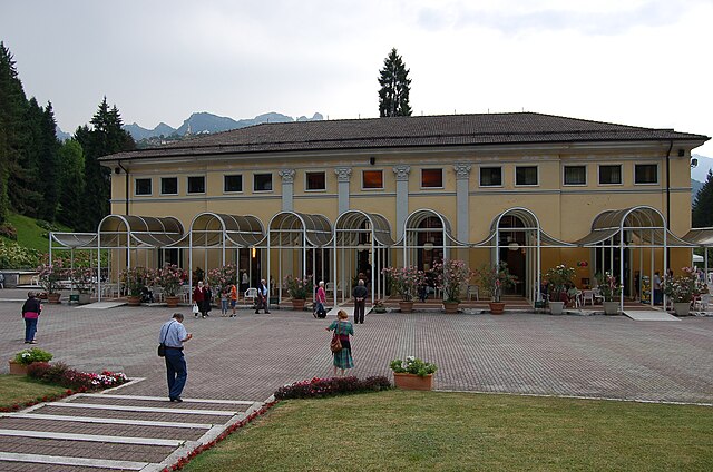
Валларса (Vallarsa, Vallarsa)
%202018.svg)
- коммуна Италии
 Hiking in Валларса
Vallarsa, located in the province of Trento in northern Italy, offers a variety of beautiful hiking opportunities for outdoor enthusiasts. Nestled in the picturesque Vallagarina Valley and surrounded by the stunning backdrop of the Lessinia and Piccole Dolomiti mountain ranges, Vallarsa is known for its dramatic landscapes, diverse flora and fauna, and rich cultural heritage.
Key Aspects of Hiking in Vallarsa:
-
Scenic Trails: The area boasts a network of well-marked hiking trails suitable for all skill levels. Trails range from easy walks to challenging routes that offer breathtaking views of the surrounding mountains, valleys, and forests.
-
Natural Beauty: Hikers can explore various ecosystems, including alpine meadows, rocky terrains, and dense forests. The region is also home to unique geological formations and a variety of wildlife, including deer and a myriad of bird species.
-
Cultural Sites: Along the trails, you may come across charming villages, historical sites, and remnants of ancient trade routes. The rich history of the region adds an intriguing cultural dimension to your hiking experience.
-
Seasonal Considerations: The best time to hike in Vallarsa generally falls between late spring and early fall, as winter snowfall can limit access to higher elevations. However, some lower trails are accessible year-round.
-
Local Guidance: Consider hiring a local guide or joining a hiking group to enhance your experience, especially if you're unfamiliar with the area. Local guides can provide insight into the region's flora, fauna, and history.
-
Accessibility: Vallarsa can be reached by public transport or car, and there are several access points to hiking trails, making it convenient for day hikes or longer treks.
-
Safety Tips: As with any hiking adventure, it's important to plan ahead, dress appropriately for the weather, carry enough water and snacks, and inform someone of your hiking plans.
Popular Hiking Routes
- Monte Rovea: A moderate hike that rewards you with stunning panoramic views from the summit.
- Sentiero dei Rassic: A well-marked trail that offers a glimpse into the local ecosystem and stunning natural scenery.
- Passo di San Valentino: A more strenuous hike that takes you to higher elevations and provides breathtaking vistas of the Dolomites.
Conclusion
Hiking in Vallarsa is a fantastic opportunity to immerse yourself in both nature and culture. Whether you are seeking a peaceful walk or an adventurous trek, Vallarsa has something to offer every hiker. Always remember to respect the local environment and adhere to Leave No Trace principles to help preserve this beautiful region for future generations.
- Страна:

- Почтовый код: 38060
- Телефонный код: 0464
- Код автомобильного номера: TN
- Координаты: 45° 46' 58" N, 11° 7' 4" E


- GPS треки (wikiloc): [Ссылка]
- Высота над уровнем моря: 724 м m
- Площадь: 77.87 кв.км
- Население: 1360
- Веб сайт: http://www.comune.vallarsa.tn.it
- Википедия русская: wiki(ru)
- Википедия английская: wiki(en)
- Википедия национальная: wiki(it)
- Хранилище Wikidata: Wikidata: Q327644
- Катеория в википедии: [Ссылка]
- код Freebase: [/m/0gb18z]
- код GeoNames: Альт: [6542644]
- код VIAF: Альт: [248334610]
- ID отношения в OpenStreetMap: [45924]
- код GND: Альт: [7698912-4]
- код ISTAT: 022210
- кадастровый код Италии: L588
Граничит с регионами:


Ала
- коммуна Италии
Hiking in Ала
Ala, located in the Trentino region of northern Italy, is a great base for hiking enthusiasts. Nestled in the Vallagarina valley, it offers a variety of trails that range from easy walks to more challenging hikes, all set against the backdrop of stunning landscapes, vineyards, and historical sites....
- Страна:
- Почтовый код: 38061
- Телефонный код: 0464
- Код автомобильного номера: TN
- Координаты: 45° 45' 0" N, 11° 0' 0" E
- GPS треки (wikiloc): [Ссылка]
- Высота над уровнем моря: 210 м m
- Площадь: 119.87 кв.км
- Население: 8887
- Веб сайт: [Ссылка]


Роверето
- коммуна Италии
Hiking in Роверето
Rovereto, located in northern Italy in the Trentino region, is surrounded by beautiful landscapes and offers a variety of hiking opportunities. The area is known for its stunning natural scenery, including mountains, valleys, and lakes. Here are some highlights about hiking in Rovereto:...
- Страна:
- Почтовый код: 38068
- Телефонный код: 0464
- Код автомобильного номера: TN
- Координаты: 45° 53' 0" N, 11° 2' 3" E
- GPS треки (wikiloc): [Ссылка]
- Высота над уровнем моря: 204 м m
- Площадь: 50.99 кв.км
- Население: 39482
- Веб сайт: [Ссылка]


Трамбилено
- коммуна Италии
Hiking in Трамбилено
Trambileno is a charming locality in the province of Trento, Italy, nestled in the stunning natural landscape of the Italian Alps. While it may not be as widely known as some other hiking destinations, it offers beautiful trails and scenic views that attract outdoor enthusiasts looking for a less-traveled path....
- Страна:
- Почтовый код: 38068
- Телефонный код: 0464
- Код автомобильного номера: TN
- Координаты: 45° 52' 0" N, 11° 4' 0" E
- GPS треки (wikiloc): [Ссылка]
- Высота над уровнем моря: 525 м m
- Площадь: 50.7 кв.км
- Население: 1471
- Веб сайт: [Ссылка]

Рекоаро-Терме
- коммуна Италии
Hiking in Рекоаро-Терме
Recoaro Terme is a beautiful destination in the Veneto region of Italy, nestled in the foothills of the Alps. Known for its thermal springs and picturesque landscapes, it's a great spot for hiking enthusiasts of all levels. Here are some highlights for hiking in Recoaro Terme:...
- Страна:
- Почтовый код: 36076
- Телефонный код: 0445
- Код автомобильного номера: VI
- Координаты: 45° 42' 0" N, 11° 14' 0" E
- GPS треки (wikiloc): [Ссылка]
- Высота над уровнем моря: 445 м m
- Площадь: 60.15 кв.км
- Население: 6306
- Веб сайт: [Ссылка]
Валли-дель-Пазубио
- коммуна Италии
Hiking in Валли-дель-Пазубио
Valli del Pasubio is a stunning area for hiking, located in the northern part of Italy within the Vicenza province of the Veneto region, close to the border with Trentino. This area is known for its picturesque landscapes, historical significance, and diverse flora and fauna....
- Страна:
- Почтовый код: 36030
- Телефонный код: 0445
- Код автомобильного номера: VI
- Координаты: 45° 45' 0" N, 11° 16' 0" E
- GPS треки (wikiloc): [Ссылка]
- Высота над уровнем моря: 350 м m
- Площадь: 49.35 кв.км
- Население: 3169
- Веб сайт: [Ссылка]