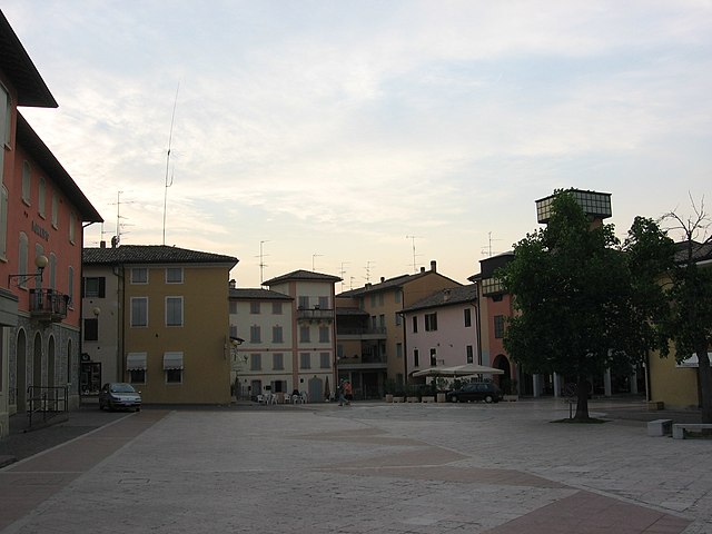
Веццано-суль-Кростоло (Vezzano sul Crostolo, Vezzano sul Crostolo)
.svg)
- коммуна Италии
 Hiking in Веццано-суль-Кростоло
Vezzano sul Crostolo, located in the province of Reggio Emilia in northern Italy, is a charming destination for hiking enthusiasts. The region is characterized by its picturesque landscapes, rolling hills, and scenic trails that offer a great way to explore the natural beauty of the Apennine foothills.
Key Highlights for Hiking in Vezzano sul Crostolo:
-
Scenic Trails: The area boasts a variety of hiking trails suitable for different skill levels, from easy walks to more challenging routes. Trails often wind through lush forests, alongside rivers, and past charming rural landscapes.
-
Natural Parks: Nearby natural parks, such as the Parco Nazionale Appennino Tosco-Emiliano, provide an excellent opportunity for hikers to experience diverse flora and fauna, as well as breathtaking views.
-
Local Flora and Fauna: While hiking, you may encounter a variety of plant species as well as wildlife typical of the region, including deer, wild boar, and a range of bird species.
-
Cultural Attractions: The area is also rich in history and culture, with ancient churches, castles, and historic villages to explore. Combining a hike with a visit to these cultural sites can enrich your experience.
-
Gastronomy: After a long hike, you can enjoy local cuisine at nearby trattorias and osterias. Try local specialties such as tortelli or gnocco fritto, which provide a delicious reward after a day of hiking.
Suggested Hiking Tips:
- Trail Maps: Make sure to obtain a trail map or use a hiking app to navigate the area’s trails.
- Weather Conditions: Check the weather forecast before heading out to ensure a safe hiking experience.
- Gear: Wear appropriate hiking shoes and bring enough water, snacks, and a first-aid kit.
- Timing: It’s ideal to start hikes early in the morning to avoid the heat and enjoy cooler temperatures, especially in the summer months.
Vezzano sul Crostolo offers an excellent blend of nature, culture, and adventure, making it a worthwhile destination for hikers visiting the Emilia-Romagna region of Italy.
- Страна:

- Почтовый код: 42030
- Телефонный код: 0522
- Код автомобильного номера: RE
- Координаты: 44° 36' 0" N, 10° 33' 0" E


- GPS треки (wikiloc): [Ссылка]
- Высота над уровнем моря: 166 м m
- Площадь: 37.82 кв.км
- Население: 4262
- Веб сайт: http://www.comune.vezzano-sul-crostolo.re.it
- Википедия русская: wiki(ru)
- Википедия английская: wiki(en)
- Википедия национальная: wiki(it)
- Хранилище Wikidata: Wikidata: Q111299
- Катеория в википедии: [Ссылка]
- код Freebase: [/m/0gkfz5]
- код GeoNames: Альт: [6538446]
- код VIAF: Альт: [249402390]
- ID отношения в OpenStreetMap: [43327]
- код GND: Альт: [4624321-5]
- идентификатор местоположения ArchINFORM: [7121]
- UN/LOCODE: [ITVSC]
- код ISTAT: 035043
- кадастровый код Италии: L820
Граничит с регионами:


Альбинея
- коммуна Италии
Hiking in Альбинея
Albinea, a charming town in the Emilia-Romagna region of Italy, offers some beautiful opportunities for hiking and enjoying nature. Nestled in the rolling hills near the city of Reggio Emilia, Albinea provides scenic views and a variety of trails suitable for different skill levels....
- Страна:
- Почтовый код: 42020
- Телефонный код: 0522
- Код автомобильного номера: RE
- Координаты: 44° 37' 0" N, 10° 36' 0" E
- GPS треки (wikiloc): [Ссылка]
- Высота над уровнем моря: 166 м m
- Площадь: 43.89 кв.км
- Население: 8830
- Веб сайт: [Ссылка]


Каносса
- коммуна Италии
Hiking in Каносса
Canossa, located in the Apennine Mountains of Italy, is a region steeped in history and natural beauty, making it a wonderful destination for hiking enthusiasts. Here are some key points about hiking in Canossa:...
- Страна:
- Почтовый код: 42026
- Телефонный код: 0522
- Код автомобильного номера: RE
- Координаты: 44° 34' 25" N, 10° 27' 19" E
- GPS треки (wikiloc): [Ссылка]
- Высота над уровнем моря: 219 м m
- Площадь: 53.08 кв.км
- Население: 3762
- Веб сайт: [Ссылка]


Казина
- коммуна Италии
Hiking in Казина
Casina is a charming village located in the Emilia-Romagna region of Italy, nestled in the Apennine foothills. When you’re looking to hike in and around Casina, you'll find a variety of trails that offer beautiful views, lush forests, and an opportunity to experience the local flora and fauna....
- Страна:
- Почтовый код: 42034
- Телефонный код: 0522
- Код автомобильного номера: RE
- Координаты: 44° 30' 40" N, 10° 30' 9" E
- GPS треки (wikiloc): [Ссылка]
- Высота над уровнем моря: 574 м m
- Площадь: 63.8 кв.км
- Население: 4492
- Веб сайт: [Ссылка]

Куаттро-Кастелла
- коммуна Италии
Hiking in Куаттро-Кастелла
Quattro Castella is a charming area located in the province of Reggio Emilia in northern Italy. Known for its picturesque landscapes, rolling hills, and rich history, it offers a variety of hiking opportunities suitable for different skill levels. Here’s what you should know about hiking in this area:...
- Страна:
- Почтовый код: 42020
- Телефонный код: 0522
- Код автомобильного номера: RE
- Координаты: 44° 38' 0" N, 10° 28' 0" E
- GPS треки (wikiloc): [Ссылка]
- Высота над уровнем моря: 160 м m
- Площадь: 46.31 кв.км
- Население: 13217
- Веб сайт: [Ссылка]


Сан-Поло-д'Энца
- коммуна Италии
Hiking in Сан-Поло-д'Энца
San Polo d'Enza is a charming village located in the Emilia-Romagna region of Italy, nestled between the Apennine mountains and the Po Valley. It's a great starting point for hikers looking to explore the natural beauty of this area, which is characterized by rolling hills, lush forests, and scenic vistas....
- Страна:
- Почтовый код: 42020
- Телефонный код: 0522
- Код автомобильного номера: RE
- Координаты: 44° 38' 0" N, 10° 26' 0" E
- GPS треки (wikiloc): [Ссылка]
- Высота над уровнем моря: 174 м m
- Площадь: 32.29 кв.км
- Население: 6156
- Веб сайт: [Ссылка]


Виано
- коммуна Италии
Hiking in Виано
Viano is a picturesque town located in the Emilia-Romagna region of Italy, characterized by its beautiful landscapes, rolling hills, and charming countryside. While it may not be as widely recognized as some other hiking destinations, it offers plenty of opportunities for outdoor enthusiasts....
- Страна:
- Почтовый код: 42030
- Телефонный код: 0522
- Код автомобильного номера: RE
- Координаты: 44° 32' 43" N, 10° 37' 28" E
- GPS треки (wikiloc): [Ссылка]
- Высота над уровнем моря: 275 м m
- Площадь: 44.97 кв.км
- Население: 3337
- Веб сайт: [Ссылка]