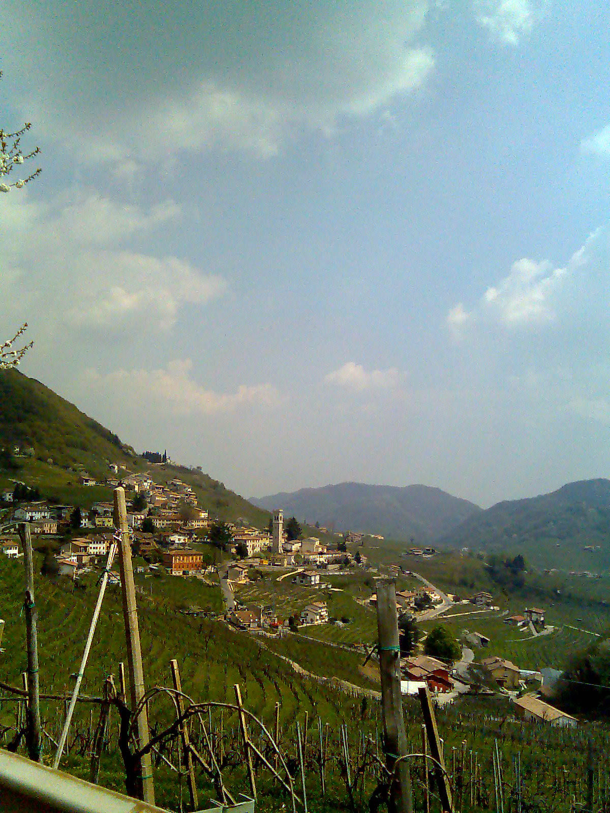
Видор (Vidor, Vidor)
.svg)
- коммуна Италии
 Hiking in Видор
Vidor, Texas, is not primarily known as a hiking destination, as it is located in a relatively flat area with limited mountainous terrain. However, there are still some outdoor activities you can enjoy in and around Vidor. Here are a few suggestions:
-
Local Parks: Vidor has several parks where you can enjoy walking trails and nature. Look for places like Vidor City Park, which may offer some green space for leisurely walks.
-
Nearby Nature Reserves: While Vidor itself may not have extensive hiking trails, nearby areas such as Big Thicket National Preserve offer more rugged terrain and a variety of hiking opportunities. The preserve features several trails that range in difficulty and provide beautiful views of the diverse ecosystems.
-
Water Activities: Since Vidor is near rivers and lakes, consider incorporating kayaking or fishing into your outdoor experience. These activities often complement hiking trips and can lead to some beautiful scenery.
-
Plan for Weather: If you decide to go hiking or walking in the area, be sure to check the weather, as Southeast Texas can experience heat and humidity, especially in the summer months. Bring plenty of water, wear appropriate clothing, and protect yourself from the sun.
-
Local Hiking Groups: If you're interested in meeting fellow outdoor enthusiasts, look for hiking clubs or outdoor groups in the nearby areas. They can provide guidance, companionship, and tips for hiking in the region.
While Vidor may not be a hiking hotspot, you can still find ways to enjoy the outdoors and incorporate hiking into your plans by exploring nearby nature preserves and parks.
- Страна:

- Почтовый код: 31020
- Телефонный код: 0423
- Код автомобильного номера: TV
- Координаты: 45° 52' 0" N, 12° 2' 0" E


- GPS треки (wikiloc): [Ссылка]
- Высота над уровнем моря: 152 м m
- Площадь: 13.43 кв.км
- Население: 3687
- Веб сайт: http://www.comune.vidor.tv.it
- Википедия русская: wiki(ru)
- Википедия английская: wiki(en)
- Википедия национальная: wiki(it)
- Хранилище Wikidata: Wikidata: Q46754
- Катеория в википедии: [Ссылка]
- код Freebase: [/m/041dv6]
- код GeoNames: Альт: [6540997]
- код VIAF: Альт: [127113662]
- ID отношения в OpenStreetMap: [46341]
- UN/LOCODE: [ITVDP]
- код ISTAT: 026090
- кадастровый код Италии: L856
Граничит с регионами:
Морьяго-делла-Батталья
- коммуна Италии
Hiking in Морьяго-делла-Батталья
Moriago della Battaglia, located in the Treviso region of Italy, is a great spot for hiking enthusiasts. The area is characterized by its scenic landscapes, rolling hills, and rich historical context, particularly the significance it held during World War I....
- Страна:
- Почтовый код: 31010
- Телефонный код: 0438
- Код автомобильного номера: TV
- Координаты: 45° 52' 0" N, 12° 6' 0" E
- GPS треки (wikiloc): [Ссылка]
- Высота над уровнем моря: 119 м m
- Площадь: 13.76 кв.км
- Население: 2815
- Веб сайт: [Ссылка]
Педеробба
- коммуна Италии
Hiking in Педеробба
Pederobba, located in the Treviso province of the Veneto region in Italy, offers beautiful landscapes and a variety of hiking opportunities. The region boasts rolling hills, vineyards, and scenic views of the nearby mountains, making it a great destination for nature enthusiasts and hikers alike....
- Страна:
- Почтовый код: 31040
- Телефонный код: 0423
- Код автомобильного номера: TV
- Координаты: 45° 52' 26" N, 11° 56' 51" E
- GPS треки (wikiloc): [Ссылка]
- Высота над уровнем моря: 174 м m
- Площадь: 27.32 кв.км
- Население: 7353
- Веб сайт: [Ссылка]

Вальдоббьадене
- коммуна Италии
Hiking in Вальдоббьадене
Valdobbiadene, located in the Veneto region of Italy, is renowned for its stunning landscapes, rolling hills, and vineyards, which are integral to the production of the famous Prosecco wine. Hiking in this area offers a fantastic opportunity to explore its natural beauty, cultural heritage, and diverse trails suitable for different skill levels....
- Страна:
- Почтовый код: 31049
- Телефонный код: 0423
- Код автомобильного номера: TV
- Координаты: 45° 54' 0" N, 11° 55' 0" E
- GPS треки (wikiloc): [Ссылка]
- Высота над уровнем моря: 247 м m
- Площадь: 62.9 кв.км
- Население: 10349
- Веб сайт: [Ссылка]
Фарра-ди-Солиго
- коммуна Италии
Hiking in Фарра-ди-Солиго
Farra di Soligo is a charming town located in the Veneto region of Italy, surrounded by beautiful landscapes and hills that are perfect for hiking. The area is known for its scenic views, vineyards, and historical sites, making it a great destination for outdoor enthusiasts and those interested in exploring Italian culture....
- Страна:
- Почтовый код: 31010
- Телефонный код: 0438
- Код автомобильного номера: TV
- Координаты: 45° 53' 0" N, 12° 7' 0" E
- GPS треки (wikiloc): [Ссылка]
- Высота над уровнем моря: 163 м m
- Площадь: 28.34 кв.км
- Население: 8798
- Веб сайт: [Ссылка]


Крочетта-Монтелло
- коммуна Италии
Hiking in Крочетта-Монтелло
Crocetta del Montello, located in the Veneto region of Italy, is an excellent destination for hiking enthusiasts. The area is known for its beautiful landscapes, rolling hills, and rich flora and fauna. Here are some highlights and tips for hiking in this region:...
- Страна:
- Почтовый код: 31035
- Телефонный код: 0423
- Код автомобильного номера: TV
- Координаты: 45° 50' 0" N, 12° 2' 0" E
- GPS треки (wikiloc): [Ссылка]
- Высота над уровнем моря: 148 м m
- Площадь: 26.57 кв.км
- Население: 6106
- Веб сайт: [Ссылка]