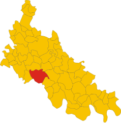
Вилланова-дель-Силларо (Villanova del Sillaro, Villanova del Sillaro)
.svg)
- коммуна Италии
 Hiking in Вилланова-дель-Силларо
Villanova del Sillaro is a charming small village located in the Emilia-Romagna region of Italy. While it may not be as famed as some larger Italian hiking destinations, it offers an enchanting landscape for those looking to explore the Italian countryside.
Hiking Options in the Area
-
Countryside Trails: The region around Villanova del Sillaro is characterized by rolling hills, farmland, and picturesque views. Several rural paths can be found, which are excellent for leisurely hikes and taking in the scenery.
-
Nearby Natural Parks: Depending on your proximity and willingness to travel a bit, the surrounding areas of Emilia-Romagna have several natural parks, such as the Parco Regionale dell’Appennino Tosco-Emiliano. These parks offer more extensive hiking trails with varied difficulty levels, beautiful forests, and stunning vistas.
-
Cultural Hikes: Incorporate a bit of local culture into your hikes. You may find trails leading to nearby historical villages or landmarks, allowing you to enjoy both the natural beauty and the rich history of the region.
Preparing for Your Hike
-
Maps and Guides: Ensure you have a reliable map or a GPS device, as some trails may be less marked. Local tourist information centers can provide helpful resources.
-
Gear: Wear appropriate hiking shoes, and dress in layers to accommodate varying weather conditions. Bring plenty of water, snacks, and a first-aid kit.
-
Weather Check: Before heading out, check the weather conditions for the day to ensure a safe and enjoyable hiking experience.
-
Local Wildlife: Be aware of the local wildlife and take necessary precautions when hiking, especially if you’re venturing into more remote areas.
Local Attractions
Consider exploring local food and wine as part of your hiking adventure. Emilia-Romagna is known for its culinary delights, including Parmigiano-Reggiano cheese and balsamic vinegar.
Conclusion
Hiking in and around Villanova del Sillaro may not offer the rugged terrains of more famous hiking areas, but it provides an intimate and scenic experience ideal for those wanting to enjoy tranquility and natural beauty. Don't forget to take the time to enjoy the local culture and cuisine while you're out exploring!
- Страна:

- Почтовый код: 26818
- Телефонный код: 0371
- Код автомобильного номера: LO
- Координаты: 45° 14' 20" N, 9° 28' 58" E


- GPS треки (wikiloc): [Ссылка]
- Высота над уровнем моря: 69 м m
- Площадь: 13.5 кв.км
- Население: 1869
- Веб сайт: http://www.comune.villanova.pc.it
- Википедия русская: wiki(ru)
- Википедия английская: wiki(en)
- Википедия национальная: wiki(it)
- Хранилище Wikidata: Wikidata: Q42251
- Катеория в википедии: [Ссылка]
- код Freebase: [/m/0gr6cz]
- код GeoNames: Альт: [6543357]
- код VIAF: Альт: [299924384]
- ID отношения в OpenStreetMap: [44503]
- код ISTAT: 098060
- кадастровый код Италии: L977
Граничит с регионами:


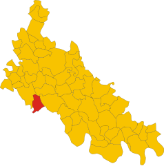
Сант-Анджело-Лодиджано
- коммуна Италии
Hiking in Сант-Анджело-Лодиджано
Sant'Angelo Lodigiano, located in the Lombardy region of Italy, offers a picturesque setting for hiking enthusiasts. While it may not be as famous as other Italian hiking destinations, it does have its own charm and opportunities for outdoor activities....
- Страна:
- Почтовый код: 26866
- Телефонный код: 0371
- Код автомобильного номера: LO
- Координаты: 45° 14' 20" N, 9° 24' 35" E
- GPS треки (wikiloc): [Ссылка]
- Высота над уровнем моря: 73 м m
- Площадь: 20.05 кв.км
- Население: 13202
- Веб сайт: [Ссылка]


Оссаго-Лодиджано
- коммуна Италии
Hiking in Оссаго-Лодиджано
Ossago Lodigiano is a small town located in the Lombardy region of Italy, not far from the larger city of Lodi. The area is primarily characterized by its flat plains, agricultural landscapes, and the proximity to the Adda River, making it a serene and picturesque setting for hiking....
- Страна:
- Почтовый код: 26816
- Телефонный код: 0371
- Код автомобильного номера: LO
- Координаты: 45° 14' 48" N, 9° 32' 17" E
- GPS треки (wikiloc): [Ссылка]
- Высота над уровнем моря: 71 м m
- Площадь: 11.53 кв.км
- Население: 1416
- Веб сайт: [Ссылка]


Пьеве-Фиссирага
- коммуна Италии
Hiking in Пьеве-Фиссирага
Pieve Fissiraga is a small town in the Lombardy region of Italy, situated near Lodi, and while it may not be a well-known hiking destination, it can serve as a starting point for exploring the surrounding countryside. Here are some insights into hiking in and around Pieve Fissiraga:...
- Страна:
- Почтовый код: 26854
- Телефонный код: 0371
- Код автомобильного номера: LO
- Координаты: 45° 15' 51" N, 9° 27' 34" E
- GPS треки (wikiloc): [Ссылка]
- Высота над уровнем моря: 76 м m
- Площадь: 12.27 кв.км
- Население: 1780
- Веб сайт: [Ссылка]

Боргетто-Лодиджано
- коммуна Италии
Hiking in Боргетто-Лодиджано
Borghetto Lodigiano, located in the Lombardy region of Italy, is a charming small town that offers a unique blend of rural landscapes and historical sights, making it a pleasant destination for hiking enthusiasts....
- Страна:
- Почтовый код: 26812
- Телефонный код: 0371
- Код автомобильного номера: LO
- Координаты: 45° 12' 57" N, 9° 30' 1" E
- GPS треки (wikiloc): [Ссылка]
- Высота над уровнем моря: 68 м m
- Площадь: 23.64 кв.км
- Население: 4302
- Веб сайт: [Ссылка]


Массаленго
- коммуна Италии
Hiking in Массаленго
Massalengo is a small municipality located in the Lombardy region of Italy, near the city of Lodi. While it may not be as well-known for hiking as some of Italy's more mountainous regions, there are still opportunities for outdoor activities in and around this area....
- Страна:
- Почтовый код: 26815
- Телефонный код: 0371
- Код автомобильного номера: LO
- Координаты: 45° 15' 57" N, 9° 29' 28" E
- GPS треки (wikiloc): [Ссылка]
- Высота над уровнем моря: 76 м m
- Площадь: 8.48 кв.км
- Население: 4571
- Веб сайт: [Ссылка]

Граффиньяна
- коммуна Италии
Hiking in Граффиньяна
Graffignana is a small town located in the Lombardy region of northern Italy. While it might not be as well-known for hiking as some other areas in Italy, there are still opportunities for outdoor enthusiasts to enjoy nature and engage in hiking activities in and around the town....
- Страна:
- Почтовый код: 26813
- Телефонный код: 0371
- Код автомобильного номера: LO
- Координаты: 45° 12' 27" N, 9° 27' 19" E
- GPS треки (wikiloc): [Ссылка]
- Высота над уровнем моря: 67 м m
- Площадь: 10.92 кв.км
- Население: 2612
- Веб сайт: [Ссылка]