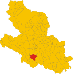
Виллаваллелонга (Villavallelonga, Villavallelonga)

- коммуна Италии
 Hiking in Виллаваллелонга
Villavallelonga is a charming village located in the Abruzzo region of Italy, nestled within the scenic landscape of the Apennine Mountains. Known for its natural beauty, Villavallelonga offers a variety of hiking opportunities suitable for all levels of experience.
Hiking Trails
-
Mount Meta: One of the most popular hikes in the area, this trail leads you to the summit of Mount Meta, offering breathtaking views of the surrounding mountains and valleys. The ascent can be challenging, but the panoramic scenery is incredibly rewarding.
-
Natural Park of Abruzzo, Lazio and Molise: The trails within this protected area are extensive and varied. You can encounter diverse fauna and flora, including the famous Marsican brown bear. Some trails are easy, making them perfect for families, while others are more demanding.
-
Cascata delle Valli: This hike takes you to beautiful waterfalls in the area. It’s a moderate trek, and the sound of cascading water adds to the serene experience.
Seasonality
- Spring and Autumn: These seasons are ideal for hiking in Villavallelonga, as the weather is mild, and the landscape is vibrant with wildflowers and changing leaves.
- Summer: While it can get hot, early morning hikes are pleasant, and the higher altitudes offer cooler temperatures.
- Winter: The area can be stunning in winter, particularly for snowshoeing or winter hiking, but it’s essential to be prepared for potential snow and icy conditions.
Tips for Hiking in Villavallelonga
- Preparation: Always check trail maps and local weather conditions before heading out. Some trails may not be well marked.
- Gear: Suitable hiking boots, weather-appropriate clothing, and trekking poles (if needed) are highly recommended. A map or a GPS device can be very useful.
- Water and Snacks: Ensure you carry enough water and some snacks, especially for longer hikes.
- Wildlife Safety: Be aware of the local wildlife and follow guidelines to keep both yourself and the animals safe.
- Respect Nature: Stay on marked trails, pack out what you bring in, and leave no trace of your visit.
Local Culture
Don’t miss the opportunity to experience Villavallelonga's local culture, including traditional Abruzzese cuisine, warm hospitality, and historical sites within the village.
Whether you’re seeking serene landscapes, wildlife encounters, or a bit of adventure, hiking in Villavallelonga is sure to provide an unforgettable experience!
- Страна:

- Почтовый код: 67050
- Телефонный код: 0863
- Код автомобильного номера: AQ
- Координаты: 41° 52' 21" N, 13° 37' 20" E


- GPS треки (wikiloc): [Ссылка]
- Высота над уровнем моря: 1005 м m
- Площадь: 73.74 кв.км
- Население: 879
- Веб сайт: http://www.comune.villavallelonga.aq.it/
- Википедия русская: wiki(ru)
- Википедия английская: wiki(en)
- Википедия национальная: wiki(it)
- Хранилище Wikidata: Wikidata: Q50170
- Катеория в википедии: [Ссылка]
- код Freebase: [/m/03vw0d]
- код GeoNames: Альт: [6537453]
- код VIAF: Альт: [240074355]
- ID отношения в OpenStreetMap: [41559]
- WOEID: [726211]
- dmoz: Альт: [Regional/Europe/Italy/Abruzzo/Localities/Villavallelonga/]
- Google Maps Customer ID: [1569981056574633040]
- код ISTAT: 066106
- кадастровый код Италии: M031
Граничит с регионами:
Камполи-Аппенино
- коммуна Италии
Hiking in Камполи-Аппенино
Campoli Appennino is a picturesque village located in the heart of the Apennine Mountains in Italy. It offers a variety of hiking opportunities with stunning landscapes, diverse flora and fauna, and rich cultural heritage. Here are some highlights and tips for hiking in this area:...
- Страна:
- Почтовый код: 03030
- Телефонный код: 0776
- Код автомобильного номера: FR
- Координаты: 41° 44' 0" N, 13° 41' 0" E
- GPS треки (wikiloc): [Ссылка]
- Высота над уровнем моря: 650 м m
- Площадь: 32.43 кв.км
- Население: 1686
- Веб сайт: [Ссылка]
Пескосолидо
- коммуна Италии
Hiking in Пескосолидо
Pescosolido is a small town located in the province of Frosinone in the Lazio region of Italy. Nestled in the Apennine Mountains, it offers beautiful landscapes and opportunities for hiking enthusiasts. Here’s some information to consider if you’re planning to hike in the area:...
- Страна:
- Почтовый код: 03030
- Телефонный код: 0776
- Код автомобильного номера: FR
- Координаты: 41° 44' 57" N, 13° 39' 27" E
- GPS треки (wikiloc): [Ссылка]
- Высота над уровнем моря: 630 м m
- Площадь: 44.9 кв.км
- Население: 1518
- Веб сайт: [Ссылка]


Бальсорано
- коммуна Италии
Hiking in Бальсорано
Balsorano, located in the Abruzzo region of Italy, is a charming destination that offers a variety of hiking opportunities amid scenic landscapes. The area is characterized by its mountainous terrain, dense forests, and picturesque valleys, making it a great spot for outdoor enthusiasts....
- Страна:
- Почтовый код: 67052
- Телефонный код: 0863
- Код автомобильного номера: AQ
- Координаты: 41° 48' 35" N, 13° 33' 35" E
- GPS треки (wikiloc): [Ссылка]
- Высота над уровнем моря: 340 м m
- Площадь: 58.85 кв.км
- Население: 3455
- Веб сайт: [Ссылка]

Коллелонго
- коммуна Италии
Hiking in Коллелонго
Collelongo is a charming town located in the province of L'Aquila in the Abruzzo region of Italy, surrounded by the stunning landscapes of the Apennine Mountains. The area is ideal for hiking enthusiasts, thanks to its diverse terrains and natural beauty....
- Страна:
- Почтовый код: 67050
- Телефонный код: 0863
- Код автомобильного номера: AQ
- Координаты: 41° 53' 16" N, 13° 35' 9" E
- GPS треки (wikiloc): [Ссылка]
- Высота над уровнем моря: 915 м m
- Площадь: 54.02 кв.км
- Население: 1190
- Веб сайт: [Ссылка]


Лечче-неи-Марси
- коммуна Италии
Hiking in Лечче-неи-Марси
Lecce nei Marsi, located in the Abruzzo region of Italy, is a beautiful area surrounded by stunning natural landscapes, making it an excellent destination for hiking enthusiasts. Here are some key points about hiking in this region:...
- Страна:
- Почтовый код: 67050
- Телефонный код: 0863
- Код автомобильного номера: AQ
- Координаты: 41° 56' 5" N, 13° 41' 16" E
- GPS треки (wikiloc): [Ссылка]
- Высота над уровнем моря: 740 м m
- Площадь: 66.4 кв.км
- Население: 1662
- Веб сайт: [Ссылка]


Пескассероли
- коммуна Италии
Hiking in Пескассероли
Pescasseroli is a charming town located in the Abruzzo region of Italy, nestled within the heart of the Parco Nazionale d'Abruzzo, Lazio e Molise. This area is known for its stunning landscapes, diverse wildlife, and a variety of hiking trails that cater to different levels of experience....
- Страна:
- Почтовый код: 67032
- Телефонный код: 0863
- Код автомобильного номера: AQ
- Координаты: 41° 48' 18" N, 13° 47' 23" E
- GPS треки (wikiloc): [Ссылка]
- Высота над уровнем моря: 1167 м m
- Площадь: 91.17 кв.км
- Население: 2203
- Веб сайт: [Ссылка]