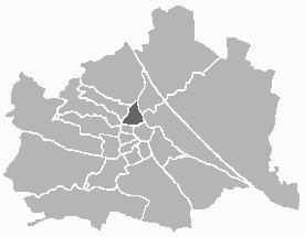
Веринг (Währing, Währing)

 Hiking in Веринг
Währing is a district in Vienna, Austria, known for its beautiful parks and hills, making it a delightful destination for hiking enthusiasts. Here are some highlights and tips for hiking in Währing:
Hiking Trails
-
Pötzleinsdorfer Schlosspark: This park features a combination of gentle terrain and modest hills. It's great for leisurely walks amidst lush greenery and historical architecture.
-
Währinger Gürtel: The areas around the Gürtel provide a scenic backdrop for hikes, with views of Vienna and surrounding landscapes. Trails vary in difficulty, allowing for both casual strolls and more challenging hikes.
-
Kahlenberg: While not directly in Währing, Kahlenberg is close by and offers some of the most popular hiking trails in the region. The views from the summit are spectacular, making it a great destination for a day hike.
-
Vienna Woods (Wienerwald): The Vienna Woods stretch just beyond Währing and offer extensive hiking opportunities. With various trails ranging from easy to challenging, you can enjoy forests, wildlife, and panoramic views of the city.
Tips for Hiking in Währing
- Plan Your Route: Before you head out, it’s good to plan your hike based on your fitness level and the time you have available.
- Check Weather Conditions: Weather in Vienna can change, so it’s always a good idea to check the forecast before you set off.
- Stay Hydrated: Bring water, especially if you plan on hiking for an extended period.
- Local Amenities: Währing has cafes and restaurants where you can rest and enjoy local cuisine after your hike.
Accessibility
Währing is easily accessible via public transport, including U-Bahn (subway) lines and bus services, making it convenient for both locals and tourists to start their hiking adventures.
Conclusion
Hiking in Währing provides a lovely blend of urban convenience and natural beauty. Whether you're looking for a peaceful stroll or an invigorating hike, this area of Vienna has something to offer for everyone. Enjoy your hike!
- Страна:

- Почтовый код: 1180
- Код автомобильного номера: W
- Координаты: 48° 13' 59" N, 16° 18' 53" E


- GPS треки (wikiloc): [Ссылка]
- Высота над уровнем моря: 247 м m
- Площадь: 6.28 кв.км
- Веб сайт: https://www.wien.gv.at/bezirke/waehring/
- Википедия русская: wiki(ru)
- Википедия английская: wiki(en)
- Википедия национальная: wiki(de)
- Хранилище Wikidata: Wikidata: Q690417
- Галерея изображений в википедии: [Ссылка]
- Катеория в википедии: [Ссылка]
- код Freebase: [/m/06fl4d]
- код GeoNames: Альт: [2762091]
- код VIAF: Альт: [133827232]
- код GND: Альт: [4079297-3]
- идентификатор местоположения ArchINFORM: [3698]
- код LCNAF: Альт: [n91027421]
- код австрийского муниципалитета: [91801]
Граничит с регионами:

Альзергрунд
Hiking in Альзергрунд
Alsergrund is one of the 23 districts of Vienna, Austria, and while it's not primarily known for hiking in the traditional sense of wilderness trails, it does offer some enjoyable walking opportunities, particularly for urban hiking or strolling through green spaces....
- Страна:
- Почтовый код: 1090
- Код автомобильного номера: W
- Координаты: 48° 13' 31" N, 16° 21' 25" E
- GPS треки (wikiloc): [Ссылка]
- Высота над уровнем моря: 179 м m
- Площадь: 2.99 кв.км
- Веб сайт: [Ссылка]
Хернальс
Hiking in Хернальс
Hernals is a district in Vienna, Austria, known for its charming neighborhoods and proximity to nature. While Hernals itself is primarily urban, the nearby areas, especially the Vienna Woods (Wienerwald), offer excellent hiking opportunities....
- Страна:
- Почтовый код: 1170
- Код автомобильного номера: W
- Координаты: 48° 13' 57" N, 16° 16' 46" E
- GPS треки (wikiloc): [Ссылка]
- Высота над уровнем моря: 224 м m
- Площадь: 11.35 кв.км
- Веб сайт: [Ссылка]


Дёблинг
- округ Вены
Hiking in Дёблинг
Döbling is a charming district in Vienna, Austria, known for its scenic landscapes, vineyards, and proximity to the Vienna Woods (Wienerwald). Here are some highlights and tips for hiking in Döbling:...
- Страна:
- Почтовый код: 1190
- Код автомобильного номера: W
- Координаты: 48° 15' 59" N, 16° 19' 22" E
- GPS треки (wikiloc): [Ссылка]
- Высота над уровнем моря: 247 м m
- Площадь: 24.9 кв.км
- Веб сайт: [Ссылка]