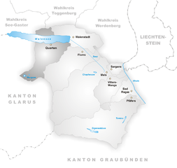
Валенштадт (Walenstadt, Walenstadt)

 Hiking in Валенштадт
Walenstadt is a charming town located in the canton of St. Gallen, Switzerland, known for its picturesque views of the surrounding mountains and Lake Walensee. The area offers a variety of hiking opportunities for different skill levels, making it a great destination for outdoor enthusiasts. Here are some highlights and tips for hiking in and around Walenstadt:
Popular Hiking Trails
-
Walensee Panorama Trail: This scenic trail follows the shoreline of Lake Walensee, offering stunning views of the water and the towering mountains. It's a relatively easy hike, making it suitable for families and casual walkers.
-
Churfirsten Mountain Range: For those looking for more challenging hikes, the Churfirsten mountain range offers numerous trails. The hike to the Churfirsten summit provides breathtaking views of the surrounding area and can be challenging but rewarding.
-
Flumserberg: Easily accessible from Walenstadt, the Flumserberg region offers a mix of hiking trails, from easy walks to demanding climbs. The area is well-marked and provides facilities such as restaurants and picnic spots.
-
Hike to the Grotto of St. Margrethen: This lesser-known trail leads to a beautiful grotto and can be combined with a trek in the nearby forested areas. It's a nice option for those seeking a quieter experience.
Tips for Hiking in Walenstadt
-
Weather Check: Always check the weather forecast before heading out, as conditions can change rapidly in the mountains.
-
Gear: Wear appropriate hiking gear, including sturdy shoes, and dress in layers to accommodate changing temperatures.
-
Maps and Signage: Trails around Walenstadt are generally well-marked, but it’s always useful to carry a printed map or download a navigation app as a backup.
-
Hydration and Snacks: Bring plenty of water and some snacks to keep your energy up, especially on longer hikes.
-
Local Information: Stop by the local tourist office in Walenstadt to get the latest trail maps, information on current trail conditions, and any recommended routes.
Best Time to Hike
The best times to hike in Walenstadt are during the spring, summer, and early fall months (April to October) when the weather is temperate, and most trails are accessible. Winter hiking is also an option, particularly for snowshoeing or winter walks, but it may require specific preparations and gear.
Conclusion
Overall, hiking in Walenstadt provides an unforgettable experience with breathtaking landscapes, diverse trails, and a chance to immerse yourself in the natural beauty of Switzerland. Whether you're a beginner or an experienced hiker, you'll find something that suits your needs in this beautiful region. Happy hiking!
- Страна:

- Почтовый код: 8880
- Телефонный код: 081
- Код автомобильного номера: SG
- Координаты: 47° 7' 24" N, 9° 18' 54" E


- GPS треки (wikiloc): [Ссылка]
- Высота над уровнем моря: 613 м m
- Площадь: 45.81 кв.км
- Население: 5598
- Веб сайт: http://www.walenstadt.ch
- Википедия русская: wiki(ru)
- Википедия английская: wiki(en)
- Википедия национальная: wiki(de)
- Хранилище Wikidata: Wikidata: Q64191
- Катеория в википедии: [Ссылка]
- код Freebase: [/m/087k8_]
- код GeoNames: Альт: [7287525]
- код VIAF: Альт: [150448641]
- ID отношения в OpenStreetMap: [1683959]
- код GND: Альт: [4398231-1]
- идентификатор местоположения ArchINFORM: [8888]
- место в MusicBrainz: [d3905b63-a4b8-4ffc-8395-d485ef671270]
- идентификатор HDS: [1359]
- код швейцарского муниципалитета: [3298]
Граничит с регионами:

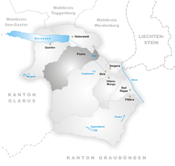
Квартен
Hiking in Квартен
Quarten is a beautiful hiking destination located in the Canton of St. Gallen in Switzerland, nestled near Lake Zurich. The region is known for its stunning scenery, with breathtaking views of the Swiss Alps, lush forests, and charming alpine meadows. Here are some highlights and tips for hiking in Quarten:...
- Страна:
- Почтовый код: 8883
- Телефонный код: 081
- Код автомобильного номера: SG
- Координаты: 47° 5' 4" N, 9° 13' 15" E
- GPS треки (wikiloc): [Ссылка]
- Высота над уровнем моря: 1420 м m
- Площадь: 61.90 кв.км
- Население: 2877
- Веб сайт: [Ссылка]


Вартау
Hiking in Вартау
Wartau, located in the canton of St. Gallen in Switzerland, is a beautiful destination for hiking enthusiasts. The region boasts stunning landscapes, including rolling hills, picturesque valleys, and views of the Swiss Alps....
- Страна:
- Почтовый код: 9478
- Телефонный код: 081
- Код автомобильного номера: SG
- Координаты: 47° 4' 59" N, 9° 29' 0" E
- GPS треки (wikiloc): [Ссылка]
- Высота над уровнем моря: 472 м m
- Площадь: 41.74 кв.км
- Население: 5296
- Веб сайт: [Ссылка]


Грабс
- коммуна в Швейцарии
Hiking in Грабс
Grabs is a picturesque village located in the canton of St. Gallen in Switzerland, making it an excellent base for hiking enthusiasts. The region is characterized by its stunning Alpine scenery, charming villages, and a variety of hiking trails suitable for different skill levels....
- Страна:
- Почтовый код: 9472
- Телефонный код: 081
- Код автомобильного номера: SG
- Координаты: 47° 10' 59" N, 9° 27' 0" E
- GPS треки (wikiloc): [Ссылка]
- Высота над уровнем моря: 1082 м m
- Площадь: 54.65 кв.км
- Население: 6951
- Веб сайт: [Ссылка]


Зефелен
Hiking in Зефелен
Sevelen, located in the canton of St. Gallen in Switzerland, is a picturesque village surrounded by stunning natural landscapes, making it a great destination for hiking enthusiasts. Here are some key points to consider if you're planning to hike in Sevelen:...
- Страна:
- Почтовый код: 9475
- Телефонный код: 081
- Код автомобильного номера: SG
- Координаты: 47° 7' 14" N, 9° 29' 8" E
- GPS треки (wikiloc): [Ссылка]
- Высота над уровнем моря: 681 м m
- Площадь: 30.34 кв.км
- Население: 5049
- Веб сайт: [Ссылка]

Флумс
Hiking in Флумс
Flums is a picturesque village located in the Swiss canton of St. Gallen, surrounded by stunning landscapes and mountainous terrain, making it a fantastic destination for hikers of all levels. Here’s a brief overview of what you can expect when hiking in Flums:...
- Страна:
- Почтовый код: 8890
- Телефонный код: 081
- Код автомобильного номера: SG
- Координаты: 47° 5' 34" N, 9° 20' 38" E
- GPS треки (wikiloc): [Ссылка]
- Высота над уровнем моря: 1124 м m
- Площадь: 75.03 кв.км
- Население: 4941
- Веб сайт: [Ссылка]