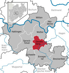
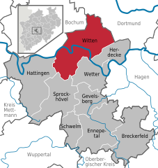
Веттер (Рур) (Wetter (Ruhr), Wetter (Ruhr))

%20in%20EN.svg)
 Hiking in Веттер (Рур)
Wetter (Ruhr) is a charming municipality located in the North Rhine-Westphalia region of Germany, offering a variety of outdoor recreation opportunities, including hiking. Nestled in the Ruhr area, it features scenic landscapes that appeal to outdoor enthusiasts. Here are some key points about hiking in Wetter (Ruhr):
Trails and Nature:
-
Ruhr Valley Trails: The region is home to numerous trails that follow the Ruhr River, providing hikers with beautiful views of the riverbanks, lush forests, and picturesque landscapes. The Ruhr Valley trail (RuhrtalRadweg) is ideal for both hiking and cycling.
-
Local Nature Reserves: Nearby nature reserves, such as the Harkortsee and the surrounding forests, offer well-marked hiking trails that vary in difficulty. This diverse terrain allows for leisurely walks as well as more challenging hikes.
-
The Märkischer Kreis: While Wetter itself has trails, the nearby Märkischer Kreis offers additional hiking routes and natural parks, providing options for day trips.
Recommendations for Hikers:
-
Preparation: Always check the weather conditions before heading out, as they can change quickly in this area. Make sure to wear appropriate footwear and clothing.
-
Navigation: Although many trails are well-marked, carrying a map or using a hiking app can help you stay oriented and discover new routes.
-
Local Amenities: Wetter (Ruhr) has various amenities, including cafes and restaurants where you can rest and enjoy local cuisine. Consider planning your hike around these spots for a more enjoyable experience.
-
Hiking Groups: Joining local hiking groups or guided tours can enhance your experience by providing insights into the natural and cultural history of the area.
Conclusion:
Hiking in Wetter (Ruhr) offers a blend of natural beauty and cultural experiences, making it an excellent destination for both casual hikers and more serious outdoor enthusiasts. Whether you're exploring the riverside trails or venturing into the surrounding forests, you're likely to find a rewarding outdoor experience.
- Страна:

- Почтовый код: 58300
- Телефонный код: 02335
- Код автомобильного номера: EN
- Координаты: 51° 23' 17" N, 7° 23' 42" E


- GPS треки (wikiloc): [Ссылка]
- Высота над уровнем моря: 110 м m
- Площадь: 31.47 кв.км
- Население: 27628
- Веб сайт: https://www.stadt-wetter.de/
- Википедия русская: wiki(ru)
- Википедия английская: wiki(en)
- Википедия национальная: wiki(de)
- Хранилище Wikidata: Wikidata: Q11343
- Галерея изображений в википедии: [Ссылка]
- Катеория в википедии: [Ссылка]
- Карты в википедии: [Ссылка]
- код Freebase: [/m/08tk2w]
- код GeoNames: Альт: [2809984]
- код VIAF: Альт: [158395946]
- ID отношения в OpenStreetMap: [162832]
- код GND: Альт: [4065854-5]
- идентификатор местоположения ArchINFORM: [11517]
- код LCNAF: Альт: [n89146551]
- место в MusicBrainz: [ea24fbcb-e8c6-42f4-a6a5-c92e8a3466fe]
- идентификатор муниципалитетов в Германии: 05954032
- код GNS: -1887095
Включает регионы:
Esborn
Hiking in Esborn
Esborn is a charming village located in the North Rhine-Westphalia region of Germany, situated near the city of Wetter and the picturesque Ruhr valley. The area offers a variety of hiking opportunities that cater to different skill levels and preferences....
- Страна:
- Почтовый код: 58300
- Телефонный код: 02335
- Координаты: 51° 23' 11" N, 7° 20' 12" E
- GPS треки (wikiloc): [Ссылка]
- Высота над уровнем моря: 142 м m


Венгерн
- район города Веттера, Германия
Hiking in Венгерн
Wengern, located in the Bernese Oberland region of Switzerland, is a stunning area for hiking, offering breathtaking views of the Alps, lush meadows, and charming alpine villages. Here’s a guide to what you can expect when hiking in Wengern:...
- Страна:
- Почтовый код: 58300
- Телефонный код: 02335
- Координаты: 51° 24' 1" N, 7° 20' 39" E
- GPS треки (wikiloc): [Ссылка]
- Высота над уровнем моря: 92 м m
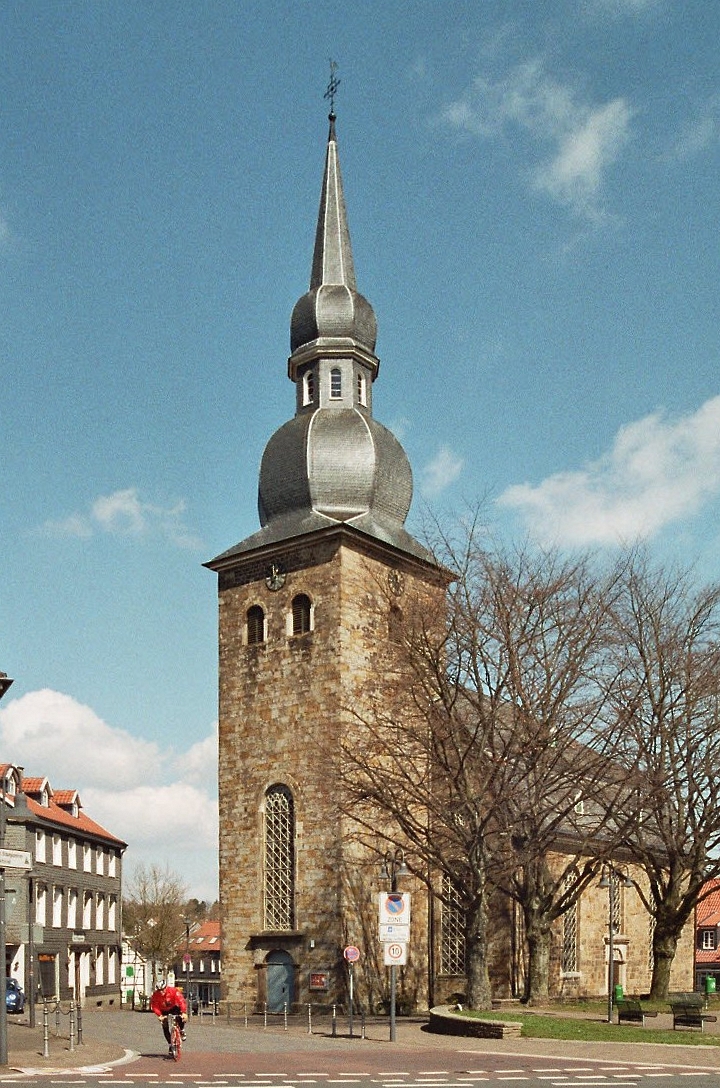
Веттер
Hiking in Веттер
Alt-Wetter is a beautiful region in Germany, offering a diverse range of hiking opportunities that cater to various skill levels. Nestled in the heart of nature, it features picturesque landscapes, lush forests, and rolling hills. Here are some highlights and tips for hiking in Alt-Wetter:...
- Страна:
- Координаты: 51° 22' 52" N, 7° 23' 13" E
- GPS треки (wikiloc): [Ссылка]
Volmarstein
Hiking in Volmarstein
Volmarstein is a district in the city of Wetter (Ruhr) in North Rhine-Westphalia, Germany. While it may not be as widely known for hiking as larger national parks or mountainous regions, there are certainly opportunities for walking and enjoying nature in and around the area....
- Страна:
- Почтовый код: 58300
- Телефонный код: 02335
- Координаты: 51° 22' 17" N, 7° 23' 2" E
- GPS треки (wikiloc): [Ссылка]
- Высота над уровнем моря: 176 м m
Граничит с регионами:

Гефельсберг
Hiking in Гефельсберг
Gevelsberg, a charming town located in North Rhine-Westphalia, Germany, offers several opportunities for hiking enthusiasts to explore its picturesque landscapes. Nestled in the Ruhr area, Gevelsberg is surrounded by beautiful natural settings, including rolling hills, forests, and scenic valleys....
- Страна:
- Почтовый код: 58285
- Телефонный код: 02332
- Код автомобильного номера: EN
- Координаты: 51° 18' 0" N, 7° 20' 0" E
- GPS треки (wikiloc): [Ссылка]
- Высота над уровнем моря: 170 м m
- Площадь: 26.27 кв.км
- Население: 30910
- Веб сайт: [Ссылка]


Хердекке
Hiking in Хердекке
Herdecke is a charming town located in North Rhine-Westphalia, Germany, situated near the Ruhr River and surrounded by picturesque landscapes, making it a great destination for hiking enthusiasts. The region is characterized by rolling hills, forests, and scenic views, providing a variety of trails for different skill levels....
- Страна:
- Почтовый код: 58313
- Телефонный код: 02330
- Код автомобильного номера: EN
- Координаты: 51° 24' 0" N, 7° 26' 0" E
- GPS треки (wikiloc): [Ссылка]
- Высота над уровнем моря: 150 м m
- Площадь: 22.4 кв.км
- Население: 22836
- Веб сайт: [Ссылка]
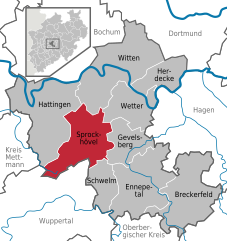
Шпрокхёфель
Hiking in Шпрокхёфель
Sprockhövel is a charming town located in North Rhine-Westphalia, Germany, and is surrounded by beautiful landscapes that are ideal for hiking enthusiasts. Here are some highlights and tips for hiking in the Sprockhövel area:...
- Страна:
- Почтовый код: 45549
- Телефонный код: 0202; 02324; 02339
- Код автомобильного номера: EN, WIT
- Координаты: 51° 21' 0" N, 7° 15' 0" E
- GPS треки (wikiloc): [Ссылка]
- Высота над уровнем моря: 219 м m
- Площадь: 48 кв.км
- Население: 24783
- Веб сайт: [Ссылка]

Хаген
- город в Германии
Hiking in Хаген
Hagen, located in North Rhine-Westphalia, Germany, offers a variety of hiking opportunities that showcase the area's natural beauty and diverse landscapes. Here are some highlights and tips for hiking in and around Hagen:...
- Страна:
- Почтовый код: 58000–58135
- Телефонный код: 02331; 02304; 02337; 02334
- Код автомобильного номера: HA
- Координаты: 51° 21' 34" N, 7° 28' 30" E
- GPS треки (wikiloc): [Ссылка]
- Высота над уровнем моря: 106 м m
- Площадь: 160.45 кв.км
- Население: 188266
- Веб сайт: [Ссылка]

Виттен
- город в Германии
Hiking in Виттен
Witten, located in North Rhine-Westphalia, Germany, offers a variety of hiking opportunities that showcase the region's natural beauty and historical sites. Here are some highlights for hiking in and around Witten:...
- Страна:
- Почтовый код: 58456; 58455; 58454; 58453; 58452
- Телефонный код: 02302
- Координаты: 51° 26' 0" N, 7° 20' 0" E
- GPS треки (wikiloc): [Ссылка]
- Высота над уровнем моря: 104 м m
- Площадь: 72.37 кв.км
- Население: 96565
- Веб сайт: [Ссылка]