Вольфсберг (Wolfsberg District, Bezirk Wolfsberg)
- округ в Австрии, Каринтия
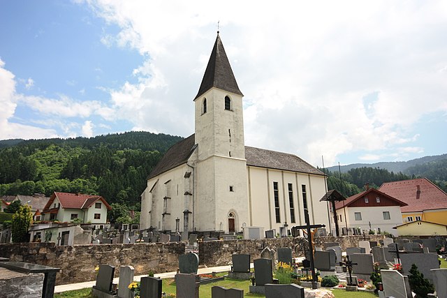
 Hiking in Вольфсберг
Wolfsberg District, located in the Carinthia region of Austria, is known for its stunning landscapes, rich cultural history, and extensive hiking opportunities. Here are some highlights for hiking in the area:
Scenic Trails
-
Wolfsberg's Nature Trails: There are numerous marked trails that vary in difficulty, catering to both beginners and experienced hikers. The surroundings include lush forests, serene lakes, and panoramic views of the surrounding mountains.
-
Lavanttal Valley: The Lavanttal Valley offers beautiful trails, showcasing the natural beauty of the area. Hiking along the Lavant river provides a unique experience of both water and mountain scenery.
-
Karnisch Alps: For those seeking more challenging hikes, the Karnisch Alps provide rugged trails and breathtaking vistas. Some routes take you to higher altitudes with rewarding views of the alpine landscape.
Hiking Highlights
-
Vogelsberg: This popular hiking area offers a variety of paths for all skill levels. Look for trails that feature stunning views of nearby mountains and valleys.
-
Schloss Wolfsberg: A hike around or to this historical castle offers both cultural enrichment and lovely views of the surrounding area.
-
Lakes and Waterfalls: There are various hikes that lead to picturesque lakes and waterfalls. These are great spots to take a break and enjoy the tranquil environment.
Tips for Hiking in Wolfsberg District
-
Weather Considerations: Always check the weather forecast before heading out, as conditions can change rapidly in mountainous areas.
-
Local Maps and Guides: It’s advisable to carry a local hiking map or use a hiking app to stay on track. The local visitor center can also provide information about the trails.
-
Proper Gear: Wear appropriate hiking boots and dress in layers to adapt to changing weather conditions. Don’t forget essentials like water, snacks, and a first aid kit.
-
Wildlife and Nature: Keep an eye out for diverse wildlife and the unique flora that the region has to offer. Stay on marked trails to protect the natural environment.
Accessibility
Many trails in the Wolfsberg District are accessible from the local towns, making it easy to explore the beautiful landscape. Public transportation options can often take you close to starting points for various hikes.
Whether you're looking for a leisurely stroll or a more demanding hike, the Wolfsberg District offers a rewarding outdoor experience amidst stunning natural beauty.
- Страна:

- Столица: Вольфсберг
- Код автомобильного номера: WO
- Координаты: 46° 50' 31" N, 14° 51' 36" E


- GPS треки (wikiloc): [Ссылка]
- Высота над уровнем моря: 455 м m
- Веб сайт: http://www.verwaltung.ktn.gv.at/cgi-bin/evoweb.dll/web/akl/406_DE
- Википедия русская: wiki(ru)
- Википедия английская: wiki(en)
- Википедия национальная: wiki(de)
- Хранилище Wikidata: Wikidata: Q665641
- Катеория в википедии: [Ссылка]
- код Freebase: [/m/0dzv5d]
- код GeoNames: Альт: [2760908]
- код VIAF: Альт: [144359237]
- идентификатор местоположения ArchINFORM: [14657]
- код LCNAF: Альт: [n88221654]
Включает регионы:

Вольфсберг
- муниципалитет в Австрии, Каринтия, Вольфсберг
Hiking in Вольфсберг
Wolfsberg, located in the Carinthia region of Austria, is surrounded by beautiful landscapes ideal for hiking. The area is characterized by its rolling hills, dense forests, and picturesque alpine views, making it a great destination for both novice and experienced hikers. Here are some highlights and tips for hiking in this region:...
- Страна:
- Почтовый код: 9400
- Телефонный код: 04352
- Код автомобильного номера: WO
- Координаты: 46° 50' 31" N, 14° 50' 27" E
- GPS треки (wikiloc): [Ссылка]
- Высота над уровнем моря: 463 м m
- Площадь: 278.30 кв.км
- Население: 25035
- Веб сайт: [Ссылка]

Санкт-Андре
Hiking in Санкт-Андре
Sankt Andrä, located in Austria, is a picturesque region that offers a variety of hiking opportunities for outdoor enthusiasts. The area is characterized by its stunning landscapes, including rolling hills, forests, and nearby mountains, making it ideal for both casual walks and more challenging hikes....
- Страна:
- Почтовый код: 9433
- Телефонный код: 04358
- Код автомобильного номера: WO
- Координаты: 46° 46' 0" N, 14° 49' 0" E
- GPS треки (wikiloc): [Ссылка]
- Высота над уровнем моря: 446 м m
- Площадь: 113.5 кв.км
- Население: 9957
- Веб сайт: [Ссылка]

Прайтенег
Hiking in Прайтенег
Preitenegg is a picturesque region located in Austria, known for its stunning natural landscapes and diverse hiking opportunities. Nestled in the foothills of the Alps, it offers various trails suitable for hikers of all skill levels, from leisurely walks to more challenging hikes....
- Страна:
- Почтовый код: 9451
- Телефонный код: 04354
- Код автомобильного номера: WO
- Координаты: 46° 56' 25" N, 14° 55' 18" E
- GPS треки (wikiloc): [Ссылка]
- Высота над уровнем моря: 1078 м m
- Площадь: 68.34 кв.км
- Население: 932
- Веб сайт: [Ссылка]

Бад-Санкт-Леонхард-им-Лафантталь
- политическая община в Австрии
Hiking in Бад-Санкт-Леонхард-им-Лафантталь
Bad Sankt Leonhard im Lavanttal is a picturesque village located in Austria’s Carinthia region, known for its stunning natural landscapes and excellent hiking opportunities. Here are some key points about hiking in this area:...
- Страна:
- Почтовый код: 9462
- Телефонный код: 04350
- Код автомобильного номера: WO
- Координаты: 46° 57' 45" N, 14° 47' 41" E
- GPS треки (wikiloc): [Ссылка]
- Высота над уровнем моря: 714 м m
- Площадь: 111.83 кв.км
- Население: 4375
- Веб сайт: [Ссылка]
Франчах-Санкт-Гертрауд
Hiking in Франчах-Санкт-Гертрауд
Frantschach-Sankt Gertraud is a picturesque area located in Austria, known for its stunning natural landscapes and variety of hiking opportunities. Here are some highlights and considerations for hiking in this region:...
- Страна:
- Почтовый код: 9413
- Телефонный код: 04352
- Код автомобильного номера: WO
- Координаты: 46° 51' 31" N, 14° 56' 7" E
- GPS треки (wikiloc): [Ссылка]
- Высота над уровнем моря: 1168 м m
- Площадь: 100.97 кв.км
- Население: 2605
- Веб сайт: [Ссылка]

Санкт-Георген-им-Лавантталь
Hiking in Санкт-Георген-им-Лавантталь
Sankt Georgen im Lavanttal, located in Austria, offers a variety of scenic hiking opportunities amidst beautiful natural landscapes. The region is characterized by its rolling hills, lush forests, and the stunning backdrop of the Lavant Valley. Here’s what you need to know for a hiking experience in this area:...
- Страна:
- Почтовый код: 9423
- Телефонный код: 0 43 57
- Код автомобильного номера: WO
- Координаты: 46° 44' 24" N, 14° 57' 40" E
- GPS треки (wikiloc): [Ссылка]
- Высота над уровнем моря: 1204 м m
- Площадь: 7239 кв.км
- Население: 1981
- Веб сайт: [Ссылка]

Райхенфельс
Hiking in Райхенфельс
Reichenfels, a picturesque village located in Carinthia, Austria, is surrounded by stunning natural landscapes that make it an excellent destination for hiking enthusiasts. Here are some key points about hiking in and around Reichenfels:...
- Страна:
- Почтовый код: 9463
- Телефонный код: 04359
- Код автомобильного номера: WO
- Координаты: 47° 0' 27" N, 14° 44' 37" E
- GPS треки (wikiloc): [Ссылка]
- Высота над уровнем моря: 809 м m
- Площадь: 87.21 кв.км
- Население: 1851
- Веб сайт: [Ссылка]

Санкт-Пауль-им-Лавантталь
Hiking in Санкт-Пауль-им-Лавантталь
Sankt Paul im Lavanttal is a picturesque area in Austria, located in Carinthia. It offers a variety of hiking opportunities suitable for all skill levels, making it a great destination for outdoor enthusiasts. Here are some highlights of hiking in Sankt Paul im Lavanttal:...
- Страна:
- Почтовый код: 9470
- Телефонный код: 04357
- Код автомобильного номера: WO
- Координаты: 46° 42' 8" N, 14° 52' 7" E
- GPS треки (wikiloc): [Ссылка]
- Высота над уровнем моря: 412 м m
- Площадь: 47.32 кв.км
- Население: 3303
- Веб сайт: [Ссылка]

Лафамюнд
Hiking in Лафамюнд
Lavamünd is a picturesque town located in Austria, near the border with Slovenia, and is surrounded by beautiful natural landscapes, making it an excellent destination for hiking enthusiasts. Here are some highlights and tips for hiking in the Lavamünd area:...
- Страна:
- Почтовый код: 9473
- Телефонный код: 04356
- Код автомобильного номера: WO
- Координаты: 46° 38' 30" N, 14° 56' 30" E
- GPS треки (wikiloc): [Ссылка]
- Высота над уровнем моря: 348 м m
- Площадь: 93.78 кв.км
- Население: 2941
- Веб сайт: [Ссылка]
Граничит с регионами:


Мурау
Hiking in Мурау
Murau District, located in Styria, Austria, is a fantastic destination for hiking enthusiasts. Characterized by its stunning natural landscapes, lush forests, and picturesque alpine scenery, the area offers a variety of trails suitable for different skill levels, from gentle walks to challenging hikes....
- Страна:
- Код автомобильного номера: MU
- Координаты: 47° 7' 1" N, 14° 16' 59" E
- GPS треки (wikiloc): [Ссылка]
- Высота над уровнем моря: 1510 м m
- Площадь: 1384 кв.км
- Население: 28388