Агатенбург (Agathenburg, Agathenburg)

 Hiking in Агатенбург
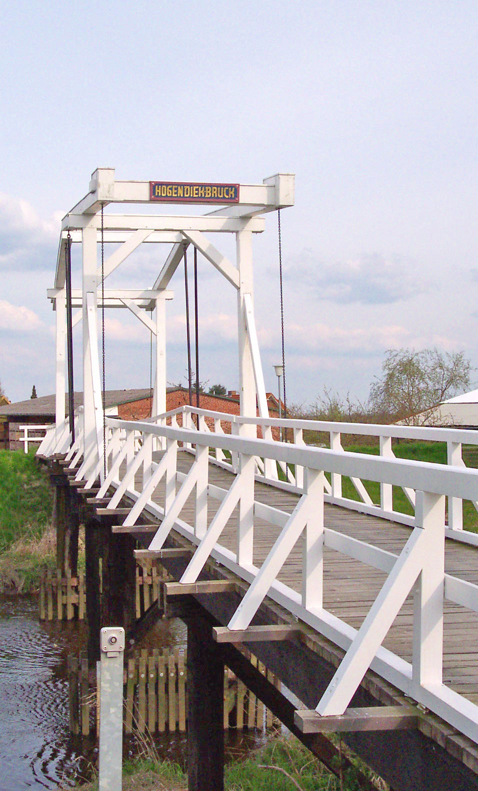
Agathenburg is a small municipality located in Lower Saxony, Germany, and while it may not be as widely recognized as major hiking destinations, it offers opportunities for outdoor enthusiasts who enjoy tranquil and scenic landscapes.
-
Nearby Nature Parks: Agathenburg is situated close to several nature reserves and parks where you can hike. The surrounding countryside features beautiful landscapes, including forests, meadows, and rivers. Look for nature trails that provide an opportunity to explore local flora and fauna.
-
Walking and Biking Trails: Local trails may not be extensive, but you can often find walking and biking paths that wind through the area. These trails can provide a pleasant day out and can typically accommodate different skill levels.
-
Local Experience: Hiking in Agathenburg allows you to experience the charm of rural Germany, with quiet roads, agricultural fields, and small villages. It's a great way to connect with the local environment and culture.
-
Planning Your Hike: Before heading out, check local guides or apps for trail maps and conditions. Make sure to wear appropriate hiking gear, stay hydrated, and be aware of the weather forecast. Starting with shorter trails is recommended if you're unfamiliar with the area.
-
Accessibility: If you're relying on public transport, ensure you check the bus or train services that connect Agathenburg to other nearby destinations with larger hiking areas.
-
Safety: As with any hiking experience, it's important to inform someone about your hiking plans and estimated return time, especially in less populated areas.
While Agathenburg may not be a hiking hotspot, exploring it can be a delightful experience for those looking to escape into nature and enjoy a peaceful outing.
- Страна:

- Почтовый код: 21684
- Телефонный код: 04141
- Код автомобильного номера: STD
- Координаты: 53° 33' 50" N, 9° 31' 47" E


- GPS треки (wikiloc): [Ссылка]
- Высота над уровнем моря: 16 м m
- Площадь: 11.32 кв.км
- Население: 1177
- Веб сайт: http://www.horneburg.de/
- Википедия русская: wiki(ru)
- Википедия английская: wiki(en)
- Википедия национальная: wiki(de)
- Хранилище Wikidata: Wikidata: Q391337
- Катеория в википедии: [Ссылка]
- код Freebase: [/m/02r_gbd]
- код Freebase: [/m/02r_gbd]
- код Freebase: [/m/02r_gbd]
- код GeoNames: Альт: [6552780]
- код GeoNames: Альт: [6552780]
- код GeoNames: Альт: [6552780]
- код VIAF: Альт: [234309753]
- код VIAF: Альт: [234309753]
- код VIAF: Альт: [234309753]
- ID отношения в OpenStreetMap: [445842]
- ID отношения в OpenStreetMap: [445842]
- ID отношения в OpenStreetMap: [445842]
- код GND: Альт: [4359025-1]
- код GND: Альт: [4359025-1]
- код GND: Альт: [4359025-1]
- идентификатор муниципалитетов в Германии: 03359001
- идентификатор муниципалитетов в Германии: 03359001
- идентификатор муниципалитетов в Германии: 03359001
Граничит с регионами:

Штайнкирхен
Hiking in Штайнкирхен
Steinkirchen, located in Lower Saxony, Germany, is a charming small town that offers access to beautiful natural landscapes ideal for hiking. The area is characterized by its picturesque surroundings, making it a fantastic destination for outdoor enthusiasts. Here are some highlights and tips for hiking in Steinkirchen and its nearby areas:...
- Страна:
- Почтовый код: 21720
- Телефонный код: 04142
- Код автомобильного номера: STD
- Координаты: 53° 32' 59" N, 9° 35' 59" E
- GPS треки (wikiloc): [Ссылка]
- Высота над уровнем моря: 7 м m
- Площадь: 9.55 кв.км
- Население: 1644
- Веб сайт: [Ссылка]


Гудерхандфиртель
Hiking in Гудерхандфиртель
Guderhandviertel is a small village located in the North Rhine-Westphalia state of Germany, surrounded by scenic landscapes that are perfect for hiking enthusiasts. While it may not be as widely known as some larger hiking destinations, it offers a range of trails suitable for various experience levels....
- Страна:
- Почтовый код: 21720
- Телефонный код: 04163; 04142
- Код автомобильного номера: STD
- Координаты: 53° 33' 0" N, 9° 37' 0" E
- GPS треки (wikiloc): [Ссылка]
- Высота над уровнем моря: 2 м m
- Площадь: 8.94 кв.км
- Население: 1119
- Веб сайт: [Ссылка]


Доллерн
Hiking in Доллерн
Dollern is a quaint village located in Lower Saxony, Germany, which is surrounded by beautiful natural landscapes, making it suitable for hiking enthusiasts. While it may not be a well-known hiking destination, here are some aspects you might consider when hiking in and around Dollern:...
- Страна:
- Почтовый код: 21739
- Телефонный код: 04163
- Код автомобильного номера: STD
- Координаты: 53° 32' 0" N, 9° 33' 0" E
- GPS треки (wikiloc): [Ссылка]
- Высота над уровнем моря: 31 м m
- Площадь: 11.96 кв.км
- Население: 2052
- Веб сайт: [Ссылка]


Холлерн-Твиленфлет
Hiking in Холлерн-Твиленфлет
Hollern-Twielenfleth is a small district located in Lower Saxony, Germany, along the banks of the Elbe River. While it may not be a widely recognized hiking destination like larger natural parks, it offers some enjoyable opportunities for outdoor activities, particularly for those who appreciate scenic views and peaceful surroundings....
- Страна:
- Почтовый код: 21723
- Телефонный код: 04141
- Код автомобильного номера: STD
- Координаты: 53° 36' 0" N, 9° 32' 0" E
- GPS треки (wikiloc): [Ссылка]
- Высота над уровнем моря: 2 м m
- Площадь: 20.46 кв.км
- Население: 3436
- Веб сайт: [Ссылка]


Штаде
- город в Германии, в земле Нижняя Саксония
Hiking in Штаде
Stade is a picturesque town in Lower Saxony, Germany, with a rich maritime history and beautiful surroundings. While Stade itself may not be a well-known hiking destination, it is located near several natural areas and parks that offer hiking opportunities. Here are some aspects to consider for hiking in and around Stade:...
- Страна:
- Почтовый код: 21684; 21683; 21682; 21680
- Телефонный код: 04141
- Код автомобильного номера: STD
- Координаты: 53° 36' 3" N, 9° 28' 35" E
- GPS треки (wikiloc): [Ссылка]
- Высота над уровнем моря: 9 м m
- Площадь: 110.04 кв.км
- Население: 46378
- Веб сайт: [Ссылка]