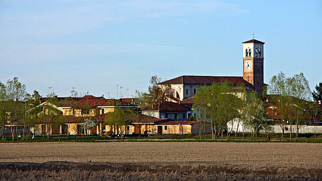
Альбонезе (Albonese, Albonese)
.svg)
- коммуна Италии
 Hiking in Альбонезе
It seems there may be some confusion, as "Albonese" does not appear to correspond to a known hiking location or region in the context of popular hiking destinations. However, if you meant a specific area, region, or park that is similar in name or if you could provide more context (such as country or notable features), I would be happy to help you with information on hiking opportunities there.
If you're looking for general hiking advice or information about a different area, please let me know!
- Страна:

- Почтовый код: 27020
- Телефонный код: 0384
- Код автомобильного номера: PV
- Координаты: 45° 18' 0" N, 8° 42' 0" E


- GPS треки (wikiloc): [Ссылка]
- Высота над уровнем моря: 113 м m
- Площадь: 4.33 кв.км
- Население: 553
- Веб сайт: http://www.comune.albonese.pv.it
- Википедия русская: wiki(ru)
- Википедия английская: wiki(en)
- Википедия национальная: wiki(it)
- Хранилище Wikidata: Wikidata: Q39868
- Катеория в википедии: [Ссылка]
- код Freebase: [/m/0gjglp]
- код GeoNames: Альт: [6540623]
- ID отношения в OpenStreetMap: [44628]
- UN/LOCODE: [ITAL9]
- код ISTAT: 018003
- кадастровый код Италии: A171
Граничит с регионами:
Борголавеццаро
- коммуна Италии
Hiking in Борголавеццаро
Borgolavezzaro is a small village in the province of Novara, located in the Piedmont region of Italy. The area surrounding Borgolavezzaro offers a unique blend of natural beauty, scenic landscapes, and cultural experiences that can make hiking here enjoyable....
- Страна:
- Почтовый код: 28071
- Телефонный код: 0321
- Код автомобильного номера: NO
- Координаты: 45° 19' 0" N, 8° 42' 0" E
- GPS треки (wikiloc): [Ссылка]
- Высота над уровнем моря: 118 м m
- Площадь: 21.09 кв.км
- Население: 2041
- Веб сайт: [Ссылка]


Никорво
- коммуна Италии
Hiking in Никорво
Nicorvo is a smaller and relatively lesser-known destination for hiking, primarily situated in Italy. Although not as famous as other regions, it still offers scenic views, natural beauty, and opportunities for outdoor activities. While the specific trails and routes in Nicorvo may not be extensively documented, here are some general tips and considerations for hiking in smaller or less commercialized areas:...
- Страна:
- Почтовый код: 27020
- Телефонный код: 0384
- Код автомобильного номера: PV
- Координаты: 45° 17' 0" N, 8° 40' 0" E
- GPS треки (wikiloc): [Ссылка]
- Высота над уровнем моря: 115 м m
- Площадь: 8.08 кв.км
- Население: 300
- Веб сайт: [Ссылка]


Чилавенья
- коммуна Италии
Hiking in Чилавенья
Cilavegna is a small town in the Lombardy region of Italy, located in the province of Pavia. While it is not widely known as a major hiking destination, there are opportunities for walking and enjoying nature in the surrounding areas....
- Страна:
- Почтовый код: 27024
- Телефонный код: 0381
- Код автомобильного номера: PV
- Координаты: 45° 19' 0" N, 8° 45' 0" E
- GPS треки (wikiloc): [Ссылка]
- Высота над уровнем моря: 115 м m
- Площадь: 18.05 кв.км
- Население: 5548
- Веб сайт: [Ссылка]


Парона
- коммуна Италии
Hiking in Парона
Hiking in Parona, a small town in the province of Pavia in Lombardy, Italy, offers a variety of picturesque routes. Nestled in a region characterized by rolling hills, vineyards, and proximity to the Po River, Parona is an excellent base for exploring the natural beauty of the area. Here are some key points to consider for hiking in and around Parona:...
- Страна:
- Почтовый код: 27020
- Телефонный код: 0384
- Код автомобильного номера: PV
- Координаты: 45° 16' 54" N, 8° 45' 2" E
- GPS треки (wikiloc): [Ссылка]
- Высота над уровнем моря: 113 м m
- Площадь: 9.3 кв.км
- Население: 1903
- Веб сайт: [Ссылка]


Мортара
- коммуна Италии
Hiking in Мортара
Mortara, located in the Lombardy region of northern Italy, is not primarily known as a hiking destination due to its flat and agricultural landscape. However, it does offer some opportunities for outdoor activities and nature walks within the surrounding areas. Here are a few points to consider if you're interested in hiking near Mortara:...
- Страна:
- Почтовый код: 27036
- Телефонный код: 0384
- Код автомобильного номера: PV
- Координаты: 45° 15' 0" N, 8° 45' 0" E
- GPS треки (wikiloc): [Ссылка]
- Высота над уровнем моря: 108 м m
- Площадь: 52 кв.км
- Население: 15355
- Веб сайт: [Ссылка]