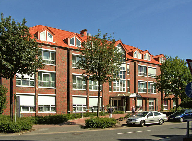
Альгермиссен (Algermissen, Algermissen)

- община в земле Нижняя Саксония (Германия)
 Hiking in Альгермиссен
Algermissen is a small municipality located in Lower Saxony, Germany. While it may not be as well-known for hiking as larger natural parks or mountainous regions, there are still opportunities for outdoor activities in and around the area.
Hiking Opportunities:
-
Local Trails: Algermissen is surrounded by rural landscapes, with potential paths and trails suitable for walking and hiking. Explore the countryside, farms, and smaller woodlands typical of this region.
-
Nearby Natural Reserves: Consider venturing slightly further to explore natural areas and reserves in Lower Saxony. For example, the surrounding forests and meadows might offer additional trails for a more elevated hiking experience.
-
Bike and Hike: Given the flat terrain around Algermissen, combining hiking and biking could be a great way to experience more of the landscape.
Tips for Hiking in Algermissen:
- Maps: Make sure to carry a local map or use a GPS-enabled app to track your route, as marked trails might be limited.
- Safety: Inform someone about your plans if you’re heading out alone. It’s also a good idea to have a basic first aid kit.
- Weather: Check the weather forecast before heading out, as conditions can change quickly, especially in the spring or autumn.
Resources:
Local hiking clubs or community centers might have additional information on organized hikes or recommended trails in and around Algermissen. Enjoy your hiking adventure!
- Страна:

- Почтовый код: 31191
- Телефонный код: 05126
- Код автомобильного номера: HI
- Координаты: 52° 15' 12" N, 9° 58' 9" E


- GPS треки (wikiloc): [Ссылка]
- Высота над уровнем моря: 79 м m
- Площадь: 35.62 кв.км
- Население: 7840
- Веб сайт: http://www.algermissen.de/
- Википедия русская: wiki(ru)
- Википедия английская: wiki(en)
- Википедия национальная: wiki(de)
- Хранилище Wikidata: Wikidata: Q574412
- Катеория в википедии: [Ссылка]
- код Freebase: [/m/0c736p]
- код Freebase: [/m/0c736p]
- код GeoNames: Альт: [2958509]
- код GeoNames: Альт: [2958509]
- код VIAF: Альт: [239487347]
- код VIAF: Альт: [239487347]
- ID отношения в OpenStreetMap: [91859]
- ID отношения в OpenStreetMap: [91859]
- код GND: Альт: [4112484-4]
- код GND: Альт: [4112484-4]
- идентификатор местоположения ArchINFORM: [354]
- идентификатор местоположения ArchINFORM: [354]
- код Historical Gazetteer: [ALGSENJO42XG]
- код Historical Gazetteer: [ALGSENJO42XG]
- идентификатор муниципалитетов в Германии: 03254003
- идентификатор муниципалитетов в Германии: 03254003
Граничит с регионами:


Латцен
Hiking in Латцен
Laatzen, located in Lower Saxony, Germany, offers access to several beautiful hiking opportunities, particularly within the surrounding areas, such as the nearby Hannover region and various trails in natural reserves. Here are some key points to consider if you're interested in hiking in or around Laatzen:...
- Страна:
- Почтовый код: 30880
- Телефонный код: 0511; 05102
- Код автомобильного номера: H
- Координаты: 52° 19' 0" N, 9° 48' 0" E
- GPS треки (wikiloc): [Ссылка]
- Высота над уровнем моря: 46 м m
- Площадь: 34.05 кв.км
- Население: 40939
- Веб сайт: [Ссылка]

Харзум
Hiking in Харзум
Harsum, located in Lower Saxony, Germany, is a charming area that offers various outdoor activities, including hiking. While it may not be as well-known as some larger hiking destinations, there are several trails and natural areas worth exploring....
- Страна:
- Почтовый код: 31177
- Телефонный код: 05128; 05127
- Код автомобильного номера: HI
- Координаты: 52° 12' 0" N, 9° 57' 0" E
- GPS треки (wikiloc): [Ссылка]
- Высота над уровнем моря: 70 м m
- Площадь: 49.93 кв.км
- Население: 11367
- Веб сайт: [Ссылка]


Зарштедт
Hiking in Зарштедт
Sarstedt, located in the Lower Saxony region of Germany, offers a variety of hiking opportunities that are great for both novice and experienced hikers. While the immediate area may not have the dramatic landscapes found in other parts of Germany, it provides a charming environment with scenic trails and beautiful natural surroundings....
- Страна:
- Почтовый код: 31157
- Телефонный код: 05066
- Код автомобильного номера: HI
- Координаты: 52° 14' 22" N, 9° 51' 38" E
- GPS треки (wikiloc): [Ссылка]
- Высота над уровнем моря: 64 м m
- Площадь: 42.94 кв.км
- Население: 19262
- Веб сайт: [Ссылка]


Хоэнхамельн
Hiking in Хоэнхамельн
Hohenhameln, a charming village located in Lower Saxony, Germany, is surrounded by scenic landscapes that are ideal for hiking enthusiasts. While it may not be one of the more famous hiking destinations, it offers a peaceful experience for those looking to explore the countryside....
- Страна:
- Почтовый код: 31249
- Телефонный код: 05128
- Код автомобильного номера: PE
- Координаты: 52° 15' 27" N, 10° 3' 51" E
- GPS треки (wikiloc): [Ссылка]
- Высота над уровнем моря: 104 м m
- Площадь: 69.42 кв.км
- Население: 9174
- Веб сайт: [Ссылка]


Зенде
Hiking in Зенде
Sehnde is a quaint town located in Lower Saxony, Germany, not too far from Hanover. While it's not primarily known as a hiking destination, there are several beautiful trails and natural areas around Sehnde that outdoor enthusiasts can enjoy....
- Страна:
- Почтовый код: 31319
- Телефонный код: 05138; 05132
- Код автомобильного номера: H
- Координаты: 52° 18' 58" N, 9° 57' 51" E
- GPS треки (wikiloc): [Ссылка]
- Высота над уровнем моря: 53 м m
- Площадь: 103.58 кв.км
- Население: 23584
- Веб сайт: [Ссылка]