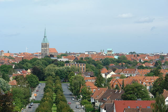
Харзум (Harsum, Harsum)

 Hiking in Харзум
Harsum, located in Lower Saxony, Germany, is a charming area that offers various outdoor activities, including hiking. While it may not be as well-known as some larger hiking destinations, there are several trails and natural areas worth exploring.
Hiking Opportunities in and around Harsum:
-
Local Trails: Harsum is surrounded by scenic countryside and forests, providing a variety of walking paths. The area is relatively flat and easy to navigate, making it suitable for hikers of all skill levels.
-
Nature Reserves: Nearby nature reserves often have marked hiking trails, allowing you to enjoy the local flora and fauna. The region's landscapes can range from lush fields to wooded areas, with opportunities to spot local wildlife.
-
Access to Larger Trails: Harsum is located near larger hiking circuits in the Harz region, which can be reached by car or public transport. If you're up for a day trip, consider exploring the trails that lead through the Harz National Park, offering more challenging hikes and stunning views.
-
Urban Hiking: If you prefer a more urban environment, you can also explore Harsum itself and its surroundings on foot, allowing you to take in local architecture and culture while enjoying leisurely walks.
Tips for Hiking in Harsum:
-
Prepare for Weather: Check the local weather conditions before heading out, as it can change quickly. Dress in layers and wear appropriate hiking shoes.
-
Trail Maps: Make sure to have a map of the local trails, either printed or on your smartphone, as some paths may not be well-marked.
-
Hydration and Snacks: Carry sufficient water and snacks to keep your energy up, especially if you plan on hiking for several hours.
-
Volunteers and Guides: Consider joining local hiking groups or guided tours if you're unfamiliar with the area. This can enhance your experience and ensure you don’t miss any highlights.
-
Respect Nature: Stick to marked trails, take your trash with you, and respect wildlife and local regulations.
Hiking in Harsum can be a delightful experience for those looking to escape into nature while enjoying the quiet charm of the Lower Saxony countryside. Happy hiking!
- Страна:

- Почтовый код: 31177
- Телефонный код: 05128; 05127
- Код автомобильного номера: HI
- Координаты: 52° 12' 0" N, 9° 57' 0" E


- GPS треки (wikiloc): [Ссылка]
- Высота над уровнем моря: 70 м m
- Площадь: 49.93 кв.км
- Население: 11367
- Веб сайт: http://www.harsum.de
- Википедия русская: wiki(ru)
- Википедия английская: wiki(en)
- Википедия национальная: wiki(de)
- Хранилище Wikidata: Wikidata: Q531536
- Катеория в википедии: [Ссылка]
- код Freebase: [/m/0c7384]
- код Freebase: [/m/0c7384]
- код GeoNames: Альт: [2910269]
- код GeoNames: Альт: [2910269]
- код VIAF: Альт: [154847894]
- код VIAF: Альт: [154847894]
- ID отношения в OpenStreetMap: [69785]
- ID отношения в OpenStreetMap: [69785]
- код GND: Альт: [4119882-7]
- код GND: Альт: [4119882-7]
- код LCNAF: Альт: [n85357521]
- код LCNAF: Альт: [n85357521]
- место в MusicBrainz: [5f342103-5f99-481e-a693-04051fcb1676]
- место в MusicBrainz: [5f342103-5f99-481e-a693-04051fcb1676]
- WOEID: [657429]
- WOEID: [657429]
- идентификатор муниципалитетов в Германии: 03254020
- идентификатор муниципалитетов в Германии: 03254020
Граничит с регионами:

Хильдесхайм
- город в Нижней Саксонии, Германия
Hiking in Хильдесхайм
Hildesheim, located in Lower Saxony, Germany, offers a variety of hiking opportunities that cater to different skill levels and interests. The region is rich in natural beauty, historic sites, and charming villages. Here are some highlights for hiking in and around Hildesheim:...
- Страна:
- Почтовый код: 31101–31141
- Телефонный код: 05121
- Код автомобильного номера: HI
- Координаты: 52° 9' 0" N, 9° 57' 0" E
- GPS треки (wikiloc): [Ссылка]
- Высота над уровнем моря: 78 м m
- Площадь: 92.29 кв.км
- Население: 101701
- Веб сайт: [Ссылка]


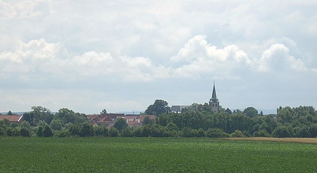
Зарштедт
Hiking in Зарштедт
Sarstedt, located in the Lower Saxony region of Germany, offers a variety of hiking opportunities that are great for both novice and experienced hikers. While the immediate area may not have the dramatic landscapes found in other parts of Germany, it provides a charming environment with scenic trails and beautiful natural surroundings....
- Страна:
- Почтовый код: 31157
- Телефонный код: 05066
- Код автомобильного номера: HI
- Координаты: 52° 14' 22" N, 9° 51' 38" E
- GPS треки (wikiloc): [Ссылка]
- Высота над уровнем моря: 64 м m
- Площадь: 42.94 кв.км
- Население: 19262
- Веб сайт: [Ссылка]


Хоэнхамельн
Hiking in Хоэнхамельн
Hohenhameln, a charming village located in Lower Saxony, Germany, is surrounded by scenic landscapes that are ideal for hiking enthusiasts. While it may not be one of the more famous hiking destinations, it offers a peaceful experience for those looking to explore the countryside....
- Страна:
- Почтовый код: 31249
- Телефонный код: 05128
- Код автомобильного номера: PE
- Координаты: 52° 15' 27" N, 10° 3' 51" E
- GPS треки (wikiloc): [Ссылка]
- Высота над уровнем моря: 104 м m
- Площадь: 69.42 кв.км
- Население: 9174
- Веб сайт: [Ссылка]

Альгермиссен
- община в земле Нижняя Саксония (Германия)
Hiking in Альгермиссен
Algermissen is a small municipality located in Lower Saxony, Germany. While it may not be as well-known for hiking as larger natural parks or mountainous regions, there are still opportunities for outdoor activities in and around the area....
- Страна:
- Почтовый код: 31191
- Телефонный код: 05126
- Код автомобильного номера: HI
- Координаты: 52° 15' 12" N, 9° 58' 9" E
- GPS треки (wikiloc): [Ссылка]
- Высота над уровнем моря: 79 м m
- Площадь: 35.62 кв.км
- Население: 7840
- Веб сайт: [Ссылка]


Гизен
Hiking in Гизен
Giesen, located in Lower Saxony, Germany, is a great spot for hiking enthusiasts. The region is characterized by its natural beauty, with lush forests, rolling hills, and the nearby Leine River, which offers picturesque landscapes....
- Страна:
- Почтовый код: 31180
- Телефонный код: 05121; 05066
- Код автомобильного номера: HI
- Координаты: 52° 12' 0" N, 9° 53' 0" E
- GPS треки (wikiloc): [Ссылка]
- Высота над уровнем моря: 70 м m
- Площадь: 33.90 кв.км
- Население: 9698
- Веб сайт: [Ссылка]


Шеллертен
Hiking in Шеллертен
Schellerten is a small town in Lower Saxony, Germany, located near the city of Hildesheim. While it may not be as widely known as some other hiking destinations, it does offer access to some scenic outdoor spaces and trails suitable for hiking enthusiasts....
- Страна:
- Почтовый код: 31174
- Телефонный код: 05123
- Код автомобильного номера: HI
- Координаты: 52° 10' 0" N, 10° 5' 0" E
- GPS треки (wikiloc): [Ссылка]
- Высота над уровнем моря: 99 м m
- Площадь: 80.02 кв.км
- Население: 8014
- Веб сайт: [Ссылка]