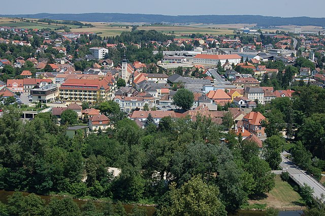
Альтенбург (Нижняя Австрия) (Altenburg, Lower Austria, Altenburg)
 Hiking in Альтенбург (Нижняя Австрия)
Altenburg, located in Lower Austria, is a beautiful area for hiking enthusiasts. The region is characterized by rolling hills, picturesque landscapes, and rich forests, making it ideal for outdoor adventures.
Hiking Trails:
-
Altenburg Circuit: This popular trail takes you around the town and through surrounding countryside, offering stunning views of vineyards and forests. It's well-marked and suitable for various skill levels.
-
The Traisen Valley: This trail leads you along the Traisen River, showcasing diverse flora and fauna. It’s a great option for those who enjoy a more serene and scenic environment.
-
Burg Kreuzenstein: A hike that combines history with nature, featuring views of the historic Kreuzenstein Castle. The trail is moderately challenging and rewards hikers with gorgeous panoramas.
-
Historical Paths: Altenburg is rich in history, and some hiking routes take you to notable historical sites, providing both a workout and a cultural experience.
Best Time to Hike:
The best time to hike in Altenburg is during the spring and early autumn when the weather is mild, and the landscape is particularly beautiful with blooming flowers or vibrant autumn colors.
Tips for Hiking in Altenburg:
- Trail Maps: Always carry a trail map or download a hiking app with offline maps, as some areas might have limited cell service.
- Footwear: Wear sturdy, comfortable hiking boots, as some trails may be uneven or hilly.
- Weather Preparation: Check the weather forecast before you head out and be prepared for sudden changes, especially in mountainous regions.
- Hydration and Snacks: Bring enough water and energy snacks to keep you energized throughout your hike.
- Leave No Trace: Respect nature by following Leave No Trace principles, ensuring you pack out what you pack in.
Exploring Altenburg’s hiking paths allows you to experience the natural beauty of Lower Austria while enjoying physical activity in a peaceful setting. Enjoy your hike!
- Страна:

- Почтовый код: 3591
- Телефонный код: 02982
- Код автомобильного номера: HO
- Координаты: 48° 39' 0" N, 15° 35' 0" E


- GPS треки (wikiloc): [Ссылка]
- Высота над уровнем моря: 388 м m
- Площадь: 28.1 кв.км
- Население: 828
- Веб сайт: http://www.altenburg.gv.at
- Википедия русская: wiki(ru)
- Википедия английская: wiki(en)
- Википедия национальная: wiki(de)
- Хранилище Wikidata: Wikidata: Q436918
- Катеория в википедии: [Ссылка]
- код Freebase: [/m/02qx7x9]
- код GeoNames: Альт: [7872895]
- код австрийского муниципалитета: [31101]
- код Цифрового атласа Римской империи: [42783]
Граничит с регионами:
Гарс-ам-Камп
Hiking in Гарс-ам-Камп
Gars am Kamp is a picturesque village located in Lower Austria, known for its scenic landscapes and well-marked hiking trails. Nestled in the Kamp Valley, it offers a mix of cultural heritage and natural beauty, making it a great destination for hikers of all levels....
- Страна:
- Почтовый код: 3571
- Телефонный код: 02985
- Код автомобильного номера: HO
- Координаты: 48° 35' 57" N, 15° 39' 48" E
- GPS треки (wikiloc): [Ссылка]
- Высота над уровнем моря: 256 м m
- Площадь: 50.46 кв.км
- Население: 3534
- Веб сайт: [Ссылка]
Рёренбах
Hiking in Рёренбах
Röhrenbach is a lesser-known but beautiful area for hiking, often characterized by its scenic landscapes, lush greenery, and charming trails. Here are some key points you might find useful when considering a hike in Röhrenbach:...
- Страна:
- Почтовый код: 3592
- Телефонный код: 02989
- Код автомобильного номера: HO
- Координаты: 48° 39' 26" N, 15° 30' 47" E
- GPS треки (wikiloc): [Ссылка]
- Высота над уровнем моря: 445 м m
- Площадь: 25.12 кв.км
- Население: 522
- Веб сайт: [Ссылка]

Хорн
- муниципалитет в Австрии, Нижняя Австрия, Хорн
Hiking in Хорн
Horn, located in the northeastern part of Austria, is a beautiful area rich in natural landscapes and outdoor activities, making it a great destination for hiking enthusiasts. The region is characterized by rolling hills, lush forests, and scenic views of the surrounding countryside....
- Страна:
- Почтовый код: 3580
- Телефонный код: 0 29 82
- Код автомобильного номера: HO
- Координаты: 48° 39' 55" N, 15° 39' 21" E
- GPS треки (wikiloc): [Ссылка]
- Высота над уровнем моря: 311 м m
- Площадь: 39.23 кв.км
- Население: 6520
- Веб сайт: [Ссылка]

Санкт-Леонхард-ам-Хорнервальд
Hiking in Санкт-Леонхард-ам-Хорнервальд
Sankt Leonhard am Hornerwald is a charming village in Lower Austria, known for its beautiful landscapes and scenic hiking opportunities. This region offers a variety of trails that cater to different skill levels and preferences, making it an excellent destination for both casual hikers and seasoned trekkers....
- Страна:
- Почтовый код: 3572
- Телефонный код: 02987
- Код автомобильного номера: KR
- Координаты: 48° 35' 0" N, 15° 32' 0" E
- GPS треки (wikiloc): [Ссылка]
- Высота над уровнем моря: 582 м m
- Площадь: 51.57 кв.км
- Население: 1119
- Веб сайт: [Ссылка]

Розенбург-Мольд
Hiking in Розенбург-Мольд
Rosenburg-Mold, located in Austria's Lower Austria region, is an excellent destination for hiking enthusiasts. The area is known for its beautiful landscapes, rich biodiversity, and winding trails that cater to a range of hiking abilities....
- Страна:
- Почтовый код: 3573
- Телефонный код: 02982
- Код автомобильного номера: HO
- Координаты: 48° 38' 24" N, 15° 42' 0" E
- GPS треки (wikiloc): [Ссылка]
- Высота над уровнем моря: 268 м m
- Площадь: 30.66 кв.км
- Население: 856
- Веб сайт: [Ссылка]

Пёлла
Hiking in Пёлла
Pölla, located in Lower Austria, is an area known for its natural beauty and hiking opportunities. The region features a mix of forests, hills, and valleys, making it ideal for various hiking trails. Here are some highlights for hiking in Pölla:...
- Страна:
- Телефонный код: 02988
- Код автомобильного номера: ZT
- Координаты: 48° 38' 0" N, 15° 27' 0" E
- GPS треки (wikiloc): [Ссылка]
- Высота над уровнем моря: 475 м m
- Площадь: 104.51 кв.км
- Население: 939
- Веб сайт: [Ссылка]

Санкт-Бернхард-Фрауэнхофен
Hiking in Санкт-Бернхард-Фрауэнхофен
Sankt Bernhard-Frauenhofen is a picturesque region located in Austria, known for its beautiful landscapes and outdoor activities, including hiking. Here are some key aspects to consider for hiking in this area:...
- Страна:
- Почтовый код: 3580
- Телефонный код: 02982
- Код автомобильного номера: HO
- Координаты: 48° 40' 58" N, 15° 35' 38" E
- GPS треки (wikiloc): [Ссылка]
- Высота над уровнем моря: 328 м m
- Площадь: 29.47 кв.км
- Население: 1299
- Веб сайт: [Ссылка]