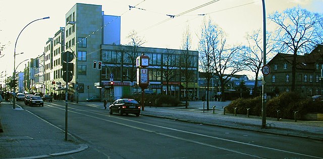
Альтглинике (Altglienicke, Altglienicke)

- район в Берлине
 Hiking in Альтглинике
Altglienicke is a district located in the southeastern part of Berlin, Germany. While it's primarily urban and residential, there are still some opportunities for hiking enthusiasts to enjoy nature nearby. Here are some aspects to consider if you're planning to hike in or around Altglienicke:
Nearby Nature Areas:
-
Wuhletal Hiking Trail: This trail follows the Wuhle River and provides a scenic route for walkers and hikers. The path often winds through forests and parks, making it an excellent choice for some leisurely hiking.
-
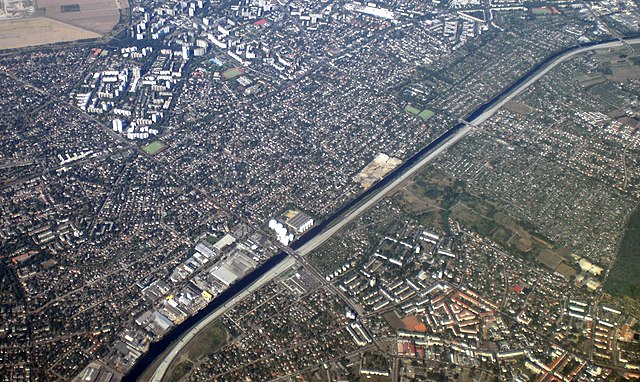
Dahme River: A bit further out, the Dahme River region offers lovely walking and biking paths alongside the water. This area is good for those looking to explore nature while still being close to Altglienicke.
-
Parc de Semper: While not a hiking trail per se, this park offers several paths and walking areas where you can enjoy a more casual hike and appreciate the local flora.
Local Parks:
- Treptower Park and Plänterwald are slightly further away but are easily accessible and provide a great opportunity for longer hikes amidst beautiful green spaces with wonderful views of the Spree River.
Tips for Hiking in Altglienicke:
- Routes: Plan your route ahead of time, making sure to consider trail conditions and accessibility, as some paths may be better maintained than others.
- Weather: Check the weather forecast before heading out, especially in autumn and winter when conditions can change rapidly.
- Footwear: Wear sturdy hiking shoes, especially if you decide to venture onto less-maintained paths.
- Local Knowledge: If you're unfamiliar with the area, consider reaching out to local hiking clubs or forums for recommendations on the best routes.
Public Transportation:
Altglienicke is well-connected by public transport, making it easy to reach various hiking spots in and around Berlin. The nearby S-Bahn and bus services can take you directly to other nature parks and trails.
Although Altglienicke itself may not be a hiking destination, its proximity to several green areas and parks provides decent opportunities to engage in outdoor activities. Enjoy your hike!
- Страна:

- Координаты: 52° 25' 0" N, 13° 32' 0" E


- GPS треки (wikiloc): [Ссылка]
- Высота над уровнем моря: 34 м m
- Площадь: 7.89 кв.км
- Население: 26426
- Википедия русская: wiki(ru)
- Википедия английская: wiki(en)
- Википедия национальная: wiki(de)
- Хранилище Wikidata: Wikidata: Q641472
- Галерея изображений в википедии: [Ссылка]
- Катеория в википедии: [Ссылка]
- Карты в википедии: [Ссылка]
- код Freebase: [/m/05_5ry9]
- код GeoNames: Альт: [2957185]
- код VIAF: Альт: [242738980]
- код GND: Альт: [4591405-9]
- идентификатор местоположения ArchINFORM: [43227]
- код TGN: [1003954]
Граничит с регионами:


Бонсдорф
- район в Берлине
Hiking in Бонсдорф
Bohnsdorf is a district located in the outskirts of Berlin, Germany. While it may not be widely recognized as a major hiking destination, it offers several opportunities for nature walks and outdoor activities....
- Страна:
- Координаты: 52° 24' 0" N, 13° 34' 0" E
- GPS треки (wikiloc): [Ссылка]
- Высота над уровнем моря: 37 м m
- Площадь: 6.52 кв.км
- Население: 10805

Адлерсхоф
- район в Берлине
Hiking in Адлерсхоф
Adlershof is a neighborhood in Berlin, Germany, primarily known for its historical significance and technological developments. While it may not be renowned for hiking in the traditional sense, there are several opportunities for outdoor activities and exploring nature in nearby areas....
- Страна:
- Координаты: 52° 26' 16" N, 13° 32' 51" E
- GPS треки (wikiloc): [Ссылка]
- Высота над уровнем моря: 37 м m
- Площадь: 6.11 кв.км
- Население: 15294
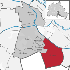
Рудов
- район в Берлине
Hiking in Рудов
Rudow is a district in the borough of Neukölln in Berlin, Germany. Although it is primarily an urban area and not known for traditional hiking, there are opportunities for walks and exploring nature in and around the district. Here are some options and tips for hiking or walking in and around Rudow:...
- Страна:
- Почтовый код: 12357; 12355; 12353
- Координаты: 52° 25' 0" N, 13° 30' 0" E
- GPS треки (wikiloc): [Ссылка]
- Высота над уровнем моря: 38 м m
- Площадь: 11.8 кв.км
- Население: 41618


Грюнау
- район в Берлине
Hiking in Грюнау
Grünau is a lovely district located in the southeastern part of Berlin, surrounded by beautiful nature, including the scenic shores of the Dahme River and various lakes. While it may not be as expansive in hiking trails as some national parks, it offers several appealing routes for outdoor enthusiasts. Here are some highlights:...
- Страна:
- Координаты: 52° 25' 0" N, 13° 34' 0" E
- GPS треки (wikiloc): [Ссылка]
- Высота над уровнем моря: 35 м m
- Площадь: 9.13 кв.км


Йоханнисталь
- район в Берлине
Hiking in Йоханнисталь
Johannisthal is a district in Berlin that is primarily known for its residential areas and proximity to green spaces rather than hiking trails. However, you can still enjoy outdoor activities and lighter hiking options in and around the area....
- Страна:
- Координаты: 52° 26' 36" N, 13° 30' 8" E
- GPS треки (wikiloc): [Ссылка]
- Высота над уровнем моря: 37 м m
- Площадь: 6.54 кв.км