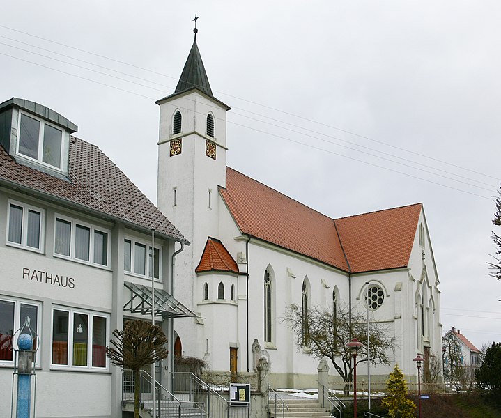
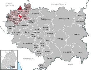
Альтсхаузен (Altshausen, Altshausen)

- город в Германии
 Hiking in Альтсхаузен
Altshausen, a charming small town located in the state of Baden-Württemberg, Germany, offers a variety of picturesque hiking opportunities, particularly for those who enjoy the scenic landscapes of the Swabian Jura. Here are some key features and tips for hiking in and around Altshausen:
Scenic Trails
-
Nature Trails: The region is known for its rich natural beauty, with well-marked trails that take you through dense forests, rolling hills, and fields. The trails often provide stunning views of the surrounding countryside.
-
Swabian Jura Trails: The Swabian Jura, a limestone plateau, offers a range of hiking routes. Nearby trails lead you to picturesque spots like the “Burg Hohenzollern” and other historical sites that offer breathtaking views.
-
Circular Hiking Routes: Some local hiking trails form circular routes, allowing for easier navigation and the ability to return to your starting point without retracing your steps.
Points of Interest
- Historical Sites: While hiking, you may encounter ruins and castles, such as the remnants of Altshausen Castle, which add a touch of history to your trekking experience.
- Local Flora and Fauna: The region is rich in biodiversity, making it a great spot for nature enthusiasts and photographers.
Tips for Hiking in Altshausen
- Trail Information: Before heading out, consider visiting local tourist information centers or checking online resources for trail maps and conditions.
- Weather Considerations: The weather can change quickly in this region, so be sure to dress in layers and check the forecast before your hike.
- Footwear: Good hiking boots are essential, as the terrain can vary from smooth paths to rocky areas.
- Provisions: Carry enough water and snacks, especially on longer hikes, as facilities may be sparse on some trails.
Conclusion
Hiking in Altshausen not only provides a great way to connect with nature and enjoy the sights but is also an opportunity to immerse yourself in the local culture and history. Whether you're a beginner or an experienced hiker, you'll find trails that suit your ability and interests in this lovely part of Germany.
- Страна:

- Почтовый код: 88361
- Телефонный код: 07584
- Код автомобильного номера: RV
- Координаты: 47° 55' 53" N, 9° 32' 39" E


- GPS треки (wikiloc): [Ссылка]
- Высота над уровнем моря: 594 м m
- Площадь: 20.48 кв.км
- Население: 4003
- Веб сайт: https://www.altshausen.de/
- Википедия русская: wiki(ru)
- Википедия английская: wiki(en)
- Википедия национальная: wiki(de)
- Хранилище Wikidata: Wikidata: Q179013
- Галерея изображений в википедии: [Ссылка]
- Катеория в википедии: [Ссылка]
- код Freebase: [/m/03jf94]
- код GeoNames: Альт: [2956847]
- код VIAF: Альт: [123592155]
- ID отношения в OpenStreetMap: [2808120]
- код GND: Альт: [4222281-3]
- идентификатор местоположения ArchINFORM: [8139]
- код LCNAF: Альт: [no2010161799]
- код Historical Gazetteer: [ALTSE1JN47SW]
- код BabelNet: [03748321n]
- идентификатор муниципалитетов в Германии: 08436005
Граничит с регионами:


Аулендорф
- город в земле Баден-Вюртемберг, Германия
Hiking in Аулендорф
Aulendorf is a charming town located in the Baden-Württemberg region of Germany, surrounded by beautiful landscapes that make it a great destination for hiking enthusiasts. Here are some key aspects of hiking in and around Aulendorf:...
- Страна:
- Почтовый код: 88326
- Телефонный код: 07525
- Код автомобильного номера: RV
- Координаты: 47° 57' 15" N, 9° 38' 20" E
- GPS треки (wikiloc): [Ссылка]
- Высота над уровнем моря: 576 м m
- Площадь: 52.34 кв.км
- Население: 9988
- Веб сайт: [Ссылка]
Бомс
Hiking in Бомс
Boms, which is likely referring to a specific region or area (potentially in South Korea), offers unique hiking experiences that showcase beautiful landscapes, diverse flora, and panoramic views. While I may not have specific details about Boms, I can provide guidance on general considerations for hiking in mountainous or hilly areas, as well as tips for enjoying your hike....
- Страна:
- Почтовый код: 88361
- Телефонный код: 07581
- Код автомобильного номера: RV
- Координаты: 47° 58' 35" N, 9° 30' 59" E
- GPS треки (wikiloc): [Ссылка]
- Высота над уровнем моря: 615 м m
- Площадь: 9.56 кв.км
- Население: 636
- Веб сайт: [Ссылка]