
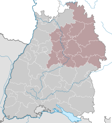
Баден-Вюртемберг (Baden-Württemberg, Baden-Württemberg)


- федеральная земля Германии
 Hiking in Баден-Вюртемберг
Baden-Württemberg, located in southwestern Germany, is a fantastic region for hiking enthusiasts. With its diverse landscapes, from the Black Forest to the Swabian Jura and picturesque vineyards along the Rhine River, the area offers a variety of trails suitable for all skill levels. Here are some highlights:
Black Forest (Schwarzwald)
- Overview: The Black Forest is famous for its dense forests, rolling hills, and charming villages. It’s a fantastic destination for both casual walks and more challenging hikes.
- Popular Trails:
- Westweg: A long-distance hiking trail spanning about 285 kilometers, it runs from the northern to the southern tip of the Black Forest.
- Feldberg: The highest peak in the Black Forest offers several trails that reward hikers with breathtaking views.
Swabian Jura (Schwäbische Alb)
- Overview: This hilly region is known for its limestone formations and deep valleys. It provides excellent opportunities for both hiking and rock climbing.
- Popular Trails:
- Albtrauf: A scenic ridge trail that offers spectacular views of the surrounding landscape.
- Hiking Trails Around Urach: Features beautiful waterfalls and historical sites, including castles.
Lake Constance (Bodensee)
- Overview: The area around Lake Constance is perfect for lakeside walks, offering stunning views of the Alps and the lake itself.
- Lake Constance Cycle Path: This flat path is suitable for both hiking and cycling, circling the entire lake and passing through charming towns.
Highlights
- Nature: Hiking in Baden-Württemberg offers opportunities to encounter diverse flora and fauna, including rare species in protected areas.
- Cultural Sites: Along the trails, you can explore historical towns, castles, and local vineyards, experiencing the rich culture of the region.
- Food and Wine: Many vineyards in the area allow hikers to enjoy local wines and traditional German cuisine at country inns.
Practical Tips
- Best Time to Hike: Late spring to early autumn (May to September) is ideal for hiking, with long daylight hours and pleasant temperatures.
- Trail Markings: Trails are generally well-marked with signs and symbols. Familiarize yourself with local maps and guidebooks.
- Gear: Bring proper hiking boots, plenty of water, and some snacks. Weather can change quickly, so dress in layers.
Whether you’re looking for leisurely walks or strenuous hikes, Baden-Württemberg has something for every hiker. Happy trails!
- Страна:

- Столица: Штутгарт
- Координаты: 48° 32' 16" N, 9° 2' 28" E


- GPS треки (wikiloc): [Ссылка]
- Высота над уровнем моря: 327 м m
- Площадь: 35751.65 кв.км
- Население: 10703000
- Веб сайт: http://www.baden-wuerttemberg.de/
- Википедия русская: wiki(ru)
- Википедия английская: wiki(en)
- Википедия национальная: wiki(de)
- Хранилище Wikidata: Wikidata: Q985
- Галерея изображений в википедии: [Ссылка]
- Катеория в википедии: [Ссылка]
- Карты в википедии: [Ссылка]
- код Freebase: [/m/0hk4q]
- код GeoNames: Альт: [2953481]
- код BNF: [11947106q]
- код VIAF: Альт: [154758959]
- ID отношения в OpenStreetMap: [62611]
- код GND: Альт: [4004176-1]
- идентификатор местоположения ArchINFORM: [2695]
- код LCNAF: Альт: [n79089399]
- код тезауруса PACTOLS: [pcrt5XVcjL9AlR]
- место в MusicBrainz: [4b8c47dd-0fe2-450e-8a21-d4d739ee0e0c]
- код темы Quora: [Baden-Württemberg]
- код TGN: [7003692]
- код SUDOC: [026360012]
- код в энциклопедии «Британника онлайн»: [place/Baden-Wurttemberg]
- код в Большой каталанской энциклопедии: [0006606]
- код в Encyclopædia Universalis: [bade-wurtemberg]
- идентификатор HDS: [7341]
- код ISNI: Альт: [0000 0004 0427 6821]
- код NKC: [ge128877]
- dmoz: Альт: [Regional/Europe/Germany/States/Baden-Württemberg/]
- код NLI: [000983356]
- код NUTS: [DE1]
- код YSO: [108227]
- код статьи Klexikon: [Baden-Württemberg]
- код BabelNet: [03512414n]
- код онлайн-версии Энциклопедии Брокгауз: [baden-wurttemberg]
- код GAMEO: [Baden-Württemberg (Germany)]
- FAST ID: [1206037]
- код NDL: [00553749]
- STW Thesaurus for Economics ID: [16841-2]
- код BNE: Альт: [XX461348]
- код SELIBR: [140217]
- код BAV: [ADV11349111]
- код NLA: [36512628]
- Basisklassifikation: [15.55]
- код US National Archives: 10044810
- ISO 3166-2: DE-BW
- код региона Германии: 08
- FIPS 10-4: GM01
- GACS ID: 10528
- Swedish Anbytarforum: 6075.0
Включает регионы:


Административный округ Карлсруэ
- административная единица в Баден-Вюртемберге, Германия
Hiking in Административный округ Карлсруэ
Karlsruhe, located in the southwest of Germany, is a great base for hiking enthusiasts. The region offers a mix of urban and natural landscapes, with easy access to nearby hills and forests. Here are some key highlights for hiking in the Karlsruhe area:...
- Страна:
- Столица: Карлсруэ
- Координаты: 49° 0' 0" N, 8° 30' 0" E
- GPS треки (wikiloc): [Ссылка]
- Высота над уровнем моря: 120 м m
- Площадь: 6919 кв.км
- Веб сайт: [Ссылка]


Фрайбург
- административный округ земли Баден-Вюртемберг
Hiking in Фрайбург
Freiburg, located in the southwestern part of Germany, is a gateway to some stunning hiking opportunities, particularly due to its proximity to the Black Forest (Schwarzwald) region. Here are some key points to consider when planning a hiking trip in and around Freiburg:...
- Страна:
- Столица: Фрайбург-им-Брайсгау
- Координаты: 48° 0' 0" N, 8° 19' 48" E
- GPS треки (wikiloc): [Ссылка]
- Площадь: 9347 кв.км
- Веб сайт: [Ссылка]


Тюбинген
Hiking in Тюбинген
Tübingen, located in the state of Baden-Württemberg, Germany, is surrounded by beautiful landscapes that offer a variety of hiking opportunities. The region features a mix of lush forests, rolling hills, and scenic river valleys that make it an ideal destination for outdoor enthusiasts....
- Страна:
- Столица: Тюбинген
- Координаты: 48° 10' 12" N, 9° 30' 0" E
- GPS треки (wikiloc): [Ссылка]
- Высота над уровнем моря: 534 м m
- Площадь: 8918 кв.км
- Веб сайт: [Ссылка]

административный округ Штутгарт
- административный округ Баден-Вюртемберга (Германия)
Hiking in административный округ Штутгарт
Stuttgart, located in the southwestern region of Germany, is surrounded by beautiful natural landscapes that offer a variety of hiking opportunities. The region is characterized by its rolling hills, vineyards, and dense forests, making it an ideal spot for outdoor enthusiasts. Here are some highlights of hiking in the Stuttgart region:...
- Страна:
- Столица: Штутгарт
- Координаты: 49° 0' 0" N, 9° 40' 12" E
- GPS треки (wikiloc): [Ссылка]
- Высота над уровнем моря: 365 м m
- Площадь: 10558 кв.км
- Веб сайт: [Ссылка]
Граничит с регионами:

Цюрих
- кантон в Швейцарии
Hiking in Цюрих
The Canton of Zürich offers a rich variety of hiking opportunities, suitable for all skill levels and preferences. Here are some highlights and tips for hiking in this region:...
- Страна:

- Столица: Цюрих
- Код автомобильного номера: ZH
- Координаты: 47° 0' 0" N, 9° 0' 0" E
- GPS треки (wikiloc): [Ссылка]
- Высота над уровнем моря: 408 м m
- Площадь: 1729 кв.км
- Население: 1408575
- Веб сайт: [Ссылка]


Аргау
- кантон в Швейцарии
Hiking in Аргау
The Canton of Aargau, located in Switzerland, offers a variety of hiking opportunities that cater to different skill levels and preferences. Here's an overview of what you can expect when hiking in this beautiful region:...
- Страна:
- Столица: Арау
- Код автомобильного номера: AG
- Координаты: 47° 22' 49" N, 8° 0' 51" E
- GPS треки (wikiloc): [Ссылка]
- Высота над уровнем моря: 382 м m
- Площадь: 1403.77 кв.км
- Население: 568671
- Веб сайт: [Ссылка]


Гессен
- федеральная земля Германии
Hiking in Гессен
Hesse, located in central Germany, offers a diverse range of hiking opportunities, thanks to its varied landscapes that include forests, hills, and charming villages. Here are some highlights of hiking in the region:...
- Страна:
- Столица: Висбаден
- Координаты: 50° 39' 58" N, 8° 35' 28" E
- GPS треки (wikiloc): [Ссылка]
- Высота над уровнем моря: 264 м m
- Площадь: 21100.0 кв.км
- Население: 6045425
- Веб сайт: [Ссылка]


Рейнланд-Пфальц
- федеральная земля Германии
Hiking in Рейнланд-Пфальц
Rhineland-Palatinate, located in western Germany, is a fantastic destination for hiking enthusiasts. This region is known for its diverse landscapes, ranging from the rolling vineyards of the Moselle Valley to the rugged terrain of the Eifel Mountains and the picturesque trails of the Rhine Gorge....
- Страна:
- Столица: Майнц
- Координаты: 49° 54' 47" N, 7° 26' 59" E
- GPS треки (wikiloc): [Ссылка]
- Высота над уровнем моря: 0 м m
- Площадь: 19853.36 кв.км
- Население: 4011582
- Веб сайт: [Ссылка]


Базель-Ланд
- полукантон в Швейцарии
Hiking in Базель-Ланд
Hiking in the Canton of Basel-Landschaft, located in Switzerland, offers an excellent opportunity to explore the region's beautiful landscapes, charming villages, and diverse ecosystems. Here are some key points to consider when planning your hike in this area:...
- Страна:
- Столица: Листаль
- Код автомобильного номера: BL
- Координаты: 47° 27' 47" N, 7° 45' 21" E
- GPS треки (wikiloc): [Ссылка]
- Высота над уровнем моря: 327 м m
- Площадь: 517.67 кв.км
- Веб сайт: [Ссылка]

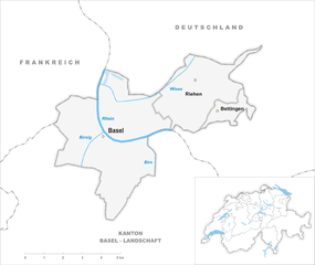
Базель-Штадт
- полукантон в Швейцарии
Hiking in Базель-Штадт
Hiking in the Canton of Basel-Stadt offers a unique blend of urban landscapes and natural surroundings. Though Basel-Stadt is one of the smallest cantons in Switzerland and is largely urban, it provides access to beautiful parks, scenic riversides, and nearby regions that are perfect for hiking....
- Страна:
- Столица: Базель
- Код автомобильного номера: BS
- Координаты: 47° 34' 0" N, 7° 36' 0" E
- GPS треки (wikiloc): [Ссылка]
- Высота над уровнем моря: 260 м m
- Площадь: 36.95 кв.км
- Население: 200256
- Веб сайт: [Ссылка]
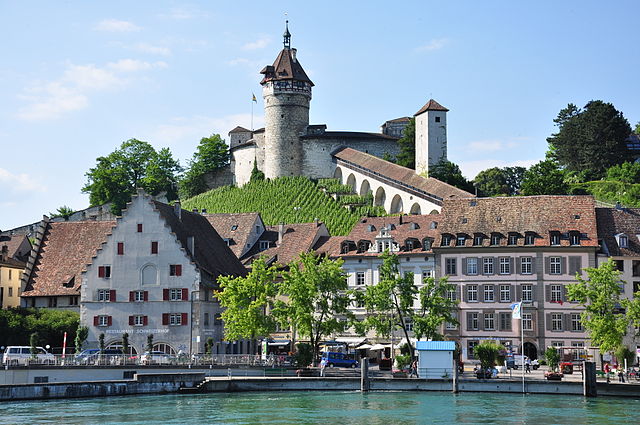

Шаффхаузен
- кантон в Швейцарии
Hiking in Шаффхаузен
The Canton of Schaffhausen, located in the northern part of Switzerland, is a wonderful destination for hiking enthusiasts. This region offers a mix of stunning landscapes, historical sites, and vibrant nature that can cater to hikers of all levels....
- Страна:
- Столица: Шаффхаузен
- Код автомобильного номера: SH
- Координаты: 47° 43' 0" N, 8° 34' 0" E
- GPS треки (wikiloc): [Ссылка]
- Высота над уровнем моря: 392 м m
- Площадь: 298.42 кв.км
- Население: 73400
- Веб сайт: [Ссылка]


Тургау
- кантон в Швейцарии
Hiking in Тургау
The Canton of Thurgau in Switzerland is an excellent destination for hiking enthusiasts. Known for its picturesque landscapes, rolling hills, lush vineyards, and beautiful lakes, the region offers a variety of trails suitable for all skill levels. Here are some highlights of hiking in Thurgau:...
- Страна:
- Столица: Фрауэнфельд
- Код автомобильного номера: TG
- Координаты: 47° 35' 0" N, 9° 4' 0" E
- GPS треки (wikiloc): [Ссылка]
- Высота над уровнем моря: 417 м m
- Площадь: 991.77 кв.км
- Веб сайт: [Ссылка]


Нижний Рейн
- департамент Франции
- Страна:

- Столица: Страсбург
- Координаты: 48° 49' 0" N, 7° 47' 0" E
- GPS треки (wikiloc): [Ссылка]
- Площадь: 4755 кв.км
- Население: 1121407
- Веб сайт: [Ссылка]
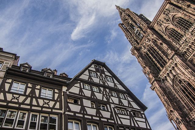

Гранд-Эст
- регион Франции
Hiking in Гранд-Эст
Grand Est, a beautiful region in northeastern France, offers a diverse array of hiking opportunities. The region is characterized by a mix of picturesque landscapes, including rolling hills, vineyards, dense forests, and the stunning Vosges Mountains. Here are some key points about hiking in Grand Est:...
- Страна:
- Столица: Страсбург
- Координаты: 48° 35' 56" N, 7° 45' 36" E
- GPS треки (wikiloc): [Ссылка]
- Площадь: 57433 кв.км
- Население: 5555186
- Веб сайт: [Ссылка]


Форарльберг
- федеральная земля на западе Австрии
Hiking in Форарльберг
Vorarlberg, the westernmost province of Austria, is a fantastic destination for hiking enthusiasts. Nestled between the Alps and the Rhine River, it offers a diverse landscape with breathtaking views, lush valleys, and well-marked trails catering to various skill levels....
- Страна:

- Столица: Брегенц
- Координаты: 47° 14' 37" N, 9° 53' 38" E
- GPS треки (wikiloc): [Ссылка]
- Высота над уровнем моря: 1063 м m
- Площадь: 2601.48 кв.км
- Население: 388711
- Веб сайт: [Ссылка]


Бавария
- федеральная земля Германии
Hiking in Бавария
Hiking in Bavaria is a fantastic experience, offering a diverse range of landscapes, stunning views, and well-marked trails. Here are some key highlights and tips for hiking in Bavaria:...
- Страна:
- Столица: Мюнхен
- Координаты: 48° 46' 39" N, 11° 25' 52" E
- GPS треки (wikiloc): [Ссылка]
- Высота над уровнем моря: 503 м m
- Площадь: 70551 кв.км
- Население: 12930751
- Веб сайт: [Ссылка]