
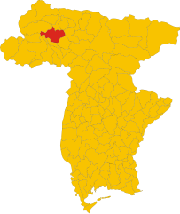
Ампеццо (Ampezzo, Ampezzo)
.svg)
- коммуна Италии
 Hiking in Ампеццо
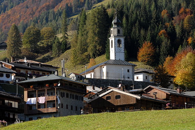
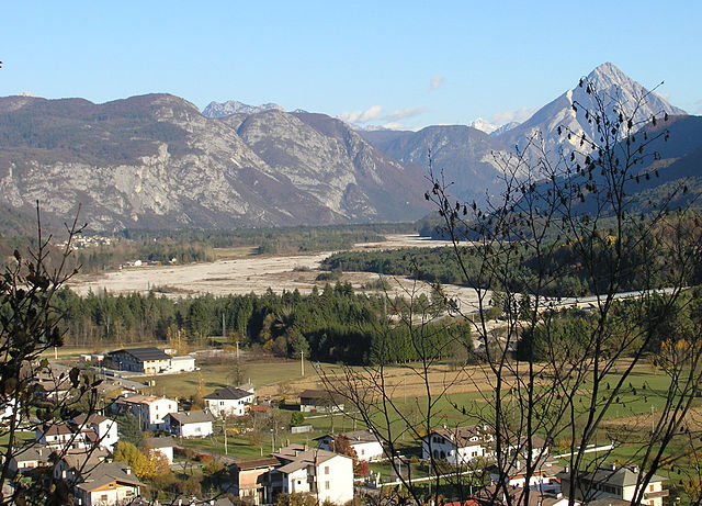
Ampezzo, located in the Friuli Venezia Giulia region of Italy, is a beautiful destination for hiking enthusiasts. Nestled in the Carnic Alps, it offers stunning landscapes, diverse trails, and ample opportunities to connect with nature.
Hiking Trails
-
Dolomiti d'Ampezzo Natural Park: This park is renowned for its breathtaking mountain scenery, rich flora, and fauna. Trails range from easy walks to challenging hikes, catering to all skill levels.
-
The Path of the Mines: A historical trail that takes you through areas where mining was once a prominent activity. It offers both natural beauty and a glimpse into the region's past.
-
Laghi di Fusine: A hike to the Fusine Lakes is a must. The area is not only picturesque, with emerald green waters surrounded by mountain peaks, but it also offers a network of trails suitable for various levels.
-
Monte Baranci: For those looking for a moderate hike, the trail to Monte Baranci provides panoramic views and is accessible from the town.
-
Sella Nevea: A bit further afield but still accessible, Sella Nevea is a fantastic area for exploring alpine routes. This area offers trails that can take you from the valley up to the ridges with stunning views.
Equipment and Preparation
- Boots: Sturdy hiking boots are essential for comfort and support on varying terrains.
- Clothing: Dress in layers, as weather conditions can change rapidly in the mountains. Waterproof and windproof clothing is advisable.
- Navigation: Although trails are generally marked, carrying a map or GPS device is recommended for safety.
- Supplies: Bring enough water, snacks, and a first aid kit for your hike.
Best Time to Hike
The ideal hiking season in Ampezzo runs from late spring to early autumn (May to October), when the weather is generally mild, and the trails are more accessible. Summer is a peak season, while early fall is perfect for fewer crowds and beautiful autumn colors.
Additional Tips
- Local Guides: Consider hiring a local guide for a richer experience and to ensure you don't miss any hidden gems.
- Respect Nature: Stay on marked trails and follow Leave No Trace principles to help preserve the natural environment.
Overall, Ampezzo offers a unique blend of adventure and serenity, making it a fantastic destination for outdoor enthusiasts. Enjoy your hiking experience in this stunning region!
- Страна:

- Почтовый код: 33021
- Телефонный код: 0433
- Код автомобильного номера: UD
- Координаты: 46° 25' 0" N, 12° 47' 0" E


- GPS треки (wikiloc): [Ссылка]
- Высота над уровнем моря: 560 м m
- Площадь: 73 кв.км
- Население: 983
- Веб сайт: http://www.comune.ampezzo.ud.it/
- Википедия русская: wiki(ru)
- Википедия английская: wiki(en)
- Википедия национальная: wiki(it)
- Хранилище Wikidata: Wikidata: Q53214
- Катеория в википедии: [Ссылка]
- код Freebase: [/m/0gk84c]
- код GeoNames: Альт: [6539645]
- код VIAF: Альт: [144459023]
- ID отношения в OpenStreetMap: [79101]
- WOEID: [710119]
- UN/LOCODE: [ITAPZ]
- код ISTAT: 030003
- кадастровый код Италии: A267
Граничит с регионами:


Форни-ди-Сотто
- коммуна Италии
Hiking in Форни-ди-Сотто
Forni di Sotto is a beautiful gem in the Friuli Venezia Giulia region of northern Italy, nestled in the Carnic Alps. This area is known for its stunning natural landscapes, rich biodiversity, and a variety of hiking trails suitable for all levels of experience. Here are some highlights about hiking in Forni di Sotto:...
- Страна:
- Почтовый код: 33020
- Телефонный код: 0433
- Код автомобильного номера: UD
- Координаты: 46° 24' 0" N, 12° 40' 0" E
- GPS треки (wikiloc): [Ссылка]
- Высота над уровнем моря: 777 м m
- Площадь: 93.6 кв.км
- Население: 583
- Веб сайт: [Ссылка]

Оваро
- коммуна Италии
Hiking in Оваро
Ovaro is a beautiful town located in the Friuli Venezia Giulia region of northeastern Italy. It's situated in the Carnic Alps and is surrounded by stunning natural landscapes, making it a great destination for hiking enthusiasts. Here are some key points to consider when hiking in and around Ovaro:...
- Страна:
- Почтовый код: 33025
- Телефонный код: 0433
- Код автомобильного номера: UD
- Координаты: 46° 29' 0" N, 12° 52' 0" E
- GPS треки (wikiloc): [Ссылка]
- Высота над уровнем моря: 525 м m
- Площадь: 57.9 кв.км
- Население: 1875
- Веб сайт: [Ссылка]

Саурис
- коммуна Италии
Hiking in Саурис
Sauris, a picturesque village located in the Friuli Venezia Giulia region of Italy, is a hidden gem for hikers. Nestled in the Julian Alps, it offers stunning landscapes, rich cultural heritage, and an array of hiking trails suitable for various experience levels....
- Страна:
- Почтовый код: 33020
- Телефонный код: 0433
- Код автомобильного номера: UD
- Координаты: 46° 27' 58" N, 12° 42' 31" E
- GPS треки (wikiloc): [Ссылка]
- Высота над уровнем моря: 1212 м m
- Площадь: 41.49 кв.км
- Население: 405
- Веб сайт: [Ссылка]

Соккьеве
- коммуна Италии
Hiking in Соккьеве
Socchieve, a picturesque area in the Julian Alps of Italy, is known for its stunning natural landscapes and diverse hiking trails suitable for a variety of skill levels. Here’s what you can expect when hiking in Socchieve:...
- Страна:
- Почтовый код: 33020
- Телефонный код: 0433
- Код автомобильного номера: UD
- Координаты: 46° 23' 48" N, 12° 50' 53" E
- GPS треки (wikiloc): [Ссылка]
- Высота над уровнем моря: 480 м m
- Площадь: 66.12 кв.км
- Население: 896
- Веб сайт: [Ссылка]