
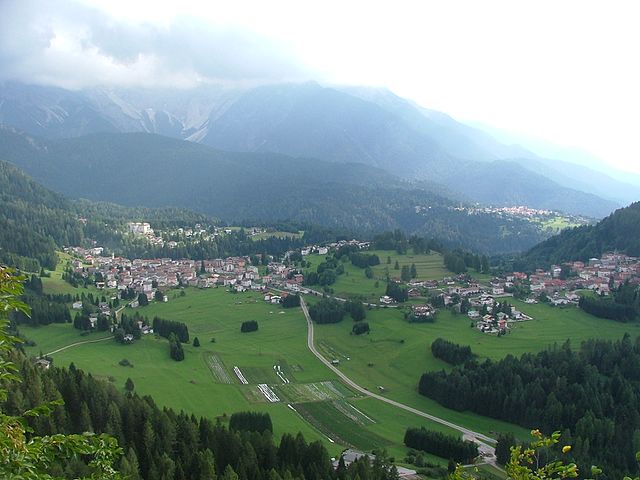
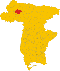
Саурис (Sauris, Sauris)
.svg)
- коммуна Италии
 Hiking in Саурис
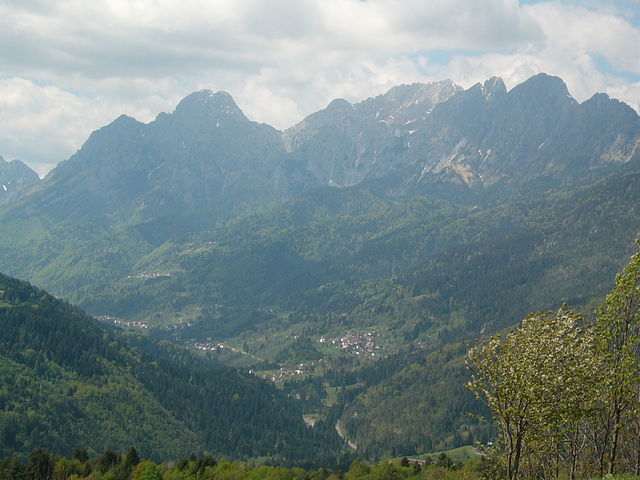
Sauris, a picturesque village located in the Friuli Venezia Giulia region of Italy, is a hidden gem for hikers. Nestled in the Julian Alps, it offers stunning landscapes, rich cultural heritage, and an array of hiking trails suitable for various experience levels.
Hiking Trails
-
Sentiero delle Vette: This trail offers breathtaking views of the surrounding mountains and valleys. It’s a moderately challenging hike, perfect for those looking to experience both nature and the awe-inspiring landscapes of the Alps.
-
Lago di Sauris: The area around Sauris Lake is ideal for leisurely walks and is particularly beautiful in the early morning or late afternoon when the reflections on the water are stunning. The surrounding trails can lead you through lush forest and provide plenty of opportunities for photography.
-
Bivacco M. D. di Sauris: This trail leads to a mountain hut where hikers can rest and enjoy the panoramic views. It’s a great destination for day hikes, and the journey there is filled with the tranquility of nature.
-
Sentiero dei Cacciatori: A more rugged trail ideal for experienced hikers, this path takes you through some less-trodden routes, providing a deeper insight into the region’s natural beauty and wildlife.
Things to Consider
-
Season: The best time to hike in Sauris is during the late spring to early autumn (May to October), as the trails are well-maintained and the weather is generally pleasant.
-
What to Bring: Always carry sufficient water, snacks, a map, and a first aid kit. Sturdy hiking boots and clothing suitable for changing weather conditions are essential.
-
Cultural Exploration: Don't miss the chance to sample the local cuisine, particularly the famous Sauris ham, and take some time to explore the traditional wooden architecture of the village.
-
Guided Tours: If you're unfamiliar with the area or want to delve deeper into local flora, fauna, and history, consider hiring a local guide who can enhance your hiking experience.
Safety
Always check weather conditions before heading out and let someone know your hiking plans. Be aware of the terrain and your own physical limits, and enjoy the beauty and tranquility that Sauris has to offer. Happy hiking!
- Страна:

- Почтовый код: 33020
- Телефонный код: 0433
- Код автомобильного номера: UD
- Координаты: 46° 27' 58" N, 12° 42' 31" E


- GPS треки (wikiloc): [Ссылка]
- Высота над уровнем моря: 1212 м m
- Площадь: 41.49 кв.км
- Население: 405
- Веб сайт: http://www.comune.sauris.ud.it/
- Википедия русская: wiki(ru)
- Википедия английская: wiki(en)
- Википедия национальная: wiki(it)
- Хранилище Wikidata: Wikidata: Q53363
- Катеория в википедии: [Ссылка]
- код Freebase: [/m/0gkb84]
- код GeoNames: Альт: [6541507]
- код VIAF: Альт: [149134679]
- ID отношения в OpenStreetMap: [79122]
- код LCNAF: Альт: [n2005036591]
- код ISTAT: 030107
- кадастровый код Италии: I464
Граничит с регионами:

Виго-ди-Кадоре
- коммуна Италии
Hiking in Виго-ди-Кадоре
Vigo di Cadore is a picturesque village in the Dolomites, located in the Veneto region of Italy. It’s an excellent starting point for hiking enthusiasts due to its stunning landscapes, diverse trails, and rich natural and cultural heritage. Here are some highlights about hiking in Vigo di Cadore:...
- Страна:
- Почтовый код: 32040
- Телефонный код: 0435
- Код автомобильного номера: BL
- Координаты: 46° 30' 0" N, 12° 28' 0" E
- GPS треки (wikiloc): [Ссылка]
- Высота над уровнем моря: 947 м m
- Площадь: 70.07 кв.км
- Население: 1409
- Веб сайт: [Ссылка]


Ампеццо
- коммуна Италии
Hiking in Ампеццо
Ampezzo, located in the Friuli Venezia Giulia region of Italy, is a beautiful destination for hiking enthusiasts. Nestled in the Carnic Alps, it offers stunning landscapes, diverse trails, and ample opportunities to connect with nature....
- Страна:
- Почтовый код: 33021
- Телефонный код: 0433
- Код автомобильного номера: UD
- Координаты: 46° 25' 0" N, 12° 47' 0" E
- GPS треки (wikiloc): [Ссылка]
- Высота над уровнем моря: 560 м m
- Площадь: 73 кв.км
- Население: 983
- Веб сайт: [Ссылка]


Форни-ди-Сопра
- коммуна Италии
Hiking in Форни-ди-Сопра
Forni di Sopra is a beautiful destination for hiking enthusiasts, located in the Friuli Venezia Giulia region of northeastern Italy. Nestled in the Carnic Alps, it offers a stunning backdrop of lush valleys, rugged mountains, and pristine landscapes. Here are some key points about hiking in Forni di Sopra:...
- Страна:
- Почтовый код: 33024
- Телефонный код: 0433
- Код автомобильного номера: UD
- Координаты: 46° 25' 0" N, 12° 35' 0" E
- GPS треки (wikiloc): [Ссылка]
- Высота над уровнем моря: 907 м m
- Площадь: 81.66 кв.км
- Население: 955
- Веб сайт: [Ссылка]


Форни-ди-Сотто
- коммуна Италии
Hiking in Форни-ди-Сотто
Forni di Sotto is a beautiful gem in the Friuli Venezia Giulia region of northern Italy, nestled in the Carnic Alps. This area is known for its stunning natural landscapes, rich biodiversity, and a variety of hiking trails suitable for all levels of experience. Here are some highlights about hiking in Forni di Sotto:...
- Страна:
- Почтовый код: 33020
- Телефонный код: 0433
- Код автомобильного номера: UD
- Координаты: 46° 24' 0" N, 12° 40' 0" E
- GPS треки (wikiloc): [Ссылка]
- Высота над уровнем моря: 777 м m
- Площадь: 93.6 кв.км
- Население: 583
- Веб сайт: [Ссылка]

Оваро
- коммуна Италии
Hiking in Оваро
Ovaro is a beautiful town located in the Friuli Venezia Giulia region of northeastern Italy. It's situated in the Carnic Alps and is surrounded by stunning natural landscapes, making it a great destination for hiking enthusiasts. Here are some key points to consider when hiking in and around Ovaro:...
- Страна:
- Почтовый код: 33025
- Телефонный код: 0433
- Код автомобильного номера: UD
- Координаты: 46° 29' 0" N, 12° 52' 0" E
- GPS треки (wikiloc): [Ссылка]
- Высота над уровнем моря: 525 м m
- Площадь: 57.9 кв.км
- Население: 1875
- Веб сайт: [Ссылка]

Прато-Карнико
- коммуна Италии
Hiking in Прато-Карнико
Prato Carnico is a beautiful alpine village located in the Friuli Venezia Giulia region of northeastern Italy. It's set in the Carnic Alps, offering stunning natural landscapes that are perfect for hiking enthusiasts. Here are some highlights and tips for hiking in the Prato Carnico area:...
- Страна:
- Почтовый код: 33020
- Телефонный код: 0433
- Код автомобильного номера: UD
- Координаты: 46° 31' 0" N, 12° 49' 0" E
- GPS треки (wikiloc): [Ссылка]
- Высота над уровнем моря: 686 м m
- Площадь: 81.72 кв.км
- Население: 898
- Веб сайт: [Ссылка]