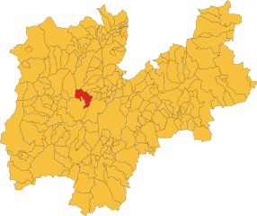
Андало (Andalo, Andalo)
%202018.svg)
- коммуна Италии
 Hiking in Андало
Andalo is a beautiful village located in the Trentino region of northern Italy, surrounded by the scenic Dolomites. This area is a fantastic destination for hiking enthusiasts, offering a variety of trails that cater to all skill levels, from leisurely strolls to challenging alpine hikes. Here are some highlights of hiking in Andalo:
Trail Options
-
Easier Trails:
- Sentiero della Pace: A gentle trail that offers breathtaking views of the surrounding mountains and is suitable for families.
- Path from Andalo to Molveno: This trail runs along the lake and offers stunning views.
-
Moderate Trails:
- Piz Galin: A moderate hike that takes you to the summit, where you'll be rewarded with panoramic views of the Brenta Dolomites.
- Laghi di Cornisello: An accessible hike leading to beautiful glacial lakes, perfect for a picnic.
-
Challenging Hikes:
- Via Ferrata: For those looking for a thrill, some Via Ferrata routes in the area offer a combination of climbing and hiking.
- Cima Tosa: A more strenuous hike that can be part of a multi-day trek, leading to one of the highest peaks in the Brenta group.
Tips for Hiking in Andalo
- Check the Weather: Mountain weather can change rapidly, so it's crucial to check forecasts before heading out.
- Use Proper Gear: Good hiking boots, weather-appropriate clothing, and trekking poles can enhance your hiking experience.
- Stay Hydrated: Bring plenty of water, especially on warmer days or on more strenuous hikes.
- Navigation Tools: While many trails are well marked, a map or GPS device can be helpful for more remote paths.
Wildlife and Scenery
Hiking in Andalo not only provides access to stunning landscapes but also the opportunity to see diverse wildlife, including deer, chamois, and a variety of bird species. Keep your camera ready for the breathtaking vistas and the unique flora along the trails.
Local Attractions
When you’re not hiking, consider exploring the charming village of Andalo, known for its local cuisine, shops, and beautiful parks. Don’t miss the nearby Molveno Lake for more leisure activities and picturesque views.
Seasonality
While summer is the peak hiking season, fall can also be a stunning time to hike with vibrant foliage. Winter sports are prevalent in the area, so plan accordingly if you're visiting during the colder months.
Andalo is truly a gem for outdoor lovers, providing not just hiking, but an entire experience immersed in nature. Enjoy your adventure!
- Страна:

- Почтовый код: 38010
- Телефонный код: 0461
- Код автомобильного номера: TN
- Координаты: 46° 10' 0" N, 11° 0' 16" E


- GPS треки (wikiloc): [Ссылка]
- Высота над уровнем моря: 1040 м m
- Площадь: 11.38 кв.км
- Население: 1102
- Веб сайт: http://www.comune.andalo.tn.it/
- Википедия русская: wiki(ru)
- Википедия английская: wiki(en)
- Википедия национальная: wiki(it)
- Хранилище Wikidata: Wikidata: Q243857
- Катеория в википедии: [Ссылка]
- код Freebase: [/m/0g2fjl]
- код GeoNames: Альт: [6537242]
- код VIAF: Альт: [233864864]
- ID отношения в OpenStreetMap: [46918]
- UN/LOCODE: [ITXAN]
- код ISTAT: 022005
- кадастровый код Италии: A274
Граничит с регионами:


Каведаго
- коммуна Италии
Hiking in Каведаго
Cavedago is a charming village situated in the Trentino region of northern Italy, near the picturesque Dolomites. It serves as an excellent base for hiking enthusiasts due to its stunning natural landscapes and a variety of trails suitable for all skill levels....
- Страна:
- Почтовый код: 38010
- Телефонный код: 0461
- Код автомобильного номера: TN
- Координаты: 46° 11' 0" N, 11° 2' 0" E
- GPS треки (wikiloc): [Ссылка]
- Высота над уровнем моря: 864 м m
- Площадь: 10.03 кв.км
- Население: 531
- Веб сайт: [Ссылка]


Фай-делла-Паганелла
- коммуна Италии
Hiking in Фай-делла-Паганелла
Fai della Paganella is a picturesque mountain village located in the Trentino region of northern Italy, offering stunning landscapes and a variety of hiking opportunities. Nestled in the Brenta Dolomites, it is an excellent destination for both novice and experienced hikers. Here are some key highlights and tips for hiking in this beautiful area:...
- Страна:
- Почтовый код: 38010
- Телефонный код: 0461
- Код автомобильного номера: TN
- Координаты: 46° 11' 0" N, 11° 4' 0" E
- GPS треки (wikiloc): [Ссылка]
- Высота над уровнем моря: 958 м m
- Площадь: 12.13 кв.км
- Население: 905
- Веб сайт: [Ссылка]

Мольвено
- коммуна Италии
Hiking in Мольвено
Molveno, a picturesque village located in the Trentino region of northern Italy, is known for its stunning natural surroundings, making it an excellent destination for hiking enthusiasts. Nestled near the shores of Lake Molveno and at the foot of the Brenta Dolomites, visitors can enjoy a variety of hiking trails catering to all skill levels....
- Страна:
- Почтовый код: 38018
- Телефонный код: 0461
- Код автомобильного номера: TN
- Координаты: 46° 8' 35" N, 10° 57' 53" E
- GPS треки (wikiloc): [Ссылка]
- Высота над уровнем моря: 864 м m
- Площадь: 34.12 кв.км
- Население: 1123
- Веб сайт: [Ссылка]

Сан-Лоренцо-ин-Банале
- коммуна Италии
Hiking in Сан-Лоренцо-ин-Банале
San Lorenzo in Banale is a picturesque village located in the Trentino region of northern Italy, surrounded by the stunning natural beauty of the Brenta Dolomites. This area offers a variety of hiking opportunities for all skill levels, making it a popular destination for outdoor enthusiasts. Here are some key highlights about hiking in and around San Lorenzo in Banale:...
- Страна:
- Почтовый код: 38078
- Телефонный код: 0465
- Код автомобильного номера: TN
- Координаты: 46° 5' 0" N, 10° 55' 0" E
- GPS треки (wikiloc): [Ссылка]
- Высота над уровнем моря: 758 м m
- Площадь: 61.41 кв.км
- Веб сайт: [Ссылка]
Terre d'Adige
Hiking in Terre d'Adige
Hiking in Terre d'Adige offers a wonderful experience, characterized by stunning natural landscapes and a rich cultural heritage. Located in the Trentino region of northern Italy, this area is known for its picturesque valleys, vineyards, and the Adige River, which meanders through the landscape....
- Страна:
- Почтовый код: 38010
- Телефонный код: 0461
- Координаты: 46° 9' 6" N, 11° 5' 50" E
- GPS треки (wikiloc): [Ссылка]
- Веб сайт: [Ссылка]