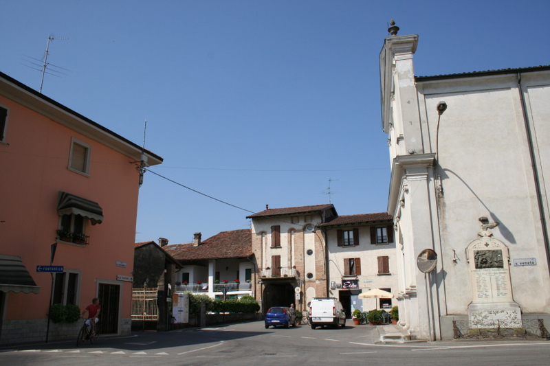
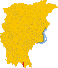
Антеньяте (Antegnate, Antegnate)
.svg)
- коммуна Италии
 Hiking in Антеньяте
Antegnate is a small town located in the Lombardy region of northern Italy. It is not as well-known for hiking as some other areas in Italy, but it does offer access to beautiful countryside and opportunities for outdoor activities.
Hiking Opportunities:
-
Surrounding Nature: The area around Antegnate is characterized by rolling hills, agricultural land, and small forests, making it ideal for leisurely walks and nature hikes. You can explore the scenic countryside, enjoy the views, and experience local flora and fauna.
-
Local Trails: While there may not be extensive designated hiking trails, you can often find paths and routes through rural areas by following local roads or tracks. Be sure to check local maps or speak to residents for recommendations.
-
Close Proximity to Larger Hiking Areas: Antegnate is located not too far from the Oglio River Park and other natural areas, which can provide more extensive hiking trails. Exploring these nearby parks can offer more diverse hiking experiences.
-
Community and Seasonal Events: Look out for local hiking or outdoor events that may be organized by community groups or local tourism boards. These can provide guided hikes and a chance to meet fellow outdoor enthusiasts.
Tips for Hiking in Antegnate:
- Seasonal Considerations: The best time for hiking in the area is typically in the spring and fall when the weather is mild. Summer can be hot, while winter may bring snow and chilly temperatures.
- Gear Up: Make sure to wear appropriate hiking shoes and clothing. Carry enough water, snacks, and a first-aid kit regardless of the length of your hike.
- Respect Local Guidelines: When hiking in any area, be sure to respect local guidelines, wildlife, and private property.
- Explore Local Culture: Don't forget to take time to enjoy the local culture and cuisine after your hikes. Antegnate and the surrounding region offer delicious local dishes that can be a great reward after a day of hiking.
Overall, while Antegnate may not be a primary hiking destination, it provides opportunities for enjoyable outdoor experiences.
- Страна:

- Почтовый код: 24051
- Телефонный код: 0363
- Код автомобильного номера: BG
- Координаты: 45° 29' 7" N, 9° 47' 20" E


- GPS треки (wikiloc): [Ссылка]
- Высота над уровнем моря: 112 м m
- Площадь: 9.73 кв.км
- Население: 3206
- Веб сайт: http://www.comune.antegnate.bg.it
- Википедия русская: wiki(ru)
- Википедия английская: wiki(en)
- Википедия национальная: wiki(it)
- Хранилище Wikidata: Wikidata: Q95069
- Галерея изображений в википедии: [Ссылка]
- Катеория в википедии: [Ссылка]
- код Freebase: [/m/0gj8k9]
- код GeoNames: Альт: [6537144]
- код VIAF: Альт: [241251893]
- ID отношения в OpenStreetMap: [45115]
- UN/LOCODE: [ITATN]
- код ISTAT: 016010
- кадастровый код Италии: A304
Граничит с регионами:


Кальчо
- коммуна Италии
Hiking in Кальчо
Calcio, a small town in Lombardy near the Adda River, may not be as widely recognized as a hiking destination compared to other areas in Italy, but it offers charming landscapes and opportunities for outdoor activities. While the town itself is not a major hiking hub, it’s surrounded by beautiful natural areas that can be explored on foot....
- Страна:
- Почтовый код: 24054
- Телефонный код: 0363
- Код автомобильного номера: BG
- Координаты: 45° 30' 30" N, 9° 51' 3" E
- GPS треки (wikiloc): [Ссылка]
- Высота над уровнем моря: 123 м m
- Площадь: 15.67 кв.км
- Население: 5326
- Веб сайт: [Ссылка]


Ково
- коммуна Италии
Hiking in Ково
Covo is a charming destination for hiking, located in Italy’s beautiful region of Abruzzo. While it might not be as widely known as other hiking hotspots, it offers a unique blend of natural beauty and cultural experiences....
- Страна:
- Почтовый код: 24050
- Телефонный код: 0363
- Код автомобильного номера: BG
- Координаты: 45° 30' 0" N, 9° 46' 0" E
- GPS треки (wikiloc): [Ссылка]
- Высота над уровнем моря: 115 м m
- Площадь: 12.94 кв.км
- Население: 4088
- Веб сайт: [Ссылка]


Фонтанелла
- коммуна Италии
Hiking in Фонтанелла
Fontanella is a charming village located in the province of Bergamo, Lombardy, Italy, surrounded by stunning natural landscapes that make it an attractive destination for hikers. The area offers a variety of trails that accommodate different skill levels, from leisurely walks to more challenging hikes....
- Страна:
- Почтовый код: 24056
- Телефонный код: 0363
- Код автомобильного номера: BG
- Координаты: 45° 28' 0" N, 9° 48' 0" E
- GPS треки (wikiloc): [Ссылка]
- Высота над уровнем моря: 105 м m
- Площадь: 17.8 кв.км
- Население: 4464
- Веб сайт: [Ссылка]
Барбата
- коммуна Италии
Hiking in Барбата
Hiking in Barbata, a beautiful region, can be an exciting experience for outdoor enthusiasts. While Barbata isn't a specific location commonly recognized in hiking guidebooks, it could refer to a local area that may be known for its trails, landscapes, or nature....
- Страна:
- Почтовый код: 24040
- Телефонный код: 0363
- Код автомобильного номера: BG
- Координаты: 45° 29' 0" N, 9° 47' 0" E
- GPS треки (wikiloc): [Ссылка]
- Высота над уровнем моря: 105 м m
- Площадь: 7.98 кв.км
- Население: 712
- Веб сайт: [Ссылка]