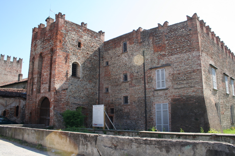
Кальчо (Calcio, Lombardy, Calcio)
.svg)
- коммуна Италии
 Hiking in Кальчо
Calcio, a small town in Lombardy near the Adda River, may not be as widely recognized as a hiking destination compared to other areas in Italy, but it offers charming landscapes and opportunities for outdoor activities. While the town itself is not a major hiking hub, it’s surrounded by beautiful natural areas that can be explored on foot.
Hiking Opportunities Near Calcio:
-
Adda River Park: This regional park located nearby offers various walking and hiking trails along the Adda River. The park is known for its picturesque scenery, including riverside views and lush vegetation. The trails are generally well-marked and suitable for hikers of different skill levels.
-
Monticello Pizzighettone: This area has some trails offering beautiful views of the surrounding countryside. The paths vary in difficulty, allowing for both leisurely walks and more challenging hikes.
-
Crespi d'Adda: A UNESCO World Heritage site located a short distance from Calcio, this village combines industrial heritage with natural beauty. There are paths that can be explored around the village, offering a unique experience of eco-industrial architecture in a natural setting.
-
Local Nature Trails: Look for local signposts for nature trails around the countryside. Many small towns and villages in Lombardy have trails that can be explored, often leading through picturesque farmland and scenic vistas.
Preparation and Tips:
-
Maps and Guides: It’s a good idea to carry a local map or download hiking apps that provide GPS tracking and trail information.
-
Weather Considerations: Check the weather before heading out, as conditions can change. Spring and autumn are excellent seasons for hiking in Lombardy, with mild temperatures and beautiful foliage.
-
Proper Gear: Wear comfortable hiking shoes and clothing suited for the outdoors. Carry enough water and snacks, especially on longer hikes.
-
Local Insights: Consider reaching out to local hiking groups or visitor centers for recommendations on current trails, conditions, and any guided hikes available.
While Calcio may not be a mainstream hiking destination, the surrounding region offers lovely scenery and opportunities to explore the beautiful Lombardy countryside. Enjoy your hiking adventure!
- Страна:

- Почтовый код: 24054
- Телефонный код: 0363
- Код автомобильного номера: BG
- Координаты: 45° 30' 30" N, 9° 51' 3" E


- GPS треки (wikiloc): [Ссылка]
- Высота над уровнем моря: 123 м m
- Площадь: 15.67 кв.км
- Население: 5326
- Веб сайт: http://www.comune.calcio.bg.it
- Википедия русская: wiki(ru)
- Википедия английская: wiki(en)
- Википедия национальная: wiki(it)
- Хранилище Wikidata: Wikidata: Q100125
- Галерея изображений в википедии: [Ссылка]
- Катеория в википедии: [Ссылка]
- код Freebase: [/m/0cx108]
- код GeoNames: Альт: [6541493]
- код VIAF: Альт: [235262557]
- ID отношения в OpenStreetMap: [45116]
- место в MusicBrainz: [dabef828-8f98-411d-8e00-9a98a3d58fe0]
- WOEID: [711715]
- UN/LOCODE: [ITCLC]
- код ISTAT: 016044
- кадастровый код Италии: B395
Граничит с регионами:


Чивидате-аль-Пьяно
- коммуна Италии
Hiking in Чивидате-аль-Пьяно
Cividate al Piano is a quaint town in the province of Bergamo, located in Lombardy, Italy. Nestled in the picturesque landscape at the foot of the Alps, it offers a variety of hiking opportunities for both novice and experienced hikers....
- Страна:
- Почтовый код: 24050
- Телефонный код: 0363
- Код автомобильного номера: BG
- Координаты: 45° 33' 0" N, 9° 49' 0" E
- GPS треки (wikiloc): [Ссылка]
- Высота над уровнем моря: 147 м m
- Площадь: 9.73 кв.км
- Население: 5185
- Веб сайт: [Ссылка]


Кортенуова
- коммуна Италии
Hiking in Кортенуова
Cortenuova, located in the Lombardy region of Italy, is not primarily known for hiking as it is situated in a relatively flat area. However, the surrounding region of Lombardy offers a variety of outdoor activities, including hiking, especially if you venture a bit farther into the nearby foothills and mountains....
- Страна:
- Почтовый код: 24050
- Телефонный код: 0363
- Код автомобильного номера: BG
- Координаты: 45° 32' 20" N, 9° 47' 16" E
- GPS треки (wikiloc): [Ссылка]
- Высота над уровнем моря: 133 м m
- Площадь: 7.35 кв.км
- Население: 1986
- Веб сайт: [Ссылка]


Ково
- коммуна Италии
Hiking in Ково
Covo is a charming destination for hiking, located in Italy’s beautiful region of Abruzzo. While it might not be as widely known as other hiking hotspots, it offers a unique blend of natural beauty and cultural experiences....
- Страна:
- Почтовый код: 24050
- Телефонный код: 0363
- Код автомобильного номера: BG
- Координаты: 45° 30' 0" N, 9° 46' 0" E
- GPS треки (wikiloc): [Ссылка]
- Высота над уровнем моря: 115 м m
- Площадь: 12.94 кв.км
- Население: 4088
- Веб сайт: [Ссылка]


Фонтанелла
- коммуна Италии
Hiking in Фонтанелла
Fontanella is a charming village located in the province of Bergamo, Lombardy, Italy, surrounded by stunning natural landscapes that make it an attractive destination for hikers. The area offers a variety of trails that accommodate different skill levels, from leisurely walks to more challenging hikes....
- Страна:
- Почтовый код: 24056
- Телефонный код: 0363
- Код автомобильного номера: BG
- Координаты: 45° 28' 0" N, 9° 48' 0" E
- GPS треки (wikiloc): [Ссылка]
- Высота над уровнем моря: 105 м m
- Площадь: 17.8 кв.км
- Население: 4464
- Веб сайт: [Ссылка]

Пумененго
- коммуна Италии
Hiking in Пумененго
It seems there might be some confusion, as there isn't a well-known hiking destination specifically named "Pumenengo." It's possible you meant a different location, or it could be a lesser-known area....
- Страна:
- Почтовый код: 24050
- Телефонный код: 0363
- Код автомобильного номера: BG
- Координаты: 45° 28' 0" N, 9° 52' 0" E
- GPS треки (wikiloc): [Ссылка]
- Высота над уровнем моря: 106 м m
- Площадь: 10.12 кв.км
- Население: 1715
- Веб сайт: [Ссылка]
Рудьяно
- коммуна Италии
Hiking in Рудьяно
Rudiano is a small town in the Lombardy region of Italy, known for its picturesque landscapes and tranquil environment. While it may not be a widely recognized hiking destination, the surrounding area offers opportunities for outdoor activities, especially for those who enjoy exploring less crowded trails....
- Страна:
- Почтовый код: 25030
- Телефонный код: 030
- Код автомобильного номера: BS
- Координаты: 45° 29' 0" N, 9° 53' 0" E
- GPS треки (wikiloc): [Ссылка]
- Высота над уровнем моря: 117 м m
- Площадь: 9.85 кв.км
- Население: 5783
- Веб сайт: [Ссылка]
Ураго-д'Ольо
- коммуна Италии
Hiking in Ураго-д'Ольо
Urago d'Oglio is a charming municipality in Italy, nestled in the Lombardy region, and offers a variety of scenic hiking opportunities for outdoor enthusiasts. Although it's a small area, there are several aspects to consider when hiking there:...
- Страна:
- Почтовый код: 25030
- Телефонный код: 030
- Код автомобильного номера: BS
- Координаты: 45° 31' 0" N, 9° 52' 0" E
- GPS треки (wikiloc): [Ссылка]
- Высота над уровнем моря: 131 м m
- Площадь: 10 кв.км
- Население: 3814
- Веб сайт: [Ссылка]


Антеньяте
- коммуна Италии
Hiking in Антеньяте
Antegnate is a small town located in the Lombardy region of northern Italy. It is not as well-known for hiking as some other areas in Italy, but it does offer access to beautiful countryside and opportunities for outdoor activities....
- Страна:
- Почтовый код: 24051
- Телефонный код: 0363
- Код автомобильного номера: BG
- Координаты: 45° 29' 7" N, 9° 47' 20" E
- GPS треки (wikiloc): [Ссылка]
- Высота над уровнем моря: 112 м m
- Площадь: 9.73 кв.км
- Население: 3206
- Веб сайт: [Ссылка]