Apensen (Samtgemeinde Apensen)
 Hiking in Apensen
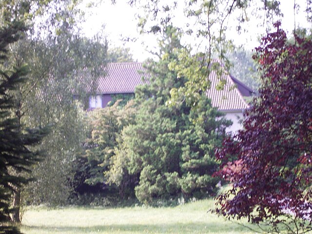
Apensen is a municipality located in the Lower Saxony region of Germany, known for its enchanting landscapes, rural charm, and proximity to natural reserves. While it might not be widely recognized as a major hiking destination, it offers various trails and paths that allow hikers to explore its scenic countryside and enjoy the tranquility that nature has to offer.
Hiking Options in Apensen:
-
Scenic Trails: The surrounding area features trails that wind through forests, fields, and along rivers. These paths are generally well-marked and provide opportunities for both short walks and longer hikes.
-
Nature Reserves: The nearby nature reserves and parks offer additional trails and diverse wildlife viewing opportunities. Hiking in these areas can be rewarding for both beginner and experienced hikers.
-
Local Recommendations: It's always a good idea to check with local tourist information centers for maps and recommendations on specific trails. They can provide details on the difficulty level, length, and highlights of different routes.
-
Nearby Hiking Destinations: If you are looking for more extensive hiking experiences, you can explore nearby regions. The Lüneburg Heath (Lüneburger Heide) is a renowned area for hiking, with its stunning heath landscapes and numerous marked trails.
Hiking Tips:
- Prepare: Bring sufficient water, snacks, and a first-aid kit. Check the weather before heading out, as conditions can change rapidly.
- Footwear: Wear appropriate hiking shoes to protect your feet and provide good traction on various terrains.
- Stay on Trails: To preserve the natural habitat, stick to marked trails and avoid cutting through vegetation.
- Respect Wildlife: Observe wildlife from a distance and avoid disturbing their natural environment.
Conclusion:
Hiking in Apensen may not be as famous as other hiking locations in Germany, but it provides a serene environment for those looking to escape into nature. Whether it's a leisurely stroll or a more rigorous hike, the area offers a chance to connect with the beautiful landscapes of Lower Saxony.
- Страна:

- Координаты: 53° 26' 9" N, 9° 37' 9" E


- GPS треки (wikiloc): [Ссылка]
- Площадь: 74.01 кв.км
- Население: 9139
- Веб сайт: http://www.apensen.de/
- Википедия английская: wiki(en)
- Википедия национальная: wiki(de)
- Хранилище Wikidata: Wikidata: Q488313
- Катеория в википедии: [Ссылка]
- код Freebase: [/m/0284q73]
- код Freebase: [/m/0284q73]
- код Freebase: [/m/0284q73]
- код VIAF: Альт: [239176557]
- код VIAF: Альт: [239176557]
- код VIAF: Альт: [239176557]
- ID отношения в OpenStreetMap: [446432]
- ID отношения в OpenStreetMap: [446432]
- ID отношения в OpenStreetMap: [446432]
- код GND: Альт: [4389370-3]
- код GND: Альт: [4389370-3]
- код GND: Альт: [4389370-3]
- код региона Германии: 033595401
- код региона Германии: 033595401
- код региона Германии: 033595401
Включает регионы:

Зауэнзик
Hiking in Зауэнзик
Sauensiek is a small village located in Lower Saxony, Germany, and offers some picturesque landscapes for hiking enthusiasts. While it may not be as widely known as some other hiking destinations, it provides a charming experience for those looking to explore the natural beauty of the area. Here are some aspects to consider when planning a hiking trip to Sauensiek:...
- Страна:
- Почтовый код: 21644
- Телефонный код: 04169
- Код автомобильного номера: STD
- Координаты: 53° 23' 0" N, 9° 36' 0" E
- GPS треки (wikiloc): [Ссылка]
- Высота над уровнем моря: 39 м m
- Площадь: 31.37 кв.км
- Население: 2468
- Веб сайт: [Ссылка]


Бекдорф
Hiking in Бекдорф
Beckdorf, located in Lower Saxony, Germany, is not one of the most well-known hiking destinations but offers a quaint experience for those looking to explore nature in a more serene setting. Here are some aspects to consider if you’re planning to hike in or around Beckdorf:...
- Страна:
- Почтовый код: 21643
- Телефонный код: 04167
- Код автомобильного номера: STD
- Координаты: 53° 24' 47" N, 9° 36' 38" E
- GPS треки (wikiloc): [Ссылка]
- Высота над уровнем моря: 40 м m
- Площадь: 21.98 кв.км
- Население: 2679
- Веб сайт: [Ссылка]


Апензен
Hiking in Апензен
Apensen, a small town in Lower Saxony, Germany, offers a charming hiking experience characterized by its serene landscapes and natural beauty. While it may not be as well-known as larger national parks, there are several aspects to consider when hiking in and around Apensen:...
- Страна:
- Почтовый код: 21641
- Телефонный код: 04167; 04163
- Код автомобильного номера: STD
- Координаты: 53° 26' 9" N, 9° 36' 56" E
- GPS треки (wikiloc): [Ссылка]
- Высота над уровнем моря: 29 м m
- Площадь: 20.74 кв.км
- Население: 4225
- Веб сайт: [Ссылка]
Граничит с регионами:


Букстехуде
Hiking in Букстехуде
Buxtehude, located in Lower Saxony, Germany, is known for its beautiful landscapes and charming surroundings, making it a great destination for hiking enthusiasts. The area is characterized by its lush woodlands, scenic rivers, and picturesque countryside....
- Страна:
- Почтовый код: 21614
- Телефонный код: 04161
- Код автомобильного номера: STD
- Координаты: 53° 28' 37" N, 9° 42' 4" E
- GPS треки (wikiloc): [Ссылка]
- Высота над уровнем моря: 5 м m
- Площадь: 76.49 кв.км
- Население: 40033
- Веб сайт: [Ссылка]

Harsefeld
Hiking in Harsefeld
Harsefeld, located in the Samtgemeinde (collective municipality) of Harsefeld in Lower Saxony, Germany, offers a beautiful setting for hiking enthusiasts. The region is characterized by its picturesque landscapes, including lush forests, charming rural paths, and scenic views of agricultural fields....
- Страна:
- Координаты: 53° 27' 0" N, 9° 30' 0" E
- GPS треки (wikiloc): [Ссылка]
- Население: 21294
- Веб сайт: [Ссылка]


Хорнебург
- укрупнённая община Нижней Саксонии
Hiking in Хорнебург
Horneburg, located in the Lower Saxony region of Germany, is surrounded by a picturesque landscape that offers a mix of trails suitable for different hiking levels. While it may not be as well-known as some other hiking destinations in Germany, the area provides a tranquil outdoor experience, ideal for nature lovers and those looking to escape the hustle and bustle of city life....
- Страна:
- Координаты: 53° 30' 0" N, 9° 35' 0" E
- GPS треки (wikiloc): [Ссылка]
- Население: 12572
- Веб сайт: [Ссылка]