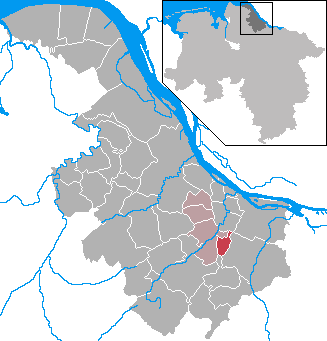
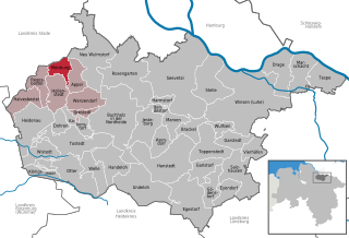
Букстехуде (Buxtehude, Buxtehude)

 Hiking in Букстехуде
Buxtehude, located in Lower Saxony, Germany, is known for its beautiful landscapes and charming surroundings, making it a great destination for hiking enthusiasts. The area is characterized by its lush woodlands, scenic rivers, and picturesque countryside.
Hiking Trails:
-
Buxtehude Walking Trails: There are various marked walking trails around the town that offer a range of options for hikers of all skill levels. These trails often lead through forests and fields, providing a peaceful environment.
-
Niederelbe Cycle Route: While primarily a cycling route, this path is also popular with hikers. It follows the Elbe River and offers stunning views of the waterway, as well as the surrounding countryside.
-
Nature Reserves: The nearby nature reserves, such as the “Buxtehuder Moor,” are ideal for those looking to explore more natural landscapes. They provide a chance to see local wildlife and unique plant species.
Tips for Hiking in Buxtehude:
- Seasonal Considerations: The best time for hiking in Buxtehude is from late spring to early autumn when the weather is generally mild and the trails are accessible.
- Equipment: Wear comfortable hiking shoes, and consider bringing a daypack with water, snacks, and a first aid kit.
- Maps and Navigation: While trails are often marked, having a map or a hiking app for navigation can enhance your experience.
- Respect Nature: Stick to marked paths to minimize impact on the environment and ensure the preservation of the local flora and fauna.
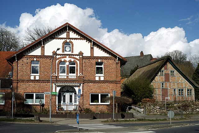
Local Attractions:
While hiking, you might also want to explore the charming town itself, with its historical buildings, quaint streets, and local shops. Don’t forget to visit the old town center and enjoy some local cuisine after a day on the trails!
Overall, Buxtehude offers a peaceful and picturesque hiking experience, perfect for those looking to enjoy the beauty of Lower Saxony.
- Страна:

- Почтовый код: 21614
- Телефонный код: 04161
- Код автомобильного номера: STD
- Координаты: 53° 28' 37" N, 9° 42' 4" E


- GPS треки (wikiloc): [Ссылка]
- Высота над уровнем моря: 5 м m
- Площадь: 76.49 кв.км
- Население: 40033
- Веб сайт: https://www.buxtehude.de/
- Википедия русская: wiki(ru)
- Википедия английская: wiki(en)
- Википедия национальная: wiki(de)
- Хранилище Wikidata: Wikidata: Q14868
- Галерея изображений в википедии: [Ссылка]
- Катеория в википедии: [Ссылка]
- Карты в википедии: [Ссылка]
- код Freebase: [/m/041599]
- код Freebase: [/m/041599]
- код Freebase: [/m/041599]
- код GeoNames: Альт: [2940451]
- код GeoNames: Альт: [2940451]
- код GeoNames: Альт: [2940451]
- код VIAF: Альт: [153620344]
- код VIAF: Альт: [153620344]
- код VIAF: Альт: [153620344]
- ID отношения в OpenStreetMap: [279078]
- ID отношения в OpenStreetMap: [279078]
- ID отношения в OpenStreetMap: [279078]
- код GND: Альт: [4009245-8]
- код GND: Альт: [4009245-8]
- код GND: Альт: [4009245-8]
- идентификатор местоположения ArchINFORM: [9678]
- идентификатор местоположения ArchINFORM: [9678]
- идентификатор местоположения ArchINFORM: [9678]
- код LCNAF: Альт: [n81136794]
- код LCNAF: Альт: [n81136794]
- код LCNAF: Альт: [n81136794]
- место в MusicBrainz: [b0dc42d7-0a66-4e4a-9cfd-3e845f209b0b]
- место в MusicBrainz: [b0dc42d7-0a66-4e4a-9cfd-3e845f209b0b]
- место в MusicBrainz: [b0dc42d7-0a66-4e4a-9cfd-3e845f209b0b]
- WOEID: [642951]
- WOEID: [642951]
- WOEID: [642951]
- код темы Quora: [Buxtehude]
- код темы Quora: [Buxtehude]
- код темы Quora: [Buxtehude]
- код в Большой каталанской энциклопедии: [0458934]
- код в Большой каталанской энциклопедии: [0458934]
- код в Большой каталанской энциклопедии: [0458934]
- код Historical Gazetteer: [BUXUDEJO43UL]
- код Historical Gazetteer: [BUXUDEJO43UL]
- код Historical Gazetteer: [BUXUDEJO43UL]
- EMLO location ID: [5cda842d-171c-4023-9b17-9fbaa1e5b0f4]
- EMLO location ID: [5cda842d-171c-4023-9b17-9fbaa1e5b0f4]
- EMLO location ID: [5cda842d-171c-4023-9b17-9fbaa1e5b0f4]
- код NKC: [ge893713]
- код NKC: [ge893713]
- код NKC: [ge893713]
- идентификатор муниципалитетов в Германии: 03359010
- идентификатор муниципалитетов в Германии: 03359010
- идентификатор муниципалитетов в Германии: 03359010
Включает регионы:

Daensen
Hiking in Daensen
Daensen, which is not as widely recognized as some other hiking destinations, is known for its serene landscapes that offer a variety of hiking trails suitable for different skill levels. Here’s an overview of what you might expect when hiking in the area:...
- Страна:
- Почтовый код: 21614
- Телефонный код: 04161
- Координаты: 53° 25' 19" N, 9° 41' 49" E
- GPS треки (wikiloc): [Ссылка]
- Высота над уровнем моря: 38 м m
Dammhausen
Hiking in Dammhausen
Dammhausen, located in the Lower Saxony region of Germany, offers some beautiful hiking opportunities, especially for those who enjoy scenic rural landscapes and tranquil nature. Here are a few points to consider when planning a hike in or around Dammhausen:...
- Страна:
- Почтовый код: 21614
- Телефонный код: 04161
- Координаты: 53° 29' 23" N, 9° 39' 51" E
- GPS треки (wikiloc): [Ссылка]
- Высота над уровнем моря: 1 м m
Eilendorf
Hiking in Eilendorf
Eilendorf, located near Buxtehude in Lower Saxony, Germany, is surrounded by beautiful landscapes that are great for hiking. While Eilendorf itself is a quaint village, the surrounding areas offer various trails that cater to different skill levels. Here are some highlights about hiking in and around Eilendorf:...
- Страна:
- Почтовый код: 21614
- Телефонный код: 04161
- Координаты: 53° 27' 6" N, 9° 41' 56" E
- GPS треки (wikiloc): [Ссылка]
- Высота над уровнем моря: 33 м m
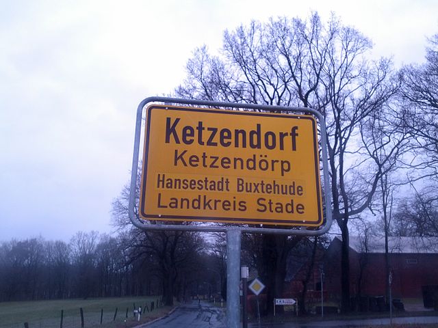
Ketzendorf
Hiking in Ketzendorf
Ketzendorf is a charming place, typically known for its picturesque landscapes and opportunities for outdoor activities, including hiking. While specific hiking trails may not be as well-known as those in larger national parks, Ketzendorf often features local footpaths that offer beautiful views of the surrounding countryside....
- Страна:
- Почтовый код: 21614
- Телефонный код: 04168
- Координаты: 53° 26' 39" N, 9° 45' 53" E
- GPS треки (wikiloc): [Ссылка]
- Высота над уровнем моря: 1 м m
Neukloster
Hiking in Neukloster
Neukloster, located in close proximity to Buxtehude in Lower Saxony, Germany, is surrounded by picturesque landscapes that can be inviting for hiking enthusiasts. While it may not be as well-known for its hiking trails as some larger natural parks, there are still some opportunities to explore the region's natural beauty....
- Страна:
- Почтовый код: 21614
- Телефонный код: 04161
- Координаты: 53° 28' 51" N, 9° 38' 23" E
- GPS треки (wikiloc): [Ссылка]
- Высота над уровнем моря: 8 м m

Ovelgönne
Hiking in Ovelgönne
Ovelgönne, a district in Buxtehude, is located in Lower Saxony, Germany. This area is not specifically known for extensive hiking trails, but it offers a charming landscape that can be enjoyed through various walking and hiking routes....
- Страна:
- Почтовый код: 21614
- Телефонный код: 04161
- Координаты: 53° 27' 1" N, 9° 45' 13" E
- GPS треки (wikiloc): [Ссылка]
- Высота над уровнем моря: 17 м m
Immenbeck
Hiking in Immenbeck
Immenbeck is a small area in Lower Saxony, Germany, located close to the city of Stade. While it's not a major hiking destination compared to national parks or mountainous regions, it does offer some pleasant rural walking opportunities. Here are some points to consider when hiking in and around Immenbeck:...
- Страна:
- Почтовый код: 21614
- Телефонный код: 04161
- Координаты: 53° 26' 50" N, 9° 43' 44" E
- GPS треки (wikiloc): [Ссылка]
- Высота над уровнем моря: 37 м m
Ottensen
Hiking in Ottensen
Ottensen is a district in the city of Buxtehude, Lower Saxony, Germany. While it may not be as famous for hiking as some mountainous regions, it offers a variety of outdoor activities and scenic walks that can be enjoyed by hikers of all levels....
- Страна:
- Почтовый код: 21614
- Телефонный код: 04161
- Координаты: 53° 27' 3" N, 9° 39' 49" E
- GPS треки (wikiloc): [Ссылка]
- Высота над уровнем моря: 29 м m
Westmoor
Hiking in Westmoor
Westmoor is a scenic area that offers a variety of hiking opportunities, characterized by its beautiful landscapes, diverse ecosystems, and well-marked trails. While specific details about "Westmoor" might depend on the exact location you're referring to, here are some general points that are often true for hiking in such areas:...
- Страна:
- Почтовый код: 21614
- Координаты: 53° 29' 1" N, 9° 41' 3" E
- GPS треки (wikiloc): [Ссылка]
Ostmoor
Hiking in Ostmoor
Ostmoor, located in the northern part of Germany, typically refers to a nature reserve or a region characterized by wetlands and unique ecosystems, making it an interesting destination for hiking enthusiasts. Here are some key points about hiking in Ostmoor:...
- Страна:
- Почтовый код: 21614
- Координаты: 53° 28' 0" N, 9° 43' 15" E
- GPS треки (wikiloc): [Ссылка]
Weide
Hiking in Weide
Weide, which is likely a misspelling or a less common term, may not refer to a specific hiking destination. However, if you're looking for information on hiking in areas known for meadows (the translation of "weide" in German), or if you've meant to refer to a specific region or location, please clarify, and I can provide more targeted information....
- Страна:
- Почтовый код: 21614
- Телефонный код: 04161
- Координаты: 53° 29' 19" N, 9° 44' 52" E
- GPS треки (wikiloc): [Ссылка]
Ziegelkamp
Hiking in Ziegelkamp
Ziegelkamp, located in Germany, offers a variety of hiking opportunities in a picturesque natural setting. Depending on the specific area you're referring to (as there might be routes with variations in landscape and difficulty), here's a general overview of what to expect when hiking in Ziegelkamp:...
- Страна:
- Координаты: 53° 28' 8" N, 9° 41' 29" E
- GPS треки (wikiloc): [Ссылка]
Граничит с регионами:


Хорнебург
- укрупнённая община Нижней Саксонии
Hiking in Хорнебург
Horneburg, located in the Lower Saxony region of Germany, is surrounded by a picturesque landscape that offers a mix of trails suitable for different hiking levels. While it may not be as well-known as some other hiking destinations in Germany, the area provides a tranquil outdoor experience, ideal for nature lovers and those looking to escape the hustle and bustle of city life....
- Страна:
- Координаты: 53° 30' 0" N, 9° 35' 0" E
- GPS треки (wikiloc): [Ссылка]
- Население: 12572
- Веб сайт: [Ссылка]
Apensen
Hiking in Apensen
Apensen is a municipality located in the Lower Saxony region of Germany, known for its enchanting landscapes, rural charm, and proximity to natural reserves. While it might not be widely recognized as a major hiking destination, it offers various trails and paths that allow hikers to explore its scenic countryside and enjoy the tranquility that nature has to offer....
- Страна:
- Координаты: 53° 26' 9" N, 9° 37' 9" E
- GPS треки (wikiloc): [Ссылка]
- Площадь: 74.01 кв.км
- Население: 9139
- Веб сайт: [Ссылка]


Нойенкирхен
- муниципалитет в германии в Германии, Нижняя Саксония, Штаде (район, Управление Люэ
Hiking in Нойенкирхен
Neuenkirchen, located in the Stade district of Lower Saxony, Germany, is a quaint town surrounded by beautiful countryside ideal for hiking enthusiasts. While Neuenkirchen itself may not have extensive hiking trails, its proximity to other natural areas makes it a great base for exploring the outdoors....
- Страна:
- Почтовый код: 21640
- Телефонный код: 04163
- Код автомобильного номера: STD
- Координаты: 53° 31' 0" N, 9° 36' 0" E
- GPS треки (wikiloc): [Ссылка]
- Высота над уровнем моря: 10 м m
- Площадь: 8.04 кв.км
- Население: 816
- Веб сайт: [Ссылка]


Бекдорф
Hiking in Бекдорф
Beckdorf, located in Lower Saxony, Germany, is not one of the most well-known hiking destinations but offers a quaint experience for those looking to explore nature in a more serene setting. Here are some aspects to consider if you’re planning to hike in or around Beckdorf:...
- Страна:
- Почтовый код: 21643
- Телефонный код: 04167
- Код автомобильного номера: STD
- Координаты: 53° 24' 47" N, 9° 36' 38" E
- GPS треки (wikiloc): [Ссылка]
- Высота над уровнем моря: 40 м m
- Площадь: 21.98 кв.км
- Население: 2679
- Веб сайт: [Ссылка]


Апензен
Hiking in Апензен
Apensen, a small town in Lower Saxony, Germany, offers a charming hiking experience characterized by its serene landscapes and natural beauty. While it may not be as well-known as larger national parks, there are several aspects to consider when hiking in and around Apensen:...
- Страна:
- Почтовый код: 21641
- Телефонный код: 04167; 04163
- Код автомобильного номера: STD
- Координаты: 53° 26' 9" N, 9° 36' 56" E
- GPS треки (wikiloc): [Ссылка]
- Высота над уровнем моря: 29 м m
- Площадь: 20.74 кв.км
- Население: 4225
- Веб сайт: [Ссылка]


Йорк
- община в Германии, Нижняя Саксония, Штаде
Hiking in Йорк
Jork, a small town in Lower Saxony, Germany, may not be widely known as a hiking destination, but it offers some scenic routes and nearby natural areas for outdoor enthusiasts. Here are some highlights related to hiking in and around Jork:...
- Страна:
- Почтовый код: 21635
- Телефонный код: 04162
- Код автомобильного номера: STD
- Координаты: 53° 31' 55" N, 9° 40' 51" E
- GPS треки (wikiloc): [Ссылка]
- Высота над уровнем моря: 3 м m
- Площадь: 62.26 кв.км
- Население: 12050
- Веб сайт: [Ссылка]
Ноттенсдорф
Hiking in Ноттенсдорф
Nottensdorf, located in the northern part of Germany, offers some lovely hiking opportunities in a scenic environment. The region is characterized by a mix of forests, meadows, and waterways, providing a diverse landscape for hikers of all skill levels....
- Страна:
- Почтовый код: 21640
- Телефонный код: 04163
- Код автомобильного номера: STD
- Координаты: 53° 29' 0" N, 9° 36' 0" E
- GPS треки (wikiloc): [Ссылка]
- Высота над уровнем моря: 22 м m
- Площадь: 7.14 кв.км
- Население: 1441
- Веб сайт: [Ссылка]
Мойсбург
Hiking in Мойсбург
Moisburg, located in Lower Saxony, Germany, is a small town that offers a quaint atmosphere and access to beautiful natural scenery. While Moisburg itself may not be widely recognized as a major hiking destination, its surroundings provide opportunities for outdoor activities, including hiking....
- Страна:
- Почтовый код: 21647
- Телефонный код: 04165
- Код автомобильного номера: WL
- Координаты: 53° 23' 59" N, 9° 41' 59" E
- GPS треки (wikiloc): [Ссылка]
- Высота над уровнем моря: 15 м m
- Площадь: 11.25 кв.км
- Население: 1936
- Веб сайт: [Ссылка]


Ной-Вульмсторф
Hiking in Ной-Вульмсторф
Neu Wulmstorf is located in Lower Saxony, Germany, and while it may not be a major hiking destination like some national parks, it does offer some pleasant outdoor experiences for those looking to enjoy nature and hiking....
- Страна:
- Почтовый код: 21629
- Телефонный код: 04168; 040
- Код автомобильного номера: WL
- Координаты: 53° 25' 22" N, 9° 47' 23" E
- GPS треки (wikiloc): [Ссылка]
- Высота над уровнем моря: 49 м m
- Площадь: 56.16 кв.км
- Население: 21159
- Веб сайт: [Ссылка]