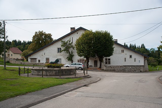
Arc-sous-Cicon (Arc-sous-Cicon)


- коммуна во Франции
 Hiking in Arc-sous-Cicon
Arc-sous-Cicon is a picturesque village located in the Doubs department of the Bourgogne-Franche-Comté region in eastern France. This area is known for its scenic landscapes, rolling hills, forests, and recreational opportunities, particularly for hiking enthusiasts.
Hiking Highlights in Arc-sous-Cicon:
-
Natural Surroundings: The region boasts beautiful natural scenery, including lush forests, meadows, and panoramic views of the surrounding landscape. The area is part of the Jura Mountains, which provide a diverse terrain for various hiking trails.
-
Trails: Several well-marked hiking trails can be found around Arc-sous-Cicon, catering to different skill levels:
- Easy Trails: Suitable for families and beginners, featuring gentle terrain and shorter distances.
- Moderate Trails: For those with some hiking experience, offering a mix of elevation gain and length.
- Challenging Trails: Designed for experienced hikers seeking a rigorous workout and more remote paths.
-
Flora and Fauna: Hikers can enjoy the rich biodiversity of the region. Keep an eye out for local wildlife such as deer, foxes, and various bird species. The changing seasons also offer unique floral displays.
-
Panoramic Views: Many trails lead to viewpoints that offer stunning vistas of the Jura Mountains and valleys below, making for perfect photo opportunities.
-
Cultural Sites: In addition to natural beauty, hikers may encounter historical sites, including traditional architecture and remnants of local history, adding cultural richness to the hiking experience.
-
Hiking Tips:
- Weather Awareness: Check weather conditions before heading out and dress accordingly. The weather can change quickly in mountainous regions.
- Hydration and Supplies: Carry enough water and snacks, especially for longer hikes.
- Trail Maps: Use local maps or hiking apps to navigate the trails and ensure you're on the correct path.
- Stay Respectful: Follow Leave No Trace principles to keep the area pristine and respect wildlife and fellow hikers.
-
Local Amenities: Arc-sous-Cicon and the surrounding areas have facilities for accommodation, dining, and local shops, making it convenient for hikers to plan day trips or longer stays.
Conclusion
Hiking in Arc-sous-Cicon offers a fantastic opportunity to explore the natural beauty of the Jura Mountains while enjoying the peaceful ambiance of this charming French village. Whether you’re a seasoned hiker or a casual walker, there are plenty of trails and sights to experience.
- Страна:

- Почтовый код: 25520
- Координаты: 47° 3' 9" N, 6° 22' 52" E


- GPS треки (wikiloc): [Ссылка]
- Площадь: 28.49 кв.км
- Население: 676
- Википедия английская: wiki(en)
- Википедия национальная: wiki(fr)
- Хранилище Wikidata: Wikidata: Q630979
- Катеория в википедии: [Ссылка]
- код Freebase: [/m/03mgbp9]
- код Freebase: [/m/03mgbp9]
- код GeoNames: Альт: [6447815]
- код GeoNames: Альт: [6447815]
- номер SIREN: [212500250]
- номер SIREN: [212500250]
- код BNF: [152522515]
- код BNF: [152522515]
- код VIAF: Альт: [246288956]
- код VIAF: Альт: [246288956]
- код муниципалитета INSEE: 25025
- код муниципалитета INSEE: 25025
Граничит с регионами:


Nods
- коммуна во Франции
Hiking in Nods
Nods is a charming village located in the Doubs department of France, nestled in the picturesque landscapes of the Jura Mountains. Hiking in and around Nods can be a rewarding experience, offering various trails that cater to different skill levels and preferences....
- Страна:
- Почтовый код: 25580
- Координаты: 47° 5' 48" N, 6° 20' 16" E
- GPS треки (wikiloc): [Ссылка]
- Площадь: 11.78 кв.км
- Население: 574

Passonfontaine
- коммуна во Франции
Hiking in Passonfontaine
Passonfontaine is a picturesque area located in France, known for its stunning natural landscapes and hiking opportunities. While it may not be as widely recognized as some of the larger national parks, it offers a variety of trails that cater to different skill levels, making it a great destination for both novice and experienced hikers....
- Страна:
- Почтовый код: 25690
- Координаты: 47° 6' 28" N, 6° 25' 8" E
- GPS треки (wikiloc): [Ссылка]
- Площадь: 19.49 кв.км
- Население: 316