
Ду (Doubs, Doubs)


- департамент Франции
 Hiking in Ду
Hiking in the Doubs region, located in eastern France, offers stunning landscapes and a rich natural heritage. The Doubs department is known for its rugged terrain, deep valleys, and diverse ecosystems, making it a wonderful destination for outdoor enthusiasts. Here are some highlights and recommendations for hiking in the area:
1.
- Doubs River: The Doubs River itself runs through the region, providing picturesque views and opportunities for riverside hikes. The gorge and surrounding cliffs offer various trails with breathtaking scenery.
- Cascade du Drugeon: This beautiful waterfall is a popular spot for hiking enthusiasts, with trails leading to stunning viewpoints.
2.
- Jura Mountains: The nearby Jura mountain range offers numerous trails that feature panoramic views, wooded areas, and charming alpine landscapes. The region is also known for its rich biodiversity.
- Parc Naturel Régional du Haut-Jura: This regional park is perfect for hiking, with a vast network of trails varying in difficulty. It’s an area where you can encounter local wildlife and enjoy the tranquility of nature.
3.
- Sentier des Vignes: This trail takes you through vineyards and offers a unique perspective of the local wine culture along with beautiful views of the landscape.
- Le Sentier des Forges: A historical trail that combines nature with heritage, leading hikers through forests and past ancient forges.
4.
- Spring and Summer: The best times for hiking in Doubs are spring and summer when the weather is mild, flowers are blooming, and many trails are fully accessible.
- Autumn: The fall brings spectacular foliage, with vibrant colors painting the landscape, making hikes particularly picturesque.
5.
- Make sure to wear appropriate hiking gear, including sturdy shoes and weather-appropriate clothing.
- Carry enough water and snacks, and be aware of trail markers for navigation.
- It's advisable to check local weather conditions before heading out and to choose trails that match your fitness level.
6.
- Take the opportunity to explore local villages and enjoy regional cuisine. The Doubs region is known for its cheese (like Comté), cured meats, and traditional pastries.
7.
- Consider obtaining local hiking maps or guides, and check in with local tourist offices or hiking clubs for updated information on trails and conditions.
Hiking in the Doubs is a fantastic way to experience nature while enjoying the serenity and beauty of this less-traveled part of France!
- Страна:

- Столица: Безансон
- Координаты: 47° 10' 0" N, 6° 25' 0" E


- GPS треки (wikiloc): [Ссылка]
- Площадь: 5234 кв.км
- Население: 536959
- Веб сайт: http://www.doubs.pref.gouv.fr/
- Википедия русская: wiki(ru)
- Википедия английская: wiki(en)
- Википедия национальная: wiki(fr)
- Хранилище Wikidata: Wikidata: Q3361
- Галерея изображений в википедии: [Ссылка]
- Катеория в википедии: [Ссылка]
- Карты в википедии: [Ссылка]
- код Freebase: [/m/0lb4g]
- код GeoNames: Альт: [3020989]
- номер SIREN: [222500019]
- код BNF: [119334605]
- код VIAF: Альт: [123302481]
- ID отношения в OpenStreetMap: [7462]
- код GND: Альт: [4085479-6]
- идентификатор местоположения ArchINFORM: [2724]
- код LCNAF: Альт: [n93053168]
- место в MusicBrainz: [c9613e93-6dd1-4356-902d-cdd39ceebe67]
- код TGN: [7002933]
- код в энциклопедии «Британника онлайн»: [place/Doubs]
- код в Большой каталанской энциклопедии: [0022889]
- код NLI: [001032727]
- код NUTS: [FR431]
- код департамента Франции INSEE: [25]
- ISO 3166-2: FR-25
Включает регионы:


Rigney
- коммуна во Франции
Hiking in Rigney
It seems that there isn't a well-known hiking area specifically named "Rigney." However, if you're referring to a specific location related to hiking, please clarify, and I would be glad to provide information!...
- Страна:
- Почтовый код: 25640
- Координаты: 47° 23' 17" N, 6° 10' 33" E
- GPS треки (wikiloc): [Ссылка]
- Площадь: 9.58 кв.км
- Население: 406
- Веб сайт: [Ссылка]


Bretigney
- коммуна во Франции
Hiking in Bretigney
Bretigney is a charming location for hiking, surrounded by stunning natural landscapes and a rich array of trails. While it may not be as famous as some other hiking destinations, it offers a variety of paths suitable for all skill levels....
- Страна:
- Почтовый код: 25250
- Координаты: 47° 29' 8" N, 6° 38' 13" E
- GPS треки (wikiloc): [Ссылка]
- Площадь: 1.83 кв.км
- Население: 73
- Веб сайт: [Ссылка]


Lanans
Hiking in Lanans
It seems there might be a typographical error or confusion with the name "Lanans," as there is no widely recognized hiking destination by that name as of my last update in October 2023. If you're referring to a specific location, it might help to clarify or provide additional context....
- Страна:
- Почтовый код: 25360
- Координаты: 47° 17' 49" N, 6° 26' 56" E
- GPS треки (wikiloc): [Ссылка]
- Площадь: 10.05 кв.км
- Население: 159


Roset-Fluans
- коммуна во Франции
Hiking in Roset-Fluans
Roset-Fluans is a charming commune located in the Doubs department in the Bourgogne-Franche-Comté region of France. It's nestled in the picturesque Jura mountains, which provide excellent opportunities for hiking and enjoying the outdoors....
- Страна:
- Почтовый код: 25410
- Координаты: 47° 9' 48" N, 5° 49' 33" E
- GPS треки (wikiloc): [Ссылка]
- Высота над уровнем моря: 260 м m
- Площадь: 8.28 кв.км
- Население: 507
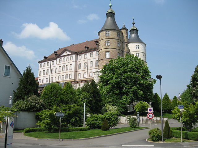

Монбельяр
- коммуна во Франции
Hiking in Монбельяр
Montbéliard, a picturesque town located in the Bourgogne-Franche-Comté region of eastern France, offers various hiking opportunities that allow you to explore the beautiful landscapes and rich history of the area....
- Страна:
- Почтовый код: 25200
- Координаты: 47° 30' 35" N, 6° 47' 54" E
- GPS треки (wikiloc): [Ссылка]
- Высота над уровнем моря: 337 м m
- Площадь: 15.01 кв.км
- Население: 25336
- Веб сайт: [Ссылка]


Chaux-lès-Clerval
- коммуна во Франции
Hiking in Chaux-lès-Clerval
Chaux-lès-Clerval is a small commune located in the Doubs department in the Bourgogne-Franche-Comté region of eastern France. The surrounding landscape offers beautiful natural scenery that can be quite enjoyable for hikers....
- Страна:
- Почтовый код: 25340
- Координаты: 47° 22' 58" N, 6° 30' 28" E
- GPS треки (wikiloc): [Ссылка]
- Площадь: 8.57 кв.км
- Население: 156


Lavans-Vuillafans
- коммуна во Франции
Hiking in Lavans-Vuillafans
Lavans-Vuillafans is a picturesque village located in the Doubs department of the Bourgogne-Franche-Comté region in eastern France. The area is known for its natural beauty, dense forests, and scenic landscapes, making it a wonderful destination for hiking enthusiasts....
- Страна:
- Почтовый код: 25580
- Координаты: 47° 5' 11" N, 6° 14' 39" E
- GPS треки (wikiloc): [Ссылка]
- Площадь: 10.16 кв.км
- Население: 228


Belleherbe
- коммуна во Франции
Hiking in Belleherbe
Belleherbe is a charming village located in the Doubs department of the Bourgogne-Franche-Comté region in eastern France. It’s surrounded by beautiful landscapes, making it a great spot for hiking enthusiasts. Here are some key details about hiking in and around Belleherbe:...
- Страна:
- Почтовый код: 25380
- Координаты: 47° 15' 43" N, 6° 39' 30" E
- GPS треки (wikiloc): [Ссылка]
- Площадь: 16.13 кв.км
- Население: 604


Ла-Клюз-э-Мижу
- коммуна во Франции
Hiking in Ла-Клюз-э-Мижу
La Cluse-et-Mijoux is a picturesque commune located in the Doubs department of the Bourgogne-Franche-Comté region in eastern France. Nestled in the Jura mountains, it offers beautiful landscapes, lush forests, and scenic views, making it a great destination for hiking enthusiasts....
- Страна:
- Почтовый код: 25300
- Координаты: 46° 52' 19" N, 6° 22' 43" E
- GPS треки (wikiloc): [Ссылка]
- Площадь: 22.5 кв.км
- Население: 1318
- Веб сайт: [Ссылка]


La Prétière
- коммуна во Франции
Hiking in La Prétière
La Prétière is a beautiful area for outdoor enthusiasts and hikers. Located in the Vienne region of France, it offers a mix of scenic landscapes, lush green forests, and a variety of trails suitable for different skill levels. Here’s what you can expect when hiking in La Prétière:...
- Страна:
- Почтовый код: 25250
- Координаты: 47° 26' 41" N, 6° 36' 34" E
- GPS треки (wikiloc): [Ссылка]
- Площадь: 2.71 кв.км
- Население: 160


Morteau
- коммуна во Франции
Hiking in Morteau
Morteau, a charming town located in the Doubs department of France, is surrounded by beautiful landscapes that are perfect for hiking enthusiasts. Nestled near the Jura Mountains and the border with Switzerland, Morteau offers a variety of trails suitable for different skill levels and preferences....
- Страна:
- Почтовый код: 25500
- Координаты: 47° 3' 29" N, 6° 36' 22" E
- GPS треки (wikiloc): [Ссылка]
- Площадь: 14.11 кв.км
- Население: 6849
- Веб сайт: [Ссылка]

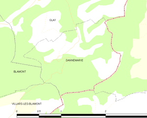
Dannemarie
Hiking in Dannemarie
Dannemarie, located in the Doubs department in the Bourgogne-Franche-Comté region of France, offers beautiful hiking opportunities through its picturesque landscapes, rolling hills, and forests. Here are some highlights and tips for hiking in the area:...
- Страна:
- Почтовый код: 25310
- Координаты: 47° 23' 25" N, 6° 53' 50" E
- GPS треки (wikiloc): [Ссылка]
- Площадь: 2.25 кв.км
- Население: 112

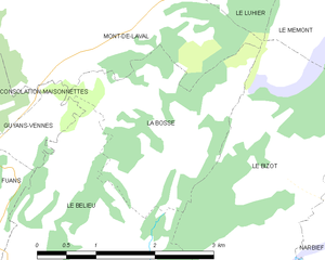
La Bosse
Hiking in La Bosse
La Bosse, located in the Doubs department in eastern France, is a part of the Jura Mountains and offers some stunning hiking opportunities. Here are a few highlights for hiking in this beautiful region:...
- Страна:
- Почтовый код: 25210
- Координаты: 47° 8' 17" N, 6° 39' 1" E
- GPS треки (wikiloc): [Ссылка]
- Площадь: 5.13 кв.км
- Население: 75


Châtelblanc
- коммуна во Франции
Hiking in Châtelblanc
Châtelblanc is a charming village located in the Jura Mountains of France, known for its stunning landscapes and a variety of outdoor activities, including hiking. Here are some key points to consider when hiking in Châtelblanc:...
- Страна:
- Почтовый код: 25240
- Координаты: 46° 40' 22" N, 6° 6' 57" E
- GPS треки (wikiloc): [Ссылка]
- Площадь: 20.79 кв.км
- Население: 123


Orchamps-Vennes
- коммуна во Франции
Hiking in Orchamps-Vennes
Orchamps-Vennes is a charming village located in the Doubs department of the Bourgogne-Franche-Comté region in eastern France. This area offers a variety of hiking opportunities that cater to different experience levels, from casual walkers to more experienced hikers....
- Страна:
- Почтовый код: 25390
- Координаты: 47° 8' 3" N, 6° 31' 31" E
- GPS треки (wikiloc): [Ссылка]
- Площадь: 24.79 кв.км
- Население: 2085


Dannemarie-sur-Crète
- коммуна во Франции
Hiking in Dannemarie-sur-Crète
Dannemarie-sur-Crète is a charming small village located in the Bourgogne-Franche-Comté region of eastern France. The area is known for its picturesque landscapes, rolling hills, and natural beauty, making it a great destination for hiking enthusiasts....
- Страна:
- Почтовый код: 25410
- Координаты: 47° 12' 22" N, 5° 51' 56" E
- GPS треки (wikiloc): [Ссылка]
- Площадь: 4.06 кв.км
- Население: 1411


Понтарлье
- коммуна во Франции
Hiking in Понтарлье
Pontarlier, located in the Doubs department of the Bourgogne-Franche-Comté region in eastern France, is a great base for hiking enthusiasts. Known for its stunning natural landscapes, the area features a mix of forests, mountains, and picturesque valleys....
- Страна:
- Почтовый код: 25300
- Координаты: 46° 54' 22" N, 6° 21' 17" E
- GPS треки (wikiloc): [Ссылка]
- Высота над уровнем моря: 837 м m
- Площадь: 41.35 кв.км
- Население: 17140
- Веб сайт: [Ссылка]

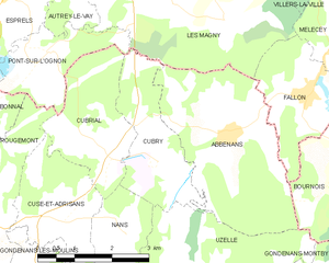
Cubry
- коммуна во Франции
Hiking in Cubry
It seems that there might be a typographical error or a misunderstanding regarding "Cubry." If you're referring to a specific region, national park, or local hiking area, please provide more details or clarify the name, and I'd be glad to assist you....
- Страна:
- Почтовый код: 25680
- Координаты: 47° 29' 36" N, 6° 25' 21" E
- GPS треки (wikiloc): [Ссылка]
- Площадь: 5.4 кв.км
- Население: 85


Blamont
- коммуна во Франции
Hiking in Blamont
Blamont is not a widely recognized hiking destination, and information about it may be limited or specific to regional trails. However, it's possible that Blamont refers to a local area in a specific region, possibly in France or another location....
- Страна:
- Почтовый код: 25310
- Координаты: 47° 23' 8" N, 6° 50' 53" E
- GPS треки (wikiloc): [Ссылка]
- Площадь: 10.06 кв.км
- Население: 1224

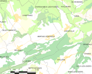
Amathay-Vésigneux
- коммуна во Франции
Hiking in Amathay-Vésigneux
Amathay-Vésigneux is a small commune located in the eastern part of France, in the Auvergne-Rhône-Alpes region. While it may not be as widely recognized as some larger hiking destinations, it offers a unique landscape and opportunities for outdoor enthusiasts....
- Страна:
- Почтовый код: 25330
- Координаты: 47° 1' 25" N, 6° 12' 0" E
- GPS треки (wikiloc): [Ссылка]
- Площадь: 12.13 кв.км
- Население: 160

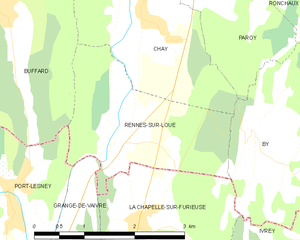
Rennes-sur-Loue
- коммуна во Франции
Hiking in Rennes-sur-Loue
Rennes-sur-Loue is a picturesque village located in the Jura region of France, known for its stunning natural landscapes, hiking trails, and the scenic Loue River. Here are some key points to consider when hiking in and around Rennes-sur-Loue:...
- Страна:
- Почтовый код: 25440
- Координаты: 47° 0' 44" N, 5° 51' 10" E
- GPS треки (wikiloc): [Ссылка]
- Площадь: 5.5 кв.км
- Население: 95

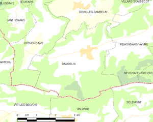
Dambelin
- коммуна во Франции
Hiking in Dambelin
Dambelin is not a widely recognized hiking destination in my training data, and it's possible that it may be a lesser-known or local area. However, I can provide you with general information on how to approach hiking in any area and what to consider when exploring a new location....
- Страна:
- Почтовый код: 25150
- Координаты: 47° 22' 30" N, 6° 40' 33" E
- GPS треки (wikiloc): [Ссылка]
- Площадь: 12.43 кв.км
- Население: 484


Échay
- коммуна во Франции
Hiking in Échay
Échay, a small village in the Haute-Savoie region of France, is surrounded by scenic landscapes perfect for hiking enthusiasts. The area offers a variety of trails that showcase the natural beauty of the Alps, including stunning views, lush forests, and alpine meadows....
- Страна:
- Почтовый код: 25440
- Координаты: 47° 2' 43" N, 5° 56' 53" E
- GPS треки (wikiloc): [Ссылка]
- Площадь: 5.49 кв.км
- Население: 128


Échenans
- коммуна во Франции
Hiking in Échenans
Échenans is a small commune in the Bourgogne-Franche-Comté region of France, located near the city of Montbéliard. While Échenans itself may not be widely recognized as a major hiking destination, the surrounding areas offer opportunities for hiking enthusiasts....
- Страна:
- Почтовый код: 25550
- Координаты: 47° 31' 34" N, 6° 41' 43" E
- GPS треки (wikiloc): [Ссылка]
- Высота над уровнем моря: 345 м m
- Площадь: 1.7 кв.км
- Население: 155


Échevannes
Hiking in Échevannes
Échevannes is a small commune located in the Doubs department in eastern France, nestled within the picturesque Jura region. This area is known for its stunning natural landscapes, characterized by rolling hills, dense forests, and tranquil lakes, making it a great spot for hiking enthusiasts....
- Страна:
- Почтовый код: 25580
- Координаты: 47° 4' 27" N, 6° 13' 51" E
- GPS треки (wikiloc): [Ссылка]
- Высота над уровнем моря: 650 м m
- Площадь: 5.23 кв.км
- Население: 89

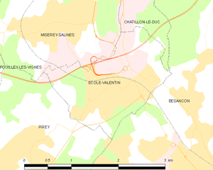
École-Valentin
- коммуна во Франции
Hiking in École-Valentin
École-Valentin is a small town located in the Doubs department in the Bourgogne-Franche-Comté region of eastern France. While not primarily known as a hiking destination, it is situated near several beautiful natural areas that offer opportunities for outdoor exploration....
- Страна:
- Почтовый код: 25480
- Координаты: 47° 16' 20" N, 5° 59' 5" E
- GPS треки (wikiloc): [Ссылка]
- Высота над уровнем моря: 290 м m
- Площадь: 3.22 кв.км
- Население: 2476
- Веб сайт: [Ссылка]

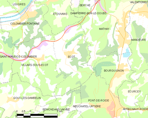
Écot
- коммуна во Франции
Hiking in Écot
Écot is a charming area located in the Vosges department of northeastern France, known for its beautiful natural landscapes and serene hiking opportunities. Hiking in Écot offers a chance to explore lush forests, rolling hills, and scenic viewpoints....
- Страна:
- Почтовый код: 25150
- Координаты: 47° 25' 34" N, 6° 43' 57" E
- GPS треки (wikiloc): [Ссылка]
- Площадь: 11.02 кв.км
- Население: 503


Écurcey
- коммуна во Франции
Hiking in Écurcey
Écurcey is a small commune located in the Normandy region of France, known for its picturesque landscapes and rural charm. Although Écurcey may not be widely recognized as a major hiking destination, it is surrounded by beautiful natural areas that can be explored....
- Страна:
- Почтовый код: 25150
- Координаты: 47° 24' 19" N, 6° 48' 45" E
- GPS треки (wikiloc): [Ссылка]
- Площадь: 7.43 кв.км
- Население: 273


Émagny
- коммуна во Франции
Hiking in Émagny
Émagny is a small commune in the Doubs department in the Bourgogne-Franche-Comté region of eastern France. While it may not be as widely known as some larger hiking destinations, its natural surroundings and rural charm can offer a pleasant experience for hikers looking to explore the region....
- Страна:
- Почтовый код: 25170
- Координаты: 47° 18' 41" N, 5° 52' 10" E
- GPS треки (wikiloc): [Ссылка]
- Площадь: 5.15 кв.км
- Население: 589
- Веб сайт: [Ссылка]


Rignosot
- коммуна во Франции
Hiking in Rignosot
It seems there might be a misunderstanding or a typo regarding "Rignosot," as it does not appear to correspond to a known hiking destination or location as of my last training cut-off in October 2023. If you meant a specific area or region, please provide more details or check the spelling....
- Страна:
- Почтовый код: 25640
- Координаты: 47° 23' 18" N, 6° 11' 39" E
- GPS треки (wikiloc): [Ссылка]
- Площадь: 3.85 кв.км
- Население: 117


Noirefontaine
- коммуна во Франции
Hiking in Noirefontaine
Noirefontaine is an area in the French region of Auvergne-Rhône-Alpes, known for its scenic beauty and great opportunities for hiking. This region boasts a mix of lush forests, rolling hills, and picturesque landscapes, making it an ideal destination for outdoor enthusiasts....
- Страна:
- Почтовый код: 25190
- Координаты: 47° 20' 56" N, 6° 45' 43" E
- GPS треки (wikiloc): [Ссылка]
- Площадь: 3.35 кв.км
- Население: 396


Métabief
- коммуна во Франции
Hiking in Métabief
Métabief is a charming destination located in the Jura Mountains in eastern France, known for its stunning natural landscapes, picturesque views, and a variety of hiking trails suitable for all skill levels. Here are some key points to consider if you're planning a hiking trip in Métabief:...
- Страна:
- Почтовый код: 25370
- Координаты: 46° 46' 23" N, 6° 21' 6" E
- GPS треки (wikiloc): [Ссылка]
- Площадь: 5.76 кв.км
- Население: 1179
- Веб сайт: [Ссылка]


Épenouse
- коммуна во Франции
Hiking in Épenouse
Épenouse is a charming commune located in the Jura department of eastern France. It offers a variety of hiking opportunities for both novice and experienced hikers, surrounded by stunning natural landscapes, including forests, rolling hills, and picturesque views of the Jura Mountains....
- Страна:
- Почтовый код: 25530
- Координаты: 47° 12' 52" N, 6° 24' 6" E
- GPS треки (wikiloc): [Ссылка]
- Площадь: 5.75 кв.км
- Население: 147


Épenoy
- коммуна во Франции
Hiking in Épenoy
Épenoy is a picturesque village located in the Bourgogne-Franche-Comté region of eastern France, nestled in the Jura Mountains. This area is known for its stunning landscapes, diverse flora and fauna, and a range of hiking opportunities suitable for various experience levels....
- Страна:
- Почтовый код: 25800
- Координаты: 47° 7' 52" N, 6° 22' 14" E
- GPS треки (wikiloc): [Ссылка]
- Площадь: 13.25 кв.км
- Население: 631


Épeugney
- коммуна во Франции
Hiking in Épeugney
Épeugney is a picturesque village in the Haute-Saône department in the Bourgogne-Franche-Comté region of eastern France. The surrounding landscape is characterized by rolling hills, forests, and meadows, offering a serene backdrop for hiking enthusiasts. Here's what you can expect when hiking in and around Épeugney:...
- Страна:
- Почтовый код: 25290
- Координаты: 47° 7' 3" N, 6° 1' 28" E
- GPS треки (wikiloc): [Ссылка]
- Площадь: 13.95 кв.км
- Население: 603


Étalans
- коммуна во Франции
Hiking in Étalans
Étalans is a charming village located in the Doubs department in the Bourgogne-Franche-Comté region of France. It is surrounded by beautiful natural landscapes, making it a great spot for hiking enthusiasts. Here are some highlights and tips for hiking in and around Étalans:...
- Страна:
- Почтовый код: 25580
- Координаты: 47° 9' 5" N, 6° 16' 6" E
- GPS треки (wikiloc): [Ссылка]
- Площадь: 23.95 кв.км
- Население: 1219
- Веб сайт: [Ссылка]


Éternoz
- коммуна во Франции
Hiking in Éternoz
Éternoz is a charming commune located in the Jura department in the region of Bourgogne-Franche-Comté, eastern France. The surrounding landscape is characterized by lush forests, rolling hills, and picturesque views, making it a great spot for hiking enthusiasts....
- Страна:
- Почтовый код: 25330
- Координаты: 47° 0' 26" N, 6° 1' 46" E
- GPS треки (wikiloc): [Ссылка]
- Площадь: 29.26 кв.км
- Население: 337


Étrabonne
- коммуна во Франции
Hiking in Étrabonne
Étrabonne, located in the Auvergne-Rhône-Alpes region of France, is a charming destination for hiking enthusiasts. Surrounded by the serene beauty of the French Alps, this area offers a variety of trails suitable for all levels of hikers, from beginners to experienced trekkers....
- Страна:
- Почтовый код: 25170
- Координаты: 47° 14' 2" N, 5° 44' 33" E
- GPS треки (wikiloc): [Ссылка]
- Площадь: 5.52 кв.км
- Население: 195


Étouvans
- коммуна во Франции
Hiking in Étouvans
Étouvans is a small commune in the Doubs department in eastern France, surrounded by beautiful natural landscapes that are ideal for hiking enthusiasts. The region offers a mix of picturesque countryside, wooded areas, and scenic hills, making it a great destination for outdoor activities....
- Страна:
- Почтовый код: 25260
- Координаты: 47° 27' 51" N, 6° 43' 11" E
- GPS треки (wikiloc): [Ссылка]
- Площадь: 6.56 кв.км
- Население: 809
- Веб сайт: [Ссылка]


Étrappe
- коммуна во Франции
Hiking in Étrappe
Étrappe, located in the region of Bourgogne-Franche-Comté in France, is a small village known for its picturesque landscapes and natural surroundings. While specific hiking trails in Étrappe might not be widely documented, the region overall offers a range of outdoor activities and beautiful scenery that can be enjoyed by hiking enthusiasts....
- Страна:
- Почтовый код: 25250
- Координаты: 47° 28' 27" N, 6° 34' 46" E
- GPS треки (wikiloc): [Ссылка]
- Площадь: 2.92 кв.км
- Население: 207


Étray
- коммуна во Франции
Hiking in Étray
Étray is a picturesque commune located in the Auvergne-Rhône-Alpes region of France, surrounded by stunning natural landscapes. While it may not be as widely known as some other hiking destinations, it offers a variety of trails and beautiful scenery that can make for an enjoyable hiking experience....
- Страна:
- Почтовый код: 25800
- Координаты: 47° 7' 23" N, 6° 20' 34" E
- GPS треки (wikiloc): [Ссылка]
- Площадь: 6 кв.км
- Население: 264


Этюп
- коммуна во Франции
Hiking in Этюп
Étupes is a charming commune located in the Doubs department in eastern France. Surrounded by natural beauty and rolling hills, it offers several opportunities for hiking enthusiasts. Here are some key points about hiking in and around Étupes:...
- Страна:
- Почтовый код: 25460
- Координаты: 47° 30' 23" N, 6° 51' 40" E
- GPS треки (wikiloc): [Ссылка]
- Площадь: 9.87 кв.км
- Население: 3698


Évillers
- коммуна во Франции
Hiking in Évillers
Évillers is a charming commune located in the Doubs department of the Bourgogne-Franche-Comté region in eastern France. It is surrounded by beautiful natural landscapes, making it an ideal destination for hiking enthusiasts....
- Страна:
- Почтовый код: 25520
- Координаты: 47° 0' 0" N, 6° 13' 33" E
- GPS треки (wikiloc): [Ссылка]
- Площадь: 13.02 кв.км
- Население: 346


Abbans-Dessous
- коммуна во Франции
Hiking in Abbans-Dessous
Abbins-Dessous, situated in the Bourgogne-Franche-Comté region of France, offers beautiful landscapes and a variety of hiking opportunities. While it may not be as widely known as some of the major hiking destinations in France, it provides a serene environment for outdoor enthusiasts. Here are some aspects to consider for hiking in this area:...
- Страна:
- Почтовый код: 25320
- Координаты: 47° 8' 1" N, 5° 52' 28" E
- GPS треки (wikiloc): [Ссылка]
- Высота над уровнем моря: 260 м m
- Площадь: 3.2 кв.км
- Население: 263


Abbans-Dessus
- коммуна во Франции
Hiking in Abbans-Dessus
Abbans-Dessus is a picturesque village located in the Doubs department of the Bourgogne-Franche-Comté region in eastern France. It's a great destination for hiking, as it offers beautiful landscapes and various trails for different skill levels. Here are some key points to consider when planning a hiking trip in and around Abbans-Dessus:...
- Страна:
- Почтовый код: 25440
- Координаты: 47° 7' 12" N, 5° 52' 55" E
- GPS треки (wikiloc): [Ссылка]
- Площадь: 4.43 кв.км
- Население: 303


Abbenans
- коммуна во Франции
Hiking in Abbenans
Abbenans is a small commune located in the Bourgogne-Franche-Comté region of France. While it may not be as widely known for hiking as some other areas in France, the surrounding countryside and natural beauty offer opportunities for outdoor activities, including hiking....
- Страна:
- Почтовый код: 25340
- Координаты: 47° 30' 0" N, 6° 27' 2" E
- GPS треки (wikiloc): [Ссылка]
- Площадь: 11.17 кв.км
- Население: 350


Abbévillers
- коммуна во Франции
Hiking in Abbévillers
Abbévillers is a charming commune located in the Doubs department in the Bourgogne-Franche-Comté region of eastern France. This area offers beautiful landscapes, rich nature, and numerous trails that cater to various hiking levels....
- Страна:
- Почтовый код: 25310
- Координаты: 47° 25' 53" N, 6° 55' 6" E
- GPS треки (wikiloc): [Ссылка]
- Площадь: 11.18 кв.км
- Население: 1026
- Веб сайт: [Ссылка]


Frasne
- коммуна во Франции
Hiking in Frasne
Frasne is a small commune located in the Jura region of eastern France, surrounded by stunning natural landscapes that are ideal for hiking enthusiasts. The area is characterized by picturesque valleys, forests, and rolling hills, offering a variety of trails suitable for different skill levels....
- Страна:
- Почтовый код: 25560
- Координаты: 46° 51' 23" N, 6° 9' 34" E
- GPS треки (wikiloc): [Ссылка]
- Высота над уровнем моря: 859 м m
- Площадь: 32.87 кв.км
- Население: 1965
- Веб сайт: [Ссылка]


Accolans
- коммуна во Франции
Hiking in Accolans
Accolans, located in the Bourgogne-Franche-Comté region of France, is a quaint village known for its beautiful landscapes and natural surroundings. While it may not be as widely recognized as some other hiking destinations, it offers a serene environment for those looking to enjoy the outdoors....
- Страна:
- Почтовый код: 25250
- Координаты: 47° 29' 40" N, 6° 31' 55" E
- GPS треки (wikiloc): [Ссылка]
- Площадь: 5.18 кв.км
- Население: 100
- Веб сайт: [Ссылка]


Adam-lès-Passavant
- коммуна во Франции
Hiking in Adam-lès-Passavant
Adam-lès-Passavant, located in the Doubs department of the Bourgogne-Franche-Comté region in eastern France, offers a charming setting for hiking enthusiasts. The area is characterized by its stunning natural landscapes, including forests, rolling hills, and scenic viewpoints....
- Страна:
- Почтовый код: 25360
- Координаты: 47° 17' 49" N, 6° 21' 42" E
- GPS треки (wikiloc): [Ссылка]
- Площадь: 9.59 кв.км
- Население: 94

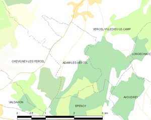
Adam-lès-Vercel
- коммуна во Франции
Hiking in Adam-lès-Vercel
Adam-lès-Vercel is a charming commune located in the Doubs department of France, nestled in the Jura Mountains. This area offers a blend of beautiful landscapes, rich biodiversity, and opportunities for hiking enthusiasts. Here are some aspects to consider for hiking in and around Adam-lès-Vercel:...
- Страна:
- Почтовый код: 25530
- Координаты: 47° 10' 5" N, 6° 23' 29" E
- GPS треки (wikiloc): [Ссылка]
- Площадь: 3.19 кв.км
- Население: 98


Corcelles-Ferrières
- коммуна во Франции
Hiking in Corcelles-Ferrières
Corcelles-Ferrières is a charming village located in the Jura region of France, known for its beautiful landscapes and outdoor activities, including hiking. The area is characterized by its picturesque green hills, forests, and a network of trails that provide excellent opportunities for both casual walkers and experienced hikers....
- Страна:
- Почтовый код: 25410
- Координаты: 47° 13' 38" N, 5° 48' 35" E
- GPS треки (wikiloc): [Ссылка]
- Высота над уровнем моря: 220 м m
- Площадь: 2.25 кв.км
- Население: 198


Consolation-Maisonnettes
- коммуна во Франции
Hiking in Consolation-Maisonnettes
Consolation-Maisonnettes, located in the Doubs department of France, offers a beautiful setting for hiking enthusiasts. The region is known for its stunning natural landscapes, including forests, rivers, and impressive rock formations. Here are some highlights of hiking in this area:...
- Страна:
- Почтовый код: 25390
- Координаты: 47° 9' 27" N, 6° 36' 21" E
- GPS треки (wikiloc): [Ссылка]
- Площадь: 4.31 кв.км
- Население: 35


Doubs
- коммуна во Франции
Hiking in Doubs
Doubs, a department in the Bourgogne-Franche-Comté region of eastern France, offers a variety of stunning hiking opportunities. The picturesque landscapes, characterized by rolling hills, forests, valleys, and the Doubs River, make it a popular destination for outdoor enthusiasts....
- Страна:
- Почтовый код: 25300
- Координаты: 46° 55' 36" N, 6° 21' 0" E
- GPS треки (wikiloc): [Ссылка]
- Высота над уровнем моря: 813 м m
- Площадь: 8.94 кв.км
- Население: 2888
- Веб сайт: [Ссылка]

Монсес
- коммуна во Франции1
Hiking in Монсес
Moncey, located in the Doubs department of the Bourgogne-Franche-Comté region in eastern France, offers a scenic landscape ideal for hiking enthusiasts. The area is known for its natural beauty, including rolling hills, dense forests, and picturesque valleys, making it a great destination for outdoor activities....
- Страна:
- Почтовый код: 25870
- Координаты: 47° 21' 46" N, 6° 7' 11" E
- GPS треки (wikiloc): [Ссылка]
- Площадь: 5 кв.км
- Население: 548
- Веб сайт: [Ссылка]


Bavans
- коммуна во Франции
Hiking in Bavans
Bavans is a picturesque village located in the Doubs department of the Bourgogne-Franche-Comté region in eastern France. While it may not be as widely known as some other hiking destinations in the country, its natural beauty offers plenty of opportunities for outdoor enthusiasts....
- Страна:
- Почтовый код: 25550
- Координаты: 47° 28' 54" N, 6° 43' 50" E
- GPS треки (wikiloc): [Ссылка]
- Площадь: 8.83 кв.км
- Население: 3683


Aibre
- коммуна во Франции
Hiking in Aibre
It seems there may be a typo or misunderstanding regarding "Aibre," as there isn’t a well-known hiking location by that name in commonly referenced hiking guides or maps. However, if you're referring to a particular area or if it’s a local name, I’d be happy to help with general hiking advice or information about popular hiking destinations in your region....
- Страна:
- Почтовый код: 25750
- Координаты: 47° 33' 4" N, 6° 41' 48" E
- GPS треки (wikiloc): [Ссылка]
- Площадь: 4.5 кв.км
- Население: 480

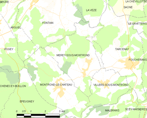
Mérey-sous-Montrond
- коммуна во Франции
Hiking in Mérey-sous-Montrond
Mérey-sous-Montrond is a charming commune located in the Doubs department in the Bourgogne-Franche-Comté region of eastern France. The area surrounding Mérey-sous-Montrond offers various opportunities for hiking enthusiasts to explore the beautiful landscapes, forests, and countryside typical of this region....
- Страна:
- Почтовый код: 25660
- Координаты: 47° 9' 5" N, 6° 4' 7" E
- GPS треки (wikiloc): [Ссылка]
- Площадь: 10.79 кв.км
- Население: 419


Ougney-Douvot
- коммуна во Франции
Hiking in Ougney-Douvot
Ougney-Douvot is a small commune located in the Bourgogne-Franche-Comté region of France. While it may not be as widely recognized as larger hiking destinations, it offers some charming opportunities for outdoor enthusiasts looking to explore the natural beauty of rural France....
- Страна:
- Почтовый код: 25640
- Координаты: 47° 18' 41" N, 6° 15' 29" E
- GPS треки (wikiloc): [Ссылка]
- Площадь: 6.56 кв.км
- Население: 235

Amancey
- коммуна во Франции
Hiking in Amancey
Amancey is a charming commune located in the Doubs department in the Bourgogne-Franche-Comté region of eastern France. Nestled within the beautiful Jura Mountains, it offers a variety of landscapes perfect for hiking enthusiasts. Here are some highlights and tips for hiking in Amancey:...
- Страна:
- Почтовый код: 25330
- Координаты: 47° 2' 17" N, 6° 4' 18" E
- GPS треки (wikiloc): [Ссылка]
- Площадь: 13.78 кв.км
- Население: 670


Amondans
- коммуна во Франции
Hiking in Amondans
It appears there might be a spelling error or misunderstanding regarding "Amondans." If you're referring to a specific location, could you please clarify the name? It could be a lesser-known area or perhaps a local term....
- Страна:
- Почтовый код: 25330
- Координаты: 47° 4' 8" N, 6° 2' 25" E
- GPS треки (wikiloc): [Ссылка]
- Площадь: 5.68 кв.км
- Население: 90


Chamesol
- коммуна во Франции
Hiking in Chamesol
Chamesol is a charming destination for hiking enthusiasts, located in the stunning Vosges mountains of France. This region is renowned for its beautiful landscapes, extensive forested areas, and variety of wildlife, making it an excellent spot for outdoor activities....
- Страна:
- Почтовый код: 25190
- Координаты: 47° 20' 51" N, 6° 49' 54" E
- GPS треки (wikiloc): [Ссылка]
- Площадь: 10.21 кв.км
- Население: 373
- Веб сайт: [Ссылка]


Gilley
Hiking in Gilley
Gilley is a charming village located in the Doubs department of the Bourgogne-Franche-Comté region in eastern France. It’s a great spot for hiking enthusiasts, offering picturesque landscapes, lush forests, and scenic views of the surrounding Jura mountains....
- Страна:
- Почтовый код: 25650
- Координаты: 47° 2' 51" N, 6° 29' 4" E
- GPS треки (wikiloc): [Ссылка]
- Площадь: 17.27 кв.км
- Население: 1615
- Веб сайт: [Ссылка]


Орнан
- коммуна во Франции
Hiking in Орнан
Ornans is a picturesque town located in the Doubs department of eastern France, known for its stunning landscapes, rich culture, and historical significance. Nestled in the Jura Mountains, it offers a variety of hiking opportunities that cater to outdoor enthusiasts of all skill levels....
- Страна:
- Почтовый код: 25290
- Координаты: 47° 6' 19" N, 6° 8' 35" E
- GPS треки (wikiloc): [Ссылка]
- Площадь: 32.64 кв.км
- Население: 4241
- Веб сайт: [Ссылка]


Routelle
- коммуна во Франции
Hiking in Routelle
Routelle, situated in the French Alps, is a fantastic destination for hiking enthusiasts. The region is characterized by its stunning landscapes, diverse flora and fauna, and a variety of trails suitable for all skill levels. Here are some key points to consider when planning a hike in Routelle:...
- Страна:
- Почтовый код: 25410
- Координаты: 47° 10' 4" N, 5° 50' 59" E
- GPS треки (wikiloc): [Ссылка]
- Площадь: 3.06 кв.км
- Население: 501

Понтарлье
- округ Франции
Hiking in Понтарлье
The Arrondissement of Pontarlier, located in the Doubs department of the Bourgogne-Franche-Comté region in eastern France, offers a variety of hiking opportunities that cater to different skill levels and preferences. Here are some highlights:...
- Страна:
- Столица: Понтарлье
- Координаты: 46° 50' 0" N, 6° 15' 0" E
- GPS треки (wikiloc): [Ссылка]
- Площадь: 1293 кв.км
- Население: 111370


Berthelange
- коммуна во Франции
Hiking in Berthelange
Berthelange, a charming location in France, offers beautiful hiking opportunities for nature enthusiasts. While specific trails may not be world-renowned, the area is likely characterized by picturesque landscapes and local charm typical of French countryside hiking experiences....
- Страна:
- Почтовый код: 25410
- Координаты: 47° 11' 52" N, 5° 46' 46" E
- GPS треки (wikiloc): [Ссылка]
- Площадь: 4.07 кв.км
- Население: 309

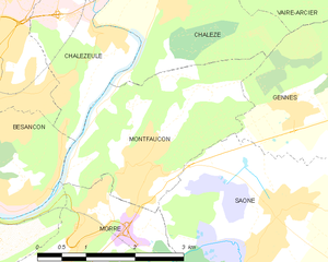
Montfaucon
Hiking in Montfaucon
Montfaucon, located in the Doubs department of France, offers beautiful hiking opportunities for outdoor enthusiasts. The region is characterized by its picturesque landscapes, rolling hills, and lush forests, making it an ideal setting for both casual walkers and more experienced hikers....
- Страна:
- Почтовый код: 25660
- Координаты: 47° 14' 4" N, 6° 4' 48" E
- GPS треки (wikiloc): [Ссылка]
- Площадь: 7.25 кв.км
- Население: 1503
- Веб сайт: [Ссылка]

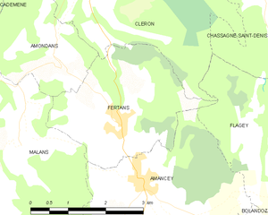
Fertans
- коммуна во Франции
Hiking in Fertans
Fertans is a small village located in the Jura region of France, known for its beautiful landscapes and nature-friendly environment. Hiking in and around Fertans offers a blend of scenic views, diverse terrains, and the tranquility of the Jura mountains. Here are some details to consider:...
- Страна:
- Почтовый код: 25330
- Координаты: 47° 3' 4" N, 6° 3' 48" E
- GPS треки (wikiloc): [Ссылка]
- Площадь: 8.19 кв.км
- Население: 261


Puessans
- коммуна во Франции
Hiking in Puessans
It seems there might be a typo or misunderstanding in your request, as "Puessans" doesn't appear to correspond to a well-known hiking area or location. If you meant "Puslinch", located in Ontario, Canada, or perhaps "Puget Sound" in Washington state, I can provide information on those areas....
- Страна:
- Почтовый код: 25680
- Координаты: 47° 25' 47" N, 6° 19' 23" E
- GPS треки (wikiloc): [Ссылка]
- Площадь: 3.59 кв.км
- Население: 32


Blussangeaux
- коммуна во Франции
Hiking in Blussangeaux
Blussangeaux is a relatively lesser-known hiking destination, so it might not have as much detailed information available compared to more popular hiking areas. However, if you find yourself in or around this region, you can expect beautiful landscapes, diverse flora and fauna, and a chance to enjoy the great outdoors. Here are some general tips and considerations for hiking in Blussangeaux:...
- Страна:
- Почтовый код: 25250
- Координаты: 47° 25' 47" N, 6° 36' 50" E
- GPS треки (wikiloc): [Ссылка]
- Площадь: 2.12 кв.км
- Население: 84


Rantechaux
- коммуна во Франции
Hiking in Rantechaux
Rantechaux, located in the Doubs department of the Bourgogne-Franche-Comté region in France, offers beautiful landscapes and a variety of hiking opportunities. While specific trails can vary, here are some general aspects and suggestions for hiking in the area:...
- Страна:
- Почтовый код: 25580
- Координаты: 47° 6' 44" N, 6° 22' 30" E
- GPS треки (wikiloc): [Ссылка]
- Площадь: 5.71 кв.км
- Население: 179


Burnevillers
- коммуна во Франции
Hiking in Burnevillers
Burnevillers is a charming destination located in the Franche-Comté region of France, known for its stunning natural landscapes and hiking opportunities. Nestled in the Jura Mountains, the area offers a variety of trails that cater to different skill levels, from leisurely walks to more demanding hikes....
- Страна:
- Почтовый код: 25470
- Координаты: 47° 19' 44" N, 7° 0' 29" E
- GPS треки (wikiloc): [Ссылка]
- Площадь: 6.74 кв.км
- Население: 46

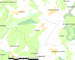
Durnes
- коммуна во Франции
Hiking in Durnes
Durness, located in the North Highlands of Scotland, is a fantastic destination for hiking enthusiasts. Its rugged coastline, dramatic landscapes, and abundant natural beauty offer a wide range of hiking opportunities suitable for various skill levels. Here are some highlights and considerations for hiking in and around Durness:...
- Страна:
- Почтовый код: 25580
- Координаты: 47° 6' 29" N, 6° 13' 53" E
- GPS треки (wikiloc): [Ссылка]
- Площадь: 8.51 кв.км
- Население: 171


Les Gras
- коммуна во Франции
Hiking in Les Gras
Les Granges is a beautiful area often associated with scenic hiking opportunities, especially in regions such as the French Alps or other mountainous regions named similarly. While specific trails can vary, hiking in mountainous areas like Les Granges typically offers various terrains, from easy walks to challenging hikes, showcasing stunning vistas, alpine flora, and diverse wildlife....
- Страна:
- Почтовый код: 25790
- Координаты: 46° 59' 41" N, 6° 32' 40" E
- GPS треки (wikiloc): [Ссылка]
- Площадь: 14.99 кв.км
- Население: 825

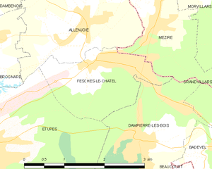
Fesches-le-Châtel
- коммуна во Франции
Hiking in Fesches-le-Châtel
Fesches-le-Châtel, located in the Bourgogne-Franche-Comté region of France, near the borders of Switzerland, offers a picturesque setting for hiking enthusiasts. While the town itself is small, its surroundings are rich in natural beauty, with rolling hills, lush forests, and scenic landscapes ripe for exploration....
- Страна:
- Почтовый код: 25490
- Координаты: 47° 31' 27" N, 6° 54' 24" E
- GPS треки (wikiloc): [Ссылка]
- Площадь: 3.46 кв.км
- Население: 2208
- Веб сайт: [Ссылка]


Gennes
- коммуна во Франции
Hiking in Gennes
Gennes is a charming village located in the Doubs department in the Bourgogne-Franche-Comté region of eastern France. It's a beautiful area known for its scenic landscapes, rolling hills, and lush forests, making it an excellent location for hiking enthusiasts....
- Страна:
- Почтовый код: 25660
- Координаты: 47° 14' 42" N, 6° 7' 16" E
- GPS треки (wikiloc): [Ссылка]
- Площадь: 7.18 кв.км
- Население: 673
- Веб сайт: [Ссылка]


Gémonval
- коммуна во Франции
Hiking in Gémonval
Gémonval, while not widely known as a hiking destination, offers beautiful landscapes and trails for those looking to explore the outdoors. If you’re planning a hiking trip there, here are a few tips and information that may enhance your experience:...
- Страна:
- Почтовый код: 25250
- Координаты: 47° 31' 56" N, 6° 35' 19" E
- GPS треки (wikiloc): [Ссылка]
- Площадь: 3.39 кв.км
- Население: 84

Fleurey
- коммуна во Франции
Hiking in Fleurey
Fleurey is likely a reference to Fleurey-sur-Ouche, a picturesque commune located in the Côte-d'Or department in the Bourgogne-Franche-Comté region of France. The region is known for its beautiful landscapes, rolling hills, and scenic trails that are perfect for hiking enthusiasts....
- Страна:
- Почтовый код: 25190
- Координаты: 47° 18' 13" N, 6° 46' 45" E
- GPS треки (wikiloc): [Ссылка]
- Площадь: 8.04 кв.км
- Население: 84


Fontaine-lès-Clerval
- коммуна во Франции
Hiking in Fontaine-lès-Clerval
Fontaine-lès-Clerval is a charming village located in the Doubs department of the Bourgogne-Franche-Comté region in eastern France. The surrounding area offers a variety of hiking opportunities, featuring beautiful landscapes full of natural beauty, rolling hills, forests, and rivers....
- Страна:
- Почтовый код: 25340
- Координаты: 47° 25' 31" N, 6° 28' 17" E
- GPS треки (wikiloc): [Ссылка]
- Высота над уровнем моря: 420 м m
- Площадь: 11.5 кв.км
- Население: 283


Sainte-Anne
Hiking in Sainte-Anne
Sainte-Anne, located in the Doubs department in eastern France, offers a range of hiking opportunities that showcase the stunning natural beauty of the Jura Mountains. The area is characterized by its picturesque landscapes, lush forests, and diverse wildlife, making it a fantastic destination for outdoor enthusiasts....
- Страна:
- Почтовый код: 25270
- Координаты: 46° 57' 16" N, 5° 59' 7" E
- GPS треки (wikiloc): [Ссылка]
- Площадь: 6.64 кв.км
- Население: 39


Anteuil
- коммуна во Франции
Hiking in Anteuil
Anteuil is a small commune in the Doubs department in eastern France. While it might not be as widely recognized for hiking as some larger national parks or regions, it offers beautiful landscapes typical of the Jura foothills. Here are some things to consider when hiking in and around Anteuil:...
- Страна:
- Почтовый код: 25340
- Координаты: 47° 23' 15" N, 6° 33' 39" E
- GPS треки (wikiloc): [Ссылка]
- Площадь: 24.29 кв.км
- Население: 661


Provenchère
Hiking in Provenchère
Provenchère, located in the Doubs region of France, is a charming destination for hiking enthusiasts. Nestled in the picturesque Jura mountains, the area is known for its stunning landscapes, diverse ecosystems, and rich flora and fauna. Here are some key features about hiking in this region:...
- Страна:
- Почтовый код: 25380
- Координаты: 47° 17' 21" N, 6° 38' 37" E
- GPS треки (wikiloc): [Ссылка]
- Площадь: 6.97 кв.км
- Население: 134

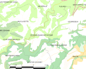
Orgeans-Blanchefontaine
- коммуна во Франции
Hiking in Orgeans-Blanchefontaine
Orgeans-Blanchefontaine, located in the Vosges department in northeastern France, is an excellent destination for hiking enthusiasts. The region is known for its beautiful natural landscapes, dense forests, and numerous trails that cater to various skill levels. Here’s what you should know about hiking in this picturesque area:...
- Страна:
- Почтовый код: 25120
- Координаты: 47° 15' 48" N, 6° 44' 37" E
- GPS треки (wikiloc): [Ссылка]
- Высота над уровнем моря: 450 м m
- Площадь: 4.83 кв.км
- Население: 49


Cernay-l'Église
- коммуна во Франции
Hiking in Cernay-l'Église
Cernay-l'Église, located in the northeastern part of France, is surrounded by beautiful natural landscapes that offer various hiking opportunities for enthusiasts. While it may not be as well-known as some other hiking destinations in the country, its rural charm and proximity to nature make it a lovely spot for outdoor activities....
- Страна:
- Почтовый код: 25120
- Координаты: 47° 15' 26" N, 6° 49' 51" E
- GPS треки (wikiloc): [Ссылка]
- Площадь: 5.95 кв.км
- Население: 304

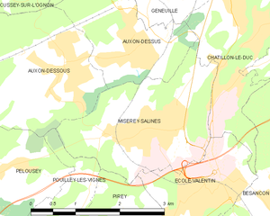
Miserey-Salines
- коммуна во Франции
Hiking in Miserey-Salines
Miserey-Salines is a quaint commune located in the Doubs department in the Bourgogne-Franche-Comté region of France. While it may not be one of the most frequently mentioned hiking destinations, it offers a serene and picturesque environment, ideal for those looking to escape the hustle and bustle of city life....
- Страна:
- Почтовый код: 25480
- Координаты: 47° 17' 11" N, 5° 58' 25" E
- GPS треки (wikiloc): [Ссылка]
- Площадь: 6.22 кв.км
- Население: 2383


Breconchaux
- коммуна во Франции
Hiking in Breconchaux
It seems you might be referring to the Brecon Beacons, a stunning National Park located in South Wales known for its beautiful landscapes, rolling hills, and diverse wildlife. Here are some details about hiking there:...
- Страна:
- Почтовый код: 25640
- Координаты: 47° 20' 25" N, 6° 16' 0" E
- GPS треки (wikiloc): [Ссылка]
- Площадь: 3.26 кв.км
- Население: 97

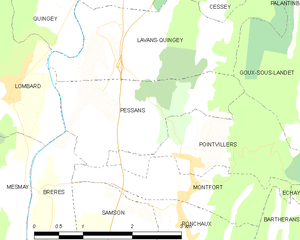
Pessans
- коммуна во Франции
Hiking in Pessans
Pessans is a charming little village located in the Auvergne-Rhône-Alpes region of France, specifically within the Ain department. The area surrounding Pessans is characterized by beautiful natural landscapes, which provide numerous opportunities for hiking enthusiasts. Here are some highlights of hiking in and around Pessans:...
- Страна:
- Почтовый код: 25440
- Координаты: 47° 4' 13" N, 5° 52' 57" E
- GPS треки (wikiloc): [Ссылка]
- Площадь: 4.35 кв.км
- Население: 88


Champlive
- коммуна во Франции
Hiking in Champlive
Champlive is a beautiful area known for its stunning landscapes and diverse hiking trails. While it may not be as widely recognized as some other hiking destinations, it offers a range of options suitable for all skill levels, from beginners to experienced hikers....
- Страна:
- Почтовый код: 25360
- Координаты: 47° 17' 21" N, 6° 14' 46" E
- GPS треки (wikiloc): [Ссылка]
- Площадь: 8.2 кв.км
- Население: 257


Roche-lès-Clerval
- коммуна во Франции
Hiking in Roche-lès-Clerval
Roche-lès-Clerval is a charming commune in the Doubs department in eastern France, surrounded by beautiful natural scenery, making it a lovely spot for hiking enthusiasts. The area is characterized by rolling hills, forests, and picturesque landscapes, offering a variety of trails for different skill levels. Here are some highlights about hiking in Roche-lès-Clerval and the surrounding region:...
- Страна:
- Почтовый код: 25340
- Координаты: 47° 22' 3" N, 6° 28' 53" E
- GPS треки (wikiloc): [Ссылка]
- Площадь: 5.34 кв.км
- Население: 129


Lavans-Quingey
- коммуна во Франции
Hiking in Lavans-Quingey
Lavans-Quingey is a charming commune located in the Jura department of France, surrounded by stunning natural landscapes that are ideal for hiking enthusiasts. This area is characterized by its rolling hills, dense forests, and scenic viewpoints, making it a great destination for outdoor activities....
- Страна:
- Почтовый код: 25440
- Координаты: 47° 5' 20" N, 5° 52' 37" E
- GPS треки (wikiloc): [Ссылка]
- Площадь: 5.9 кв.км
- Население: 208

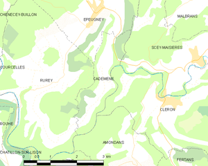
Cademène
- коммуна во Франции
Hiking in Cademène
Cademène is a picturesque area located in the Pyrenees of France, known for its stunning landscapes and extensive hiking trails. Here are some key aspects to know about hiking in Cademène:...
- Страна:
- Почтовый код: 25290
- Координаты: 47° 6' 2" N, 6° 1' 39" E
- GPS треки (wikiloc): [Ссылка]
- Площадь: 3.39 кв.км
- Население: 78


Les Hôpitaux-Vieux
- коммуна во Франции
Hiking in Les Hôpitaux-Vieux
Les Hôpitaux-Vieux is a charming village located in the Jura region of eastern France, known for its beautiful landscapes and outdoor recreational opportunities. Hiking in this area offers a chance to explore lush forests, rolling hills, and stunning views of the Jura Mountains....
- Страна:
- Почтовый код: 25370
- Координаты: 46° 47' 22" N, 6° 22' 0" E
- GPS треки (wikiloc): [Ссылка]
- Площадь: 14.21 кв.км
- Население: 431


Chaudefontaine
- коммуна во Франции
Hiking in Chaudefontaine
Chaudefontaine, located in the Doubs department in the Bourgogne-Franche-Comté region of France, offers a beautiful natural setting for hiking enthusiasts. The area is characterized by its picturesque landscapes, including rolling hills, dense forests, and serene rivers, making it an ideal destination for both casual walkers and more experienced hikers....
- Страна:
- Почтовый код: 25640
- Координаты: 47° 20' 23" N, 6° 9' 35" E
- GPS треки (wikiloc): [Ссылка]
- Площадь: 6.33 кв.км
- Население: 212


Rondefontaine
- коммуна во Франции
Hiking in Rondefontaine
Rondefontaine, located in the French region of Auvergne-Rhône-Alpes, offers a beautiful setting for hiking enthusiasts. This area is known for its stunning landscapes, diverse flora and fauna, and numerous trails that cater to different skill levels. Here are some key points to consider when hiking in Rondefontaine:...
- Страна:
- Почтовый код: 25240
- Координаты: 46° 44' 0" N, 6° 10' 57" E
- GPS треки (wikiloc): [Ссылка]
- Площадь: 2.72 кв.км
- Население: 30


Монфор
Hiking in Монфор
Montfort in the Doubs region of France is a beautiful area for hiking, surrounded by stunning natural landscapes, rolling hills, forests, and charming villages. Here are some key highlights and tips for hiking in Montfort and its surroundings:...
- Страна:
- Почтовый код: 25440
- Координаты: 47° 3' 30" N, 5° 54' 3" E
- GPS треки (wikiloc): [Ссылка]
- Площадь: 2.8 кв.км


Montlebon
- коммуна во Франции
Hiking in Montlebon
Montlebon, situated in the Doubs region of eastern France, offers picturesque landscapes ideal for hiking. Nestled in the Jura Mountains, it is surrounded by lush forests, rolling hills, and stunning viewpoints. Here are some highlights of hiking in Montlebon:...
- Страна:
- Почтовый код: 25500
- Координаты: 47° 2' 30" N, 6° 36' 27" E
- GPS треки (wikiloc): [Ссылка]
- Площадь: 27.27 кв.км
- Население: 2024


Landresse
- коммуна во Франции
Hiking in Landresse
Landresse is a charming area located in the Jura region of France, known for its beautiful landscapes, rolling hills, and lush forests. Hiking in Landresse offers opportunities to explore the stunning natural environment, including picturesque valleys, serene lakes, and scenic viewpoints....
- Страна:
- Почтовый код: 25530
- Координаты: 47° 15' 26" N, 6° 28' 10" E
- GPS треки (wikiloc): [Ссылка]
- Площадь: 14.43 кв.км
- Население: 232

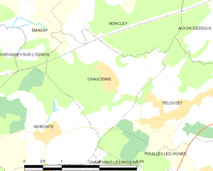
Chaucenne
- коммуна во Франции
Hiking in Chaucenne
Chaucenne is not widely recognized as a hiking destination, and there may be some confusion regarding its exact location or spelling. However, it’s possible that you meant a specific area or trail that has similar sounding names....
- Страна:
- Почтовый код: 25170
- Координаты: 47° 17' 5" N, 5° 53' 52" E
- GPS треки (wikiloc): [Ссылка]
- Площадь: 4.88 кв.км
- Население: 519
- Веб сайт: [Ссылка]


Le Bizot
- коммуна во Франции
Hiking in Le Bizot
Le Bizot is a small village located in the eastern part of France, in the Bourgogne-Franche-Comté region. It’s not typically a major hiking destination, but its surroundings offer beautiful landscapes and opportunities for outdoor activities, including hiking....
- Страна:
- Почтовый код: 25210
- Координаты: 47° 8' 9" N, 6° 40' 18" E
- GPS треки (wikiloc): [Ссылка]
- Площадь: 7.85 кв.км
- Население: 302


Grandfontaine-sur-Creuse
- коммуна во Франции
Hiking in Grandfontaine-sur-Creuse
Grandfontaine-sur-Creuse is a picturesque village located in the Vienne department of France. Its natural beauty and varied terrain make it an excellent destination for hiking enthusiasts. Here are some highlights about hiking in and around Grandfontaine-sur-Creuse:...
- Страна:
- Почтовый код: 25510
- Координаты: 47° 11' 34" N, 6° 27' 15" E
- GPS треки (wikiloc): [Ссылка]
- Площадь: 5.9 кв.км
- Население: 72

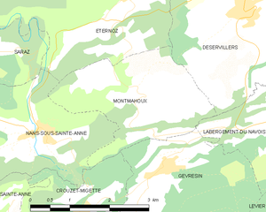
Montmahoux
- коммуна во Франции
Hiking in Montmahoux
Montmahoux, located in the French Alps, is a lesser-known but stunning destination for hiking enthusiasts. The region boasts beautiful landscapes, magnificent mountain views, and diverse ecosystems that make it ideal for outdoor activities....
- Страна:
- Почтовый код: 25270
- Координаты: 46° 59' 0" N, 6° 2' 3" E
- GPS треки (wikiloc): [Ссылка]
- Площадь: 6.52 кв.км
- Население: 100
- Веб сайт: [Ссылка]

Rochejean
- коммуна во Франции
Hiking in Rochejean
Rochejean, located in the Jura mountains of France, is a beautiful destination for hiking enthusiasts. Known for its stunning landscapes, lush forests, and diverse wildlife, Rochejean offers a range of trails suitable for various skill levels....
- Страна:
- Почтовый код: 25370
- Координаты: 46° 44' 44" N, 6° 17' 37" E
- GPS треки (wikiloc): [Ссылка]
- Площадь: 24.32 кв.км
- Население: 680


Clerval
- коммуна во Франции
Hiking in Clerval
Clerval, located in the Doubs department of the Bourgogne-Franche-Comté region in eastern France, offers a charming backdrop for hiking enthusiasts. The area is rich in natural beauty, with rolling hills, forests, and the scenic Doubs River winding through the landscape....
- Страна:
- Почтовый код: 25340
- Координаты: 47° 23' 32" N, 6° 29' 51" E
- GPS треки (wikiloc): [Ссылка]
- Площадь: 11.83 кв.км
- Население: 1035

Amagney
- коммуна во Франции
Hiking in Amagney
Amagney is a charming village located in the beautiful landscapes of the Jura region in France. While it may not be as well-known as some major hiking destinations, it offers a variety of scenic trails and opportunities for outdoor enthusiasts to explore the natural beauty of the surrounding area....
- Страна:
- Почтовый код: 25220
- Координаты: 47° 18' 18" N, 6° 9' 6" E
- GPS треки (wikiloc): [Ссылка]
- Площадь: 13.13 кв.км
- Население: 759
- Веб сайт: [Ссылка]


Fessevillers
- коммуна во Франции
Hiking in Fessevillers
Fessevillers is a small commune located in the Doubs department in the Bourgogne-Franche-Comté region of eastern France. While it may not be as well-known as some other hiking destinations, it offers a unique charm for hikers who enjoy exploring rural and natural landscapes....
- Страна:
- Почтовый код: 25470
- Координаты: 47° 16' 49" N, 6° 54' 51" E
- GPS треки (wikiloc): [Ссылка]
- Площадь: 6.16 кв.км
- Население: 158

Appenans
- коммуна во Франции
Hiking in Appenans
Hiking in the Apennines can be a wonderful experience, offering a range of landscapes, from lush green valleys to rugged peaks. The Apennine Mountain range stretches down the spine of Italy, running approximately 1,200 kilometers (750 miles) from the northern regions to the southern tip of the peninsula. Here’s what you should know about hiking in this beautiful area:...
- Страна:
- Почтовый код: 25250
- Координаты: 47° 26' 34" N, 6° 33' 54" E
- GPS треки (wikiloc): [Ссылка]
- Высота над уровнем моря: 290 м m
- Площадь: 4.07 кв.км
- Население: 384


Arbouans
- коммуна во Франции
Hiking in Arbouans
Arbouans is a small region near Montbéliard in France, known for its picturesque landscapes and scenic trails. While specific hiking trails in Arbouans may not be widely documented, the surrounding region offers appealing options for outdoor enthusiasts....
- Страна:
- Почтовый код: 25400
- Координаты: 47° 29' 26" N, 6° 48' 37" E
- GPS треки (wikiloc): [Ссылка]
- Площадь: 1.32 кв.км
- Население: 943


Arc-et-Senans
- коммуна во Франции
Hiking in Arc-et-Senans
Arc-et-Senans is a charming village located in the Doubs department of the Bourgogne-Franche-Comté region in eastern France. It's best known for its historical sites, particularly the Royal Saltworks (Salines royales), a UNESCO World Heritage site. While the primary draw may not be hiking, there are still some lovely options for those who want to explore the natural beauty surrounding the village....
- Страна:
- Почтовый код: 25610
- Координаты: 47° 1' 56" N, 5° 46' 42" E
- GPS треки (wikiloc): [Ссылка]
- Высота над уровнем моря: 233 м m
- Площадь: 14.98 кв.км
- Население: 1639
- Веб сайт: [Ссылка]

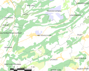
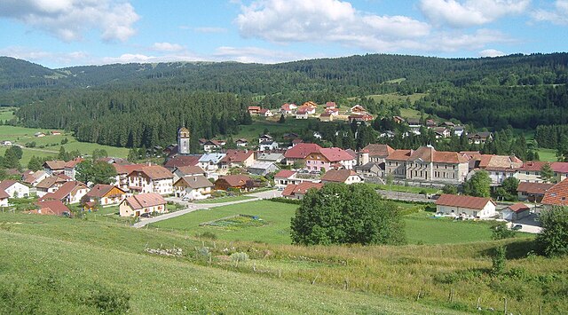
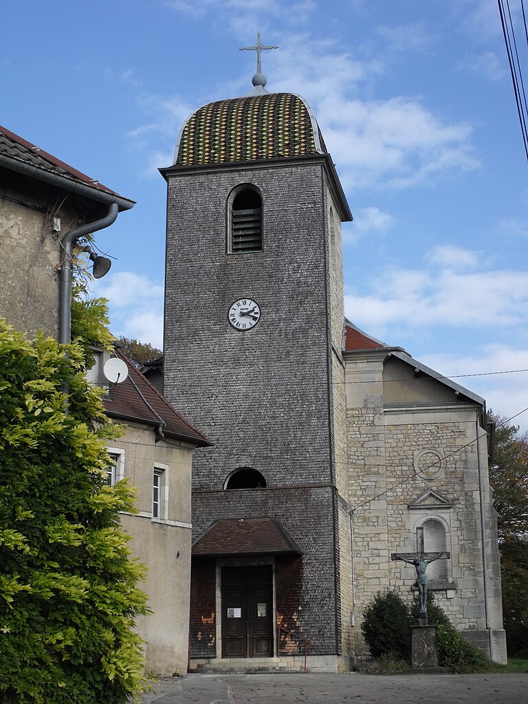
Arc-sous-Cicon
- коммуна во Франции
Hiking in Arc-sous-Cicon
Arc-sous-Cicon is a picturesque village located in the Doubs department of the Bourgogne-Franche-Comté region in eastern France. This area is known for its scenic landscapes, rolling hills, forests, and recreational opportunities, particularly for hiking enthusiasts....
- Страна:
- Почтовый код: 25520
- Координаты: 47° 3' 9" N, 6° 22' 52" E
- GPS треки (wikiloc): [Ссылка]
- Площадь: 28.49 кв.км
- Население: 676


Arc-sous-Montenot
- коммуна во Франции
Hiking in Arc-sous-Montenot
Arc-sous-Montenot is a small town located in the Bourgogne-Franche-Comté region of France. While it may not be as widely known as some of the larger hiking destinations in France, it offers beautiful landscapes, serene countryside, and opportunities for outdoor activities, including hiking....
- Страна:
- Почтовый код: 25270
- Координаты: 46° 54' 43" N, 6° 0' 8" E
- GPS треки (wikiloc): [Ссылка]
- Площадь: 10.72 кв.км
- Население: 207


Palantine
- коммуна во Франции
Hiking in Palantine
Palatine, a suburb of Chicago in Cook County, Illinois, offers a few options for hiking and enjoying the outdoors, though it might not be known for rugged terrain or extensive trails like some more mountainous areas. Here are some places you might consider for hiking and outdoor activities in and around Palatine:...
- Страна:
- Почтовый код: 25440
- Координаты: 47° 5' 21" N, 5° 56' 36" E
- GPS треки (wikiloc): [Ссылка]
- Площадь: 4.31 кв.км
- Население: 64


Arcey
- коммуна во Франции
Hiking in Arcey
Arcey is a small commune located in the Doubs department in the Bourgogne-Franche-Comté region of eastern France. While it might not be as widely known as some other hiking destinations, it offers a picturesque setting for outdoor enthusiasts who appreciate natural beauty and quieter trails....
- Страна:
- Почтовый код: 25750
- Координаты: 47° 31' 20" N, 6° 39' 39" E
- GPS треки (wikiloc): [Ссылка]
- Площадь: 12.57 кв.км
- Население: 1434
- Веб сайт: [Ссылка]


Froidevaux
- коммуна во Франции
Hiking in Froidevaux
Froidevaux is a picturesque area in the Swiss Alps, known for its stunning landscapes and hiking opportunities. Whether you’re an experienced hiker or just starting out, Froidevaux offers a variety of trails suitable for all levels. Here are some highlights for hiking in the area:...
- Страна:
- Почтовый код: 25190
- Координаты: 47° 18' 2" N, 6° 41' 30" E
- GPS треки (wikiloc): [Ссылка]
- Площадь: 3.98 кв.км
- Население: 70


Romain
- коммуна во Франции
Hiking in Romain
Hiking in Romain, located in the Doubs department of France, offers a wonderful opportunity to explore the scenic beauty of the Franche-Comté region. Doubs is known for its lush forests, rolling hills, and numerous rivers, making it a great destination for outdoor enthusiasts....
- Страна:
- Почтовый код: 25680
- Координаты: 47° 26' 35" N, 6° 22' 28" E
- GPS треки (wikiloc): [Ссылка]
- Высота над уровнем моря: 352 м m
- Площадь: 4.85 кв.км
- Население: 132

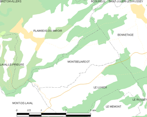
Montbéliardot
- коммуна во Франции
Hiking in Montbéliardot
Montbéliardot is a beautiful area that is not widely known among hikers, but it offers natural beauty, picturesque landscapes, and opportunities for outdoor activities. While detailed hiking trails may not be specifically documented for Montbéliardot, the surrounding regions in the Doubs department and nearby areas can provide excellent hiking experiences....
- Страна:
- Почтовый код: 25210
- Координаты: 47° 10' 31" N, 6° 39' 16" E
- GPS треки (wikiloc): [Ссылка]
- Площадь: 3.8 кв.км
- Население: 114


Hyémondans
- коммуна во Франции
Hiking in Hyémondans
Hyémondans is a charming location for hiking enthusiasts, offering both beautiful scenery and a variety of trails suited for different skill levels. Nestled in the region of Doubs in France, it's characterized by rolling hills, dense forests, and breathtaking views of the surrounding landscape....
- Страна:
- Почтовый код: 25250
- Координаты: 47° 23' 15" N, 6° 38' 58" E
- GPS треки (wikiloc): [Ссылка]
- Площадь: 6.87 кв.км
- Население: 194


Corcondray
- коммуна во Франции
Hiking in Corcondray
Corcondray isn't a well-known hiking destination, and there might be some confusion about the name. It’s possible you meant a different location, as this name doesn’t correspond to any widely recognized hiking area. However, if you are referring to a specific region or are looking for hiking in a related area, I’d be happy to help!...
- Страна:
- Почтовый код: 25410
- Координаты: 47° 13' 51" N, 5° 49' 32" E
- GPS треки (wikiloc): [Ссылка]
- Площадь: 5.38 кв.км
- Население: 144


Arguel
Hiking in Arguel
Arguel, located in the Doubs department of France, is a beautiful area that offers a variety of hiking opportunities amidst picturesque landscapes. The region is characterized by rolling hills, lush forests, and scenic views, making it a wonderful destination for nature lovers and hiking enthusiasts alike....
- Страна:
- Почтовый код: 25720
- Координаты: 47° 11' 51" N, 6° 0' 7" E
- GPS треки (wikiloc): [Ссылка]
- Площадь: 4.98 кв.км
- Население: 274


Le Moutherot
Hiking in Le Moutherot
Le Moutherot is a charming area in the Jura Mountains of France, known for its scenic landscapes and outdoor recreational opportunities, including hiking. The region features a variety of trails that accommodate different skill levels, making it suitable for both novice hikers and experienced adventurers....
- Страна:
- Почтовый код: 25170
- Координаты: 47° 14' 35" N, 5° 43' 56" E
- GPS треки (wikiloc): [Ссылка]
- Площадь: 1.3 кв.км
- Население: 131


Braillans
- коммуна во Франции
Hiking in Braillans
Braillans is a beautiful small village located in the Jura region of France, known for its stunning landscapes, rolling hills, and forests, making it an excellent destination for hiking enthusiasts. Here are some key points to consider when hiking in and around Braillans:...
- Страна:
- Почтовый код: 25640
- Координаты: 47° 18' 33" N, 6° 5' 24" E
- GPS треки (wikiloc): [Ссылка]
- Площадь: 1.95 кв.км
- Население: 190

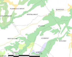
Le Luhier
- коммуна во Франции
Hiking in Le Luhier
Le Luhier is a picturesque region that offers a variety of hiking trails for both beginners and experienced hikers. Nestled in nature, this area features stunning landscapes, including dense forests, rolling hills, and picturesque streams. While I don’t have specific details on Le Luhier itself, I can give you some general tips and advice for hiking in such areas....
- Страна:
- Почтовый код: 25210
- Координаты: 47° 10' 6" N, 6° 39' 34" E
- GPS треки (wikiloc): [Ссылка]
- Площадь: 5.21 кв.км
- Население: 212

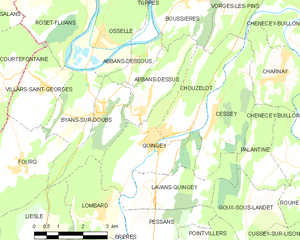
Quingey
- коммуна во Франции
Hiking in Quingey
Quingey, a charming village in the Doubs department of France, is known for its picturesque landscapes and proximity to the Jura Mountains, making it an excellent location for hiking enthusiasts. Here are some key points to consider:...
- Страна:
- Почтовый код: 25440
- Координаты: 47° 6' 12" N, 5° 52' 59" E
- GPS треки (wikiloc): [Ссылка]
- Площадь: 8.55 кв.км
- Население: 1407


Bonnevaux
Hiking in Bonnevaux
Bonnevaux is a beautiful area located in the Doubs department of the Bourgogne-Franche-Comté region in eastern France. It's known for its stunning natural landscapes, lush forests, and serene environment, making it a great destination for hiking enthusiasts....
- Страна:
- Почтовый код: 25560
- Координаты: 46° 48' 30" N, 6° 11' 7" E
- GPS треки (wikiloc): [Ссылка]
- Площадь: 16.53 кв.км
- Население: 375


Mesmay
- коммуна во Франции
Hiking in Mesmay
Mesmay is a charming little village located in the Jura department of France, known for its stunning landscapes and rich natural beauty, making it a great spot for hiking enthusiasts. Here are some key points to consider when hiking in and around Mesmay:...
- Страна:
- Почтовый код: 25440
- Координаты: 47° 3' 41" N, 5° 51' 7" E
- GPS треки (wikiloc): [Ссылка]
- Площадь: 3.11 кв.км
- Население: 72

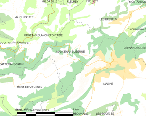
Mancenans-Lizerne
- коммуна во Франции
Hiking in Mancenans-Lizerne
Mancenans-Lizerne is a charming commune located in the Doubs department of the Bourgogne-Franche-Comté region in eastern France. The area is known for its beautiful natural surroundings, making it a great destination for hiking enthusiasts....
- Страна:
- Почтовый код: 25120
- Координаты: 47° 15' 40" N, 6° 46' 41" E
- GPS треки (wikiloc): [Ссылка]
- Площадь: 6.09 кв.км
- Население: 190


Noël-Cerneux
- коммуна во Франции
Hiking in Noël-Cerneux
Noël-Cerneux is a picturesque commune located in the Doubs department of the Bourgogne-Franche-Comté region in eastern France. Known for its stunning natural beauty, it offers a range of outdoor activities, including hiking....
- Страна:
- Почтовый код: 25500
- Координаты: 47° 6' 5" N, 6° 39' 49" E
- GPS треки (wikiloc): [Ссылка]
- Площадь: 6.36 кв.км
- Население: 409


Montrond-le-Château
- коммуна во Франции
Hiking in Montrond-le-Château
Montrond-le-Château, located in the Bourgogne-Franche-Comté region of eastern France, offers a charming and picturesque setting for hiking enthusiasts. The area is characterized by its rolling hills, lush forests, and beautiful landscapes, making it a great destination for those looking to explore nature....
- Страна:
- Почтовый код: 25660
- Координаты: 47° 8' 37" N, 6° 2' 46" E
- GPS треки (wikiloc): [Ссылка]
- Площадь: 10.9 кв.км
- Население: 560
- Веб сайт: [Ссылка]


Laire
- коммуна во Франции
Hiking in Laire
Laire is not widely recognized as a specific hiking destination, so it's possible that you meant a different location—or that Laire may be a less-known area with trails. If you are referring to a region or national park, like in the French Alps, Pyrenees, or anywhere else specifically, please clarify, and I will be happy to provide information on that area....
- Страна:
- Почтовый код: 25550
- Координаты: 47° 33' 2" N, 6° 43' 58" E
- GPS треки (wikiloc): [Ссылка]
- Площадь: 3.17 кв.км
- Население: 395


Les Écorces
- коммуна во Франции
Hiking in Les Écorces
Les Écorces is a beautiful area in Quebec, Canada, known for its stunning natural landscapes and outdoor recreational opportunities, including hiking. It's located in the municipality of Les Écorces, which is in the Quebec region known for its forests, rivers, and wildlife....
- Страна:
- Почтовый код: 25140
- Координаты: 47° 13' 3" N, 6° 47' 56" E
- GPS треки (wikiloc): [Ссылка]
- Площадь: 9.51 кв.км
- Население: 710


Longemaison
- коммуна во Франции
Hiking in Longemaison
Longemaison is a small commune located in the Jura department in east-central France, known for its beautiful natural landscapes and outdoor activities, including hiking. Here are some highlights and tips for hiking in and around Longemaison:...
- Страна:
- Почтовый код: 25690
- Координаты: 47° 4' 54" N, 6° 27' 34" E
- GPS треки (wikiloc): [Ссылка]
- Площадь: 9.63 кв.км
- Население: 146


Chouzelot
- коммуна во Франции
Hiking in Chouzelot
Chouzelot, located in France, is relatively lesser-known compared to more popular hiking destinations, but it can offer some beautiful trails and scenic landscapes. While specific trails may not be widely documented, here are some general tips and suggestions for hiking in the Chouzelot region and surrounding areas:...
- Страна:
- Почтовый код: 25440
- Координаты: 47° 6' 26" N, 5° 53' 37" E
- GPS треки (wikiloc): [Ссылка]
- Площадь: 6.41 кв.км
- Население: 269


Nommay
- коммуна во Франции
Hiking in Nommay
Nommay is a charming commune located in the Doubs department of France, close to the Swiss border. While it may not be as well-known as some larger hiking destinations, it offers access to beautiful landscapes and trails in the surrounding regions, particularly given its proximity to the Jura Mountains and the Vosges....
- Страна:
- Почтовый код: 25600
- Координаты: 47° 32' 17" N, 6° 50' 50" E
- GPS треки (wikiloc): [Ссылка]
- Площадь: 3.19 кв.км
- Население: 1672

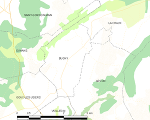
Bugny
- коммуна во Франции
Hiking in Bugny
It seems like you may have meant "Buny" or "Bugny," but I couldn't find specific information on a hiking destination by that exact name. However, if you're referring to a particular area or region, many places with similar names can offer great hiking opportunities....
- Страна:
- Почтовый код: 25520
- Координаты: 46° 59' 41" N, 6° 21' 12" E
- GPS треки (wikiloc): [Ссылка]
- Площадь: 4.77 кв.км
- Население: 218


Courchapon
- коммуна во Франции
Hiking in Courchapon
Courchapon is a beautiful area that offers fantastic hiking opportunities, particularly for those who enjoy exploring natural landscapes in France. It is located in the Jura region, which is known for its rolling hills, dense forests, and stunning views of the surrounding mountains and valleys....
- Страна:
- Почтовый код: 25170
- Координаты: 47° 15' 49" N, 5° 44' 50" E
- GPS треки (wikiloc): [Ссылка]
- Площадь: 5.31 кв.км
- Население: 192


Безансон
- округ Франции
Hiking in Безансон
The Arrondissement of Besançon, located in the Doubs department in the Bourgogne-Franche-Comté region of eastern France, offers a variety of hiking opportunities in a picturesque landscape characterized by rolling hills, forests, and historical sites. Here are some highlights and tips for hiking in this area:...
- Страна:
- Столица: Безансон
- Координаты: 47° 15' 0" N, 6° 10' 0" E
- GPS треки (wikiloc): [Ссылка]
- Площадь: 2497 кв.км
- Население: 248734

Монбельяр
- округ Франции
Hiking in Монбельяр
The Arrondissement of Montbéliard, located in the northeastern part of France in the Bourgogne-Franche-Comté region, offers a variety of hiking opportunities that showcase its beautiful landscapes, rich history, and biodiversity. Here are some key points to consider when hiking in this area:...
- Страна:
- Столица: Монбельяр
- Координаты: 47° 20' 0" N, 6° 40' 0" E
- GPS треки (wikiloc): [Ссылка]
- Площадь: 1444 кв.км
- Население: 176855

Arçon
- коммуна во Франции
Hiking in Arçon
Arçon is a beautiful location located in the Jura region of France, known for its stunning landscapes, diverse flora, and ample opportunities for hiking enthusiasts. Here are some key points to consider when planning a hiking trip in Arçon:...
- Страна:
- Почтовый код: 25300
- Координаты: 46° 56' 51" N, 6° 22' 44" E
- GPS треки (wikiloc): [Ссылка]
- Площадь: 21.34 кв.км
- Население: 820
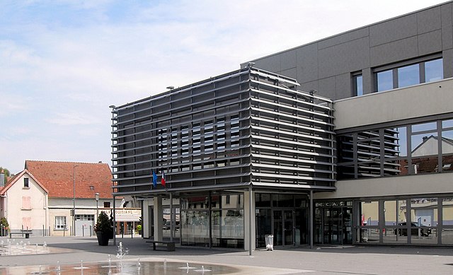

Audincourt
- коммуна во Франции
Hiking in Audincourt
Audincourt is a charming town located in the Bourgogne-Franche-Comté region of France, nestled near the city of Montbéliard. While it may not be as widely known for hiking as some other areas, there are opportunities for outdoor enthusiasts to explore the natural beauty of the surrounding region. Here are a few points to consider if you're planning to hike in and around Audincourt:...
- Страна:
- Почтовый код: 25400
- Координаты: 47° 28' 58" N, 6° 50' 23" E
- GPS треки (wikiloc): [Ссылка]
- Площадь: 8.76 кв.км
- Население: 14121
- Веб сайт: [Ссылка]


Бом-ле-Дам
- коммуна во Франции
Hiking in Бом-ле-Дам
Baume-les-Dames, located in the Doubs department of eastern France, is surrounded by scenic landscapes that offer a variety of hiking opportunities. Here are some key highlights about hiking in this charming area:...
- Страна:
- Почтовый код: 25110
- Координаты: 47° 21' 8" N, 6° 21' 36" E
- GPS треки (wikiloc): [Ссылка]
- Площадь: 24.79 кв.км
- Население: 5241
- Веб сайт: [Ссылка]


Esnans
- коммуна во Франции
Hiking in Esnans
Esnans is a small commune located in the Doubs department of eastern France, and while it may not be as widely known for hiking as some larger areas, it can offer scenic landscapes and relatively quiet trails suitable for hiking enthusiasts....
- Страна:
- Почтовый код: 25110
- Координаты: 47° 20' 20" N, 6° 19' 28" E
- GPS треки (wikiloc): [Ссылка]
- Площадь: 3.72 кв.км
- Население: 64


Шенсе-Бюйон
- коммуна во Франции
Hiking in Шенсе-Бюйон
Chenecey-Buillon, located in the Doubs department of the Bourgogne-Franche-Comté region in France, offers a pleasant natural landscape for hiking enthusiasts. The area is characterized by its scenic countryside, rolling hills, and lush forests, making it a wonderful destination for outdoor activities....
- Страна:
- Почтовый код: 25440
- Координаты: 47° 8' 24" N, 5° 57' 33" E
- GPS треки (wikiloc): [Ссылка]
- Площадь: 16.58 кв.км
- Население: 527


Santoche
- коммуна во Франции
Hiking in Santoche
It seems there may be a small misunderstanding, as there isn't a widely recognized hiking destination called "Santoche." However, if you meant "Santoch," please note that it might be a smaller or lesser-known location not widely documented in popular hiking resources....
- Страна:
- Почтовый код: 25340
- Координаты: 47° 24' 14" N, 6° 30' 27" E
- GPS треки (wikiloc): [Ссылка]
- Площадь: 2.15 кв.км
- Население: 84

Huanne-Montmartin
- коммуна во Франции
Hiking in Huanne-Montmartin
Huanne-Montmartin is a picturesque commune located in the Vosges department of northeastern France, known for its scenic landscapes and outdoor activities, including hiking. The region offers a mix of lush forests, rolling hills, and vibrant flora and fauna, making it an attractive destination for both casual walkers and trekking enthusiasts....
- Страна:
- Почтовый код: 25680
- Координаты: 47° 25' 52" N, 6° 20' 40" E
- GPS треки (wikiloc): [Ссылка]
- Площадь: 3.43 кв.км
- Население: 83

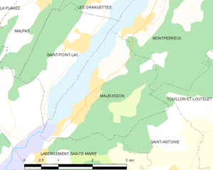
Malbuisson
- коммуна во Франции
Hiking in Malbuisson
Malbuisson is a beautiful commune located in the Doubs department in the Bourgogne-Franche-Comté region of France, nestled beside the stunning Lake Saint-Point. This area is known for its picturesque landscapes, rolling hills, and rich natural beauty, making it an excellent destination for hiking enthusiasts....
- Страна:
- Почтовый код: 25160
- Координаты: 46° 47' 53" N, 6° 18' 12" E
- GPS треки (wikiloc): [Ссылка]
- Площадь: 6.6 кв.км
- Население: 855
- Веб сайт: [Ссылка]

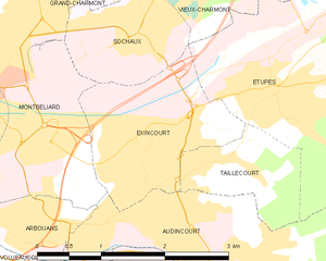
Эксенкур
- коммуна во Франции
Hiking in Эксенкур
Exincourt is a small commune in the Doubs department in the Bourgogne-Franche-Comté region of eastern France. While Exincourt itself may not be widely known for hiking, its location near the Jura Mountains and the Doubs River offers access to various scenic hiking opportunities in the surrounding areas....
- Страна:
- Почтовый код: 25400
- Координаты: 47° 29' 51" N, 6° 49' 59" E
- GPS треки (wikiloc): [Ссылка]
- Площадь: 3.45 кв.км
- Население: 3214


Athose
- коммуна во Франции
Hiking in Athose
Hiking in Athos, a peninsula in northern Greece, is a unique experience shaped by its rich history, stunning landscapes, and spiritual significance. Mount Athos is home to a number of Eastern Orthodox monasteries and is known as a monastic community, meaning that only men are permitted to visit. Here are some key points to consider when hiking in this area:...
- Страна:
- Почтовый код: 25580
- Координаты: 47° 4' 39" N, 6° 18' 34" E
- GPS треки (wikiloc): [Ссылка]
- Площадь: 7.63 кв.км
- Население: 188

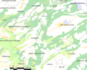
Aubonne
- коммуна во Франции
Hiking in Aubonne
Aubonne, located in the Doubs department of France, offers a serene environment perfect for hiking enthusiasts. The region is characterized by its stunning landscapes, including hilly terrains, dense forests, and picturesque views of the surrounding countryside....
- Страна:
- Почтовый код: 25520
- Координаты: 47° 2' 10" N, 6° 19' 43" E
- GPS треки (wikiloc): [Ссылка]
- Площадь: 15.17 кв.км
- Население: 239


Audeux
- коммуна во Франции
Hiking in Audeux
Audeux is a picturesque village located in the Jura department of France. Known for its scenic landscapes and natural beauty, it offers several opportunities for hiking and outdoor activities. Here are some highlights and tips for hiking in the Audeux area:...
- Страна:
- Почтовый код: 25170
- Координаты: 47° 15' 41" N, 5° 52' 13" E
- GPS треки (wikiloc): [Ссылка]
- Площадь: 1.75 кв.км
- Население: 432
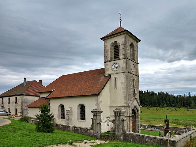

Le Mémont
- коммуна во Франции
Hiking in Le Mémont
Le Mémont is a scenic hiking destination located in the Vosges region of France. Known for its beautiful landscapes, lush forests, and panoramic views, it offers a variety of trails suitable for different skill levels....
- Страна:
- Почтовый код: 25210
- Координаты: 47° 9' 22" N, 6° 40' 54" E
- GPS треки (wikiloc): [Ссылка]
- Высота над уровнем моря: 1000 м m
- Площадь: 3.16 кв.км
- Население: 41

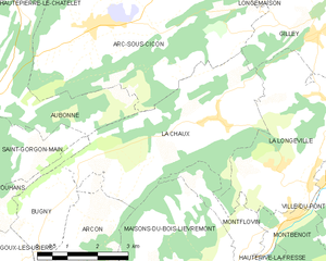
La Chaux
- коммуна во Франции
Hiking in La Chaux
La Chaux is a picturesque region in the Doubs department of France, known for its stunning natural landscapes, including rolling hills, dense forests, and scenic viewpoints. It's a great destination for hiking enthusiasts of all levels. Here are some key points to consider when hiking in La Chaux:...
- Страна:
- Почтовый код: 25650
- Координаты: 47° 1' 23" N, 6° 25' 57" E
- GPS треки (wikiloc): [Ссылка]
- Площадь: 16.94 кв.км
- Население: 497
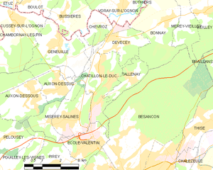
Châtillon-le-Duc
- коммуна во Франции
Hiking in Châtillon-le-Duc
Châtillon-le-Duc, located in the Doubs department of eastern France, offers a variety of hiking opportunities that cater to different skill levels and preferences. The area is characterized by its picturesque landscapes, including lush forests, rolling hills, and scenic valleys....
- Страна:
- Почтовый код: 25870
- Координаты: 47° 18' 15" N, 6° 0' 25" E
- GPS треки (wikiloc): [Ссылка]
- Площадь: 6.26 кв.км
- Население: 2040
- Веб сайт: [Ссылка]
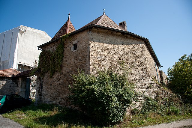

Bartherans
- коммуна во Франции
Hiking in Bartherans
It seems there might be a typo or misunderstanding regarding "Bartherans," as I am not aware of a specific location by that name associated with hiking. If "Bartherans" refers to a particular area that is less well-known or perhaps a local term, please provide a bit more context or clarify the name....
- Страна:
- Почтовый код: 25440
- Координаты: 47° 2' 30" N, 5° 55' 43" E
- GPS треки (wikiloc): [Ссылка]
- Площадь: 5.81 кв.км
- Население: 50


Ouhans
- коммуна во Франции
Hiking in Ouhans
Ouhans is a charming village located in the Franche-Comté region of France, surrounded by the stunning landscapes of the Jura Mountains. This area offers a variety of hiking opportunities suitable for different skill levels, making it a great destination for hikers....
- Страна:
- Почтовый код: 25520
- Координаты: 46° 59' 54" N, 6° 17' 37" E
- GPS треки (wikiloc): [Ссылка]
- Площадь: 15.85 кв.км
- Население: 373


Recologne
Hiking in Recologne
Recologne is a charming commune located in the Doubs department in the Bourgogne-Franche-Comté region of eastern France. This area is known for its natural beauty, rolling hills, and forests, making it an excellent place for hiking enthusiasts....
- Страна:
- Почтовый код: 25170
- Координаты: 47° 16' 23" N, 5° 49' 48" E
- GPS треки (wikiloc): [Ссылка]
- Площадь: 6.78 кв.км
- Население: 646


Autechaux
- коммуна во Франции
Hiking in Autechaux
Autechaux, located in the Doubs department of France, offers a variety of scenic hiking opportunities. The region is characterized by its rolling hills, dense forests, and picturesque views, making it an excellent destination for nature enthusiasts....
- Страна:
- Почтовый код: 25110
- Координаты: 47° 22' 40" N, 6° 23' 7" E
- GPS треки (wikiloc): [Ссылка]
- Высота над уровнем моря: 437 м m
- Площадь: 6.59 кв.км
- Население: 418
- Веб сайт: [Ссылка]


Autechaux-Roide
- коммуна во Франции
Hiking in Autechaux-Roide
Autechaux-Roide, located in the Doubs department in the Bourgogne-Franche-Comté region of France, offers a range of beautiful hiking opportunities, especially for those who appreciate nature and scenic landscapes....
- Страна:
- Почтовый код: 25150
- Координаты: 47° 23' 31" N, 6° 48' 53" E
- GPS треки (wikiloc): [Ссылка]
- Площадь: 6.56 кв.км
- Население: 534
Auxon-Dessous
- коммуна во Франции
Hiking in Auxon-Dessous
Auxon-Dessous is a charming commune in the Bourgogne-Franche-Comté region of eastern France, located near Besançon. While it may not be as widely known for hiking as some larger national parks or famous trails, it offers a variety of beautiful landscapes and opportunities for outdoor activities....
- Страна:
- Почтовый код: 25870
- Координаты: 47° 17' 58" N, 5° 57' 2" E
- GPS треки (wikiloc): [Ссылка]
- Население: 1395

Auxon-Dessus
- коммуна во Франции
Hiking in Auxon-Dessus
Auxon-Dessus is a small commune located in the Bourgogne-Franche-Comté region of eastern France, not far from the city of Besançon. While it may not be well-known as a major hiking destination, the surrounding area offers various opportunities for outdoor activities, including hiking....
- Страна:
- Почтовый код: 25870
- Координаты: 47° 18' 7" N, 5° 58' 26" E
- GPS треки (wikiloc): [Ссылка]
- Население: 1189
- Веб сайт: [Ссылка]

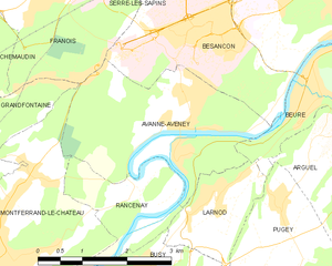
Avanne-Aveney
- коммуна во Франции
Hiking in Avanne-Aveney
Avanne-Aveney is a picturesque area in the Jura region of France, known for its beautiful landscapes and outdoor activities, including hiking. Here are some highlights and tips for hiking in this area:...
- Страна:
- Почтовый код: 25720
- Координаты: 47° 12' 8" N, 5° 57' 51" E
- GPS треки (wikiloc): [Ссылка]
- Высота над уровнем моря: 232 м m
- Площадь: 8.62 кв.км
- Население: 2277
- Веб сайт: [Ссылка]


Avilley
- коммуна во Франции
Hiking in Avilley
Avilley is a charming commune located in the Haute-Saône department in the Bourgogne-Franche-Comté region of eastern France. While it may not be as widely recognized as some other hiking destinations, it offers beautiful natural landscapes and opportunities for outdoor enthusiasts....
- Страна:
- Почтовый код: 25680
- Координаты: 47° 25' 33" N, 6° 16' 3" E
- GPS треки (wikiloc): [Ссылка]
- Площадь: 5.62 кв.км
- Население: 170
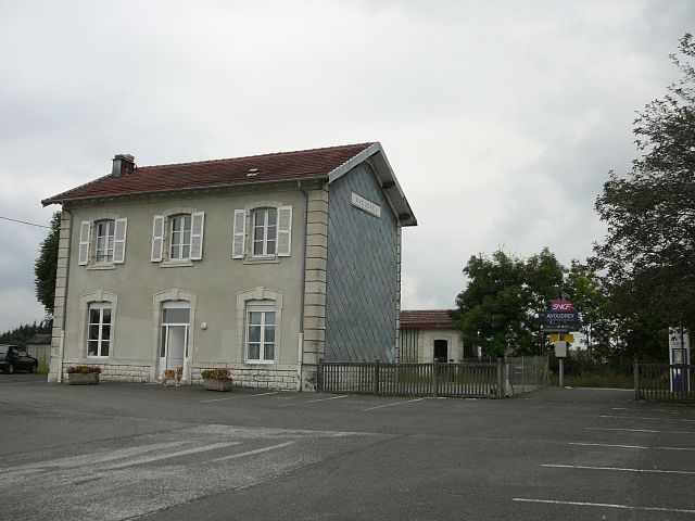

Avoudrey
- коммуна во Франции
Hiking in Avoudrey
Avoudrey is a picturesque commune located in the Doubs department in the Bourgogne-Franche-Comté region of eastern France. Its location near the Jura Mountains provides a range of hiking opportunities that cater to different skill levels. Here are some highlights about hiking in the Avoudrey region:...
- Страна:
- Почтовый код: 25690
- Координаты: 47° 8' 11" N, 6° 26' 8" E
- GPS треки (wikiloc): [Ссылка]
- Площадь: 12.86 кв.км
- Население: 896


Aïssey
- коммуна во Франции
Hiking in Aïssey
Aïssey is a picturesque area known for its beautiful landscapes and hiking opportunities, particularly in the context of the surrounding nature. While specific details about Aïssey may vary, general hiking considerations apply:...
- Страна:
- Почтовый код: 25360
- Координаты: 47° 16' 6" N, 6° 19' 55" E
- GPS треки (wikiloc): [Ссылка]
- Площадь: 10.67 кв.км
- Население: 181

Badevel
- коммуна во Франции
Hiking in Badevel
Badevel, a charming area in the Doubs department of France, offers a variety of hiking opportunities for enthusiasts of all skill levels. The region is characterized by its picturesque landscapes, which include rolling hills, dense forests, and scenic viewpoints. Here are some key highlights for hiking in Badevel:...
- Страна:
- Почтовый код: 25490
- Координаты: 47° 30' 0" N, 6° 56' 23" E
- GPS треки (wikiloc): [Ссылка]
- Площадь: 3.73 кв.км
- Население: 833


Bannans
- коммуна во Франции
Hiking in Bannans
It seems like you might be referring to "Bannans," which might be a misspelling or shorthand for a specific area or region. However, if you mean Bannerman Park or a similar named area, I can provide some general tips on hiking in parks or nature reserves. If you have a specific hiking destination or park in mind, please clarify, and I can give you more tailored information!...
- Страна:
- Почтовый код: 25560
- Координаты: 46° 53' 12" N, 6° 14' 22" E
- GPS треки (wikiloc): [Ссылка]
- Площадь: 11.56 кв.км
- Население: 365
- Веб сайт: [Ссылка]


Bart
- коммуна во Франции
Hiking in Bart
Hiking in Bart, a small commune in the Doubs department of France, offers a blend of beautiful landscapes, rich history, and the opportunity to experience the natural beauty of the Jura Mountains. Here’s what you need to know about hiking in this region:...
- Страна:
- Почтовый код: 25420
- Координаты: 47° 29' 32" N, 6° 46' 17" E
- GPS треки (wikiloc): [Ссылка]
- Площадь: 3.84 кв.км
- Население: 2022


Battenans-les-Mines
- коммуна во Франции
Hiking in Battenans-les-Mines
Battenans-les-Mines is a small commune in the Doubs department in the Bourgogne-Franche-Comté region of eastern France. While it may not be as well-known as some larger hiking destinations, its natural surroundings offer some opportunities for hiking enthusiasts....
- Страна:
- Почтовый код: 25640
- Координаты: 47° 24' 35" N, 6° 16' 7" E
- GPS треки (wikiloc): [Ссылка]
- Площадь: 2.78 кв.км
- Население: 61


Battenans-Varin
- коммуна во Франции
Hiking in Battenans-Varin
Battenans-Varin, a charming commune in the Bourgogne-Franche-Comté region of France, offers a picturesque setting for hiking enthusiasts. The area is characterized by its natural beauty, with rolling hills, lush forests, and scenic trails that vary in difficulty....
- Страна:
- Почтовый код: 25380
- Координаты: 47° 14' 56" N, 6° 42' 43" E
- GPS треки (wikiloc): [Ссылка]
- Высота над уровнем моря: 550 м m
- Площадь: 6.38 кв.км
- Население: 79


Belfays
- коммуна во Франции
Hiking in Belfays
Belfays is not a well-known location for hiking, and I couldn't find specific information about it. However, if you meant to refer to a particular area, region, or a more commonly known hiking destination, feel free to clarify!...
- Страна:
- Почтовый код: 25470
- Координаты: 47° 15' 33" N, 6° 53' 47" E
- GPS треки (wikiloc): [Ссылка]
- Площадь: 3.2 кв.км
- Население: 143


Бельмон
- коммуна во Франции, департамент Ду
Hiking in Бельмон
Hiking in Belmont, located in the Doubs department of the Bourgogne-Franche-Comté region in eastern France, offers a beautiful blend of natural landscapes and charming rural scenery. The region features rolling hills, forests, and scenic views of the Jura Mountains, making it a great destination for outdoor enthusiasts....
- Страна:
- Почтовый код: 25530
- Координаты: 47° 13' 15" N, 6° 21' 59" E
- GPS треки (wikiloc): [Ссылка]
- Высота над уровнем моря: 613 м m
- Площадь: 4.72 кв.км
- Население: 65


Belvoir
- коммуна во Франции
Hiking in Belvoir
Belvoir, located in the Doubs department of France, offers some stunning hiking opportunities amidst picturesque landscapes. The area is characterized by rolling hills, dense forests, and beautiful viewpoints over the surrounding countryside....
- Страна:
- Почтовый код: 25430
- Координаты: 47° 19' 3" N, 6° 36' 12" E
- GPS треки (wikiloc): [Ссылка]
- Площадь: 9.31 кв.км
- Население: 105


Courtefontaine
- коммуна во Франции
Hiking in Courtefontaine
Courtefontaine is a charming village located in the Doubs department of the Bourgogne-Franche-Comté region in eastern France. This area is known for its natural beauty, rich history, and outdoor activities, making it an excellent destination for hikers....
- Страна:
- Почтовый код: 25470
- Координаты: 47° 19' 14" N, 6° 54' 29" E
- GPS треки (wikiloc): [Ссылка]
- Площадь: 7.7 кв.км
- Население: 249

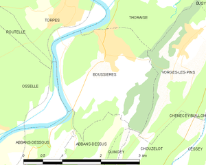
Бусьер
- коммуна во Франции
Hiking in Бусьер
Boussières is a charming commune located in the Doubs department of the Bourgogne-Franche-Comté region in eastern France. It's surrounded by beautiful natural landscapes, making it a great destination for hiking enthusiasts....
- Страна:
- Почтовый код: 25320
- Координаты: 47° 9' 27" N, 5° 54' 5" E
- GPS треки (wikiloc): [Ссылка]
- Площадь: 5.58 кв.км
- Население: 1089
- Веб сайт: [Ссылка]


Charquemont
- коммуна во Франции
Hiking in Charquemont
Charquemont is a picturesque village located in the Franche-Comté region of eastern France, known for its beautiful landscapes and outdoor opportunities, making it an excellent destination for hiking enthusiasts. Here are some highlights about hiking in and around Charquemont:...
- Страна:
- Почтовый код: 25140
- Координаты: 47° 12' 51" N, 6° 49' 18" E
- GPS треки (wikiloc): [Ссылка]
- Площадь: 21.44 кв.км
- Население: 2644
- Веб сайт: [Ссылка]
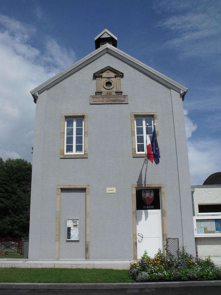
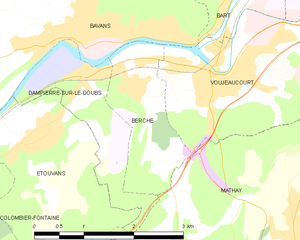
Berche
- коммуна во Франции
Hiking in Berche
It seems there might be a bit of confusion regarding the term "Berche." If you meant "Berchtesgaden," which is a well-known area for hiking located in Bavaria, Germany, I can provide you with information about that....
- Страна:
- Почтовый код: 25420
- Координаты: 47° 28' 21" N, 6° 44' 30" E
- GPS треки (wikiloc): [Ссылка]
- Площадь: 3.11 кв.км
- Население: 479
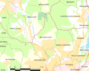
Bethoncourt
- коммуна во Франции
Hiking in Bethoncourt
Bethoncourt is a small commune located in the Doubs department in the Bourgogne-Franche-Comté region of eastern France. While it's not as widely known for hiking as some of the larger national parks or tourist destinations, it still offers opportunities for outdoor enthusiasts to explore the nearby countryside....
- Страна:
- Почтовый код: 25200
- Координаты: 47° 32' 4" N, 6° 48' 14" E
- GPS треки (wikiloc): [Ссылка]
- Площадь: 6.54 кв.км
- Население: 5652
- Веб сайт: [Ссылка]


Bonnal
- Страна:
- Почтовый код: 25680
- Координаты: 47° 30' 25" N, 6° 21' 20" E
- GPS треки (wikiloc): [Ссылка]
- Площадь: 1.8 кв.км
- Население: 32


Glay
- коммуна во Франции
Hiking in Glay
Hiking in Glay, located in the Doubs department of the Bourgogne-Franche-Comté region of France, offers a delightful experience amidst nature, characterized by diverse landscapes, lush greenery, and opportunities for wildlife observation....
- Страна:
- Почтовый код: 25310
- Координаты: 47° 24' 20" N, 6° 53' 25" E
- GPS треки (wikiloc): [Ссылка]
- Площадь: 6.49 кв.км
- Население: 347


Chevigney-sur-l'Ognon
- коммуна во Франции
Hiking in Chevigney-sur-l'Ognon
Chevigney-sur-l'Ognon, located in the Bourgogne-Franche-Comté region of eastern France, offers a tranquil setting for hiking enthusiasts. The area is characterized by its lush landscapes, rolling hills, and proximity to the Ognon River, making it an excellent destination for both casual walkers and experienced hikers....
- Страна:
- Почтовый код: 25170
- Координаты: 47° 17' 52" N, 5° 50' 18" E
- GPS треки (wikiloc): [Ссылка]
- Площадь: 4.58 кв.км
- Население: 280


Franey
- коммуна во Франции
Hiking in Franey
Franey, located in the Cape Breton Highlands National Park of Nova Scotia, is known for its stunning views and diverse terrain. The Franey Trail is a popular hiking destination for both novice and experienced hikers. Here are some key details about hiking in Franey:...
- Страна:
- Почтовый код: 25170
- Координаты: 47° 15' 42" N, 5° 49' 4" E
- GPS треки (wikiloc): [Ссылка]
- Площадь: 3.38 кв.км
- Население: 283
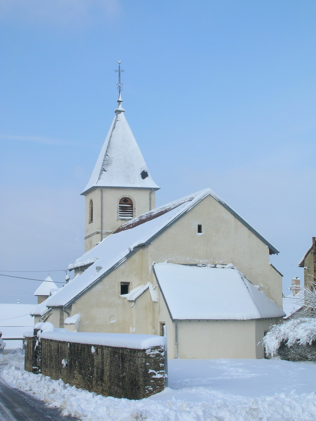

Burgille
- коммуна во Франции
Hiking in Burgille
Burgille might not be a widely recognized hiking destination, so if you’re referring to a specific region or local area that might have hiking opportunities, please clarify the location....
- Страна:
- Почтовый код: 25170
- Координаты: 47° 16' 4" N, 5° 46' 31" E
- GPS треки (wikiloc): [Ссылка]
- Площадь: 9.28 кв.км
- Население: 548
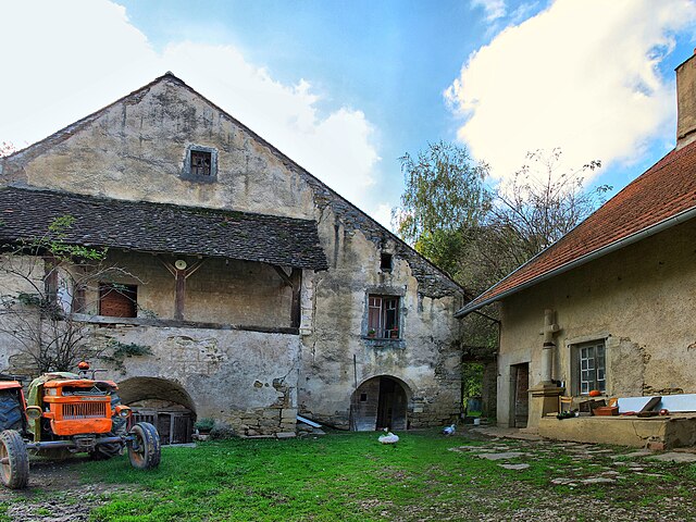

Cuse-et-Adrisans
- коммуна во Франции
Hiking in Cuse-et-Adrisans
Cuse-et-Adrisans is a charming commune located in the Haute-Saône department in the Bourgogne-Franche-Comté region of eastern France. While it may not be as well-known as some of the larger tourist destinations, it offers beautiful landscapes and a tranquil environment for hiking enthusiasts....
- Страна:
- Почтовый код: 25680
- Координаты: 47° 28' 46" N, 6° 23' 27" E
- GPS треки (wikiloc): [Ссылка]
- Площадь: 5.42 кв.км
- Население: 286
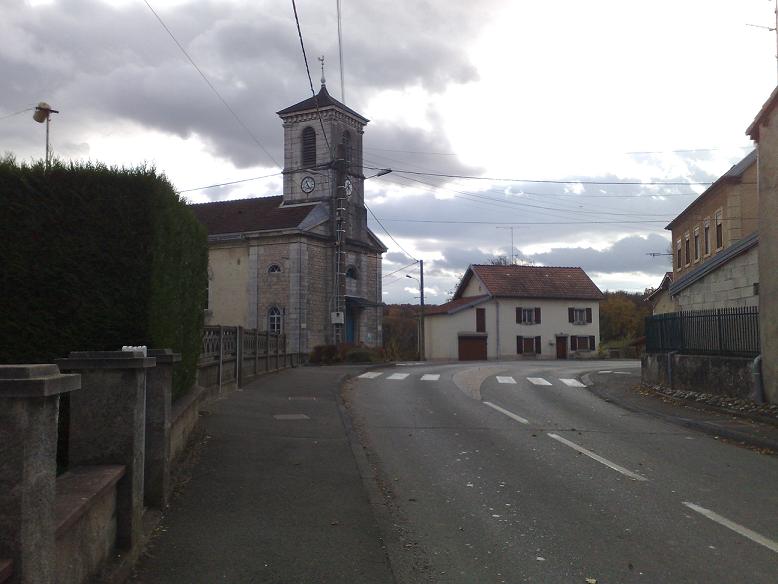

Bondeval
- коммуна во Франции
Hiking in Bondeval
Bondeval is often considered a beautiful and tranquil destination for hiking, particularly for those who appreciate natural landscapes, wildlife, and a connection to the outdoors. While there may not be as much information specifically about a place named "Bondeval," there are certain factors to consider that can make your hiking experience enjoyable:...
- Страна:
- Почтовый код: 25230
- Координаты: 47° 26' 40" N, 6° 50' 55" E
- GPS треки (wikiloc): [Ссылка]
- Площадь: 4.68 кв.км
- Население: 475

Bournois
- коммуна во Франции
Hiking in Bournois
Bournois is a charming area in France known for its natural beauty and scenic landscapes, making it a great destination for hiking enthusiasts. While specific trails might not be widely publicized, there are typically a variety of routes that cater to different skill levels, ranging from easy walks to more challenging hikes....
- Страна:
- Почтовый код: 25250
- Координаты: 47° 29' 55" N, 6° 29' 49" E
- GPS треки (wikiloc): [Ссылка]
- Площадь: 10.48 кв.км
- Население: 193
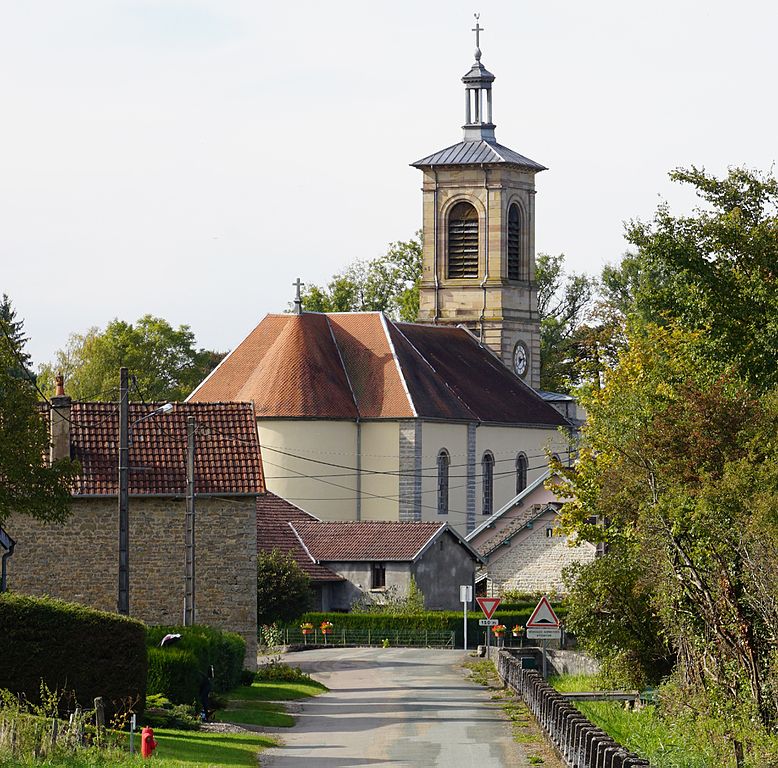
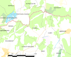
Cubrial
- коммуна во Франции
Hiking in Cubrial
It seems that "Cubrial" is not a commonly recognized hiking destination or location within my training data up to October 2023. However, I'm here to help you with hiking in a variety of locations!...
- Страна:
- Почтовый код: 25680
- Координаты: 47° 29' 45" N, 6° 24' 25" E
- GPS треки (wikiloc): [Ссылка]
- Площадь: 5.92 кв.км
- Население: 131


Bourguignon
Hiking in Bourguignon
Bourguignon is a charming commune located in the Doubs department in the Bourgogne-Franche-Comté region of eastern France. While it may not be as well-known as some other hiking destinations, it offers picturesque landscapes and opportunities for outdoor adventures in the surrounding areas....
- Страна:
- Почтовый код: 25150
- Координаты: 47° 24' 48" N, 6° 46' 48" E
- GPS треки (wikiloc): [Ссылка]
- Площадь: 5.56 кв.км
- Население: 946

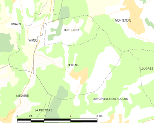
Beutal
- коммуна во Франции
Hiking in Beutal
Beutal is a small village located in the Swiss Alps, known for its stunning natural landscapes, diverse wildlife, and numerous hiking trails. While it may not be as famous as some larger destinations in Switzerland, it offers a tranquil hiking experience for those looking to escape the crowds....
- Страна:
- Почтовый код: 25250
- Координаты: 47° 28' 17" N, 6° 38' 18" E
- GPS треки (wikiloc): [Ссылка]
- Площадь: 5.78 кв.км
- Население: 291
- Веб сайт: [Ссылка]


Dampierre-sur-le-Doubs
- коммуна во Франции
Hiking in Dampierre-sur-le-Doubs
Dampierre-sur-le-Doubs is a charming commune located in the Doubs department in eastern France, known for its scenic beauty and outdoor activities, particularly hiking. Here’s what you can expect when hiking in this picturesque area:...
- Страна:
- Почтовый код: 25420
- Координаты: 47° 28' 29" N, 6° 43' 56" E
- GPS треки (wikiloc): [Ссылка]
- Площадь: 3.16 кв.км
- Население: 463
- Веб сайт: [Ссылка]


Dambenois
- коммуна во Франции
Hiking in Dambenois
Dambenois, located in the Bourgogne-Franche-Comté region of France, offers picturesque landscapes and a variety of hiking opportunities. The area is characterized by its rolling hills, forests, and scenic views, making it an appealing destination for both casual walkers and more experienced hikers....
- Страна:
- Почтовый код: 25600
- Координаты: 47° 32' 39" N, 6° 52' 4" E
- GPS треки (wikiloc): [Ссылка]
- Площадь: 3.28 кв.км
- Население: 736

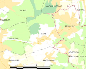
Dasle
- коммуна во Франции
Hiking in Dasle
Dasle is not a widely recognized hiking destination, so it seems there may be a confusion with the name or a lesser-known local trail. If you meant a specific area or region, please provide more details, such as the country or state....
- Страна:
- Почтовый код: 25230
- Координаты: 47° 28' 40" N, 6° 53' 39" E
- GPS треки (wikiloc): [Ссылка]
- Площадь: 5.67 кв.км
- Население: 1420

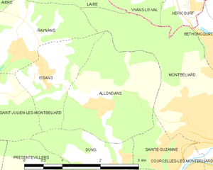
Allondans
- коммуна во Франции
Hiking in Allondans
Allondans, a small village located in the Haute-Saône department of the Bourgogne-Franche-Comté region in eastern France, offers a range of hiking opportunities that showcase the scenic beauty of the surrounding countryside. While it might not be as famous as some other hiking destinations in France, its charm lies in its tranquil landscapes and local trails....
- Страна:
- Почтовый код: 25550
- Координаты: 47° 31' 9" N, 6° 44' 51" E
- GPS треки (wikiloc): [Ссылка]
- Площадь: 5.14 кв.км
- Население: 245

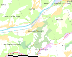
Colombier-Fontaine
- коммуна во Франции
Hiking in Colombier-Fontaine
Colombier-Fontaine is a commune located in the Bourgogne-Franche-Comté region of France. Although it might not be as famous as some other hiking destinations in the region, it offers a charming natural environment that can be appealing for hiking enthusiasts. Here are some key points about hiking in the area:...
- Страна:
- Почтовый код: 25260
- Координаты: 47° 27' 9" N, 6° 41' 23" E
- GPS треки (wikiloc): [Ссылка]
- Площадь: 7.66 кв.км
- Население: 1344


Dampierre-les-Bois
- коммуна во Франции
Hiking in Dampierre-les-Bois
Dampierre-les-Bois, located in the Doubs department in the Bourgogne-Franche-Comté region of eastern France, offers several opportunities for hiking enthusiasts. The area is characterized by its scenic landscapes, including rolling hills, forests, and meadows, which are ideal for both casual walkers and more serious hikers....
- Страна:
- Почтовый код: 25490
- Координаты: 47° 30' 25" N, 6° 54' 43" E
- GPS треки (wikiloc): [Ссылка]
- Площадь: 4.72 кв.км
- Население: 1659


Courcelles-lès-Montbéliard
- коммуна во Франции
Hiking in Courcelles-lès-Montbéliard
Courcelles-lès-Montbéliard is a charming village located in the Doubs department in the Bourgogne-Franche-Comté region of France. This area offers various hiking opportunities that cater to different skill levels and preferences....
- Страна:
- Почтовый код: 25420
- Координаты: 47° 30' 0" N, 6° 47' 10" E
- GPS треки (wikiloc): [Ссылка]
- Площадь: 2.4 кв.км
- Население: 1174
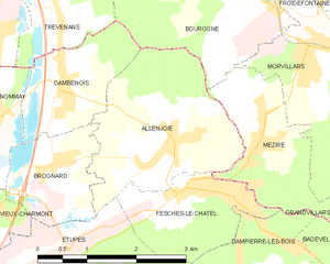
Allenjoie
- коммуна во Франции
Hiking in Allenjoie
Allenjoie is a small commune in the Doubs department in the Bourgogne-Franche-Comté region of eastern France. While it may not be widely known in terms of extensive hiking trails compared to larger parks or mountainous areas, the surrounding region does offer opportunities for outdoor activities, including hiking. Here are some points to consider when hiking in and around Allenjoie:...
- Страна:
- Почтовый код: 25490
- Координаты: 47° 32' 5" N, 6° 53' 49" E
- GPS треки (wikiloc): [Ссылка]
- Площадь: 6.56 кв.км
- Население: 734


Gondenans-Montby
- коммуна во Франции
Hiking in Gondenans-Montby
Gondenans-Montby is a picturesque village located in the Jura region of France, known for its stunning landscapes and diverse hiking opportunities. The area is characterized by rolling hills, dense forests, and meandering rivers, making it a great destination for outdoor enthusiasts. Here are some highlights and tips for hiking in Gondenans-Montby:...
- Страна:
- Почтовый код: 25340
- Координаты: 47° 25' 58" N, 6° 27' 9" E
- GPS треки (wikiloc): [Ссылка]
- Площадь: 11.78 кв.км
- Население: 176

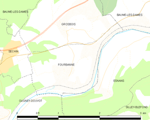
Fourbanne
- коммуна во Франции
Hiking in Fourbanne
Fourbanne is not a widely recognized hiking destination, and there might be some regional variations or lesser-known trails in that area. However, I can provide you with general guidelines on what to expect when hiking in less-populated or rural areas, which might be applicable to Fourbanne or similar regions....
- Страна:
- Почтовый код: 25110
- Координаты: 47° 19' 51" N, 6° 18' 12" E
- GPS треки (wikiloc): [Ссылка]
- Площадь: 1.97 кв.км
- Население: 173

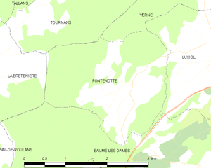
Fontenotte
- коммуна во Франции
Hiking in Fontenotte
Hiking in Fontenotte, a picturesque area often associated with its natural beauty, can offer a delightful experience for outdoor enthusiasts. While specific trail details may vary, here are some general aspects you can expect:...
- Страна:
- Почтовый код: 25110
- Координаты: 47° 22' 35" N, 6° 19' 21" E
- GPS треки (wikiloc): [Ссылка]
- Площадь: 5.65 кв.км
- Население: 59


Faimbe
- коммуна во Франции
Hiking in Faimbe
It seems that there might be a typographical error in the location you provided, as there is no well-known hiking destination named "Faimbe." However, if you are referring to a specific region or trail that is less popular or not widely recognized, please provide more details or check the spelling....
- Страна:
- Почтовый код: 25250
- Координаты: 47° 29' 17" N, 6° 36' 49" E
- GPS треки (wikiloc): [Ссылка]
- Площадь: 1.97 кв.км
- Население: 110


Chalezeule
- коммуна во Франции
Hiking in Chalezeule
Chalezeule is a picturesque village located in the eastern part of France, near the city of Besançon in the Bourgogne-Franche-Comté region. It offers a range of hiking opportunities, characterized by beautiful natural landscapes, rolling hills, and forests. Here’s what you can expect when hiking in and around Chalezeule:...
- Страна:
- Почтовый код: 25220
- Координаты: 47° 15' 33" N, 6° 4' 30" E
- GPS треки (wikiloc): [Ссылка]
- Площадь: 3.94 кв.км
- Население: 1281
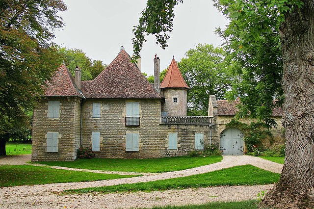

Chevroz
- коммуна во Франции
Hiking in Chevroz
Chevroz is a charming locality nestled in the heart of the Italian Alps, offering stunning landscapes and a variety of hiking opportunities for all experience levels. Here are some highlights about hiking in Chevroz:...
- Страна:
- Почтовый код: 25870
- Координаты: 47° 20' 0" N, 5° 59' 50" E
- GPS треки (wikiloc): [Ссылка]
- Площадь: 1.98 кв.км
- Население: 127


Blussans
- коммуна во Франции
Hiking in Blussans
Blussans is a picturesque village located in the Jura region of France, known for its beautiful landscapes and outdoor activities, including hiking. Here are some key aspects of hiking in Blussans:...
- Страна:
- Почтовый код: 25250
- Координаты: 47° 25' 39" N, 6° 36' 26" E
- GPS треки (wikiloc): [Ссылка]
- Площадь: 8.04 кв.км
- Население: 196


Branne
- коммуна во Франции
Hiking in Branne
Branne is a charming village in the Doubs department of the Bourgogne-Franche-Comté region in eastern France. This area is known for its picturesque landscapes, rolling hills, and forested mountains, making it a wonderful destination for hiking enthusiasts....
- Страна:
- Почтовый код: 25340
- Координаты: 47° 22' 36" N, 6° 28' 21" E
- GPS треки (wikiloc): [Ссылка]
- Площадь: 6.45 кв.км
- Население: 169


Brognard
- коммуна во Франции
Hiking in Brognard
Brognard is a charming area located in the Bourgogne-Franche-Comté region of eastern France, known for its beautiful natural landscapes and hiking opportunities. Here are some key points to consider if you're planning to hike in or around Brognard:...
- Страна:
- Почтовый код: 25600
- Координаты: 47° 31' 48" N, 6° 51' 51" E
- GPS треки (wikiloc): [Ссылка]
- Площадь: 2.9 кв.км
- Население: 476


Cussey-sur-l'Ognon
- коммуна во Франции
Hiking in Cussey-sur-l'Ognon
Cussey-sur-l'Ognon is a charming commune located in the department of Doubs in the Bourgogne-Franche-Comté region of France. The area is known for its beautiful natural landscapes, making it a great destination for hiking enthusiasts....
- Страна:
- Почтовый код: 25870
- Координаты: 47° 20' 20" N, 5° 56' 17" E
- GPS треки (wikiloc): [Ссылка]
- Площадь: 7.55 кв.км
- Население: 1014
- Веб сайт: [Ссылка]


Corcelle-Mieslot
- коммуна во Франции
Hiking in Corcelle-Mieslot
Corcelle-Mieslot, located in the picturesque region of the French Alps, offers a variety of hiking trails that cater to different skill levels. Here's a brief overview:...
- Страна:
- Почтовый код: 25640
- Координаты: 47° 21' 37" N, 6° 11' 14" E
- GPS треки (wikiloc): [Ссылка]
- Площадь: 6.42 кв.км
- Население: 108


Bonnay
- коммуна во Франции
Hiking in Bonnay
Bonnay, located in the Doubs department of France, offers some beautiful hiking opportunities amidst the scenic landscapes of the Jura Mountains. Here are a few key points about hiking in this region:...
- Страна:
- Почтовый код: 25870
- Координаты: 47° 20' 3" N, 6° 3' 1" E
- GPS треки (wikiloc): [Ссылка]
- Площадь: 7.66 кв.км
- Население: 845


Devecey
Hiking in Devecey
Devecey is a charming village in the Doubs department in eastern France, surrounded by beautiful natural landscapes that make it a great destination for hiking enthusiasts. The area offers several trails that cater to various skill levels, from easy walks suitable for families to more challenging hikes for experienced trekkers....
- Страна:
- Почтовый код: 25870
- Координаты: 47° 19' 28" N, 6° 0' 53" E
- GPS треки (wikiloc): [Ссылка]
- Площадь: 3.78 кв.км
- Население: 1424

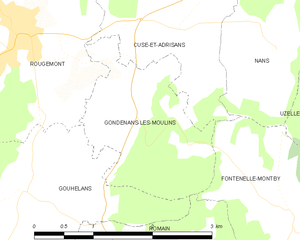
Gondenans-les-Moulins
- коммуна во Франции
Hiking in Gondenans-les-Moulins
Gondenans-les-Moulins, located in the Franche-Comté region of eastern France, is a charming village that offers several opportunities for hiking and enjoying the natural beauty of the surrounding countryside. Here are some key points about hiking in this area:...
- Страна:
- Почтовый код: 25680
- Координаты: 47° 28' 10" N, 6° 22' 54" E
- GPS треки (wikiloc): [Ссылка]
- Площадь: 3.93 кв.км
- Население: 76


Champoux
- коммуна во Франции
Hiking in Champoux
Hiking in Champoux, which is located in the picturesque region of Îles-de-la-Madeleine in Quebec, offers a variety of beautiful trails and stunning landscapes. The area is characterized by its coastal scenery, striking cliffs, sandy beaches, and lush greenery, making it a fantastic destination for hikers of all levels. Here are some key highlights about hiking in Champoux:...
- Страна:
- Почтовый код: 25640
- Координаты: 47° 20' 5" N, 6° 8' 12" E
- GPS треки (wikiloc): [Ссылка]
- Площадь: 2.98 кв.км
- Население: 90


Chalèze
- коммуна во Франции
Hiking in Chalèze
Chalèze is a lesser-known gem for hiking, often appreciated for its scenic landscapes and tranquil environment. While specific trails and exact details can vary, here are some general tips and insights for hiking in the Chalèze area:...
- Страна:
- Почтовый код: 25220
- Координаты: 47° 16' 1" N, 6° 5' 19" E
- GPS треки (wikiloc): [Ссылка]
- Площадь: 5.68 кв.км
- Население: 370


Châtillon-Guyotte
- коммуна во Франции
Hiking in Châtillon-Guyotte
Châtillon-Guyotte is a beautiful location for hiking, situated in the stunning French Alps. This area offers a mix of natural scenery, from lush forests and alpine meadows to impressive mountain views....
- Страна:
- Почтовый код: 25640
- Координаты: 47° 19' 51" N, 6° 10' 7" E
- GPS треки (wikiloc): [Ссылка]
- Площадь: 4.44 кв.км
- Население: 127


Germondans
- коммуна во Франции
Hiking in Germondans
Germondans, a picturesque area located in the Franche-Comté region of eastern France, is known for its stunning natural landscapes and rich history. Hiking in this region can offer a range of experiences from gentle walks to more challenging treks. Here are some highlights and tips for hiking in Germondans:...
- Страна:
- Почтовый код: 25640
- Координаты: 47° 24' 33" N, 6° 11' 27" E
- GPS треки (wikiloc): [Ссылка]
- Площадь: 3.52 кв.км
- Население: 60


Deluz
- коммуна во Франции
Hiking in Deluz
Deluz, located in the Doubs department of the Bourgogne-Franche-Comté region in France, offers a beautiful setting for hiking enthusiasts. The area is characterized by its picturesque landscapes, rolling hills, dense forests, and varied terrain, making it a great destination for outdoor activities....
- Страна:
- Почтовый код: 25960
- Координаты: 47° 17' 40" N, 6° 12' 3" E
- GPS треки (wikiloc): [Ссылка]
- Площадь: 8.03 кв.км
- Население: 625

Gouhelans
- коммуна во Франции
Hiking in Gouhelans
Gouhelans, also known as Gouhelans in French, is a picturesque area that typically offers beautiful landscapes, diverse ecosystems, and various trails suitable for hiking enthusiasts of all levels. As a hiking instructor familiar with the region, I can highlight some key aspects that make hiking in Gouhelans appealing:...
- Страна:
- Почтовый код: 25680
- Координаты: 47° 27' 22" N, 6° 21' 11" E
- GPS треки (wikiloc): [Ссылка]
- Площадь: 6.17 кв.км
- Население: 110


Blarians
- коммуна во Франции
Hiking in Blarians
It looks like there might be a small typo or misunderstanding regarding "Blarians." If you meant "Blarney" or another well-known hiking destination, let me know, and I can provide you with specific information about that area....
- Страна:
- Почтовый код: 25640
- Координаты: 47° 24' 42" N, 6° 10' 47" E
- GPS треки (wikiloc): [Ссылка]
- Площадь: 0.89 кв.км
- Население: 60


La Bretenière
- коммуна во Франции
Hiking in La Bretenière
La Bretenière, located in the Doubs department of France, offers a picturesque setting for hiking enthusiasts. The area is characterized by its beautiful natural landscapes, including rolling hills, lush forests, and meandering rivers, making it a great spot for both casual walkers and more experienced hikers....
- Страна:
- Почтовый код: 25640
- Координаты: 47° 22' 52" N, 6° 16' 28" E
- GPS треки (wikiloc): [Ссылка]
- Площадь: 4.16 кв.км
- Население: 70
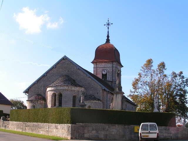

Eysson
Hiking in Eysson
Eysson is not a well-known hiking destination, and it may not be a recognized region or park in widely known hiking literature or resources. However, if you're mentioning a specific or local area named Eysson, I would recommend looking into local hiking trails, nature reserves, or conservation areas nearby....
- Страна:
- Почтовый код: 25530
- Координаты: 47° 12' 0" N, 6° 25' 49" E
- GPS треки (wikiloc): [Ссылка]
- Площадь: 6.01 кв.км
- Население: 114


Germéfontaine
- коммуна во Франции
Hiking in Germéfontaine
Germéfontaine is a beautiful destination for hiking, located in France. Nestled in the Vosges region, it offers stunning natural landscapes and a variety of trails suitable for different skill levels. Here are some highlights and tips for hiking in Germéfontaine:...
- Страна:
- Почтовый код: 25510
- Координаты: 47° 13' 30" N, 6° 28' 2" E
- GPS треки (wikiloc): [Ссылка]
- Площадь: 11.16 кв.км
- Население: 135


Cendrey
Hiking in Cendrey
Cendrey is a lesser-known area that offers beautiful natural landscapes, ideal for hiking enthusiasts seeking tranquility and stunning views. While it’s not as popular as some other hiking destinations, it can provide a unique experience away from crowded trails....
- Страна:
- Почтовый код: 25640
- Координаты: 47° 24' 14" N, 6° 14' 41" E
- GPS треки (wikiloc): [Ссылка]
- Площадь: 5.52 кв.км
- Население: 187


Byans-sur-Doubs
- коммуна во Франции
Hiking in Byans-sur-Doubs
Byans-sur-Doubs is a charming commune located in the Bourgogne-Franche-Comté region of eastern France, nestled along the banks of the Doubs River. It offers a peaceful environment and picturesque landscapes, making it a great destination for hiking enthusiasts. Here are some aspects to consider when hiking in this area:...
- Страна:
- Почтовый код: 25320
- Координаты: 47° 6' 55" N, 5° 51' 19" E
- GPS треки (wikiloc): [Ссылка]
- Площадь: 9.91 кв.км
- Население: 527


Fontenelle-Montby
- коммуна во Франции
Hiking in Fontenelle-Montby
Fontenelle-Montby is a beautiful area ideal for hiking enthusiasts, situated in the Jura Mountains of France. This region offers a range of scenic trails that cater to various skill levels, featuring lush forests, stunning vistas, and unique geological formations....
- Страна:
- Почтовый код: 25340
- Координаты: 47° 26' 58" N, 6° 24' 51" E
- GPS треки (wikiloc): [Ссылка]
- Площадь: 6.65 кв.км
- Население: 94


Crosey-le-Petit
- коммуна во Франции
Hiking in Crosey-le-Petit
Crosey-le-Petit is a picturesque commune located in the Doubs department in the Bourgogne-Franche-Comté region of eastern France. It is surrounded by beautiful natural landscapes, making it a great location for hiking enthusiasts. Here are some aspects to consider when planning a hiking trip in and around Crosey-le-Petit:...
- Страна:
- Почтовый код: 25340
- Координаты: 47° 21' 6" N, 6° 29' 9" E
- GPS треки (wikiloc): [Ссылка]
- Площадь: 9.6 кв.км
- Население: 139


Franois
- коммуна во Франции
Hiking in Franois
It seems there might be a misunderstanding as "Franois" doesn't correspond to a recognized hiking destination or national park that I'm aware of. It's possible you might be referring to a specific area, park, or trail that is not widely known or incorrectly spelled....
- Страна:
- Почтовый код: 25770
- Координаты: 47° 13' 57" N, 5° 55' 32" E
- GPS треки (wikiloc): [Ссылка]
- Площадь: 7.29 кв.км
- Население: 2274
- Веб сайт: [Ссылка]


Champagney
Hiking in Champagney
Hiking in Champagney, Doubs, offers a wonderful opportunity to explore the beautiful natural landscapes of the region. Champagney itself is located in the Bourgogne-Franche-Comté region of eastern France, a place known for its picturesque scenery, dense forests, rolling hills, and a network of well-marked hiking trails....
- Страна:
- Почтовый код: 25170
- Координаты: 47° 15' 21" N, 5° 54' 21" E
- GPS треки (wikiloc): [Ссылка]
- Высота над уровнем моря: 200 м m
- Площадь: 3.01 кв.км
- Население: 275

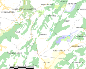
Le Bélieu
- коммуна во Франции
Hiking in Le Bélieu
Le Bélieu is a beautiful region located in the Jura Mountains of Switzerland, known for its stunning landscapes, diverse ecosystems, and excellent hiking opportunities. Here are some highlights and tips for hiking in Le Bélieu:...
- Страна:
- Почтовый код: 25500
- Координаты: 47° 7' 9" N, 6° 38' 5" E
- GPS треки (wikiloc): [Ссылка]
- Площадь: 10.72 кв.км
- Население: 422
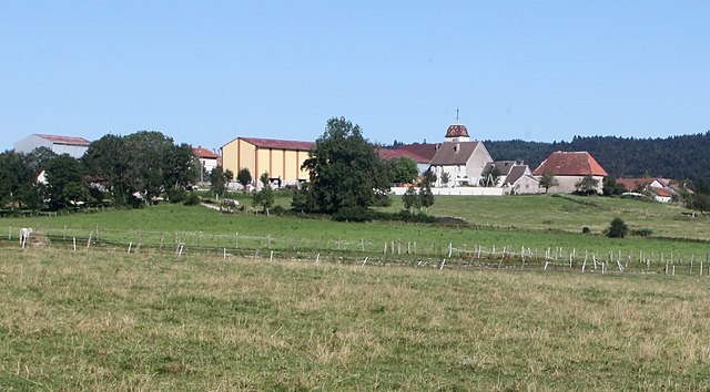

Chevigney-lès-Vercel
- коммуна во Франции
Hiking in Chevigney-lès-Vercel
Chevigney-lès-Vercel is a charming commune located in the Doubs department of the Bourgogne-Franche-Comté region in eastern France. While it may not be one of the most famous hiking destinations, it offers a variety of scenic trails that showcase the beautiful landscapes of the region....
- Страна:
- Почтовый код: 25530
- Координаты: 47° 9' 49" N, 6° 22' 18" E
- GPS треки (wikiloc): [Ссылка]
- Высота над уровнем моря: 648 м m
- Площадь: 5.38 кв.км
- Население: 125


Charbonnières-les-Sapins
- коммуна во Франции
Hiking in Charbonnières-les-Sapins
Charbonnières-les-Sapins, located in the Jura region of France, offers a beautiful setting for hiking enthusiasts. The area is known for its lush forests, rolling hills, and picturesque landscapes, making it a great destination for outdoor activities....
- Страна:
- Почтовый код: 25620
- Координаты: 47° 8' 49" N, 6° 12' 54" E
- GPS треки (wikiloc): [Ссылка]
- Площадь: 9.1 кв.км
- Население: 193
- Веб сайт: [Ссылка]


Frambouhans
- коммуна во Франции
Hiking in Frambouhans
Frambouhans is a charming village located in the Jura department of France. The region is known for its stunning natural landscapes, including forests, rolling hills, and picturesque viewpoints, making it an appealing destination for hiking enthusiasts....
- Страна:
- Почтовый код: 25140
- Координаты: 47° 13' 10" N, 6° 46' 3" E
- GPS треки (wikiloc): [Ссылка]
- Площадь: 10.1 кв.км
- Население: 881
- Веб сайт: [Ссылка]


Domprel
- коммуна во Франции
Hiking in Domprel
It seems there may be a misunderstanding or a potential misspelling, as there is no widely recognized hiking destination called "Domprel." If you're referring to a specific area or region, could you please provide more details or clarify the name?...
- Страна:
- Почтовый код: 25510
- Координаты: 47° 12' 2" N, 6° 28' 9" E
- GPS треки (wikiloc): [Ссылка]
- Площадь: 9.4 кв.км
- Население: 168

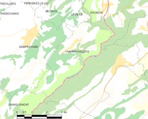
Charmauvillers
- коммуна во Франции
Hiking in Charmauvillers
Charmauvillers is a small commune located in the Vosges department in northeastern France. The area surrounding Charmauvillers offers beautiful landscapes, including rolling hills and forested terrain, making it an excellent destination for hiking enthusiasts....
- Страна:
- Почтовый код: 25470
- Координаты: 47° 14' 20" N, 6° 55' 7" E
- GPS треки (wikiloc): [Ссылка]
- Площадь: 10.47 кв.км
- Население: 253


Les Alliés
- коммуна во Франции
Hiking in Les Alliés
Les Alliés, typically referred to in the context of hiking, is likely a region in France known for its scenic landscapes and outdoor activities. However, it’s essential to clarify that "Les Alliés" may not be a well-known hiking destination compared to other regions in France, such as the Alps or the Pyrenees....
- Страна:
- Почтовый код: 25300
- Координаты: 46° 56' 53" N, 6° 26' 51" E
- GPS треки (wikiloc): [Ссылка]
- Площадь: 5.28 кв.км
- Население: 142


Chaux-lès-Passavant
- коммуна во Франции
Hiking in Chaux-lès-Passavant
Chaux-lès-Passavant is a picturesque village located in the Doubs department of the Bourgogne-Franche-Comté region in eastern France. The area is characterized by beautiful landscapes, forests, and diverse wildlife, making it a great destination for hiking enthusiasts....
- Страна:
- Почтовый код: 25530
- Координаты: 47° 14' 9" N, 6° 21' 30" E
- GPS треки (wikiloc): [Ссылка]
- Площадь: 8.44 кв.км
- Население: 142


Le Barboux
- коммуна во Франции
Hiking in Le Barboux
Le Barboux is a charming village located in the Auvergne-Rhône-Alpes region of France, known for its beautiful natural scenery and outdoor activities, including hiking. The area is characterized by rolling hills, forests, and stunning views of the surrounding mountains, making it an ideal destination for hikers of all levels....
- Страна:
- Почтовый код: 25210
- Координаты: 47° 7' 14" N, 6° 43' 1" E
- GPS треки (wikiloc): [Ссылка]
- Площадь: 11.26 кв.км
- Население: 251


Chasnans
- коммуна во Франции
Hiking in Chasnans
Chasnans, located in the French region of Bourgogne-Franche-Comté, is known for its beautiful landscapes and hiking opportunities. The area is characterized by its rolling hills, forests, and a rich variety of wildlife, making it an excellent destination for both novice and experienced hikers....
- Страна:
- Почтовый код: 25580
- Координаты: 47° 5' 11" N, 6° 18' 49" E
- GPS треки (wikiloc): [Ссылка]
- Площадь: 7.87 кв.км
- Население: 273

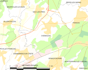
Chemaudin
- коммуна во Франции
Hiking in Chemaudin
Chemaudin is a picturesque area known for its beautiful landscapes and hiking trails. While it may not be as widely known as some other hiking destinations, it offers a variety of natural settings and trails suitable for different skill levels....
- Страна:
- Почтовый код: 25320
- Координаты: 47° 13' 26" N, 5° 53' 31" E
- GPS треки (wikiloc): [Ссылка]
- Площадь: 7.3 кв.км
- Население: 1501
- Веб сайт: [Ссылка]


Fallerans
- коммуна во Франции
Hiking in Fallerans
It seems like there might be a typo or confusion regarding "Fallerans." As of my last training data, there isn’t a well-known hiking destination by that name. However, if you meant a different location or if it refers to a lesser-known or local area, I would be happy to help you with general information about hiking....
- Страна:
- Почтовый код: 25580
- Координаты: 47° 7' 56" N, 6° 17' 24" E
- GPS треки (wikiloc): [Ссылка]
- Площадь: 10.78 кв.км
- Население: 279


Glamondans
- коммуна во Франции
Hiking in Glamondans
Glamondans is a picturesque commune located in the Doubs department of the Bourgogne-Franche-Comté region in eastern France. While it may not be a widely known hiking destination, its natural beauty and proximity to the Jura Mountains offer some lovely trails and scenic views for outdoor enthusiasts....
- Страна:
- Почтовый код: 25360
- Координаты: 47° 15' 55" N, 6° 16' 40" E
- GPS треки (wikiloc): [Ссылка]
- Площадь: 9.76 кв.км
- Население: 211

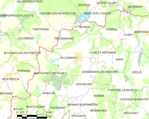
Rougemont
Hiking in Rougemont
Rougemont, located in the Doubs department of France, is a picturesque destination that offers excellent hiking opportunities amidst beautiful natural landscapes. Here's an overview of what you can expect when hiking in this area:...
- Страна:
- Почтовый код: 25680
- Координаты: 47° 28' 52" N, 6° 21' 18" E
- GPS треки (wikiloc): [Ссылка]
- Площадь: 18.33 кв.км
- Население: 1173
- Веб сайт: [Ссылка]


Le Russey
- коммуна во Франции
Hiking in Le Russey
Le Russey is a charming commune located in the Doubs department in the Bourgogne-Franche-Comté region of eastern France. It's nestled in a picturesque part of the Jura Mountains, which offers a variety of scenic hiking opportunities. Here are some points to consider when hiking in and around Le Russey:...
- Страна:
- Почтовый код: 25210
- Координаты: 47° 9' 46" N, 6° 43' 48" E
- GPS треки (wikiloc): [Ссылка]
- Площадь: 24.17 кв.км
- Население: 2282
- Веб сайт: [Ссылка]


Hérimoncourt
- коммуна во Франции
Hiking in Hérimoncourt
Hérimoncourt is a small commune located in the Doubs department of the Bourgogne-Franche-Comté region in eastern France. While it may not be as widely recognized as larger hiking destinations, it offers access to beautiful natural landscapes that are perfect for outdoor enthusiasts....
- Страна:
- Почтовый код: 25310
- Координаты: 47° 26' 26" N, 6° 52' 59" E
- GPS треки (wikiloc): [Ссылка]
- Площадь: 7.29 кв.км
- Население: 3638
- Веб сайт: [Ссылка]


Marchaux
- коммуна во Франции
Hiking in Marchaux
Marchaux, located in the Doubs department of France, offers a variety of hiking opportunities amidst its picturesque landscapes. While it may not be as widely known as some other hiking destinations, the region is characterized by rolling hills, woodlands, and charming rural scenery....
- Страна:
- Почтовый код: 25640
- Координаты: 47° 19' 24" N, 6° 7' 58" E
- GPS треки (wikiloc): [Ссылка]
- Площадь: 10.06 кв.км
- Население: 1235
- Веб сайт: [Ссылка]


Roulans
Hiking in Roulans
Roulans is a small commune located in the Doubs department in the Bourgogne-Franche-Comté region of eastern France. While it may not be as widely known for hiking as some other areas in France, it offers natural beauty and a peaceful environment for outdoor activities....
- Страна:
- Почтовый код: 25640
- Координаты: 47° 18' 59" N, 6° 14' 0" E
- GPS треки (wikiloc): [Ссылка]
- Высота над уровнем моря: 350 м m
- Площадь: 8.31 кв.км
- Население: 1125
- Веб сайт: [Ссылка]


Maîche
- коммуна во Франции
Hiking in Maîche
Maîche is a charming town located in the Doubs department of France, nestled in the Jura Mountains. This region is known for its stunning landscapes, rich biodiversity, and various outdoor activities, including hiking. Here are some highlights about hiking in and around Maîche:...
- Страна:
- Почтовый код: 25120
- Координаты: 47° 15' 4" N, 6° 48' 13" E
- GPS треки (wikiloc): [Ссылка]
- Площадь: 17.42 кв.км
- Население: 4273
- Веб сайт: [Ссылка]

Les Fontenelles
- коммуна во Франции
Hiking in Les Fontenelles
Les Fontenelles is a beautiful area located in the French region of Pays de la Loire, specifically in the Vendée department. This region is known for its varied landscapes, stunning natural beauty, and a range of outdoor activities, including hiking. Here’s a guide for hiking in Les Fontenelles:...
- Страна:
- Почтовый код: 25210
- Координаты: 47° 11' 58" N, 6° 44' 38" E
- GPS треки (wikiloc): [Ссылка]
- Площадь: 8.38 кв.км
- Население: 566
- Веб сайт: [Ссылка]


Bonnevaux-le-Prieuré
- коммуна во Франции
Hiking in Bonnevaux-le-Prieuré
Bonnevaux-le-Prieuré is a charming commune in the Vienne department of France, known for its tranquil countryside and historical significance. While it may not be a well-known hiking destination, the surrounding areas offer some beautiful landscapes and trails worth exploring. Here are some tips and highlights for hiking in and around Bonnevaux-le-Prieuré:...
- Страна:
- Почтовый код: 25620
- Координаты: 47° 8' 1" N, 6° 10' 9" E
- GPS треки (wikiloc): [Ссылка]
- Площадь: 3.08 кв.км
- Население: 116


Crosey-le-Grand
- коммуна во Франции
Hiking in Crosey-le-Grand
Crosey-le-Grand is a charming village located in the Doubs department in the Bourgogne-Franche-Comté region of eastern France. The area surrounding Crosey-le-Grand is known for its beautiful natural landscapes, making it a great destination for hiking enthusiasts....
- Страна:
- Почтовый код: 25340
- Координаты: 47° 21' 20" N, 6° 31' 30" E
- GPS треки (wikiloc): [Ссылка]
- Площадь: 10.28 кв.км
- Население: 156


Bretonvillers
- коммуна во Франции
Hiking in Bretonvillers
Bretonvillers is a charming village located in the Franche-Comté region of eastern France, known for its picturesque landscapes and natural beauty. If you’re considering hiking in and around Bretonvillers, here are some points to keep in mind:...
- Страна:
- Почтовый код: 25380
- Координаты: 47° 13' 5" N, 6° 38' 13" E
- GPS треки (wikiloc): [Ссылка]
- Площадь: 13.66 кв.км
- Население: 275


Cusance
- коммуна во Франции
Hiking in Cusance
Cusance, located in the Doubs department of France, is a charming destination for hiking enthusiasts. This region is known for its stunning natural landscapes, rich biodiversity, and picturesque villages. Here are some key points to consider if you plan on hiking in Cusance:...
- Страна:
- Почтовый код: 25110
- Координаты: 47° 19' 26" N, 6° 26' 18" E
- GPS треки (wikiloc): [Ссылка]
- Площадь: 4.04 кв.км
- Население: 71


Bouclans
- коммуна во Франции
Hiking in Bouclans
Bouclans is a small commune located in the Doubs department in the Bourgogne-Franche-Comté region of eastern France. Although it may not be as widely known as some larger hiking destinations, it offers a unique experience for those looking to explore the natural beauty of the region....
- Страна:
- Почтовый код: 25360
- Координаты: 47° 14' 50" N, 6° 14' 11" E
- GPS треки (wikiloc): [Ссылка]
- Площадь: 21.4 кв.км
- Население: 957


Champvans-les-Moulins
- коммуна во Франции
Hiking in Champvans-les-Moulins
Champvans-les-Moulins is a small village located in the Bourgogne-Franche-Comté region of France. While it's not widely known as a hiking destination, the surrounding area offers beautiful landscapes typical of the French countryside, with rolling hills, forests, and streams that can provide a tranquil setting for hiking enthusiasts....
- Страна:
- Почтовый код: 25170
- Координаты: 47° 15' 19" N, 5° 54' 56" E
- GPS треки (wikiloc): [Ссылка]
- Площадь: 2.52 кв.км
- Население: 352


Bretigney-Notre-Dame
- коммуна во Франции
Hiking in Bretigney-Notre-Dame
Bretigney-Notre-Dame is a quaint commune located in the Vosges department of northeastern France. While it may not be as widely known as some larger hiking destinations, it offers beautiful natural settings and a peaceful atmosphere, making it a great spot for hiking enthusiasts who enjoy exploring less-trodden paths....
- Страна:
- Почтовый код: 25110
- Координаты: 47° 18' 46" N, 6° 18' 10" E
- GPS треки (wikiloc): [Ссылка]
- Площадь: 5.62 кв.км
- Население: 111


Côtebrune
- коммуна во Франции
Hiking in Côtebrune
Côtebrune, while not as widely recognized as some larger hiking destinations, offers beautiful landscapes and opportunities for hiking enthusiasts. Located in the region of France, its varying terrain includes rolling hills, forests, and scenic vistas that appeal to both novice and experienced hikers....
- Страна:
- Почтовый код: 25360
- Координаты: 47° 15' 16" N, 6° 18' 44" E
- GPS треки (wikiloc): [Ссылка]
- Площадь: 3.22 кв.км
- Население: 74

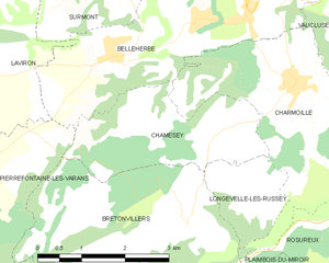
Chamesey
- коммуна во Франции
Hiking in Chamesey
Chamonix, often referred to as Chamesey, is a world-renowned destination for outdoor enthusiasts and hikers. Nestled in the French Alps, near the Mont Blanc massif, Chamonix offers a variety of hiking trails suitable for all levels of experience. Here are some key points to keep in mind when hiking in the Chamonix region:...
- Страна:
- Почтовый код: 25380
- Координаты: 47° 14' 13" N, 6° 38' 57" E
- GPS треки (wikiloc): [Ссылка]
- Площадь: 6.42 кв.км
- Население: 129


La Chevillotte
- коммуна во Франции
Hiking in La Chevillotte
La Chevillotte, located in the Doubs department of the Bourgogne-Franche-Comté region in eastern France, offers a variety of hiking opportunities in a picturesque natural setting. The surrounding area is characterized by rolling hills, forests, and beautiful views, making it a great destination for outdoor enthusiasts....
- Страна:
- Почтовый код: 25620
- Координаты: 47° 13' 12" N, 6° 9' 59" E
- GPS треки (wikiloc): [Ссылка]
- Высота над уровнем моря: 440 м m
- Площадь: 7.68 кв.км
- Население: 139

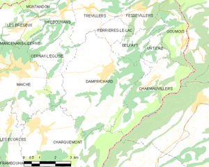
Damprichard
- коммуна во Франции
Hiking in Damprichard
Damprichard is a charming commune located in the Doubs department of the Bourgogne-Franche-Comté region in eastern France. It offers a picturesque setting for outdoor enthusiasts, especially hikers. Here are some highlights about hiking in and around Damprichard:...
- Страна:
- Почтовый код: 25450
- Координаты: 47° 14' 40" N, 6° 52' 53" E
- GPS треки (wikiloc): [Ссылка]
- Площадь: 21.9 кв.км
- Население: 1872
- Веб сайт: [Ссылка]


Les Combes
- коммуна во Франции
Hiking in Les Combes
Les Combes is a charming area perfect for hiking, situated in various regions across Europe. If you mean a specific Les Combes, such as the one in the French Alps or another location, please specify. Generally, hiking in Les Combes offers beautiful natural scenery, diverse trails, and varying levels of difficulty suitable for all kinds of hikers....
- Страна:
- Почтовый код: 25500
- Координаты: 47° 3' 33" N, 6° 32' 40" E
- GPS треки (wikiloc): [Ссылка]
- Площадь: 17.58 кв.км
- Население: 726


Chazot
Hiking in Chazot
I believe you may have meant "Chazot," which may refer to a specific area. However, if you meant "Chazot" as a reference to a hiking region, it would help to clarify the location, as there doesn't seem to be a well-known hiking area by that specific name in my data....
- Страна:
- Почтовый код: 25430
- Координаты: 47° 19' 34" N, 6° 32' 36" E
- GPS треки (wikiloc): [Ссылка]
- Площадь: 5.35 кв.км
- Население: 117
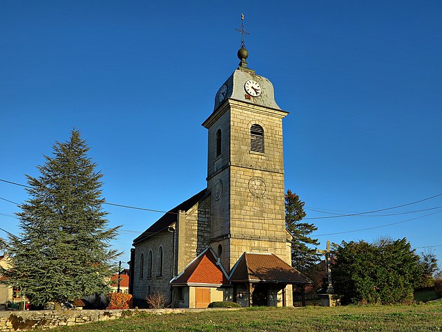

Charmoille
Hiking in Charmoille
Charmoille, located in the Doubs department of France, is a charming village nestled in the Jura Mountains. The region offers a variety of hiking opportunities that cater to different skill levels and preferences. Here are some aspects to consider when hiking in this area:...
- Страна:
- Почтовый код: 25380
- Координаты: 47° 14' 45" N, 6° 40' 15" E
- GPS треки (wikiloc): [Ссылка]
- Площадь: 10.14 кв.км
- Население: 335


Bremondans
- коммуна во Франции
Hiking in Bremondans
Bremondans is a charming small commune located in the Doubs department in the Bourgogne-Franche-Comté region of eastern France. Though not as widely known as some of the larger towns and cities, it offers several options for hiking and enjoying the natural beauty of the surrounding area....
- Страна:
- Почтовый код: 25530
- Координаты: 47° 13' 52" N, 6° 23' 52" E
- GPS треки (wikiloc): [Ссылка]
- Площадь: 7.22 кв.км
- Население: 85


Les Bréseux
- коммуна во Франции
Hiking in Les Bréseux
Les Bréseux, a picturesque area located in the Jura Mountains of France near the Swiss border, offers a variety of hiking trails that cater to different skill levels and preferences. Here are some highlights about hiking in Les Bréseux:...
- Страна:
- Почтовый код: 25120
- Координаты: 47° 16' 21" N, 6° 48' 37" E
- GPS треки (wikiloc): [Ссылка]
- Площадь: 7.37 кв.км
- Население: 489
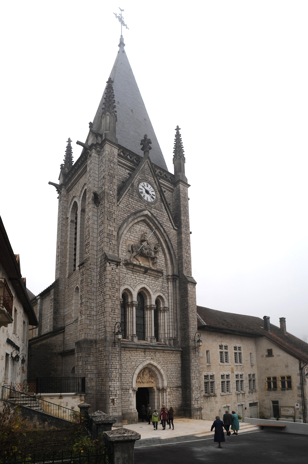
Монбенуа
- коммуна во Франции
Hiking in Монбенуа
Montbenoît is a beautiful commune located in the Jura Mountains of France. It offers stunning natural landscapes, ideal for hiking and outdoor activities. Here are some highlights and tips for hiking in Montbenoît:...
- Страна:
- Почтовый код: 25650
- Координаты: 46° 59' 34" N, 6° 27' 43" E
- GPS треки (wikiloc): [Ссылка]
- Площадь: 5.03 кв.км
- Население: 397
- Веб сайт: [Ссылка]


Fournet-Blancheroche
- коммуна во Франции
Hiking in Fournet-Blancheroche
Fournet-Blancheroche is a picturesque village located in the Doubs department of the Bourgogne-Franche-Comté region in eastern France. It is an excellent destination for hiking enthusiasts due to its beautiful natural landscapes, rolling hills, and proximity to the Jura Mountains. Here are some highlights and tips for hiking in Fournet-Blancheroche:...
- Страна:
- Почтовый код: 25140
- Координаты: 47° 10' 4" N, 6° 49' 34" E
- GPS треки (wikiloc): [Ссылка]
- Площадь: 13.08 кв.км
- Население: 373


Bonnétage
- коммуна во Франции
Hiking in Bonnétage
Bonnétage, located in the Doubs department of the Bourgogne-Franche-Comté region in eastern France, is a beautiful destination for hiking enthusiasts. Nestled in the Jura Mountains, the area offers stunning landscapes, lush forests, and panoramic views, making it an ideal location for outdoor activities....
- Страна:
- Почтовый код: 25210
- Координаты: 47° 11' 5" N, 6° 43' 24" E
- GPS треки (wikiloc): [Ссылка]
- Площадь: 17.71 кв.км
- Население: 887
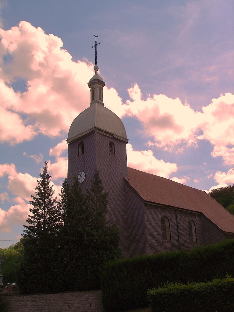

Gonsans
- коммуна во Франции
Hiking in Gonsans
It seems there might be a typo or a misunderstanding regarding the location "Gonsans," as it doesn't refer to a well-known hiking destination. However, if you meant "Gonzales" in the United States, or perhaps a region with a similar name, please clarify, and I can provide specific information....
- Страна:
- Почтовый код: 25360
- Координаты: 47° 13' 55" N, 6° 18' 1" E
- GPS треки (wikiloc): [Ссылка]
- Площадь: 17.29 кв.км
- Население: 577


Dammartin-les-Templiers
- коммуна во Франции
Hiking in Dammartin-les-Templiers
Dammartin-les-Templiers is a charming village located in the Haute-Saône department in the Bourgogne-Franche-Comté region of eastern France. This area offers a blend of natural beauty and historical charm, making it an interesting destination for hikers....
- Страна:
- Почтовый код: 25110
- Координаты: 47° 17' 27" N, 6° 16' 1" E
- GPS треки (wikiloc): [Ссылка]
- Площадь: 9.91 кв.км
- Население: 215


Foucherans
- коммуна во Франции
Hiking in Foucherans
Foucherans is a charming commune located in the Doubs department of the Bourgogne-Franche-Comté region in eastern France. While it may not be as widely recognized as major hiking destinations, it offers beautiful landscapes and some great opportunities for hiking enthusiasts....
- Страна:
- Почтовый код: 25620
- Координаты: 47° 9' 26" N, 6° 8' 12" E
- GPS треки (wikiloc): [Ссылка]
- Высота над уровнем моря: 550 м m
- Площадь: 10.95 кв.км
- Население: 466
- Веб сайт: [Ссылка]


Dampjoux
- коммуна во Франции
Hiking in Dampjoux
Dampjoux, a beautiful area located in the French Alps, offers a stunning backdrop for hiking enthusiasts. This region is known for its diverse landscapes, ranging from lush valleys to impressive mountain peaks. Here are some key points to consider when planning a hike in Dampjoux:...
- Страна:
- Почтовый код: 25190
- Координаты: 47° 20' 34" N, 6° 45' 27" E
- GPS треки (wikiloc): [Ссылка]
- Площадь: 2.31 кв.км
- Население: 179

La Chenalotte
- коммуна во Франции
Hiking in La Chenalotte
La Chenalotte is a beautiful area known for its stunning landscapes and diverse hiking trails, perfect for both beginners and experienced hikers. Located in the heart of nature, the region offers a variety of terrains, including lush forests, rocky paths, and picturesque viewpoints....
- Страна:
- Почтовый код: 25500
- Координаты: 47° 6' 31" N, 6° 41' 3" E
- GPS треки (wikiloc): [Ссылка]
- Площадь: 4.88 кв.км
- Население: 476
- Веб сайт: [Ссылка]


Courtetain-et-Salans
- коммуна во Франции
Hiking in Courtetain-et-Salans
Courtetain-et-Salans is a charming commune located in the Bourgogne-Franche-Comté region of France, known for its picturesque landscapes and natural beauty. When hiking in this area, you'll find a variety of trails that showcase the rolling hills, lush forests, and serene countryside typical of this part of France....
- Страна:
- Почтовый код: 25530
- Координаты: 47° 15' 25" N, 6° 25' 1" E
- GPS треки (wikiloc): [Ссылка]
- Площадь: 6.85 кв.км
- Население: 84
- Веб сайт: [Ссылка]


Brères
- коммуна во Франции
Hiking in Brères
Brères, located in the Aosta Valley region of Italy, offers a stunning backdrop for hiking enthusiasts. This picturesque area is characterized by its rugged mountains, lush valleys, and charming villages. Here are some highlights for hiking in and around Brères:...
- Страна:
- Почтовый код: 25440
- Координаты: 47° 3' 32" N, 5° 51' 37" E
- GPS треки (wikiloc): [Ссылка]
- Высота над уровнем моря: 260 м m
- Площадь: 2.15 кв.км
- Население: 58

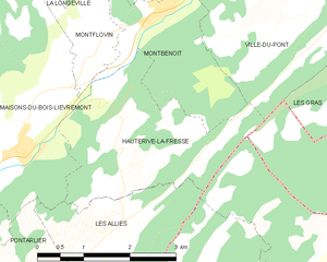
Hauterive-la-Fresse
- коммуна во Франции
Hiking in Hauterive-la-Fresse
Hauterive-la-Fresse, located in the Jura region of Switzerland, is a beautiful area known for its picturesque landscapes and outdoor activities, making it an excellent destination for hiking enthusiasts. Here are some highlights and considerations for hiking in this area:...
- Страна:
- Почтовый код: 25650
- Координаты: 46° 58' 10" N, 6° 26' 56" E
- GPS треки (wikiloc): [Ссылка]
- Площадь: 7.46 кв.км
- Население: 219


Fournets-Luisans
- коммуна во Франции
Hiking in Fournets-Luisans
Fournets-Luisans is a picturesque village located in the Doubs department of the Bourgogne-Franche-Comté region in eastern France. The area around Fournets-Luisans offers a variety of hiking opportunities that cater to different skill levels, making it a great destination for outdoor enthusiasts....
- Страна:
- Почтовый код: 25390
- Координаты: 47° 6' 42" N, 6° 33' 45" E
- GPS треки (wikiloc): [Ссылка]
- Высота над уровнем моря: 913 м m
- Площадь: 27.71 кв.км
- Население: 668


Bief
- коммуна во Франции
Hiking in Bief
Bief is a small region that can be found in various countries, so could you specify which Bief you're referring to? For instance, there might be regions named Bief in France or other locations. However, if you're looking for general hiking advice, I can provide you with tips and insights that are applicable to many hiking areas....
- Страна:
- Почтовый код: 25190
- Координаты: 47° 19' 34" N, 6° 46' 7" E
- GPS треки (wikiloc): [Ссылка]
- Площадь: 3.81 кв.км
- Население: 106
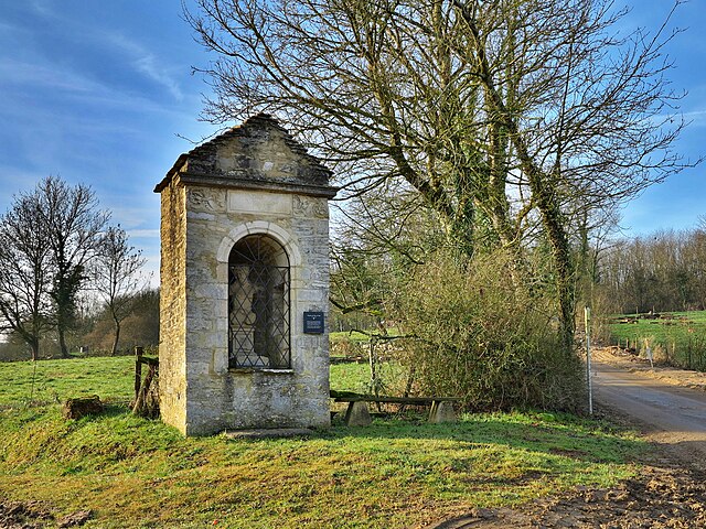

Buffard
- коммуна во Франции
Hiking in Buffard
It seems that there might be some confusion regarding "Buffard." If you're referring to a specific location, there might be a misspelling or mix-up with the name. There are many beautiful hiking destinations worldwide with similar-sounding names....
- Страна:
- Почтовый код: 25440
- Координаты: 47° 2' 12" N, 5° 49' 29" E
- GPS треки (wikiloc): [Ссылка]
- Площадь: 8.1 кв.км
- Население: 149
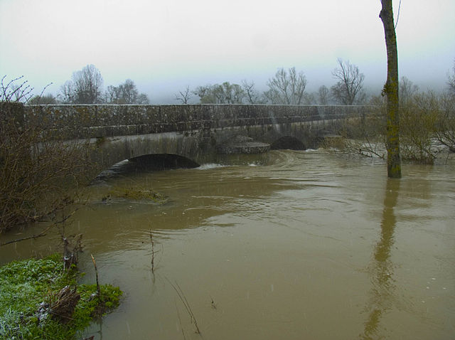

Chay
- коммуна во Франции
Hiking in Chay
Chay, located in the Doubs department of France, is a scenic area that offers beautiful landscapes and a variety of hiking opportunities. The Doubs region is known for its stunning natural beauty, featuring rolling hills, forests, rivers, and lakes, making it an excellent destination for outdoor enthusiasts....
- Страна:
- Почтовый код: 25440
- Координаты: 47° 2' 5" N, 5° 51' 39" E
- GPS треки (wikiloc): [Ссылка]
- Площадь: 6.54 кв.км
- Население: 204
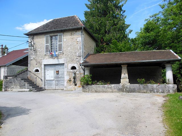

Châteauvieux-les-Fossés
- коммуна во Франции
Hiking in Châteauvieux-les-Fossés
Châteauvieux-les-Fossés is a charming village located in the Drôme department in southeastern France. It is surrounded by beautiful natural landscapes that are perfect for hiking enthusiasts. Here are some key points about hiking in and around Châteauvieux-les-Fossés:...
- Страна:
- Почтовый код: 25840
- Координаты: 47° 3' 51" N, 6° 12' 7" E
- GPS треки (wikiloc): [Ссылка]
- Высота над уровнем моря: 431 м m
- Площадь: 4.46 кв.км
- Население: 12


By
Hiking in By
By, located in the Doubs department of France, is a charming destination for hiking enthusiasts. The region is known for its stunning natural landscapes, characterized by rolling hills, dense forests, and picturesque views of the surrounding countryside and rivers....
- Страна:
- Почтовый код: 25440
- Координаты: 47° 0' 47" N, 5° 53' 22" E
- GPS треки (wikiloc): [Ссылка]
- Площадь: 7.34 кв.км
- Население: 65


Cessey
Hiking in Cessey
Cessey is not widely recognized as a specific hiking destination, so it might be a small town or area that isn't heavily documented in hiking literature. However, if you're referring to a particular region or are looking for guidance on hiking in hiking-friendly areas near where "Cessey" might be located, I’d suggest considering a few general tips and information:...
- Страна:
- Почтовый код: 25440
- Координаты: 47° 6' 31" N, 5° 54' 51" E
- GPS треки (wikiloc): [Ссылка]
- Площадь: 7.53 кв.км
- Население: 340

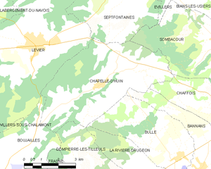
Chapelle-d'Huin
- коммуна во Франции
Hiking in Chapelle-d'Huin
Chapelle-d'Huin is a small commune located in the Doubs department of the Bourgogne-Franche-Comté region in eastern France. While it may not be as well-known as other hiking destinations, it offers beautiful landscapes and opportunities for outdoor activities, including hiking....
- Страна:
- Почтовый код: 25270
- Координаты: 46° 55' 57" N, 6° 10' 1" E
- GPS треки (wikiloc): [Ссылка]
- Площадь: 23.71 кв.км
- Население: 511


Courvières
- коммуна во Франции
Hiking in Courvières
Courvières, a charming village in France, offers beautiful hiking opportunities amidst picturesque landscapes. The area is characterized by lush greenery, rolling hills, and stunning views, making it an ideal destination for outdoor enthusiasts....
- Страна:
- Почтовый код: 25560
- Координаты: 46° 52' 9" N, 6° 6' 33" E
- GPS треки (wikiloc): [Ссылка]
- Площадь: 10.94 кв.км
- Население: 311
- Веб сайт: [Ссылка]


Charnay
- коммуна во Франции
Hiking in Charnay
Charnay, located in the Doubs department in the Bourgogne-Franche-Comté region of eastern France, is a picturesque area that offers a variety of hiking opportunities amidst beautiful landscapes....
- Страна:
- Почтовый код: 25440
- Координаты: 47° 7' 39" N, 5° 57' 20" E
- GPS треки (wikiloc): [Ссылка]
- Площадь: 5.66 кв.км
- Население: 478


Brey-et-Maison-du-Bois
- коммуна во Франции
Hiking in Brey-et-Maison-du-Bois
Brey-et-Maison-du-Bois is a charming village located in the Jura region of France, known for its beautiful natural landscapes and tranquil hiking trails. The area is characterized by lush forests, rolling hills, and picturesque vistas, making it a great destination for outdoor enthusiasts....
- Страна:
- Почтовый код: 25240
- Координаты: 46° 44' 39" N, 6° 15' 6" E
- GPS треки (wikiloc): [Ссылка]
- Площадь: 6.18 кв.км
- Население: 104


Dommartin
Hiking in Dommartin
Dommartin, located in the Doubs department of the Bourgogne-Franche-Comté region in France, offers beautiful landscapes and various hiking opportunities suitable for different experience levels. The area is characterized by rolling hills, dense forests, and scenic views, making it a great destination for nature lovers and outdoor enthusiasts....
- Страна:
- Почтовый код: 25300
- Координаты: 46° 55' 29" N, 6° 18' 25" E
- GPS треки (wikiloc): [Ссылка]
- Площадь: 6.39 кв.км
- Население: 677
- Веб сайт: [Ссылка]

Chantrans
- коммуна во Франции
Hiking in Chantrans
It seems there might be a slight misunderstanding, as "Chantrans" does not appear to be a well-known hiking destination or location as of my last update in October 2023. It could be a misspelling or a less-recognized area. If you meant a specific national park, region, or trail, please clarify the name or provide more context....
- Страна:
- Почтовый код: 25330
- Координаты: 47° 2' 36" N, 6° 9' 0" E
- GPS треки (wikiloc): [Ссылка]
- Площадь: 14.31 кв.км
- Население: 401


Fourg
- коммуна во Франции
Hiking in Fourg
Fourg is known for its beautiful landscapes and hiking opportunities, though many details can depend on the specific region or country you are referring to. If you are talking about a specific place called "Fourg," please clarify the location (such as a mountain range, state, or country), so I can provide more tailored information....
- Страна:
- Почтовый код: 25440
- Координаты: 47° 5' 53" N, 5° 48' 39" E
- GPS треки (wikiloc): [Ссылка]
- Площадь: 12.1 кв.км
- Население: 349
- Веб сайт: [Ссылка]


Hautepierre-le-Châtelet
- коммуна во Франции
Hiking in Hautepierre-le-Châtelet
Hautepierre-le-Châtelet is a small commune located in the Vosges region of northeastern France. This area is known for its scenic landscapes, rich flora and fauna, and a variety of hiking opportunities. Here are some points to consider if you're planning to hike in Hautepierre-le-Châtelet:...
- Страна:
- Почтовый код: 25580
- Координаты: 47° 2' 54" N, 6° 17' 18" E
- GPS треки (wikiloc): [Ссылка]
- Высота над уровнем моря: 790 м m
- Площадь: 9.61 кв.км
- Население: 111

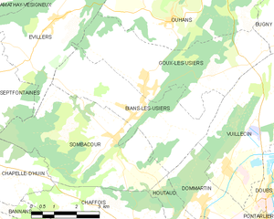
Bians-les-Usiers
- коммуна во Франции
Hiking in Bians-les-Usiers
Bians-les-Usiers is a picturesque village located in the Doubs department of France, in the region of Bourgogne-Franche-Comté. It's situated near the Jura Mountains, which provide a stunning backdrop for outdoor activities, including hiking. Here are some highlights and tips for hiking in and around Bians-les-Usiers:...
- Страна:
- Почтовый код: 25520
- Координаты: 46° 57' 44" N, 6° 16' 3" E
- GPS треки (wikiloc): [Ссылка]
- Площадь: 14.01 кв.км
- Население: 654

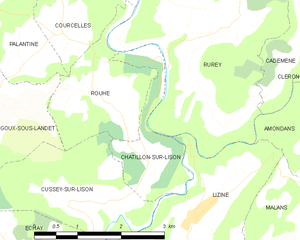
Châtillon-sur-Lison
- коммуна во Франции
Hiking in Châtillon-sur-Lison
Châtillon-sur-Lison, located in the Franche-Comté region of eastern France, offers a delightful setting for hiking enthusiasts. The area is characterized by its lush landscapes, scenic valleys, and a mix of natural and historical features. Here are some highlights and tips for hiking in Châtillon-sur-Lison:...
- Страна:
- Почтовый код: 25440
- Координаты: 47° 3' 50" N, 5° 58' 56" E
- GPS треки (wikiloc): [Ссылка]
- Высота над уровнем моря: 294 м m
- Площадь: 2.89 кв.км
- Население: 9

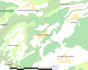
Crouzet-Migette
- коммуна во Франции
Hiking in Crouzet-Migette
Crouzet-Migette is a beautiful area in the Jura Mountains of France, known for its stunning landscapes, diverse wildlife, and rich cultural heritage. It's less well-known than other hiking destinations in France, making it a great spot for those seeking a quieter experience in nature....
- Страна:
- Почтовый код: 25270
- Координаты: 46° 57' 25" N, 6° 0' 42" E
- GPS треки (wikiloc): [Ссылка]
- Площадь: 5.67 кв.км
- Население: 120


Chassagne-Saint-Denis
- коммуна во Франции
Hiking in Chassagne-Saint-Denis
Chassagne-Saint-Denis is a charming village in the Burgundy region of France, known for its natural beauty and gentle rolling landscapes. Here are some key points to consider when hiking in and around Chassagne-Saint-Denis:...
- Страна:
- Почтовый код: 25290
- Координаты: 47° 5' 0" N, 6° 6' 51" E
- GPS треки (wikiloc): [Ссылка]
- Площадь: 9.23 кв.км
- Население: 118


Bouverans
- коммуна во Франции
Hiking in Bouverans
Bouverans is a picturesque village located in the Franche-Comté region of France, not far from the Doubs River. While it may not be as widely known as some other hiking destinations, it offers access to beautiful natural scenery and hiking opportunities in the surrounding Jura Mountains and countryside....
- Страна:
- Почтовый код: 25560
- Координаты: 46° 51' 12" N, 6° 12' 29" E
- GPS треки (wikiloc): [Ссылка]
- Площадь: 18.17 кв.км
- Население: 356
- Веб сайт: [Ссылка]

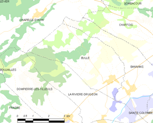
Bulle
Hiking in Bulle
Bulle, located in the Doubs region of France, offers a lovely variety of hiking opportunities that cater to different levels of experience and interests. The area is characterized by its stunning landscapes, lush forests, rolling hills, and beautiful lakes, making it an attractive destination for nature enthusiasts....
- Страна:
- Почтовый код: 25560
- Координаты: 46° 53' 38" N, 6° 13' 23" E
- GPS треки (wikiloc): [Ссылка]
- Площадь: 14.03 кв.км
- Население: 421


Fourcatier-et-Maison-Neuve
- коммуна во Франции
Hiking in Fourcatier-et-Maison-Neuve
Fourcatier-et-Maison-Neuve is a small commune located in the Jura department of France, an area that offers beautiful landscapes and opportunities for outdoor activities, including hiking. The Jura mountains are known for their rugged terrain, dense forests, and picturesque views, making them a great destination for nature enthusiasts....
- Страна:
- Почтовый код: 25370
- Координаты: 46° 45' 45" N, 6° 19' 4" E
- GPS треки (wikiloc): [Ссылка]
- Площадь: 2.75 кв.км
- Население: 103


Les Fourgs
- коммуна во Франции
Hiking in Les Fourgs
Les Fourgs, located in the Jura Mountains of France, is a fantastic destination for hikers of all skill levels. This picturesque area is characterized by its beautiful landscapes, lush forests, rolling hills, and panoramic views, making it a popular spot for outdoor enthusiasts....
- Страна:
- Почтовый код: 25300
- Координаты: 46° 50' 3" N, 6° 24' 19" E
- GPS треки (wikiloc): [Ссылка]
- Площадь: 27.99 кв.км
- Население: 1309


Gevresin
- коммуна во Франции
Hiking in Gevresin
Gevresin is not a widely recognized hiking destination, and it’s possible you might be referring to a specific region or a park that has local significance. However, if you're interested in general hiking advice or insights about hiking in different locations, I would be happy to provide that information....
- Страна:
- Почтовый код: 25270
- Координаты: 46° 58' 2" N, 6° 2' 31" E
- GPS треки (wikiloc): [Ссылка]
- Площадь: 6.91 кв.км
- Население: 118


Chapelle-des-Bois
- коммуна во Франции
Hiking in Chapelle-des-Bois
Chapelle-des-Bois is a charming village located in the Jura Mountains of France, known for its beautiful landscapes and outdoor recreational opportunities. Hiking in this area offers a variety of trails suitable for different skill levels, allowing hikers to immerse themselves in nature and enjoy the stunning scenery....
- Страна:
- Почтовый код: 25240
- Координаты: 46° 35' 54" N, 6° 6' 52" E
- GPS треки (wikiloc): [Ссылка]
- Площадь: 39.69 кв.км
- Население: 255


Pont-de-Roide-Vermondans
- коммуна во Франции
Hiking in Pont-de-Roide-Vermondans
Pont-de-Roide-Vermondans is a picturesque area located in the Doubs department in the Bourgogne-Franche-Comté region of France. It's known for its natural beauty and landscapes, making it a great destination for hiking enthusiasts. Here are some details to consider when hiking in this area:...
- Страна:
- Почтовый код: 25150
- Координаты: 47° 23' 5" N, 6° 46' 12" E
- GPS треки (wikiloc): [Ссылка]
- Площадь: 13.58 кв.км
- Население: 4215
- Веб сайт: [Ссылка]


Сент-Ипполит
- коммуна во Франции
Hiking in Сент-Ипполит
Saint-Hippolyte is a picturesque village located in the Doubs department in the Bourgogne-Franche-Comté region of France. The area is well-known for its stunning landscapes, rich nature, and cultural heritage, making it an excellent location for hiking enthusiasts. Here are some highlights regarding hiking in and around Saint-Hippolyte:...
- Страна:
- Почтовый код: 25190
- Координаты: 47° 19' 6" N, 6° 48' 44" E
- GPS треки (wikiloc): [Ссылка]
- Площадь: 11.01 кв.км
- Население: 907
- Веб сайт: [Ссылка]


Mouthe
- коммуна во Франции
Hiking in Mouthe
Mouthe, located in the Jura region of France, is known for its stunning natural landscapes and rich biodiversity, making it an excellent destination for hikers. Here are some key aspects to consider when hiking in Mouthe:...
- Страна:
- Почтовый код: 25240
- Координаты: 46° 42' 38" N, 6° 11' 37" E
- GPS треки (wikiloc): [Ссылка]
- Площадь: 38.73 кв.км
- Население: 1055
- Веб сайт: [Ссылка]


Pierrefontaine-les-Varans
- коммуна во Франции
Hiking in Pierrefontaine-les-Varans
Pierrefontaine-les-Varans, located in the Doubs department in the Bourgogne-Franche-Comté region of France, offers a variety of hiking opportunities that showcase its beautiful landscapes and local culture. Nestled in the Jura Mountains, the area is characterized by rolling hills, lush forests, and charming rural scenery. Here are some highlights and tips for hiking in and around Pierrefontaine-les-Varans:...
- Страна:
- Почтовый код: 25510
- Координаты: 47° 12' 55" N, 6° 32' 19" E
- GPS треки (wikiloc): [Ссылка]
- Площадь: 28.9 кв.км
- Население: 1394


Chaffois
- коммуна во Франции
Hiking in Chaffois
Chaffois is a charming village located in the Doubs department of the Bourgogne-Franche-Comté region in eastern France. It's known for its picturesque landscapes, which make it a great location for hiking enthusiasts. Here are some key points to consider if you're planning to hike in and around Chaffois:...
- Страна:
- Почтовый код: 25300
- Координаты: 46° 54' 54" N, 6° 16' 12" E
- GPS треки (wikiloc): [Ссылка]
- Площадь: 16.25 кв.км
- Население: 963
- Веб сайт: [Ссылка]


Boujailles
- коммуна во Франции
Hiking in Boujailles
Boujailles is a charming village located in the Jura department of France, known for its scenic landscapes and outdoor activities, including hiking. The area is characterized by its rolling hills, picturesque forests, and the Jura Mountains, making it a great destination for hiking enthusiasts of all levels....
- Страна:
- Почтовый код: 25560
- Координаты: 46° 53' 16" N, 6° 4' 49" E
- GPS треки (wikiloc): [Ссылка]
- Площадь: 28.22 кв.км
- Население: 415

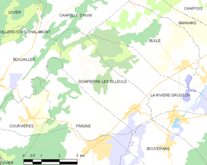
Dompierre-les-Tilleuls
- коммуна во Франции
Hiking in Dompierre-les-Tilleuls
Dompierre-les-Tilleuls is a charming village in the Jura region of France, known for its natural beauty and outdoor activities, including hiking. The area is characterized by rolling hills, forests, and scenic views, making it an excellent destination for hikers of all levels....
- Страна:
- Почтовый код: 25560
- Координаты: 46° 52' 18" N, 6° 11' 4" E
- GPS треки (wikiloc): [Ссылка]
- Площадь: 12.94 кв.км
- Население: 263


Chaux-Neuve
- коммуна во Франции
Hiking in Chaux-Neuve
Chaux-Neuve is a beautiful commune located in the Jura Mountains of France, known for its stunning landscapes and rich natural diversity. Hiking in this area offers a mix of scenic views, diverse trails, and opportunities to explore its unique flora and fauna....
- Страна:
- Почтовый код: 25240
- Координаты: 46° 40' 41" N, 6° 8' 7" E
- GPS треки (wikiloc): [Ссылка]
- Площадь: 28.31 кв.км
- Население: 305
- Веб сайт: [Ссылка]


Levier
- коммуна во Франции
Hiking in Levier
Levier is a lesser-known destination for hiking enthusiasts, but it offers a unique experience amidst beautiful landscapes. While specific trails and conditions can vary, here are some general points to consider when hiking in or around Levier:...
- Страна:
- Почтовый код: 25270
- Координаты: 46° 57' 13" N, 6° 7' 7" E
- GPS треки (wikiloc): [Ссылка]
- Площадь: 37.6 кв.км
- Население: 2020
- Веб сайт: [Ссылка]


Le Crouzet
- коммуна во Франции
Hiking in Le Crouzet
Le Crouzet is a picturesque village located in the Jura Mountains of France, known for its stunning landscapes, lush forests, and varied hiking trails. Here are some key aspects to consider if you're planning a hiking trip in and around Le Crouzet:...
- Страна:
- Почтовый код: 25240
- Координаты: 46° 42' 12" N, 6° 8' 14" E
- GPS треки (wikiloc): [Ссылка]
- Площадь: 3.77 кв.км
- Население: 56


Beure
- коммуна во Франции
Hiking in Beure
Beure, located in the Bourgogne-Franche-Comté region of France, offers some beautiful hiking opportunities, especially for those who appreciate scenic landscapes and natural beauty. While Beure itself is a small commune, it is situated near the Jura mountains, which provide various trails and outdoor experiences....
- Страна:
- Почтовый код: 25720
- Координаты: 47° 12' 29" N, 6° 0' 14" E
- GPS треки (wikiloc): [Ссылка]
- Площадь: 3.99 кв.км
- Население: 1378
- Веб сайт: [Ссылка]


Bolandoz
- коммуна во Франции
Hiking in Bolandoz
Bolandoz is a small commune located in the Bourgogne-Franche-Comté region of France, known for its natural beauty and charming landscapes. While it may not be as widely recognized as other hiking destinations, it offers various opportunities for exploration and enjoying the great outdoors....
- Страна:
- Почтовый код: 25330
- Координаты: 47° 1' 7" N, 6° 6' 41" E
- GPS треки (wikiloc): [Ссылка]
- Площадь: 12.21 кв.км
- Население: 385


Lantenne-Vertière
- коммуна во Франции
Hiking in Lantenne-Vertière
Lantenne-Vertière is a commune in the Jura department in eastern France. While it may not be as famous as larger hiking destinations, the area does offer opportunities for outdoor enthusiasts looking for a peaceful hiking experience amidst natural beauty. Here are some points to consider when planning your hike in Lantenne-Vertière:...
- Страна:
- Почтовый код: 25170
- Координаты: 47° 13' 58" N, 5° 46' 43" E
- GPS треки (wikiloc): [Ссылка]
- Площадь: 9.88 кв.км
- Население: 536


Mazerolles-le-Salin
- коммуна во Франции
Hiking in Mazerolles-le-Salin
Mazerolles-le-Salin is a small commune in the eastern part of France, situated in the Jura department. It is known for its beautiful natural landscapes and scenic routes, making it a charming destination for hiking enthusiasts....
- Страна:
- Почтовый код: 25170
- Координаты: 47° 14' 26" N, 5° 52' 9" E
- GPS треки (wikiloc): [Ссылка]
- Площадь: 4.2 кв.км
- Население: 208


Grand-Charmont
- коммуна во Франции
Hiking in Grand-Charmont
Grand-Charmont is a charming commune located in the Bourgogne-Franche-Comté region of eastern France. While it may not be as widely known as some national parks or larger hiking destinations, the surrounding area offers a variety of outdoor activities, including hiking....
- Страна:
- Почтовый код: 25200
- Координаты: 47° 31' 38" N, 6° 49' 25" E
- GPS треки (wikiloc): [Ссылка]
- Площадь: 4.56 кв.км
- Население: 5584
- Веб сайт: [Ссылка]


Geney
- коммуна во Франции
Hiking in Geney
It seems like there might be a small typo in your request for information on hiking in "Geney." If you meant Geneva, which is renowned for its proximity to beautiful hiking trails in the surrounding mountains, specifically the Jura and the Alps, I’d be happy to help with that!...
- Страна:
- Почтовый код: 25250
- Координаты: 47° 29' 9" N, 6° 34' 0" E
- GPS треки (wikiloc): [Ссылка]
- Площадь: 4.33 кв.км
- Население: 131


Jallerange
- коммуна во Франции
- Страна:
- Почтовый код: 25170
- Координаты: 47° 15' 15" N, 5° 43' 0" E
- GPS треки (wikiloc): [Ссылка]
- Площадь: 5.41 кв.км
- Население: 245


Meslières
- коммуна во Франции
Hiking in Meslières
Meslières is a picturesque village in the Haute-Saône department of France, nestled in the region of Bourgogne-Franche-Comté. This area is known for its beautiful landscapes, rolling hills, and lush forests, making it an excellent destination for hiking enthusiasts....
- Страна:
- Почтовый код: 25310
- Координаты: 47° 25' 2" N, 6° 53' 16" E
- GPS треки (wikiloc): [Ссылка]
- Площадь: 2.99 кв.км
- Население: 382


Lavernay
- коммуна во Франции
Hiking in Lavernay
Lavernay is a lesser-known area, which means it could offer unique scenic hiking experiences without the crowds often found in more popular regions. Generally speaking, when exploring a hiking spot, consider the following aspects:...
- Страна:
- Почтовый код: 25170
- Координаты: 47° 14' 47" N, 5° 49' 3" E
- GPS треки (wikiloc): [Ссылка]
- Площадь: 7.74 кв.км
- Население: 573


Pierrefontaine-lès-Blamont
- коммуна во Франции
Hiking in Pierrefontaine-lès-Blamont
Pierrefontaine-lès-Blamont, located in the Doubs department of France, offers a picturesque setting for hiking enthusiasts. The area is characterized by its rolling hills, lush forests, and scenic landscapes, making it an ideal destination for nature lovers....
- Страна:
- Почтовый код: 25310
- Координаты: 47° 22' 32" N, 6° 50' 21" E
- GPS треки (wikiloc): [Ссылка]
- Площадь: 8.96 кв.км
- Население: 445


Montagney-Servigney
- коммуна во Франции
- Страна:
- Почтовый код: 25680
- Координаты: 47° 28' 52" N, 6° 18' 23" E
- GPS треки (wikiloc): [Ссылка]
- Высота над уровнем моря: 280 м m
- Площадь: 6.55 кв.км
- Население: 126


Roches-lès-Blamont
- коммуна во Франции
Hiking in Roches-lès-Blamont
Roches-lès-Blamont is a picturesque village located in the Doubs department of the Bourgogne-Franche-Comté region in eastern France. The area is surrounded by lush landscapes, making it an excellent destination for hiking enthusiasts....
- Страна:
- Почтовый код: 25310
- Координаты: 47° 24' 35" N, 6° 51' 5" E
- GPS треки (wikiloc): [Ссылка]
- Площадь: 5.44 кв.км
- Население: 643


Dung
Hiking in Dung
Dung, located in the Doubs department of the Bourgogne-Franche-Comté region in France, is often overlooked but offers some beautiful hiking opportunities. The Doubs region is characterized by its stunning landscapes, featuring valleys, rivers, lakes, and lush forests. Here are some key points to consider if you're planning to hike in Dung or the surrounding areas:...
- Страна:
- Почтовый код: 25550
- Координаты: 47° 30' 17" N, 6° 45' 7" E
- GPS треки (wikiloc): [Ссылка]
- Площадь: 3.22 кв.км
- Население: 662


Raynans
- коммуна во Франции
Hiking in Raynans
Raynans is a small village in the Jura department of eastern France, known for its picturesque landscapes and proximity to the Jura mountain range. Hiking in this region offers a variety of trails suitable for different skill levels, and provides a chance to experience the beauty of nature, including lush forests, rolling hills, and scenic viewpoints....
- Страна:
- Почтовый код: 25550
- Координаты: 47° 31' 59" N, 6° 43' 8" E
- GPS треки (wikiloc): [Ссылка]
- Площадь: 4.03 кв.км
- Население: 343


Présentevillers
- коммуна во Франции
Hiking in Présentevillers
Présentevillers is a small village located in the Doubs department in the Bourgogne-Franche-Comté region of eastern France. While it may not be as well-known as some larger hiking destinations, it offers charming surroundings and opportunities for those looking to explore nature....
- Страна:
- Почтовый код: 25550
- Координаты: 47° 30' 4" N, 6° 43' 50" E
- GPS треки (wikiloc): [Ссылка]
- Площадь: 3.83 кв.км
- Население: 452


Sainte-Marie
- коммуна во Франции
Hiking in Sainte-Marie
Sainte-Marie, located in the Doubs department of the Bourgogne-Franche-Comté region in eastern France, offers a range of beautiful hiking opportunities that are perfect for nature enthusiasts and outdoor adventurers. The region is characterized by its lush landscapes, rolling hills, and picturesque views typical of the Jura Mountains....
- Страна:
- Почтовый код: 25113
- Координаты: 47° 30' 27" N, 6° 41' 43" E
- GPS треки (wikiloc): [Ссылка]
- Площадь: 7.17 кв.км
- Население: 709

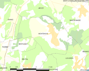
Montenois
- коммуна во Франции
Hiking in Montenois
Montenois, a commune in the Doubs department of the Bourgogne-Franche-Comté region in eastern France, is known for its natural beauty and scenic landscapes, making it a delightful hiking destination. While it may not be as famous as some other hiking locales in France, it offers a peaceful environment for outdoor enthusiasts....
- Страна:
- Почтовый код: 25260
- Координаты: 47° 29' 35" N, 6° 39' 58" E
- GPS треки (wikiloc): [Ссылка]
- Площадь: 8.03 кв.км
- Население: 1519


Ruffey-le-Château
- коммуна во Франции
Hiking in Ruffey-le-Château
Ruffey-le-Château, located in the Bourgogne-Franche-Comté region of eastern France, offers a charming setting for hiking enthusiasts. The area is characterized by a combination of gentle hills, forests, and agricultural landscapes that provide a diverse range of hiking routes suitable for different skill levels....
- Страна:
- Почтовый код: 25170
- Координаты: 47° 17' 15" N, 5° 47' 54" E
- GPS треки (wikiloc): [Ссылка]
- Площадь: 7.25 кв.км
- Население: 358


Issans
- коммуна во Франции
Hiking in Issans
It seems there might be a typo in your inquiry, as there isn't a well-known hiking destination called "Issans." However, if you meant "Islands," I could provide information about hiking on islands such as those in the Caribbean, Pacific, or other regions. Alternatively, if you're referring to a specific location or region that sounds similar, please clarify so I can assist you better!...
- Страна:
- Почтовый код: 25550
- Координаты: 47° 31' 39" N, 6° 43' 40" E
- GPS треки (wikiloc): [Ссылка]
- Площадь: 2.72 кв.км
- Население: 247


Onans
- коммуна во Франции
Hiking in Onans
It seems there might be a typo in your question, as "Onans" does not refer to a well-known hiking destination. However, if you meant "Ohnans" in the context of Ohnan, Japan, or possibly another location, please clarify so I can provide you with accurate information....
- Страна:
- Почтовый код: 25250
- Координаты: 47° 30' 8" N, 6° 36' 35" E
- GPS треки (wikiloc): [Ссылка]
- Площадь: 14.21 кв.км
- Население: 363


Дезандан
- коммуна во Франции
Hiking in Дезандан
Désandans is a small commune located in the Doubs department in the Bourgogne-Franche-Comté region of eastern France. While it may not be as widely known as some larger hiking destinations, there are still opportunities for outdoor enthusiasts to explore the scenic beauty of the area....
- Страна:
- Почтовый код: 25750
- Координаты: 47° 31' 59" N, 6° 40' 38" E
- GPS треки (wikiloc): [Ссылка]
- Площадь: 5.47 кв.км
- Население: 720


Marvelise
- коммуна во Франции
Hiking in Marvelise
Marvelise is a beautiful yet less-known region that offers incredible hiking opportunities. Nestled in nature, it provides a balance of scenic landscapes, diverse ecosystems, and trails suitable for varying skill levels. Here are some key points to consider when hiking in Marvelise:...
- Страна:
- Почтовый код: 25250
- Координаты: 47° 31' 20" N, 6° 35' 32" E
- GPS треки (wikiloc): [Ссылка]
- Площадь: 4.21 кв.км
- Население: 158


Saint-Julien-lès-Montbéliard
- коммуна во Франции
Hiking in Saint-Julien-lès-Montbéliard
Saint-Julien-lès-Montbéliard is a charming commune located in the Bourgogne-Franche-Comté region of France, near the town of Montbéliard. The area is characterized by its beautiful natural landscapes, hills, and forests, making it a great destination for hiking enthusiasts....
- Страна:
- Почтовый код: 25550
- Координаты: 47° 31' 20" N, 6° 42' 38" E
- GPS треки (wikiloc): [Ссылка]
- Площадь: 3.81 кв.км
- Население: 168


Sainte-Suzanne
- коммуна во Франции
Hiking in Sainte-Suzanne
Sainte-Suzanne, located in the Doubs department of France, is a beautiful area known for its stunning landscapes and rich natural heritage, making it a great destination for hiking enthusiasts. Here are some key highlights and tips for hiking in this region:...
- Страна:
- Почтовый код: 25630
- Координаты: 47° 30' 22" N, 6° 46' 21" E
- GPS треки (wikiloc): [Ссылка]
- Площадь: 1.59 кв.км
- Население: 1557


Hyèvre-Paroisse
- коммуна во Франции
Hiking in Hyèvre-Paroisse
Hyèvre-Paroisse is a charming village located in the Jura department of eastern France, nestled in the stunning Jura Mountains. This area is known for its beautiful landscapes, rich biodiversity, and a variety of outdoor activities, including hiking....
- Страна:
- Почтовый код: 25110
- Координаты: 47° 22' 17" N, 6° 25' 49" E
- GPS треки (wikiloc): [Ссылка]
- Площадь: 8.79 кв.км
- Население: 186

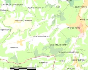
Rémondans-Vaivre
- коммуна во Франции
Hiking in Rémondans-Vaivre
Rémondans-Vaivre is a charming commune located in the eastern part of France, in the Doubs department. It offers a picturesque landscape that is great for hiking enthusiasts who want to explore the natural beauty and tranquility of the region. Here are a few highlights about hiking in Rémondans-Vaivre:...
- Страна:
- Почтовый код: 25150
- Координаты: 47° 22' 31" N, 6° 42' 48" E
- GPS треки (wikiloc): [Ссылка]
- Высота над уровнем моря: 365 м m
- Площадь: 9.19 кв.км
- Население: 233


Mancenans
- коммуна во Франции
Hiking in Mancenans
Mancenans is a small commune located in the Doubs department in the Bourgogne-Franche-Comté region of eastern France. While it may not be as widely known as some larger hiking destinations, Mancenans and its surrounding areas offer beautiful landscapes and opportunities for outdoor activities, including hiking....
- Страна:
- Почтовый код: 25250
- Координаты: 47° 27' 15" N, 6° 32' 34" E
- GPS треки (wikiloc): [Ссылка]
- Высота над уровнем моря: 756 м m
- Площадь: 11.94 кв.км
- Население: 317


Grosbois
- коммуна во Франции
Hiking in Grosbois
Grosbois is a picturesque area located in France, typically recognized for its natural beauty and opportunities for outdoor activities, including hiking. The region is characterized by lush landscapes, forests, and scenic views, making it an excellent destination for hikers of all skill levels....
- Страна:
- Почтовый код: 25110
- Координаты: 47° 20' 38" N, 6° 18' 23" E
- GPS треки (wikiloc): [Ссылка]
- Площадь: 2.96 кв.км
- Население: 237


Goux-lès-Dambelin
- коммуна во Франции
Hiking in Goux-lès-Dambelin
Goux-lès-Dambelin is a charming village located in the Doubs department in the Bourgogne-Franche-Comté region of eastern France. The surrounding area offers a variety of hiking opportunities that allow you to experience the natural beauty and local culture....
- Страна:
- Почтовый код: 25150
- Координаты: 47° 23' 48" N, 6° 40' 17" E
- GPS треки (wikiloc): [Ссылка]
- Площадь: 8.9 кв.км
- Население: 279
- Веб сайт: [Ссылка]


Neuchâtel-Urtière
- коммуна во Франции
Hiking in Neuchâtel-Urtière
Neuchâtel-Urtière, located in the Canton of Neuchâtel in Switzerland, offers some beautiful hiking opportunities in a picturesque setting. The region features a combination of rolling hills, dense forests, and stunning views of Lake Neuchâtel and the surrounding Jura mountain range....
- Страна:
- Почтовый код: 25150
- Координаты: 47° 22' 29" N, 6° 43' 49" E
- GPS треки (wikiloc): [Ссылка]
- Площадь: 6.21 кв.км
- Население: 185


Pompierre-sur-Doubs
- коммуна во Франции
Hiking in Pompierre-sur-Doubs
Pompierre-sur-Doubs is a picturesque village located in the Doubs department in the Bourgogne-Franche-Comté region of France. The area offers beautiful natural scenery, making it a suitable destination for hiking enthusiasts. Here are some highlights and tips for hiking in and around Pompierre-sur-Doubs:...
- Страна:
- Почтовый код: 25340
- Координаты: 47° 25' 7" N, 6° 31' 27" E
- GPS треки (wikiloc): [Ссылка]
- Площадь: 8.16 кв.км
- Население: 304

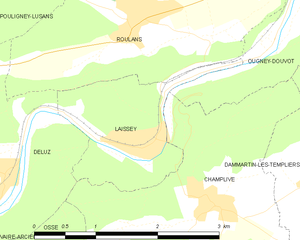
Laissey
Hiking in Laissey
Laissey is a charming village located in the Jura Mountains in France, which offers scenic hiking opportunities for outdoor enthusiasts. When planning a hike in this region, here are some key points to consider:...
- Страна:
- Почтовый код: 25820
- Координаты: 47° 17' 52" N, 6° 13' 51" E
- GPS треки (wikiloc): [Ссылка]
- Площадь: 2.86 кв.км
- Население: 443
- Веб сайт: [Ссылка]


Rognon
- коммуна во Франции
Hiking in Rognon
Rognon, located in the Doubs department of France, is a lesser-known gem for hiking enthusiasts. The region is characterized by its stunning natural landscapes, including rolling hills, dense forests, and rocky outcrops. Here are some key points to consider when hiking in Rognon:...
- Страна:
- Почтовый код: 25680
- Координаты: 47° 25' 29" N, 6° 18' 43" E
- GPS треки (wikiloc): [Ссылка]
- Площадь: 4.09 кв.км
- Население: 50


Saint-Hilaire
Hiking in Saint-Hilaire
Saint-Hilaire in the Doubs department of France is known for its beautiful landscapes and outdoor recreational opportunities, including hiking. The region is characterized by its rolling hills, lush forests, and picturesque countryside, making it a great destination for both casual walkers and experienced hikers....
- Страна:
- Почтовый код: 25640
- Координаты: 47° 20' 6" N, 6° 14' 30" E
- GPS треки (wikiloc): [Ссылка]
- Площадь: 2.64 кв.км
- Население: 160


Palise
Hiking in Palise
It seems you might be referring to a location that isn't widely recognized in hiking literature. If you meant a specific area, such as a park, trail system, or region with "Palise" in its name, please provide additional details....
- Страна:
- Почтовый код: 25870
- Координаты: 47° 22' 18" N, 6° 5' 27" E
- GPS треки (wikiloc): [Ссылка]
- Площадь: 2.09 кв.км
- Население: 140


Novillars
Hiking in Novillars
Novillars is a charming village located in the Doubs department of the Bourgogne-Franche-Comté region in eastern France. While it may not be as commonly known as some other hiking destinations, it offers beautiful landscapes and a tranquil environment for outdoor enthusiasts....
- Страна:
- Почтовый код: 25220
- Координаты: 47° 17' 9" N, 6° 7' 46" E
- GPS треки (wikiloc): [Ссылка]
- Площадь: 2.02 кв.км
- Население: 1522


Sauvagney
- коммуна во Франции
Hiking in Sauvagney
Sauvagney is a small village in the Haute-Saône department in the Bourgogne-Franche-Comté region of eastern France. While it might not be as well-known as some larger hiking destinations, the surrounding countryside offers opportunities for hiking enthusiasts to explore scenic landscapes, forests, and charming rural settings....
- Страна:
- Почтовый код: 25170
- Координаты: 47° 19' 25" N, 5° 54' 14" E
- GPS треки (wikiloc): [Ссылка]
- Площадь: 3.95 кв.км
- Население: 178


Mérey-Vieilley
- коммуна во Франции
Hiking in Mérey-Vieilley
Mérey-Vieilley is a small commune located in the region of Bourgogne-Franche-Comté in eastern France. While it may not be as well-known as some larger hiking destinations, it offers opportunities for those interested in exploring the natural beauty of the area....
- Страна:
- Почтовый код: 25870
- Координаты: 47° 19' 58" N, 6° 3' 46" E
- GPS треки (wikiloc): [Ссылка]
- Площадь: 3.42 кв.км
- Население: 142

Roche-lez-Beaupré
- коммуна во Франции
Hiking in Roche-lez-Beaupré
Roche-lez-Beaupré, located in the Doubs region of France, offers a scenic and exciting environment for hiking enthusiasts. The area is characterized by its beautiful natural landscapes, which include lush forests, impressive cliffs, and picturesque views overlooking the surrounding valleys....
- Страна:
- Почтовый код: 25220
- Координаты: 47° 16' 34" N, 6° 6' 51" E
- GPS треки (wikiloc): [Ссылка]
- Высота над уровнем моря: 265 м m
- Площадь: 5.63 кв.км
- Население: 2053
- Веб сайт: [Ссылка]

Luxiol
- коммуна во Франции
Hiking in Luxiol
It seems there might be some confusion with the name "Luxiol," as it doesn't correspond to a well-known hiking destination or national park. If you are referring to a specific location or have a typo, please provide more details so I can assist you accurately....
- Страна:
- Почтовый код: 25110
- Координаты: 47° 22' 52" N, 6° 20' 57" E
- GPS треки (wikiloc): [Ссылка]
- Площадь: 6.44 кв.км
- Население: 161
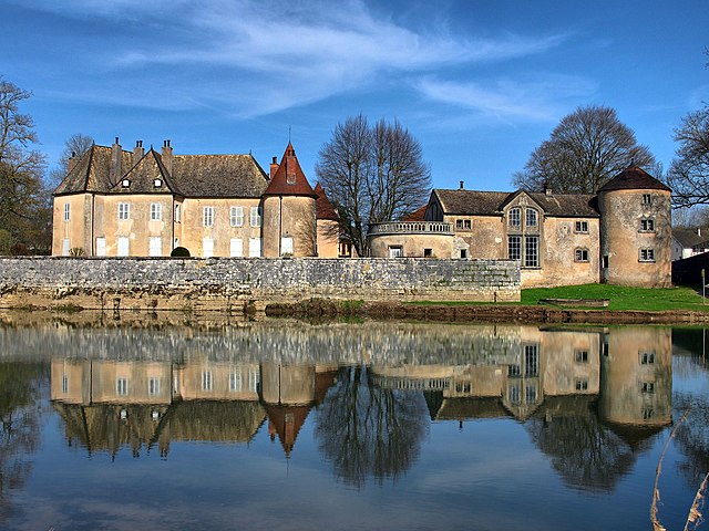

Ollans
- коммуна во Франции
Hiking in Ollans
Ollans is a charming village located in the Rhône-Alpes region of France, known for its picturesque landscapes and outdoor activities, including hiking. While specific hiking trails can vary and are subject to seasonal changes, here are some general tips and information about hiking in and around Ollans:...
- Страна:
- Почтовый код: 25640
- Координаты: 47° 25' 3" N, 6° 14' 41" E
- GPS треки (wikiloc): [Ссылка]
- Площадь: 2.31 кв.км
- Население: 38


Le Puy
- коммуна во Франции
Hiking in Le Puy
Le Puy in Doubs, located in the Bourgogne-Franche-Comté region of France, is a fantastic spot for hiking, with its beautiful natural landscapes, varied terrain, and rich cultural history. Here’s a brief overview of what you can expect when hiking in the area:...
- Страна:
- Почтовый код: 25640
- Координаты: 47° 20' 43" N, 6° 13' 41" E
- GPS треки (wikiloc): [Ссылка]
- Площадь: 3.42 кв.км
- Население: 110


Lanthenans
- коммуна во Франции
Hiking in Lanthenans
Lantheans, located in the picturesque region of France, offers exceptional hiking opportunities for outdoor enthusiasts of all skill levels. The landscape features a blend of dense forests, rolling hills, and stunning vistas. Here are some highlights and tips for hiking in the area:...
- Страна:
- Почтовый код: 25250
- Координаты: 47° 23' 41" N, 6° 37' 38" E
- GPS треки (wikiloc): [Ссылка]
- Площадь: 3.36 кв.км
- Население: 68

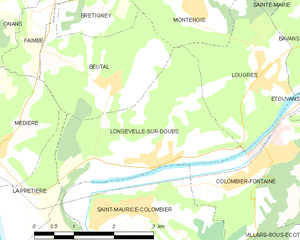
Longevelle-sur-Doubs
- коммуна во Франции
Hiking in Longevelle-sur-Doubs
Longevelle-sur-Doubs is a charming commune located in the Doubs department of eastern France, bordered by beautiful natural scenery. It is an excellent base for hiking enthusiasts due to its proximity to the Doubs River and the surrounding landscapes that offer a variety of trails suitable for different skill levels....
- Страна:
- Почтовый код: 25260
- Координаты: 47° 27' 9" N, 6° 39' 5" E
- GPS треки (wikiloc): [Ссылка]
- Площадь: 8.31 кв.км
- Население: 697
- Веб сайт: [Ссылка]


Mésandans
- коммуна во Франции
Hiking in Mésandans
Mésandans, while not widely known as a primary hiking destination, offers beautiful landscapes and a serene environment for outdoor enthusiasts. Since the area is less commercialized than many popular hiking spots, it can provide a more tranquil hiking experience. Here are some general tips and highlights about hiking in such regions:...
- Страна:
- Почтовый код: 25680
- Координаты: 47° 25' 51" N, 6° 22' 8" E
- GPS треки (wikiloc): [Ссылка]
- Площадь: 5.66 кв.км
- Население: 220


Mathay
- коммуна во Франции
Hiking in Mathay
Mathay is a beautiful destination for hiking enthusiasts, offering a range of trails that cater to different skill levels. While specific information on Mathay may be limited, I can provide general tips and insights for hiking in areas like it....
- Страна:
- Почтовый код: 25700
- Координаты: 47° 26' 13" N, 6° 47' 0" E
- GPS треки (wikiloc): [Ссылка]
- Площадь: 14.85 кв.км
- Население: 2175

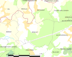
Moncley
- коммуна во Франции
Hiking in Moncley
Moncley isn't a widely recognized hiking destination, so it's important to clarify if you are referring to a specific region or a local area that may have hiking opportunities. However, I can provide general guidance on what to look for when exploring hiking locations:...
- Страна:
- Почтовый код: 25170
- Координаты: 47° 18' 30" N, 5° 53' 30" E
- GPS треки (wikiloc): [Ссылка]
- Площадь: 7.92 кв.км
- Население: 293


Saint-Maurice-Colombier
- коммуна во Франции
Hiking in Saint-Maurice-Colombier
Saint-Maurice-Colombier is located in the Doubs department in the Bourgogne-Franche-Comté region of France. It offers a picturesque backdrop for hikers, characterized by beautiful landscapes, dense forests, and rolling hills....
- Страна:
- Почтовый код: 25260
- Координаты: 47° 26' 31" N, 6° 38' 41" E
- GPS треки (wikiloc): [Ссылка]
- Высота над уровнем моря: 330 м m
- Площадь: 13.29 кв.км
- Население: 907
- Веб сайт: [Ссылка]
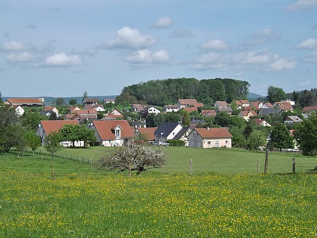

Geneuille
- коммуна во Франции
Hiking in Geneuille
Geneuille is a small commune located in the Doubs department of the Bourgogne-Franche-Comté region in eastern France. If you're considering hiking in or around Geneuille, you'll find a beautiful and diverse landscape that is characteristic of the region....
- Страна:
- Почтовый код: 25870
- Координаты: 47° 19' 25" N, 5° 58' 14" E
- GPS треки (wikiloc): [Ссылка]
- Площадь: 6.45 кв.км
- Население: 1347
- Веб сайт: [Ссылка]
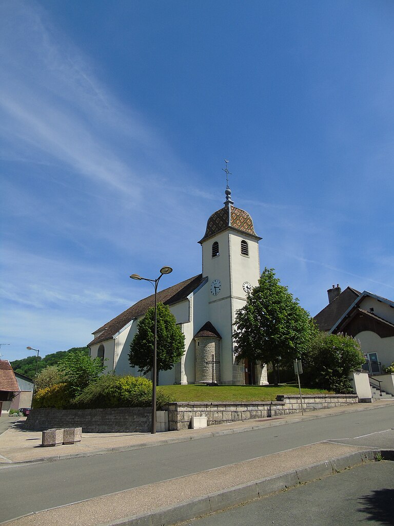
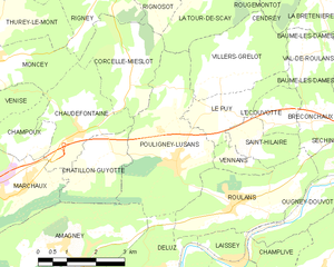
Pouligney-Lusans
- коммуна во Франции
Hiking in Pouligney-Lusans
Pouligney-Lusans is a small commune located in the Doubs department of the Bourgogne-Franche-Comté region in eastern France. While it may not be a widely recognized hiking destination, the surrounding area does offer opportunities for nature walks and hiking experiences....
- Страна:
- Почтовый код: 25640
- Координаты: 47° 19' 43" N, 6° 12' 14" E
- GPS треки (wikiloc): [Ссылка]
- Площадь: 11.6 кв.км
- Население: 835


Médière
- коммуна во Франции
Hiking in Médière
Médière, located in the beautiful region of the French Alps, is known for its stunning landscapes and a variety of hiking trails suitable for different skill levels. Here are some key points you might find helpful when considering a hiking trip in Médière:...
- Страна:
- Почтовый код: 25250
- Координаты: 47° 27' 24" N, 6° 35' 55" E
- GPS треки (wikiloc): [Ссылка]
- Площадь: 5.73 кв.км
- Население: 302


Flagey-Rigney
- коммуна во Франции
Hiking in Flagey-Rigney
Flagey-Rigney, located in the Walloon region of Belgium, offers a picturesque setting that is ideal for hiking enthusiasts. Nestled in the beautiful countryside, this area features a mix of woodlands, fields, and rolling hills, providing a variety of landscapes to explore....
- Страна:
- Почтовый код: 25640
- Координаты: 47° 25' 8" N, 6° 13' 25" E
- GPS треки (wikiloc): [Ссылка]
- Площадь: 3.03 кв.км
- Население: 108
- Веб сайт: [Ссылка]


Hyèvre-Magny
- коммуна во Франции
Hiking in Hyèvre-Magny
Hyèvre-Magny is a small commune located in the Doubs department of France. While it might not be as widely known as some larger hiking destinations, it offers some scenic spots and trails that are worth exploring, especially for those looking for a quieter, rural hiking experience....
- Страна:
- Почтовый код: 25110
- Координаты: 47° 21' 58" N, 6° 26' 15" E
- GPS треки (wikiloc): [Ссылка]
- Площадь: 3.41 кв.км
- Население: 76
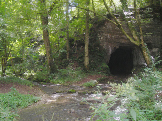

Rougemontot
- коммуна во Франции
Hiking in Rougemontot
Rougemontot is a picturesque destination located in the region of the Jura Mountains in France, known for its stunning natural scenery and outdoor activities, including hiking. Here are some things to consider if you're planning to hike in Rougemontot:...
- Страна:
- Почтовый код: 25640
- Координаты: 47° 23' 51" N, 6° 15' 46" E
- GPS треки (wikiloc): [Ссылка]
- Площадь: 4.25 кв.км
- Население: 93


Mondon
- коммуна во Франции
Hiking in Mondon
It seems there may be a typo in your request regarding "Mondon." If you are referring to a specific location, please clarify the name or provide more details. If it's a region or trail within a broader area or country, I can provide more relevant information....
- Страна:
- Почтовый код: 25680
- Координаты: 47° 26' 27" N, 6° 18' 42" E
- GPS треки (wikiloc): [Ссылка]
- Площадь: 4.5 кв.км
- Население: 92


Morre
- коммуна во Франции
Hiking in Morre
Hiking in Morre, a beautiful region in eastern France located in the Jura Mountains, offers breathtaking views, diverse landscapes, and a mix of trails suitable for all levels of hikers. Here are some highlights and considerations for hiking in this region:...
- Страна:
- Почтовый код: 25660
- Координаты: 47° 13' 32" N, 6° 3' 55" E
- GPS треки (wikiloc): [Ссылка]
- Площадь: 5.27 кв.км
- Население: 1341

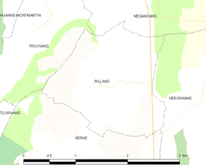
Rillans
- коммуна во Франции
Hiking in Rillans
Rillans is not a widely recognized hiking destination, but if you are referring to a specific area, such as a town or region with hiking trails, please clarify its location. If Rillans is a small locality or a lesser-known area, I'd recommend looking up local hiking maps or resources to get detailed trail information....
- Страна:
- Почтовый код: 25110
- Координаты: 47° 24' 47" N, 6° 21' 51" E
- GPS треки (wikiloc): [Ссылка]
- Площадь: 3.42 кв.км
- Население: 94


L'Hôpital-Saint-Lieffroy
- коммуна во Франции
Hiking in L'Hôpital-Saint-Lieffroy
L'Hôpital-Saint-Lieffroy is a charming commune in the Auvergne-Rhône-Alpes region of France. It's not as widely known for its hiking trails as some larger areas, but it offers a lovely countryside experience. Here are some highlights for hiking in and around L'Hôpital-Saint-Lieffroy:...
- Страна:
- Почтовый код: 25340
- Координаты: 47° 23' 56" N, 6° 27' 27" E
- GPS треки (wikiloc): [Ссылка]
- Площадь: 3.43 кв.км
- Население: 108


Montussaint
- коммуна во Франции
Hiking in Montussaint
Montussaint is not a well-known hiking destination, but it might refer to Mont Saint-Michel or a similar name. If you are looking for hiking opportunities around Mont Saint-Michel, you can enjoy stunning views of the tidal island and its historic abbey. The area offers several walking paths and trails along the bay and through the surrounding countryside....
- Страна:
- Почтовый код: 25680
- Координаты: 47° 26' 1" N, 6° 17' 32" E
- GPS треки (wikiloc): [Ссылка]
- Площадь: 3.04 кв.км
- Население: 60


Pelousey
- коммуна во Франции
Hiking in Pelousey
It seems like there might be a typo or misunderstanding regarding "Pelousey." If you're referring to a location known for hiking, could you please specify the correct name? However, if you're interested in information about hiking in a general area or region, I can certainly help with that!...
- Страна:
- Почтовый код: 25170
- Координаты: 47° 16' 31" N, 5° 55' 18" E
- GPS треки (wikiloc): [Ссылка]
- Площадь: 6.18 кв.км
- Население: 1495
- Веб сайт: [Ссылка]


Nans
- коммуна во Франции
Hiking in Nans
Nans, located in the Doubs department of France, is a beautiful area for hiking, surrounded by the stunning landscapes of the Jura Mountains. The region offers a mix of rugged terrain, lush forests, picturesque villages, and varied wildlife, making it a great destination for both experienced hikers and families looking for a peaceful outing....
- Страна:
- Почтовый код: 25680
- Координаты: 47° 28' 36" N, 6° 24' 42" E
- GPS треки (wikiloc): [Ссылка]
- Площадь: 3.2 кв.км
- Население: 102

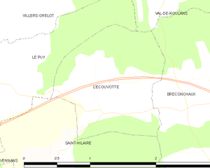
L'Écouvotte
- коммуна во Франции
Hiking in L'Écouvotte
L'Écouvotte is a beautiful hiking destination located in the Jura Mountains of France, known for its stunning landscapes, varied terrains, and rich biodiversity. Here are some highlights and tips for hiking in this area:...
- Страна:
- Почтовый код: 25640
- Координаты: 47° 20' 26" N, 6° 15' 4" E
- GPS треки (wikiloc): [Ссылка]
- Площадь: 2.16 кв.км
- Население: 93

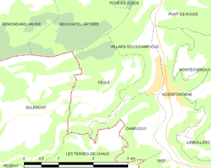
Feule
- коммуна во Франции
Hiking in Feule
It seems like there might be a typo in your request, as "Feule" doesn’t appear to be a well-known hiking destination. If you meant "Fjäll" (which refers to mountain ranges in Scandinavia) or perhaps you’re looking for hiking information in a specific area that sounds similar, please clarify or provide more details....
- Страна:
- Почтовый код: 25190
- Координаты: 47° 20' 41" N, 6° 43' 59" E
- GPS треки (wikiloc): [Ссылка]
- Площадь: 3.76 кв.км
- Население: 182


Pouilley-Français
- коммуна во Франции
Hiking in Pouilley-Français
Pouilley-Français, a charming village located in the Doubs department of the Bourgogne-Franche-Comté region in eastern France, offers a wonderful opportunity for hiking enthusiasts. The surrounding landscape features rolling hills, wooded areas, and picturesque countryside, making it a great spot for outdoor activities....
- Страна:
- Почтовый код: 25410
- Координаты: 47° 12' 26" N, 5° 50' 40" E
- GPS треки (wikiloc): [Ссылка]
- Площадь: 6.08 кв.км
- Население: 819
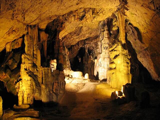
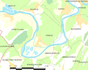
Osselle
- коммуна во Франции
Hiking in Osselle
Osselle is a small village located in the Doubs department of the Bourgogne-Franche-Comté region in eastern France. While it may not be as widely known as some other hiking destinations, it offers a charming environment for outdoor enthusiasts, particularly those who enjoy peaceful nature walks and scenic views....
- Страна:
- Почтовый код: 25320
- Координаты: 47° 8' 35" N, 5° 51' 23" E
- GPS треки (wikiloc): [Ссылка]
- Площадь: 7.68 кв.км
- Население: 447


Mercey-le-Grand
- коммуна во Франции
Hiking in Mercey-le-Grand
Mercey-le-Grand is a charming commune in the Haute-Saône department in the Bourgogne-Franche-Comté region of France. The area around Mercey-le-Grand offers a variety of hiking opportunities, characterized by its scenic landscapes, rolling hills, and lush forests....
- Страна:
- Почтовый код: 25410
- Координаты: 47° 13' 0" N, 5° 44' 19" E
- GPS треки (wikiloc): [Ссылка]
- Площадь: 6.56 кв.км
- Население: 534


Сен-Ви
- коммуна во Франции
Hiking in Сен-Ви
Saint-Vit, located in the Bourgogne-Franche-Comté region of France, offers a charming backdrop for hiking enthusiasts. While it may not be as widely known as some larger hiking destinations in the country, the surrounding areas provide beautiful landscapes and trails that can be enjoyed. Here are some aspects to consider when hiking in and around Saint-Vit:...
- Страна:
- Почтовый код: 25410
- Координаты: 47° 10' 53" N, 5° 48' 39" E
- GPS треки (wikiloc): [Ссылка]
- Площадь: 16.44 кв.км
- Население: 4833
- Веб сайт: [Ссылка]


Larnod
- коммуна во Франции
Hiking in Larnod
Larnod, located in the Rhône-Alpes region of France, offers picturesque hiking opportunities amid stunning natural landscapes. Here are some key aspects of hiking in the area:...
- Страна:
- Почтовый код: 25720
- Координаты: 47° 11' 9" N, 5° 58' 19" E
- GPS треки (wikiloc): [Ссылка]
- Площадь: 4.05 кв.км
- Население: 772

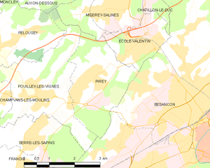
Pirey
- коммуна во Франции
Hiking in Pirey
Pirey, located near the city of Besançon in the Franche-Comté region of France, offers a variety of scenic hiking opportunities, especially for those interested in exploring the beautiful natural landscapes of the Jura Mountains....
- Страна:
- Почтовый код: 25480
- Координаты: 47° 15' 42" N, 5° 57' 47" E
- GPS треки (wikiloc): [Ссылка]
- Площадь: 6.67 кв.км
- Население: 2052
- Веб сайт: [Ссылка]
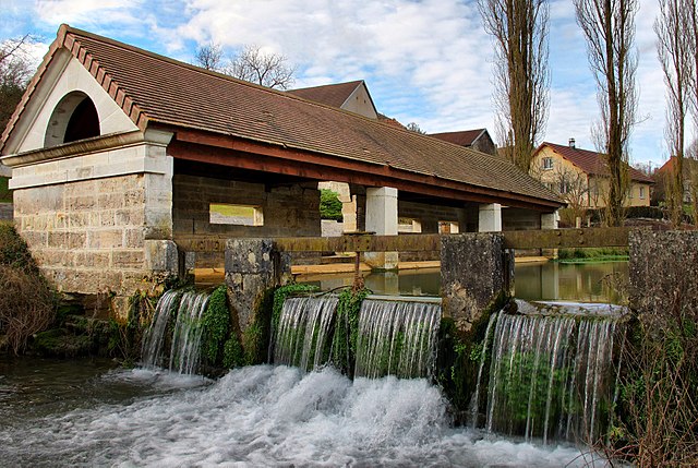

Grandfontaine
Hiking in Grandfontaine
Grandfontaine, located in the Doubs department of France, is a picturesque area that offers a range of hiking opportunities amidst beautiful natural scenery. This region is part of the Jura Mountains, characterized by lush forests, rolling hills, and stunning views. Here are some key highlights for hiking in Grandfontaine:...
- Страна:
- Почтовый код: 25320
- Координаты: 47° 11' 51" N, 5° 54' 2" E
- GPS треки (wikiloc): [Ссылка]
- Площадь: 5.68 кв.км
- Население: 1539
- Веб сайт: [Ссылка]


Montferrand-le-Château
- коммуна во Франции
Hiking in Montferrand-le-Château
Montferrand-le-Château, located near the city of Besançon in the Franche-Comté region of France, offers a range of hiking opportunities that showcase the natural beauty of the area. The region is characterized by its rolling hills, forests, and panoramic views, making it an ideal location for both casual hikers and more experienced outdoor enthusiasts....
- Страна:
- Почтовый код: 25320
- Координаты: 47° 10' 59" N, 5° 54' 28" E
- GPS треки (wikiloc): [Ссылка]
- Площадь: 7.48 кв.км
- Население: 2086
- Веб сайт: [Ссылка]

Péseux
- коммуна во Франции
Hiking in Péseux
Péseux is a charming area located in Switzerland, known for its picturesque landscapes and outdoor activities, including hiking. While specific trails and conditions may change over time, I can offer some general information on hiking in the region....
- Страна:
- Почтовый код: 25190
- Координаты: 47° 18' 59" N, 6° 40' 47" E
- GPS треки (wikiloc): [Ссылка]
- Высота над уровнем моря: 600 м m
- Площадь: 6.63 кв.км
- Население: 113

Ferrières-les-Bois
- коммуна во Франции
Hiking in Ferrières-les-Bois
Ferrières-les-Bois is a charming village located in the Jura region of France, ideal for hiking enthusiasts. The area is known for its stunning natural landscapes, including lush forests, rolling hills, and scenic vistas....
- Страна:
- Почтовый код: 25410
- Координаты: 47° 12' 16" N, 5° 48' 11" E
- GPS треки (wikiloc): [Ссылка]
- Площадь: 4.17 кв.км
- Население: 318


Pouilley-les-Vignes
- коммуна во Франции
Hiking in Pouilley-les-Vignes
Pouilley-les-Vignes is a charming commune located in the Doubs department of France, nearby the city of Besançon. The area is known for its picturesque landscapes, which makes it a great spot for hiking enthusiasts....
- Страна:
- Почтовый код: 25115
- Координаты: 47° 15' 25" N, 5° 56' 9" E
- GPS треки (wikiloc): [Ссылка]
- Площадь: 9.34 кв.км
- Население: 1951
- Веб сайт: [Ссылка]


Randevillers
- коммуна во Франции
Hiking in Randevillers
Randevillers is a picturesque commune located in the Jura department of France, offering a variety of outdoor activities for nature enthusiasts, including hiking. The region is characterized by its beautiful landscapes, rolling hills, forests, and charming villages, making it a delightful destination for hikers of all skill levels....
- Страна:
- Почтовый код: 25430
- Координаты: 47° 18' 38" N, 6° 31' 17" E
- GPS треки (wikiloc): [Ссылка]
- Площадь: 4.36 кв.км
- Население: 114
Saint-Julien-lès-Russey
- коммуна во Франции
Hiking in Saint-Julien-lès-Russey
Saint-Julien-lès-Russey is a charming commune located in the Doubs department of the Bourgogne-Franche-Comté region in eastern France. It's surrounded by beautiful natural landscapes, making it a great spot for hiking enthusiasts. Here are some highlights you might enjoy:...
- Страна:
- Почтовый код: 25210
- Координаты: 47° 13' 2" N, 6° 43' 28" E
- GPS треки (wikiloc): [Ссылка]
- Высота над уровнем моря: 550 м m
- Площадь: 10.01 кв.км
- Население: 163


Mouthier-Haute-Pierre
- коммуна во Франции
Hiking in Mouthier-Haute-Pierre
Mouthier-Haute-Pierre is a picturesque village nestled in the Jura Mountains of eastern France. It's known for its beautiful natural landscapes, making it a fantastic destination for hiking enthusiasts. Here are some highlights and tips for hiking in the area:...
- Страна:
- Почтовый код: 25920
- Координаты: 47° 2' 20" N, 6° 16' 33" E
- GPS треки (wikiloc): [Ссылка]
- Площадь: 12.13 кв.км
- Население: 320
- Веб сайт: [Ссылка]


Сансе-ле-Лон
- коммуна во Франции
Hiking in Сансе-ле-Лон
Sancey-le-Long is a charming small town located in the Doubs department in the Bourgogne-Franche-Comté region of eastern France. It's surrounded by picturesque landscapes, making it a great destination for hiking enthusiasts looking to explore nature....
- Страна:
- Почтовый код: 25430
- Координаты: 47° 18' 20" N, 6° 36' 8" E
- GPS треки (wikiloc): [Ссылка]
- Площадь: 7.02 кв.км
- Население: 345


Maisons-du-Bois-Lièvremont
- коммуна во Франции
Hiking in Maisons-du-Bois-Lièvremont
Maisons-du-Bois-Lièvremont, located in the Jura Mountains of France, is a charming destination for hiking enthusiasts. This small commune is known for its stunning natural landscapes, lush forests, and picturesque trails, making it an excellent spot for outdoor activities....
- Страна:
- Почтовый код: 25650
- Координаты: 46° 58' 2" N, 6° 25' 13" E
- GPS треки (wikiloc): [Ссылка]
- Площадь: 15.79 кв.км
- Население: 770


Lomont-sur-Crête
- коммуна во Франции
Hiking in Lomont-sur-Crête
Lomont-sur-Crête is a lovely destination for hiking enthusiasts, situated in the beautiful Jura region of France. The area is characterized by its dramatic landscapes, rolling hills, and picturesque views, making it an attractive spot for outdoor activities....
- Страна:
- Почтовый код: 25110
- Координаты: 47° 20' 18" N, 6° 25' 54" E
- GPS треки (wikiloc): [Ссылка]
- Площадь: 9.79 кв.км
- Население: 163


Osse
- коммуна во Франции
Hiking in Osse
Osse, located in the Doubs department of the Bourgogne-Franche-Comté region in eastern France, offers various hiking opportunities in a picturesque natural setting. The area's landscape is characterized by rolling hills, dense forests, and stunning views of the surrounding Jura Mountains....
- Страна:
- Почтовый код: 25360
- Координаты: 47° 16' 1" N, 6° 12' 46" E
- GPS треки (wikiloc): [Ссылка]
- Площадь: 8.21 кв.км
- Население: 328
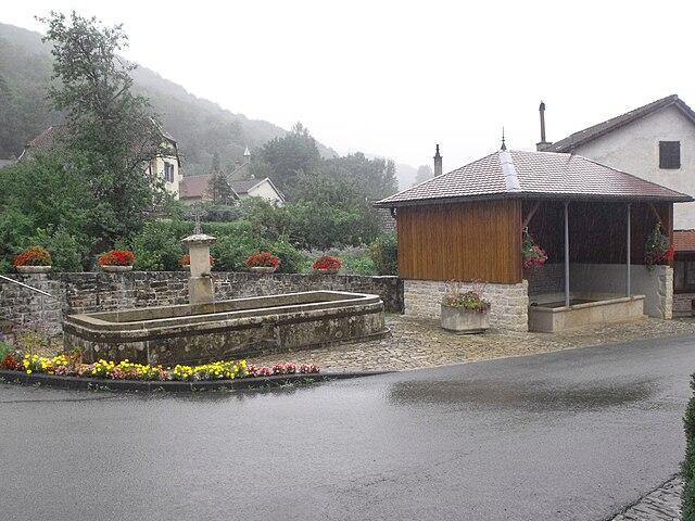

Liebvillers
- коммуна во Франции
Hiking in Liebvillers
Liebvillers is a small village located in the Vosges department of northeastern France. Although it may not be as widely known as other hiking destinations, it offers a peaceful setting and beautiful natural landscapes that can appeal to hikers looking for a quieter experience....
- Страна:
- Почтовый код: 25190
- Координаты: 47° 20' 9" N, 6° 47' 2" E
- GPS треки (wikiloc): [Ссылка]
- Площадь: 3.03 кв.км
- Население: 168


Loray
- коммуна во Франции
Hiking in Loray
It seems like there may be a mix-up with the name "Loray," as it does not appear to be a widely recognized hiking destination. However, if you were referring to an area near Loray or a specific park or region within a locality, please clarify....
- Страна:
- Почтовый код: 25390
- Координаты: 47° 9' 11" N, 6° 29' 44" E
- GPS треки (wikiloc): [Ссылка]
- Площадь: 14.39 кв.км
- Население: 491


Pointvillers
- коммуна во Франции
Hiking in Pointvillers
Pointvillers isn't widely recognized as a major hiking destination, so there may not be specific trails or parks under that name. However, if you are referring to a location that is known for hiking, such as in the Pointvillers area in a specific country, please provide a bit more context....
- Страна:
- Почтовый код: 25440
- Координаты: 47° 3' 47" N, 5° 54' 5" E
- GPS треки (wikiloc): [Ссылка]
- Площадь: 3.81 кв.км
- Население: 142


Guillon-les-Bains
- коммуна во Франции
Hiking in Guillon-les-Bains
Guillon-les-Bains is a charming location in France that offers a variety of hiking opportunities, perfect for nature enthusiasts and outdoor adventurers. Nestled in a picturesque setting, this region is well-known for its scenic landscapes, natural hot springs, and tranquil environment....
- Страна:
- Почтовый код: 25110
- Координаты: 47° 19' 8" N, 6° 23' 37" E
- GPS треки (wikiloc): [Ссылка]
- Площадь: 4.72 кв.км
- Население: 98


Nods
- коммуна во Франции
Hiking in Nods
Nods is a charming village located in the Doubs department of France, nestled in the picturesque landscapes of the Jura Mountains. Hiking in and around Nods can be a rewarding experience, offering various trails that cater to different skill levels and preferences....
- Страна:
- Почтовый код: 25580
- Координаты: 47° 5' 48" N, 6° 20' 16" E
- GPS треки (wikiloc): [Ссылка]
- Площадь: 11.78 кв.км
- Население: 574

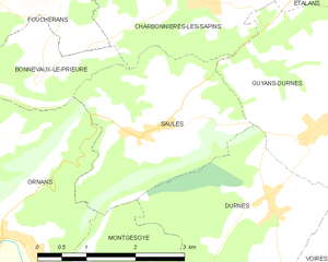
Saules
Hiking in Saules
Saules is a charming commune in the Doubs department of the Bourgogne-Franche-Comté region in eastern France. It is surrounded by stunning natural landscapes, making it a wonderful destination for hiking enthusiasts....
- Страна:
- Почтовый код: 25580
- Координаты: 47° 7' 24" N, 6° 11' 56" E
- GPS треки (wikiloc): [Ссылка]
- Площадь: 7.64 кв.км
- Население: 225


Cour-Saint-Maurice
- коммуна во Франции
Hiking in Cour-Saint-Maurice
Cour-Saint-Maurice is a picturesque village in the French Alps, known for its stunning natural beauty and excellent hiking opportunities. Nestled in the Auvergne-Rhône-Alpes region, it offers a variety of trails that cater to all skill levels, from leisurely walks through charming valleys to more challenging treks that lead to breathtaking mountain vistas....
- Страна:
- Почтовый код: 25380
- Координаты: 47° 15' 22" N, 6° 42' 3" E
- GPS треки (wikiloc): [Ссылка]
- Площадь: 4.47 кв.км
- Население: 161

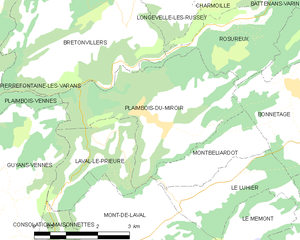
Plaimbois-du-Miroir
- коммуна во Франции
Hiking in Plaimbois-du-Miroir
Plaimbois-du-Miroir is a charming village located in the Jura region of France, known for its picturesque landscapes and outdoor activities, including hiking. The Jura Mountains offer a variety of trails that cater to hikers of different skill levels. Here are some highlights:...
- Страна:
- Почтовый код: 25210
- Координаты: 47° 11' 29" N, 6° 38' 43" E
- GPS треки (wikiloc): [Ссылка]
- Площадь: 11.71 кв.км
- Население: 238


Ferrières-le-Lac
- коммуна во Франции
Hiking in Ferrières-le-Lac
Ferrières-le-Lac, located in the Jura region of France, offers beautiful hiking opportunities, particularly thanks to its picturesque landscapes, stunning views of Lake Saint-Point, and the surrounding mountains. Here are some key points about hiking in this area:...
- Страна:
- Почтовый код: 25470
- Координаты: 47° 16' 2" N, 6° 53' 30" E
- GPS треки (wikiloc): [Ссылка]
- Площадь: 2.47 кв.км
- Население: 170


Les Plains-et-Grands-Essarts
- коммуна во Франции
Hiking in Les Plains-et-Grands-Essarts
Les Plains-et-Grands-Essarts is a beautiful area in the Normandy region of France, known for its diverse landscapes and rich natural beauty, making it a great destination for hiking enthusiasts. Here are some highlights and tips for hiking in this area:...
- Страна:
- Почтовый код: 25470
- Координаты: 47° 18' 13" N, 6° 53' 41" E
- GPS треки (wikiloc): [Ссылка]
- Высота над уровнем моря: 820 м m
- Площадь: 10.35 кв.км
- Население: 224
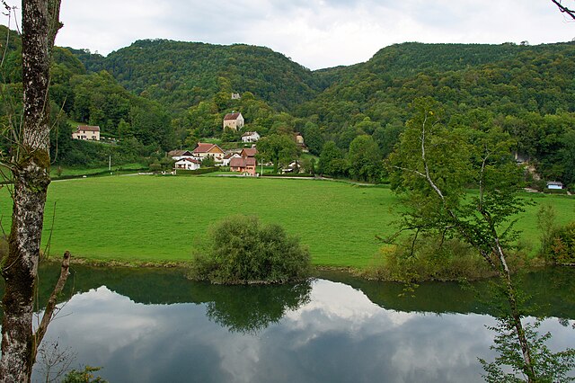

Montjoie-le-Château
- коммуна во Франции
Hiking in Montjoie-le-Château
Montjoie-le-Château is a charming area located in the Vosges region of France, known for its picturesque landscapes, rich history, and opportunities for outdoor activities, including hiking. The region boasts a variety of trails that cater to different skill levels, offering scenic views of forests, mountains, and the historic remnants of ancient fortifications....
- Страна:
- Почтовый код: 25190
- Координаты: 47° 21' 0" N, 6° 54' 7" E
- GPS треки (wikiloc): [Ссылка]
- Площадь: 5.39 кв.км
- Население: 30

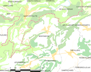
Montandon
- коммуна во Франции
Hiking in Montandon
Montandon, located in Pennsylvania, offers a range of hiking opportunities that are suitable for various skill levels. While it may not be as widely known as some of the larger national parks or mountainous regions, the surrounding landscapes and natural beauty make it a great spot for outdoor enthusiasts....
- Страна:
- Почтовый код: 25190
- Координаты: 47° 18' 14" N, 6° 50' 23" E
- GPS треки (wikiloc): [Ссылка]
- Площадь: 12.71 кв.км
- Население: 408


Malbrans
- коммуна во Франции
Hiking in Malbrans
Malbrans, also known as Malbrans Gorges, is a stunning location that offers a variety of hiking opportunities. When hiking in this area, you can expect beautiful landscapes, lush vegetation, and possibly the chance to see unique wildlife. Here are a few key points about hiking in Malbrans:...
- Страна:
- Почтовый код: 25620
- Координаты: 47° 7' 13" N, 6° 4' 53" E
- GPS треки (wikiloc): [Ссылка]
- Площадь: 8.74 кв.км
- Население: 144

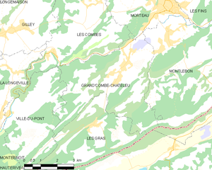
Grand'Combe-Châteleu
- коммуна во Франции
Hiking in Grand'Combe-Châteleu
Grand'Combe-Châteleu is a beautiful and less-known destination for hikers in the Jura Mountains of France. The region is characterized by its rolling hills, dense forests, and scenic vistas, making it a great spot for outdoor enthusiasts. Here are some key points to consider when hiking in this area:...
- Страна:
- Почтовый код: 25570
- Координаты: 47° 1' 34" N, 6° 34' 12" E
- GPS треки (wikiloc): [Ссылка]
- Площадь: 21.46 кв.км
- Население: 1477
- Веб сайт: [Ссылка]


Plaimbois-Vennes
- коммуна во Франции
Hiking in Plaimbois-Vennes
Plaimbois-Vennes is a charming commune located in the Doubs department in the Bourgogne-Franche-Comté region of eastern France. Nestled in the picturesque landscapes of the Jura Mountains, this area is known for its natural beauty, making it an excellent destination for hiking enthusiasts....
- Страна:
- Почтовый код: 25390
- Координаты: 47° 11' 2" N, 6° 32' 26" E
- GPS треки (wikiloc): [Ссылка]
- Площадь: 10.8 кв.км
- Население: 102
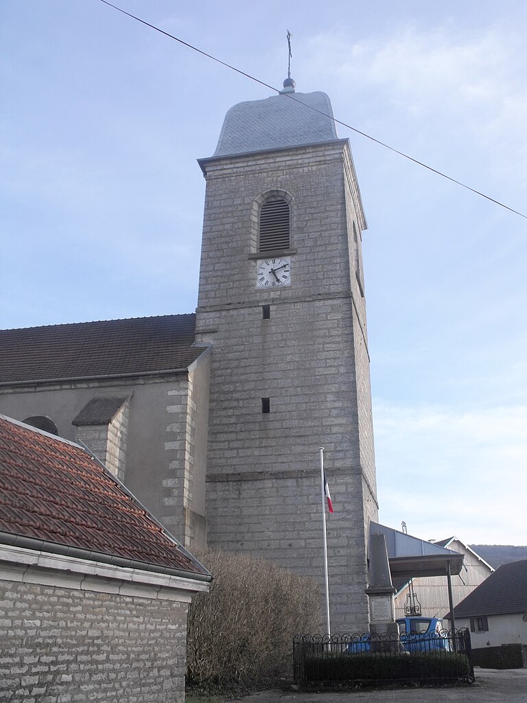

Naisey-les-Granges
- коммуна во Франции
Hiking in Naisey-les-Granges
Naisey-les-Granges is a charming village located in the Franche-Comté region of eastern France, surrounded by picturesque landscapes and natural beauty that make it an appealing destination for hiking enthusiasts. Here are some key points about hiking in Naisey-les-Granges:...
- Страна:
- Почтовый код: 25360
- Координаты: 47° 12' 43" N, 6° 14' 13" E
- GPS треки (wikiloc): [Ссылка]
- Высота над уровнем моря: 480 м m
- Площадь: 25.13 кв.км
- Население: 800
Mont-de-Vougney
- коммуна во Франции
Hiking in Mont-de-Vougney
Mont-de-Vougney is a lesser-known gem for hikers, located in the Vosges region of France near the border with Switzerland. This area is characterized by its rolling hills, dense forests, and beautiful landscapes, making it a great destination for outdoor enthusiasts....
- Страна:
- Почтовый код: 25120
- Координаты: 47° 14' 45" N, 6° 43' 53" E
- GPS треки (wikiloc): [Ссылка]
- Площадь: 7.03 кв.км
- Население: 176


Mamirolle
- коммуна во Франции
Hiking in Mamirolle
Mamirolle is a charming commune in the Doubs department of the Bourgogne-Franche-Comté region in eastern France. While Mamirolle itself is a small village, it is surrounded by beautiful landscapes and outdoor recreational opportunities, making it a nice spot for hiking enthusiasts....
- Страна:
- Почтовый код: 25620
- Координаты: 47° 11' 49" N, 6° 9' 42" E
- GPS треки (wikiloc): [Ссылка]
- Площадь: 11.49 кв.км
- Население: 1772
- Веб сайт: [Ссылка]
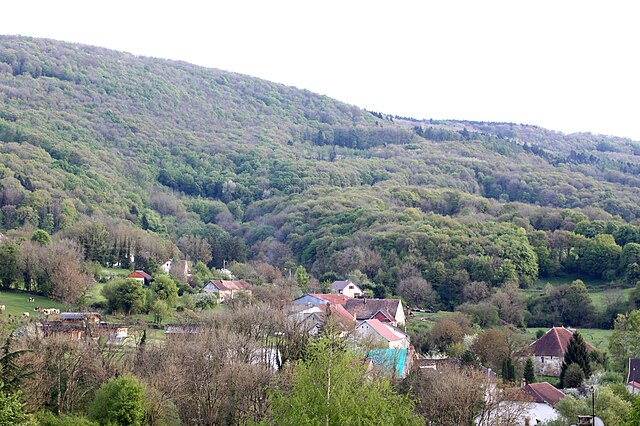

Ronchaux
- коммуна во Франции
Hiking in Ronchaux
Ronchaux is a picturesque area located in the Jura Mountains of Switzerland. It offers stunning landscapes, beautiful forests, and a variety of hiking trails suitable for different skill levels....
- Страна:
- Почтовый код: 25440
- Координаты: 47° 3' 8" N, 5° 53' 55" E
- GPS треки (wikiloc): [Ссылка]
- Площадь: 5.24 кв.км
- Население: 90


Fuans
- коммуна во Франции
Hiking in Fuans
Fuans is a picturesque village located in the Doubs department of France, nestled in the Jura Mountains near the border with Switzerland. It's a great destination for hikers looking for beautiful landscapes, forests, and scenic trails. Here are some highlights and tips for hiking in and around Fuans:...
- Страна:
- Почтовый код: 25390
- Координаты: 47° 7' 48" N, 6° 34' 17" E
- GPS треки (wikiloc): [Ссылка]
- Площадь: 11.1 кв.км
- Население: 486


Le Gratteris
- коммуна во Франции
Hiking in Le Gratteris
Le Gratteris is a less-traveled hiking destination that offers breathtaking views and a variety of trails suitable for different skill levels. While it may not be as widely known as some other hiking spots, it provides a serene environment for nature enthusiasts and those looking to escape the hustle and bustle of everyday life....
- Страна:
- Почтовый код: 25620
- Координаты: 47° 11' 1" N, 6° 8' 18" E
- GPS треки (wikiloc): [Ссылка]
- Площадь: 2.97 кв.км
- Население: 175
- Веб сайт: [Ссылка]

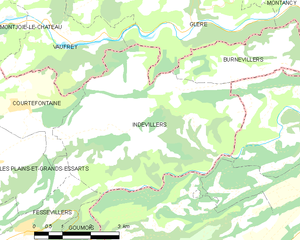
Indevillers
- коммуна во Франции
Hiking in Indevillers
Indevillers, located in the picturesque region of France, offers a charming backdrop for hiking enthusiasts. Although it may not be as widely known as some larger tourist destinations, it is surrounded by stunning natural landscapes that make it a delightful spot for those looking to explore the great outdoors....
- Страна:
- Почтовый код: 25470
- Координаты: 47° 18' 45" N, 6° 57' 25" E
- GPS треки (wikiloc): [Ссылка]
- Площадь: 22.81 кв.км
- Население: 241


Rosureux
- коммуна во Франции
Hiking in Rosureux
Rosureux is a beautiful destination for hiking enthusiasts, featuring a mix of scenic trails, diverse landscapes, and varying levels of difficulty. While the information may be slightly limited due to its lesser-known status, here are some general highlights you might expect when hiking in the Rosureux area:...
- Страна:
- Почтовый код: 25380
- Координаты: 47° 13' 6" N, 6° 41' 14" E
- GPS треки (wikiloc): [Ссылка]
- Площадь: 6.14 кв.км
- Население: 78


Montécheroux
- коммуна во Франции
Hiking in Montécheroux
Montécheroux is a charming commune located in the Doubs department in the Bourgogne-Franche-Comté region of eastern France. Nestled in a picturesque landscape that features rolling hills and dense forests, it offers a variety of hiking opportunities for both beginners and experienced hikers....
- Страна:
- Почтовый код: 25190
- Координаты: 47° 21' 0" N, 6° 48' 22" E
- GPS треки (wikiloc): [Ссылка]
- Площадь: 13.13 кв.км
- Население: 581


La Longeville
- коммуна во Франции
Hiking in La Longeville
La Longeville is a picturesque area that offers wonderful hiking opportunities, often characterized by its beautiful landscapes, diversity of terrain, and rich natural surroundings. Though specific trails can vary based on the exact location within the area, here are some general aspects to consider when hiking in La Longeville:...
- Страна:
- Почтовый код: 25650
- Координаты: 47° 0' 27" N, 6° 27' 27" E
- GPS треки (wikiloc): [Ссылка]
- Площадь: 15.66 кв.км
- Население: 778
Grand'Combe-des-Bois
- коммуна во Франции
Hiking in Grand'Combe-des-Bois
Grand'Combe-des-Bois, located in the Doubs department in the Bourgogne-Franche-Comté region of eastern France, offers a picturesque setting for hiking enthusiasts. Known for its stunning natural landscapes, the area features rolling hills, dense forests, and a variety of wildlife, making it ideal for outdoor activities....
- Страна:
- Почтовый код: 25210
- Координаты: 47° 8' 16" N, 6° 47' 27" E
- GPS треки (wikiloc): [Ссылка]
- Площадь: 11.87 кв.км
- Население: 137

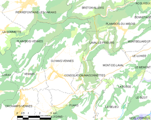
Guyans-Vennes
- коммуна во Франции
Hiking in Guyans-Vennes
Guyans-Vennes is a quaint municipality located in the Jura region of France, known for its beautiful natural landscapes and opportunities for hiking enthusiasts. Here are some key points to consider when hiking in and around Guyans-Vennes:...
- Страна:
- Почтовый код: 25390
- Координаты: 47° 9' 23" N, 6° 34' 15" E
- GPS треки (wikiloc): [Ссылка]
- Площадь: 19.67 кв.км
- Население: 816


Goux-sous-Landet
- коммуна во Франции
Hiking in Goux-sous-Landet
Goux-sous-Landet is a picturesque village located in the Jura region of France, known for its stunning natural landscapes, rolling hills, and vibrant forests. Hiking in this area offers a mix of serene trails, scenic views, and opportunities to experience the local flora and fauna....
- Страна:
- Почтовый код: 25440
- Координаты: 47° 4' 50" N, 5° 56' 1" E
- GPS треки (wikiloc): [Ссылка]
- Площадь: 5.42 кв.км
- Население: 84


Longechaux
- коммуна во Франции
Hiking in Longechaux
Longechaux is a beautiful area located in the Jura Mountains of France, known for its stunning landscapes and excellent hiking opportunities. Hiking in Longechaux offers a chance to explore lush forests, scenic views, and unique geological formations....
- Страна:
- Почтовый код: 25690
- Координаты: 47° 9' 51" N, 6° 25' 46" E
- GPS треки (wikiloc): [Ссылка]
- Площадь: 5.13 кв.км
- Население: 76


Longevelle-lès-Russey
- коммуна во Франции
Hiking in Longevelle-lès-Russey
Longevelle-lès-Russey is a charming commune located in the Doubs department in the Bourgogne-Franche-Comté region of France. The area is characterized by its beautiful landscapes, lush forests, and rolling hills, making it an attractive destination for hiking enthusiasts....
- Страна:
- Почтовый код: 25380
- Координаты: 47° 13' 32" N, 6° 39' 5" E
- GPS треки (wikiloc): [Ссылка]
- Высота над уровнем моря: 714 м m
- Площадь: 2.56 кв.км
- Население: 42


Montancy
- коммуна во Франции
Hiking in Montancy
Montancy is not a widely recognized location in hiking literature or popular hiking resources. It could be a small area or a lesser-known destination, or it might be a misspelling or variation of a nearby region known for hiking....
- Страна:
- Почтовый код: 25190
- Координаты: 47° 20' 47" N, 7° 2' 49" E
- GPS треки (wikiloc): [Ссылка]
- Площадь: 8.86 кв.км
- Население: 149


L'Hôpital-du-Grosbois
- коммуна во Франции
Hiking in L'Hôpital-du-Grosbois
L'Hôpital-du-Grosbois is a charming village located in the Doubs department of France, surrounded by beautiful landscapes ideal for hiking. Here are some details to help you make the most of your hiking experience in the area:...
- Страна:
- Почтовый код: 25620
- Координаты: 47° 10' 19" N, 6° 12' 59" E
- GPS треки (wikiloc): [Ссылка]
- Площадь: 7.84 кв.км
- Население: 586
- Веб сайт: [Ссылка]


Paroy
Hiking in Paroy
Paroy, located in the Doubs department in the Bourgogne-Franche-Comté region of France, offers a variety of outdoor hiking experiences that showcase the natural beauty of the area. The landscape primarily features rolling hills, forests, rivers, and serene countryside, making it a great destination for both casual walkers and experienced hikers....
- Страна:
- Почтовый код: 25440
- Координаты: 47° 2' 35" N, 5° 52' 54" E
- GPS треки (wikiloc): [Ссылка]
- Площадь: 4.37 кв.км
- Население: 124

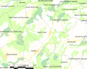
Saint-Juan
- коммуна во Франции
Hiking in Saint-Juan
Saint-Jean, depending on the region you are referring to, may provide a variety of hiking experiences. If you mean Saint-Jean-de-Maurienne in France or any other specific Saint-Jean locations, please clarify. However, here are some general aspects to consider when hiking in areas that might be called Saint-Jean:...
- Страна:
- Почтовый код: 25360
- Координаты: 47° 17' 20" N, 6° 21' 23" E
- GPS треки (wikiloc): [Ссылка]
- Площадь: 12.09 кв.км
- Население: 172


Pont-les-Moulins
- коммуна во Франции
Hiking in Pont-les-Moulins
Pont-les-Moulins, located in the scenic region of France, offers a variety of hiking opportunities suitable for different skill levels. The area is characterized by its beautiful landscapes, including rolling hills, lush forests, and charming rural vistas....
- Страна:
- Почтовый код: 25110
- Координаты: 47° 19' 25" N, 6° 21' 49" E
- GPS треки (wikiloc): [Ссылка]
- Площадь: 4.95 кв.км
- Население: 179
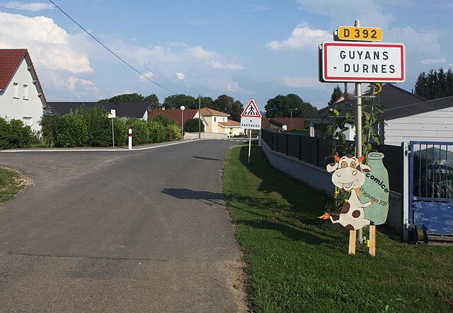

Guyans-Durnes
- коммуна во Франции
Hiking in Guyans-Durnes
It seems you've mentioned "Guyans-Durnes," which may be a region or location that is less commonly known. However, based on my training data, I can provide you with general advice on hiking in mountainous or wooded areas, and some points to consider while hiking in similar natural landscapes....
- Страна:
- Почтовый код: 25580
- Координаты: 47° 7' 22" N, 6° 14' 37" E
- GPS треки (wikiloc): [Ссылка]
- Площадь: 9.03 кв.км
- Население: 275


Narbief
- коммуна во Франции
Hiking in Narbief
Narbief is a beautiful area located in the French Jura region, known for its stunning landscapes and outdoor activities, including hiking. The region offers a variety of trails that cater to different skill levels, from casual walks to more challenging hikes. Here are some key points to consider when hiking in Narbief:...
- Страна:
- Почтовый код: 25210
- Координаты: 47° 7' 45" N, 6° 41' 27" E
- GPS треки (wikiloc): [Ссылка]
- Площадь: 3.47 кв.км
- Население: 66


Magny-Châtelard
- коммуна во Франции
Hiking in Magny-Châtelard
Magny-Châtelard is a charming area located in the French Alps, offering a range of hiking opportunities for outdoor enthusiasts. Nestled near the border of France and Switzerland, it boasts stunning scenery, including alpine meadows, forests, and breathtaking mountain views....
- Страна:
- Почтовый код: 25360
- Координаты: 47° 13' 38" N, 6° 19' 17" E
- GPS треки (wikiloc): [Ссылка]
- Высота над уровнем моря: 560 м m
- Площадь: 4.2 кв.км
- Население: 58


Pugey
- коммуна во Франции
Hiking in Pugey
Pugey, located in the Doubs department of France, is a picturesque area that offers a variety of hiking opportunities amidst beautiful natural landscapes. The region is characterized by rolling hills, lush forests, and striking geological formations, making it an ideal destination for both novice and experienced hikers....
- Страна:
- Почтовый код: 25720
- Координаты: 47° 11' 5" N, 5° 59' 26" E
- GPS треки (wikiloc): [Ссылка]
- Площадь: 7.32 кв.км
- Население: 759


Ouvans
- коммуна во Франции
Hiking in Ouvans
Ouvans, located in the Jura region of France, is a small village that offers a variety of scenic hiking opportunities. Here's a general overview of hiking in the Ouvans area:...
- Страна:
- Почтовый код: 25530
- Координаты: 47° 16' 35" N, 6° 29' 2" E
- GPS треки (wikiloc): [Ссылка]
- Площадь: 5.2 кв.км
- Население: 63
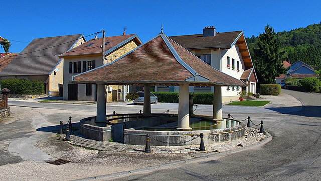
Rurey
- коммуна во Франции
Hiking in Rurey
It seems like there might be a little confusion with the name "Rurey," as it's not widely recognized as a hiking destination. However, if you're referring to a specific area or region, please provide more context or correct the name, and I'll be happy to give you detailed information....
- Страна:
- Почтовый код: 25290
- Координаты: 47° 5' 47" N, 6° 0' 33" E
- GPS треки (wikiloc): [Ссылка]
- Площадь: 14.77 кв.км
- Население: 333


Laval-le-Prieuré
- коммуна во Франции
Hiking in Laval-le-Prieuré
Laval-le-Prieuré, located in the Île-de-France region of France, offers some lovely hiking opportunities that showcase the area's natural beauty and historical significance....
- Страна:
- Почтовый код: 25210
- Координаты: 47° 10' 53" N, 6° 37' 16" E
- GPS треки (wikiloc): [Ссылка]
- Площадь: 5.29 кв.км
- Население: 33

Montgesoye
- коммуна во Франции
Hiking in Montgesoye
Montgesoye is an idyllic destination for hiking enthusiasts, nestled in the enchanting landscapes of the Jura Mountains in France. This region offers a variety of trails that cater to different skill levels and preferences....
- Страна:
- Почтовый код: 25111
- Координаты: 47° 4' 50" N, 6° 11' 28" E
- GPS треки (wikiloc): [Ссылка]
- Площадь: 11.06 кв.км
- Население: 472

Passonfontaine
- коммуна во Франции
Hiking in Passonfontaine
Passonfontaine is a picturesque area located in France, known for its stunning natural landscapes and hiking opportunities. While it may not be as widely recognized as some of the larger national parks, it offers a variety of trails that cater to different skill levels, making it a great destination for both novice and experienced hikers....
- Страна:
- Почтовый код: 25690
- Координаты: 47° 6' 28" N, 6° 25' 8" E
- GPS треки (wikiloc): [Ссылка]
- Площадь: 19.49 кв.км
- Население: 316

Fontain
Hiking in Fontain
Fontain, located near the French city of Grenoble in the Auvergne-Rhône-Alpes region, offers a variety of hiking opportunities that cater to different skill levels and interests. The area is characterized by stunning natural landscapes, including mountains, forests, and picturesque views of the surrounding valleys....
- Страна:
- Почтовый код: 25660
- Координаты: 47° 11' 55" N, 6° 1' 34" E
- GPS треки (wikiloc): [Ссылка]
- Площадь: 16.27 кв.км
- Население: 1009
- Веб сайт: [Ссылка]


Sancey-le-Grand
- коммуна во Франции
Hiking in Sancey-le-Grand
Sancey-le-Grand, located in the Doubs department of the Bourgogne-Franche-Comté region in eastern France, offers picturesque landscapes and several hiking opportunities that cater to various skill levels. The region is characterized by its rolling hills, dense forests, and charming villages, making it a great destination for nature lovers and outdoor enthusiasts....
- Страна:
- Почтовый код: 25430
- Координаты: 47° 17' 38" N, 6° 34' 56" E
- GPS треки (wikiloc): [Ссылка]
- Площадь: 23.55 кв.км
- Население: 930


La Grange
Hiking in La Grange
La Grange, located in the Doubs department of France, offers picturesque landscapes and a variety of hiking opportunities. The region is known for its beautiful natural scenery, including rolling hills, woodlands, rivers, and charming villages. Here are some key points about hiking in this area:...
- Страна:
- Почтовый код: 25380
- Координаты: 47° 16' 49" N, 6° 39' 52" E
- GPS треки (wikiloc): [Ссылка]
- Площадь: 6.16 кв.км
- Население: 92


Самсон
- коммуна во Франции
Hiking in Самсон
Samson, a charming commune in the Doubs department of the Bourgogne-Franche-Comté region in eastern France, offers some delightful hiking opportunities, particularly for those who appreciate beautiful natural landscapes and a serene environment....
- Страна:
- Почтовый код: 25440
- Координаты: 47° 3' 12" N, 5° 52' 45" E
- GPS треки (wikiloc): [Ссылка]
- Площадь: 1.95 кв.км
- Население: 91
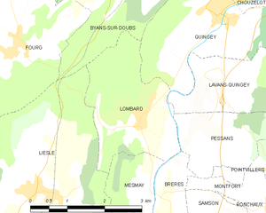
Lombard
- коммуна во Франции
Hiking in Lombard
Lombard is a beautiful area located in the Doubs department of France, known for its stunning landscapes, rich biodiversity, and numerous hiking trails. Here are some details to help you plan your hiking adventure there:...
- Страна:
- Почтовый код: 25440
- Координаты: 47° 4' 38" N, 5° 51' 13" E
- GPS треки (wikiloc): [Ссылка]
- Высота над уровнем моря: 295 м m
- Площадь: 5.92 кв.км
- Население: 198


Orve
- коммуна во Франции
Hiking in Orve
Hiking in Orve, a scenic region in Switzerland, is a delightful experience for outdoor enthusiasts. The picturesque landscapes, characterized by rolling hills, lush forests, and stunning views of the Alps, provide a variety of trails suitable for all skill levels....
- Страна:
- Почтовый код: 25430
- Координаты: 47° 19' 33" N, 6° 33' 14" E
- GPS треки (wikiloc): [Ссылка]
- Площадь: 5.51 кв.км
- Население: 67


Rouhe
- коммуна во Франции
Hiking in Rouhe
Rouhe, known for its beautiful landscapes and tranquil nature, offers a variety of hiking opportunities for all skill levels. While specific trails and routes may vary, here are some general tips and information to consider when hiking in this area:...
- Страна:
- Почтовый код: 25440
- Координаты: 47° 4' 59" N, 5° 57' 50" E
- GPS треки (wikiloc): [Ссылка]
- Площадь: 4.19 кв.км
- Население: 85
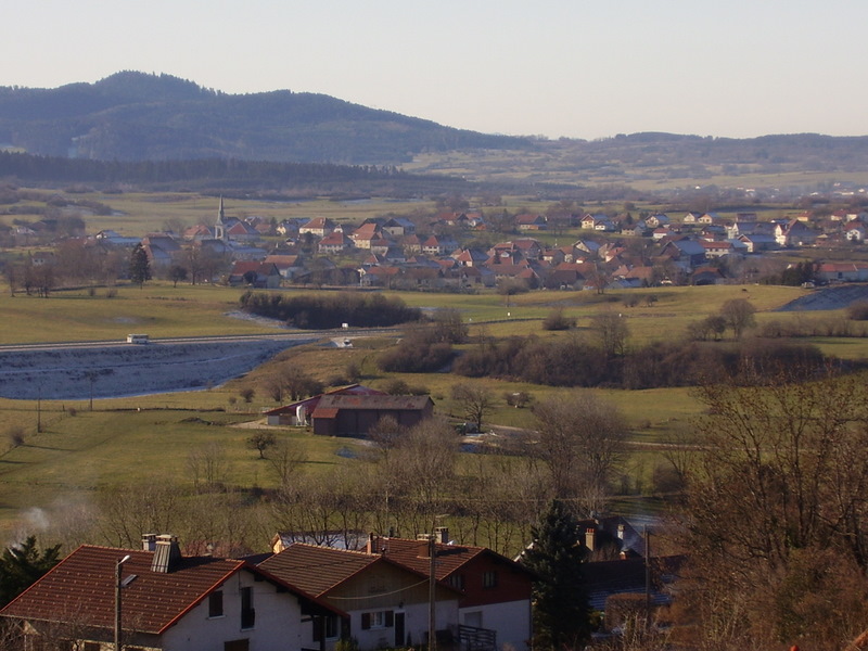
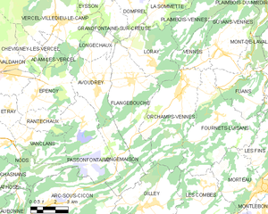
Flangebouche
- коммуна во Франции
Hiking in Flangebouche
Flangebouche, located in the Jura Mountains of France, is a hidden gem for hikers looking for beautiful landscapes, diverse terrain, and a mix of natural and cultural experiences. The region offers numerous trails suitable for all levels of hikers, from beginners to experienced trekkers....
- Страна:
- Почтовый код: 25390
- Координаты: 47° 8' 24" N, 6° 28' 18" E
- GPS треки (wikiloc): [Ссылка]
- Площадь: 23.27 кв.км
- Население: 749
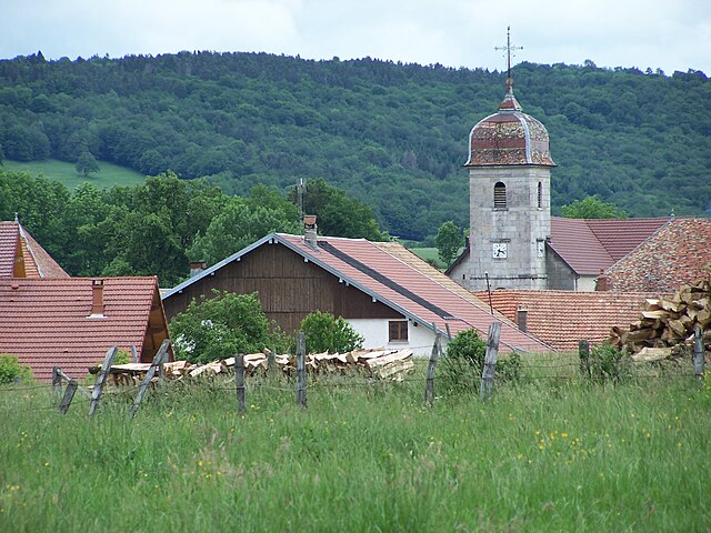

Orsans
Hiking in Orsans
Orsans, located in the Doubs department of the Bourgogne-Franche-Comté region in eastern France, offers a serene and scenic environment for hiking enthusiasts. The area is characterized by its lush forests, rolling hills, and the picturesque landscapes of the Jura Mountains. Here are some highlights and tips for hiking in Orsans:...
- Страна:
- Почтовый код: 25530
- Координаты: 47° 14' 51" N, 6° 23' 21" E
- GPS треки (wikiloc): [Ссылка]
- Площадь: 8.29 кв.км
- Население: 164


Lizine
- коммуна во Франции
Hiking in Lizine
Lizine is a lesser-known hiking destination, and specific information may vary based on local trails and conditions. However, if you’re looking to explore an area like Lizine, here are some general tips and information you might find useful for hiking in any location:...
- Страна:
- Почтовый код: 25330
- Координаты: 47° 3' 23" N, 5° 59' 39" E
- GPS треки (wikiloc): [Ссылка]
- Площадь: 7.33 кв.км
- Население: 82


Montivernage
- коммуна во Франции
Hiking in Montivernage
Montivernage is a charming area popular among hikers due to its picturesque landscapes, diverse trails, and natural beauty. While I don't have specific details about Montivernage itself, I can provide general tips and insights that are applicable for hiking in similar mountainous or rural regions....
- Страна:
- Почтовый код: 25110
- Координаты: 47° 19' 3" N, 6° 25' 38" E
- GPS треки (wikiloc): [Ссылка]
- Площадь: 3.34 кв.км
- Население: 29


Пассаван
- коммуна во Франции
Hiking in Пассаван
Passavant is a charming village located in the Doubs department in the Bourgogne-Franche-Comté region of eastern France. The area is known for its scenic landscapes, ranging from rolling hills to lush forests and water bodies, making it an excellent destination for hiking enthusiasts....
- Страна:
- Почтовый код: 25360
- Координаты: 47° 16' 29" N, 6° 23' 1" E
- GPS треки (wikiloc): [Ссылка]
- Площадь: 14.98 кв.км
- Население: 229


Flagey
Hiking in Flagey
Flagey is a charming village located in the Doubs department in the Bourgogne-Franche-Comté region of eastern France. The area offers picturesque landscapes, rolling hills, and forested trails, making it an excellent spot for hiking enthusiasts....
- Страна:
- Почтовый код: 25330
- Координаты: 47° 2' 15" N, 6° 7' 24" E
- GPS треки (wikiloc): [Ссылка]
- Площадь: 7.79 кв.км
- Население: 153


Laviron
- коммуна во Франции
Hiking in Laviron
Laviron is a beautiful area for hiking, located in the Vosges region of France. It offers a variety of trails that cater to different skill levels, from easy walks suitable for families and beginners to more challenging hikes that experienced hikers will enjoy....
- Страна:
- Почтовый код: 25510
- Координаты: 47° 15' 22" N, 6° 33' 7" E
- GPS треки (wikiloc): [Ссылка]
- Площадь: 19.92 кв.км
- Население: 335
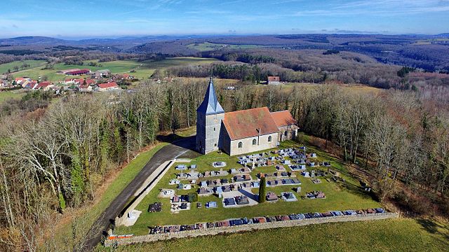
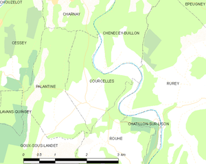
Courcelles
Hiking in Courcelles
Courcelles, located in the Doubs department of the Bourgogne-Franche-Comté region in eastern France, is surrounded by beautiful natural landscapes that make it an appealing destination for hiking enthusiasts. Here are some highlights about hiking in and around Courcelles:...
- Страна:
- Почтовый код: 25440
- Координаты: 47° 5' 38" N, 5° 57' 25" E
- GPS треки (wikiloc): [Ссылка]
- Высота над уровнем моря: 360 м m
- Площадь: 3.61 кв.км
- Население: 111


Saraz
- коммуна во Франции
Hiking in Saraz
Hiking in Saraz, a region that is often characterized by stunning landscapes, rich biodiversity, and varying terrains, can offer an array of experiences for both beginner and experienced hikers. While specific information about the trails and conditions in Saraz may depend on the particular area or country you are referring to (as "Saraz" can indicate different locations), here are some general tips and insights regarding hiking in a mountainous or scenic area like Saraz:...
- Страна:
- Почтовый код: 25330
- Координаты: 46° 59' 48" N, 5° 58' 58" E
- GPS треки (wikiloc): [Ссылка]
- Площадь: 6.02 кв.км
- Население: 11


Busy
- коммуна во Франции
Hiking in Busy
Busy is a charming village located in the Doubs department in the Bourgogne-Franche-Comté region of eastern France. The area is known for its picturesque landscapes, dense woodlands, and scenic views, making it an excellent destination for hiking enthusiasts....
- Страна:
- Почтовый код: 25320
- Координаты: 47° 10' 4" N, 5° 56' 52" E
- GPS треки (wikiloc): [Ссылка]
- Площадь: 5.2 кв.км
- Население: 618


Glère
- коммуна во Франции
Hiking in Glère
Hiking in the Glère area, particularly around the Glère Mountain in the French Alps, offers a fantastic opportunity for outdoor enthusiasts to experience stunning landscapes, diverse wildlife, and various trail options. Here are some key points to consider if you're planning a hike there:...
- Страна:
- Почтовый код: 25190
- Координаты: 47° 20' 37" N, 6° 59' 39" E
- GPS треки (wikiloc): [Ссылка]
- Площадь: 15.93 кв.км
- Население: 223


Goumois
- коммуна во Франции
Hiking in Goumois
Goumois, located in the Doubs region of France, is a picturesque village that offers stunning landscapes and a variety of hiking opportunities. Nestled in the Jura Mountains near the Swiss border, Goumois is known for its lush greenery, forests, and scenic views, making it an ideal destination for nature lovers and hikers....
- Страна:
- Почтовый код: 25470
- Координаты: 47° 15' 39" N, 6° 56' 57" E
- GPS треки (wikiloc): [Ссылка]
- Площадь: 5.83 кв.км
- Население: 169


Malans
Hiking in Malans
Malans is a charming village located in the Doubs department of the Bourgogne-Franche-Comté region in eastern France. The area surrounding Malans offers a variety of hiking opportunities, showcasing the natural beauty of the Jura mountains and the Doubs countryside....
- Страна:
- Почтовый код: 25330
- Координаты: 47° 2' 52" N, 6° 1' 51" E
- GPS треки (wikiloc): [Ссылка]
- Высота над уровнем моря: 580 м m
- Площадь: 10.49 кв.км
- Население: 173
- Веб сайт: [Ссылка]
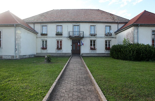

Reugney
- коммуна во Франции
Hiking in Reugney
Reugney, located in the Vosges department of France, offers a beautiful setting for hiking enthusiasts. The region is characterized by its rolling hills, dense forests, and picturesque landscapes, making it a charming destination for outdoor activities....
- Страна:
- Почтовый код: 25330
- Координаты: 47° 0' 45" N, 6° 9' 5" E
- GPS треки (wikiloc): [Ссылка]
- Площадь: 8.19 кв.км
- Население: 317

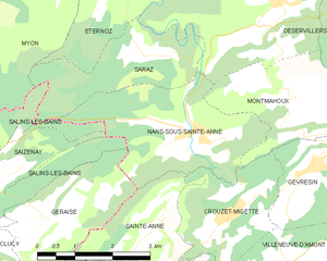
Nans-sous-Sainte-Anne
- коммуна во Франции
Hiking in Nans-sous-Sainte-Anne
Nans-sous-Sainte-Anne is a charming village located in the Jura region of France, known for its stunning natural landscapes, rich biodiversity, and various hiking opportunities. The village is nestled within the Jura Mountains, which offer a mix of lush forests, rolling hills, rivers, and captivating rock formations....
- Страна:
- Почтовый код: 25330
- Координаты: 46° 58' 36" N, 5° 59' 56" E
- GPS треки (wikiloc): [Ссылка]
- Площадь: 8.86 кв.км
- Население: 139

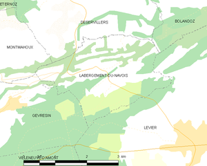
Labergement-du-Navois
- коммуна во Франции
Hiking in Labergement-du-Navois
Labergement-du-Navois, located in the Jura region of France, offers a fantastic setting for hiking enthusiasts. The area is known for its stunning natural landscapes, featuring rolling hills, dense forests, and picturesque lakes. Here are some highlights of hiking in Labergement-du-Navois:...
- Страна:
- Почтовый код: 25270
- Координаты: 46° 58' 36" N, 6° 4' 50" E
- GPS треки (wikiloc): [Ссылка]
- Площадь: 6.74 кв.км
- Население: 101

Myon
- коммуна во Франции
Hiking in Myon
Myon is a small commune in the Doubs department of the Bourgogne-Franche-Comté region in eastern France. The area is known for its beautiful natural landscapes, making it a great spot for hiking and enjoying the outdoors....
- Страна:
- Почтовый код: 25440
- Координаты: 47° 1' 29" N, 5° 56' 30" E
- GPS треки (wikiloc): [Ссылка]
- Площадь: 16.06 кв.км
- Население: 194


Saint-Gorgon-Main
- коммуна во Франции
Hiking in Saint-Gorgon-Main
Saint-Gorgon-Main is located in the Auvergne-Rhône-Alpes region of France, nearby the beautiful landscapes of the French Alps. While it's a less-known area compared to major hiking destinations, it offers some splendid opportunities for outdoor enthusiasts....
- Страна:
- Почтовый код: 25520
- Координаты: 47° 1' 22" N, 6° 19' 24" E
- GPS треки (wikiloc): [Ссылка]
- Площадь: 7.93 кв.км
- Население: 284


Sainte-Colombe
Hiking in Sainte-Colombe
Sainte-Colombe, located in the Doubs department in the Bourgogne-Franche-Comté region of France, offers a variety of beautiful hiking opportunities. The region is known for its stunning landscapes, including rolling hills, lush forests, and picturesque valleys....
- Страна:
- Почтовый код: 25300
- Координаты: 46° 52' 43" N, 6° 16' 3" E
- GPS треки (wikiloc): [Ссылка]
- Площадь: 10.49 кв.км
- Население: 387

La Planée
- коммуна во Франции
Hiking in La Planée
Hiking in La Planée, located in the French Alps, offers stunning landscapes and diverse trails suitable for different skill levels. The area is known for its picturesque views, ranging from sweeping valleys to rugged mountain peaks....
- Страна:
- Почтовый код: 25160
- Координаты: 46° 50' 25" N, 6° 16' 55" E
- GPS треки (wikiloc): [Ссылка]
- Площадь: 13 кв.км
- Население: 261


Goux-les-Usiers
- коммуна во Франции
Hiking in Goux-les-Usiers
Goux-les-Usiers, located in the Franche-Comté region of eastern France, is a charming destination for hiking enthusiasts. Nestled in the Doubs department, it offers stunning natural landscapes, including rolling hills, lush forests, and scenic waterways....
- Страна:
- Почтовый код: 25520
- Координаты: 46° 58' 18" N, 6° 16' 40" E
- GPS треки (wikiloc): [Ссылка]
- Площадь: 17.63 кв.км
- Население: 722


Houtaud
- коммуна во Франции
Hiking in Houtaud
Houtaud, a quaint village in the Jura region of France, offers some beautiful hiking opportunities that showcase the area’s stunning landscapes, including rolling hills, dense forests, and expansive views of the surrounding countryside. Here are some key points about hiking in Houtaud:...
- Страна:
- Почтовый код: 25300
- Координаты: 46° 54' 56" N, 6° 18' 43" E
- GPS треки (wikiloc): [Ссылка]
- Площадь: 7.89 кв.км
- Население: 1055
- Веб сайт: [Ссылка]

La Rivière-Drugeon
- коммуна во Франции
Hiking in La Rivière-Drugeon
La Rivière-Drugeon, located in the Doubs department of France, offers a beautiful setting for hiking enthusiasts. Nestled in the Jura Mountains, this area is characterized by stunning landscapes, lush forests, and scenic rivers. Here are some details about hiking in La Rivière-Drugeon:...
- Страна:
- Почтовый код: 25560
- Координаты: 46° 52' 3" N, 6° 12' 57" E
- GPS треки (wikiloc): [Ссылка]
- Площадь: 19.16 кв.км
- Население: 892


Монперрё
- коммуна во Франции
Hiking in Монперрё
Montperreux is a picturesque destination located near Lake Neuchâtel in Switzerland. It offers stunning views and a variety of hiking trails that cater to different skill levels. Here are some key points to consider when hiking in Montperreux:...
- Страна:
- Почтовый код: 25160
- Координаты: 46° 49' 33" N, 6° 20' 31" E
- GPS треки (wikiloc): [Ссылка]
- Площадь: 11.61 кв.км
- Население: 837


Reculfoz
- коммуна во Франции
Hiking in Reculfoz
Hiking in Reculfoz, a scenic area often characterized by its natural beauty and varied terrain, can offer a delightful experience for outdoor enthusiasts. Here are some aspects to consider when planning a hike in this region:...
- Страна:
- Почтовый код: 25240
- Координаты: 46° 42' 29" N, 6° 9' 3" E
- GPS треки (wikiloc): [Ссылка]
- Площадь: 2.54 кв.км
- Население: 41


Saint-Antoine
Hiking in Saint-Antoine
Saint-Antoine, located in the Doubs department of the Bourgogne-Franche-Comté region in eastern France, is an excellent destination for hiking enthusiasts. This area is characterized by stunning natural landscapes, including forests, rolling hills, and picturesque views of the surrounding countryside....
- Страна:
- Почтовый код: 25370
- Координаты: 46° 46' 37" N, 6° 20' 16" E
- GPS треки (wikiloc): [Ссылка]
- Площадь: 4.51 кв.км
- Население: 336


Ле-Понтет
- коммуна во Франции
Hiking in Ле-Понтет
Les Pontets is a fantastic area for hiking, located in the picturesque surroundings of the French Alps, near the border of Switzerland. This region is known for its stunning landscapes, including lush valleys, majestic mountain peaks, and picturesque lakes. Here are some highlights about hiking in and around Les Pontets:...
- Страна:
- Почтовый код: 25240
- Координаты: 46° 43' 9" N, 6° 10' 18" E
- GPS треки (wikiloc): [Ссылка]
- Площадь: 6.36 кв.км
- Население: 142


Malpas
- коммуна во Франции
Hiking in Malpas
Malpas, located in the Doubs department of France, is a picturesque area known for its natural beauty and outdoor activities, including hiking. The Doubs region is characterized by its varied landscapes, including rolling hills, dense forests, and the winding Doubs River. Here are some key points to consider when hiking in Malpas and its surroundings:...
- Страна:
- Почтовый код: 25160
- Координаты: 46° 49' 35" N, 6° 17' 22" E
- GPS треки (wikiloc): [Ссылка]
- Площадь: 5.78 кв.км
- Население: 273
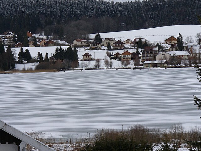

Saint-Point-Lac
- коммуна во Франции
Hiking in Saint-Point-Lac
Saint-Point-Lac is a beautiful area located in the Jura Mountains of France, known for its stunning natural scenery and diverse hiking opportunities. The region is characterized by its picturesque lake, stunning landscapes, and rich biodiversity, making it a popular destination for hikers and nature enthusiasts....
- Страна:
- Почтовый код: 25160
- Координаты: 46° 48' 48" N, 6° 18' 8" E
- GPS треки (wikiloc): [Ссылка]
- Площадь: 4.52 кв.км
- Население: 280


Oye-et-Pallet
- коммуна во Франции
Hiking in Oye-et-Pallet
Oye-et-Pallet is a small commune in the Hauts-de-France region of France, located in the Nord department. While it may not be a widely recognized hiking destination, the surrounding areas offer opportunities for outdoor activities and exploring the natural beauty of the region....
- Страна:
- Почтовый код: 25160
- Координаты: 46° 51' 12" N, 6° 20' 3" E
- GPS треки (wikiloc): [Ссылка]
- Площадь: 10.45 кв.км
- Население: 726


Sarrageois
- коммуна во Франции
Hiking in Sarrageois
Sarrageois, located in the Jura mountains of France, is known for its stunning natural beauty and diverse hiking trails. The region offers a mix of landscapes, from lush forests and rolling hills to dramatic cliffs and serene lakes, making it an ideal destination for outdoor enthusiasts....
- Страна:
- Почтовый код: 25240
- Координаты: 46° 43' 31" N, 6° 12' 59" E
- GPS треки (wikiloc): [Ссылка]
- Площадь: 13.22 кв.км
- Население: 191

Remoray-Boujeons
- коммуна во Франции
Hiking in Remoray-Boujeons
Remoray-Boujeons, located in the Jura Mountains of France, offers a variety of hiking opportunities that are perfect for outdoor enthusiasts of all levels. This region is known for its beautiful landscapes, rich biodiversity, and serene lakes. Here are some key points to consider when planning a hike in the area:...
- Страна:
- Почтовый код: 25160
- Координаты: 46° 46' 3" N, 6° 14' 20" E
- GPS треки (wikiloc): [Ссылка]
- Площадь: 15.15 кв.км
- Население: 412


Longevilles-Mont-d'Or
- коммуна во Франции
Hiking in Longevilles-Mont-d'Or
Longevilles-Mont-d'Or is a charming commune located in the Jura department of France, renowned for its picturesque landscapes and hiking opportunities. Nestled in the mountains, it is an ideal location for outdoor enthusiasts looking to explore nature....
- Страна:
- Почтовый код: 25370
- Координаты: 46° 45' 14" N, 6° 19' 0" E
- GPS треки (wikiloc): [Ссылка]
- Площадь: 13.25 кв.км
- Население: 530

Les Grangettes
- коммуна во Франции
Hiking in Les Grangettes
Les Grangettes is a beautiful hiking destination located in the French Alps, close to the town of Échirolles and the larger city of Grenoble. The area is known for its stunning natural scenery, characterized by lush meadows, alpine forests, and breathtaking mountain views....
- Страна:
- Почтовый код: 25160
- Координаты: 46° 49' 40" N, 6° 18' 40" E
- GPS треки (wikiloc): [Ссылка]
- Площадь: 5.38 кв.км
- Население: 276
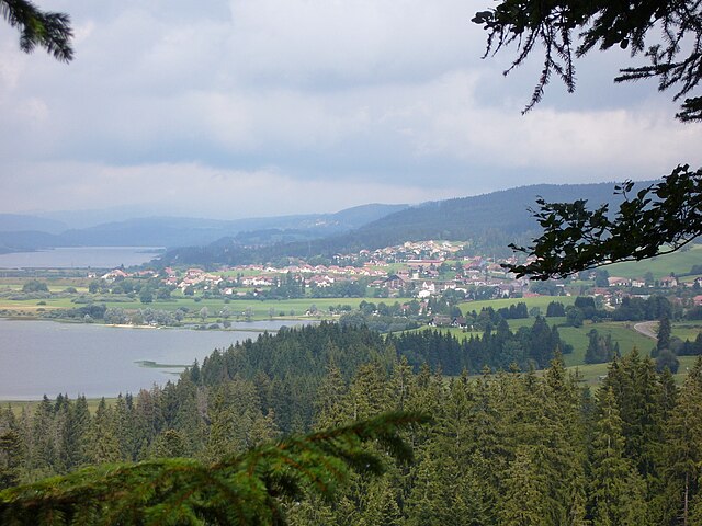

Labergement-Sainte-Marie
- коммуна во Франции
Hiking in Labergement-Sainte-Marie
Labergement-Sainte-Marie is a charming village located in the Doubs department of the Bourgogne-Franche-Comté region in eastern France. Nestled in the heart of the Jura Mountains, it offers beautiful landscapes, rich flora and fauna, and a variety of hiking opportunities suitable for different skill levels....
- Страна:
- Почтовый код: 25160
- Координаты: 46° 46' 29" N, 6° 16' 50" E
- GPS треки (wikiloc): [Ссылка]
- Площадь: 22.12 кв.км
- Население: 1160

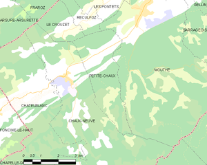
Petite-Chaux
- коммуна во Франции
Hiking in Petite-Chaux
Petite-Chaux is a beautiful hiking destination located in the Jura mountains of Switzerland, known for its scenic landscapes, diverse flora and fauna, and well-maintained trails. Here are some highlights and tips for hiking in the area:...
- Страна:
- Почтовый код: 25240
- Координаты: 46° 41' 39" N, 6° 10' 5" E
- GPS треки (wikiloc): [Ссылка]
- Площадь: 9.81 кв.км
- Население: 147
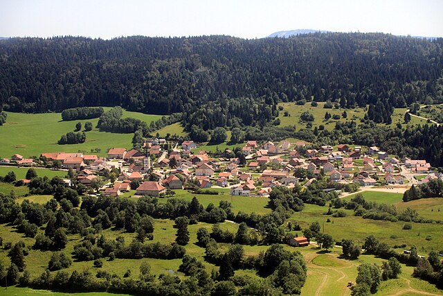

Granges-Narboz
- коммуна во Франции
Hiking in Granges-Narboz
Granges-Narboz, located in the Jura mountains of France, offers various hiking opportunities for nature enthusiasts and outdoor adventurers. This picturesque area is characterized by rolling hills, dense forests, and stunning views of the surrounding landscapes, making it a great spot for hiking....
- Страна:
- Почтовый код: 25300
- Координаты: 46° 52' 45" N, 6° 18' 38" E
- GPS треки (wikiloc): [Ссылка]
- Площадь: 16.22 кв.км
- Население: 1170
- Веб сайт: [Ссылка]

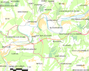
л'Иль-сюр-ле-Ду
- коммуна во Франции
Hiking in л'Иль-сюр-ле-Ду
L'Isle-sur-le-Doubs, located in the Doubs department of France, offers a delightful hiking experience amidst beautiful natural scenery. Sitting along the Doubs River, this area features diverse landscapes, including forests, hills, and riversides, making it perfect for outdoor enthusiasts....
- Страна:
- Почтовый код: 25250
- Координаты: 47° 26' 52" N, 6° 35' 10" E
- GPS треки (wikiloc): [Ссылка]
- Площадь: 10.67 кв.км
- Население: 3078
- Веб сайт: [Ссылка]
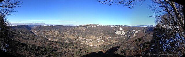
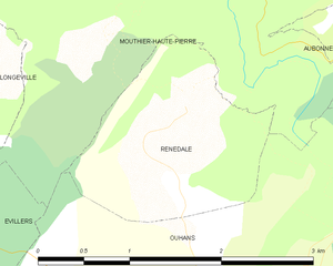
Renédale
- коммуна во Франции
Hiking in Renédale
Renédale is not a well-known hiking destination, and I don't have specific information about it as of my last update in October 2023. However, if there's a location called Renédale that has emerged or gained popularity recently, you might want to check local hiking guides, websites, or social media for the latest information and trail reviews....
- Страна:
- Почтовый код: 25520
- Координаты: 47° 1' 4" N, 6° 16' 39" E
- GPS треки (wikiloc): [Ссылка]
- Площадь: 2.88 кв.км
- Население: 41


Rancenay
- коммуна во Франции
Hiking in Rancenay
Rancenay is a small commune located in the Doubs department in the Bourgogne-Franche-Comté region of eastern France. The area is known for its beautiful natural landscapes, making it a great destination for hiking and outdoor activities. Here are some highlights about hiking in Rancenay:...
- Страна:
- Почтовый код: 25320
- Координаты: 47° 11' 13" N, 5° 57' 1" E
- GPS треки (wikiloc): [Ссылка]
- Площадь: 3.66 кв.км
- Население: 293


Rang
- коммуна во Франции
Hiking in Rang
Hiking in Rang, located in the Doubs department of France, offers a fantastic opportunity to explore the natural beauty of the Jura Mountains and the surrounding landscapes. The area is known for its stunning scenery, diverse wildlife, and numerous trails that cater to all levels of hikers....
- Страна:
- Почтовый код: 25250
- Координаты: 47° 25' 35" N, 6° 33' 46" E
- GPS треки (wikiloc): [Ссылка]
- Площадь: 10.32 кв.км
- Население: 420

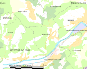
Lougres
- коммуна во Франции
Hiking in Lougres
It seems like there may be a small confusion with the name "Lougres." As of my last training data cut-off in October 2023, there isn't a widely known hiking destination by that name. However, if you're referring to the region of Lugares or perhaps a specific location in Europe or elsewhere that sounds similar, please clarify for more detailed advice....
- Страна:
- Почтовый код: 25260
- Координаты: 47° 28' 18" N, 6° 41' 12" E
- GPS треки (wikiloc): [Ссылка]
- Площадь: 5.97 кв.км
- Население: 774
- Веб сайт: [Ссылка]


Jougne
- коммуна во Франции
Hiking in Jougne
Jougne is a charming village located in the Jura Mountains of France, close to the Swiss border. It offers various hiking opportunities with stunning views of the surrounding landscapes, dense forests, and picturesque alpine scenery. Here’s an overview of what you can expect when hiking in Jougne:...
- Страна:
- Почтовый код: 25370
- Координаты: 46° 45' 49" N, 6° 23' 16" E
- GPS треки (wikiloc): [Ссылка]
- Площадь: 29.03 кв.км
- Население: 1792
- Веб сайт: [Ссылка]


Placey
- коммуна во Франции
Hiking in Placey
It seems like there might be a typo or misunderstanding regarding "Placey." If you meant a specific location such as "Placer County" in California or a different hiking destination, please let me know! However, if you were asking about a place I might not be familiar with, I can still offer general tips for hiking....
- Страна:
- Почтовый код: 25170
- Координаты: 47° 15' 36" N, 5° 50' 48" E
- GPS треки (wikiloc): [Ссылка]
- Площадь: 2.57 кв.км
- Население: 191

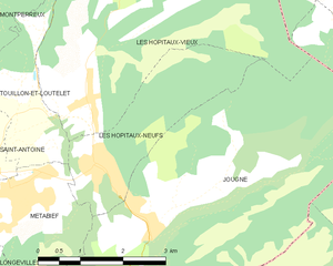
Les Hôpitaux-Neufs
- коммуна во Франции
Hiking in Les Hôpitaux-Neufs
Les Hôpitaux-Neufs is a charming village in the Jura Mountains of France, situated near the popular tourist destination of the Haut-Doubs region. This area is known for its stunning natural landscapes, including dense forests, rolling hills, and captivating lakes, making it an excellent spot for hiking enthusiasts....
- Страна:
- Почтовый код: 25370
- Координаты: 46° 46' 35" N, 6° 22' 22" E
- GPS треки (wikiloc): [Ссылка]
- Площадь: 6.56 кв.км
- Население: 849
- Веб сайт: [Ссылка]
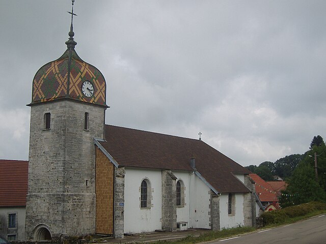

Déservillers
- коммуна во Франции
Hiking in Déservillers
Déservillers is a charming commune in the Doubs department of the Bourgogne-Franche-Comté region in eastern France. The area is known for its picturesque landscapes, forests, and countryside, making it an excellent destination for hiking enthusiasts. Here are some highlights and tips for hiking in Déservillers:...
- Страна:
- Почтовый код: 25330
- Координаты: 47° 0' 11" N, 6° 4' 17" E
- GPS треки (wikiloc): [Ссылка]
- Площадь: 13.88 кв.км
- Население: 343
- Веб сайт: [Ссылка]
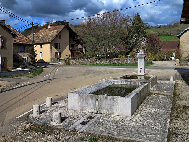
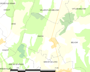
Rahon
- коммуна во Франции
Hiking in Rahon
Rahon, located in the Doubs department of France, offers a beautiful setting for hiking enthusiasts. This region is known for its stunning landscapes, featuring rolling hills, forests, and scenic valleys. Here are some key points to consider when hiking in Rahon:...
- Страна:
- Почтовый код: 25430
- Координаты: 47° 19' 21" N, 6° 35' 28" E
- GPS треки (wikiloc): [Ссылка]
- Площадь: 5.69 кв.км
- Население: 128


Cléron
- коммуна во Франции
Hiking in Cléron
Cléron is a charming village located in the Doubs department of the Bourgogne-Franche-Comté region in eastern France. It is known for its beautiful landscapes, rich natural environment, and historical significance, making it a great spot for hiking enthusiasts....
- Страна:
- Почтовый код: 25330
- Координаты: 47° 5' 14" N, 6° 3' 41" E
- GPS треки (wikiloc): [Ссылка]
- Площадь: 14.56 кв.км
- Население: 322


Lods
- коммуна во Франции
Hiking in Lods
Lodz, Poland, is not traditionally renowned for hiking in the way some mountainous regions are, but it does offer unique opportunities for outdoor activities and exploring nature. The area surrounding Lodz features a mix of urban parks, forests, and trails that can cater to walkers and casual hikers. Here are some options for enjoying the outdoors around Lodz:...
- Страна:
- Почтовый код: 25930
- Координаты: 47° 2' 42" N, 6° 14' 53" E
- GPS треки (wikiloc): [Ссылка]
- Площадь: 6.25 кв.км
- Население: 224
- Веб сайт: [Ссылка]


Nancray
- коммуна во Франции
Hiking in Nancray
Nancray, located in the Doubs department of the Bourgogne-Franche-Comté region in eastern France, offers a picturesque setting for hiking enthusiasts. The area is characterized by rolling hills, lush forests, and quaint villages, making it a great spot for both casual walkers and seasoned hikers. Here are some key points to consider when hiking in Nancray:...
- Страна:
- Почтовый код: 25360
- Координаты: 47° 14' 43" N, 6° 10' 53" E
- GPS треки (wikiloc): [Ссылка]
- Площадь: 16.48 кв.км
- Население: 1276
- Веб сайт: [Ссылка]


Montflovin
- коммуна во Франции
Hiking in Montflovin
Montflovin is a small village located in the Jura Mountains of France, known for its stunning landscapes and outdoor recreational opportunities. Hiking in this area offers a great experience for both seasoned hikers and beginners, with various trails that cater to different skill levels....
- Страна:
- Почтовый код: 25650
- Координаты: 46° 59' 11" N, 6° 26' 42" E
- GPS треки (wikiloc): [Ссылка]
- Площадь: 3.35 кв.км
- Население: 100


Cussey-sur-Lison
- коммуна во Франции
Hiking in Cussey-sur-Lison
Cussey-sur-Lison is a charming village located in the Côte-d'Or department of the Bourgogne-Franche-Comté region in eastern France. It offers a variety of hiking opportunities amidst beautiful natural landscapes, with rolling hills, forests, and scenic views....
- Страна:
- Почтовый код: 25440
- Координаты: 47° 3' 35" N, 5° 57' 20" E
- GPS треки (wikiloc): [Ссылка]
- Высота над уровнем моря: 360 м m
- Площадь: 5.66 кв.км
- Население: 65

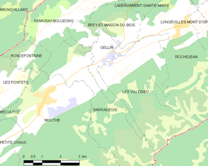
Gellin
- коммуна во Франции
Hiking in Gellin
It seems there may be a misunderstanding, as "Gellin" does not correspond to a widely recognized hiking destination. If you meant a specific area, state, or country, please clarify the name so I can provide you with accurate information....
- Страна:
- Почтовый код: 25240
- Координаты: 46° 43' 56" N, 6° 14' 17" E
- GPS треки (wikiloc): [Ссылка]
- Площадь: 4.87 кв.км
- Население: 238
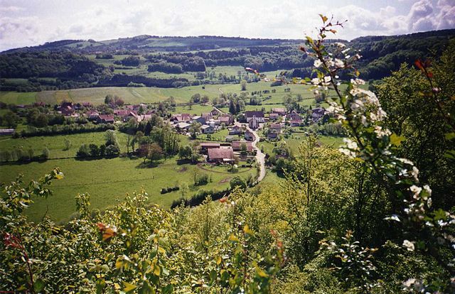

Rosières-sur-Barbèche
- коммуна во Франции
Hiking in Rosières-sur-Barbèche
Rosières-sur-Barbèche is a picturesque village located in the Auvergne-Rhône-Alpes region of France. Hiking in this area offers a blend of beautiful landscapes, diverse wildlife, and a variety of trails suitable for different skill levels. Here are some highlights and tips for hiking in Rosières-sur-Barbèche:...
- Страна:
- Почтовый код: 25190
- Координаты: 47° 18' 56" N, 6° 39' 33" E
- GPS треки (wikiloc): [Ссылка]
- Площадь: 5.31 кв.км
- Население: 121


Saône
Hiking in Saône
Hiking in the Saône and Doubs regions of France offers a beautiful blend of picturesque landscapes, lush forests, rivers, and charming villages. Here's an overview of what you can expect while hiking in these areas:...
- Страна:
- Почтовый код: 25660
- Координаты: 47° 13' 29" N, 6° 7' 4" E
- GPS треки (wikiloc): [Ссылка]
- Площадь: 20.55 кв.км
- Население: 3326
- Веб сайт: [Ссылка]


Longeville
- коммуна во Франции
Hiking in Longeville
Longeville is a charming commune in the Vosges department of the Grand Est region of France, known for its natural beauty and hiking opportunities. Here are some key points to consider when planning a hiking trip in and around Longeville:...
- Страна:
- Почтовый код: 25330
- Координаты: 47° 1' 52" N, 6° 13' 40" E
- GPS треки (wikiloc): [Ссылка]
- Площадь: 9.46 кв.км
- Население: 168


Noironte
- коммуна во Франции
Hiking in Noironte
Noironte is a lesser-known destination for hiking, and getting specific information might be challenging if you haven’t found particular trails or parks in mind. However, if it's located in a region known for outdoor activities, you can generally expect a few common features:...
- Страна:
- Почтовый код: 25170
- Координаты: 47° 16' 19" N, 5° 52' 28" E
- GPS треки (wikiloc): [Ссылка]
- Площадь: 6.73 кв.км
- Население: 380
- Веб сайт: [Ссылка]


Les Fins
- коммуна во Франции
Hiking in Les Fins
Les Fins is a charming village located in the Doubs department of the Bourgogne-Franche-Comté region in eastern France, near the Swiss border. The area is known for its beautiful natural landscapes, rolling hills, and rich flora and fauna, making it a great destination for hiking enthusiasts....
- Страна:
- Почтовый код: 25500
- Координаты: 47° 4' 51" N, 6° 37' 42" E
- GPS треки (wikiloc): [Ссылка]
- Площадь: 25.39 кв.км
- Население: 3055


Liesle
- коммуна во Франции
Hiking in Liesle
Liesle is a lesser-known hiking destination, but it offers a unique experience for nature enthusiasts. Depending on the specific Liesle you're referring to (as there may be more than one location with a similar name), the general characteristics of hiking in this area can include beautiful landscapes, varying trail difficulties, and opportunities to observe local flora and fauna....
- Страна:
- Почтовый код: 25440
- Координаты: 47° 3' 42" N, 5° 48' 53" E
- GPS треки (wikiloc): [Ссылка]
- Площадь: 16.54 кв.км
- Население: 522
- Веб сайт: [Ссылка]


Mont-de-Laval
- коммуна во Франции
Hiking in Mont-de-Laval
Mont-de-Laval is situated in the beautiful region of the French Alps, and offers a variety of hiking opportunities that cater to different skill levels. Here are some highlights regarding hiking in the area:...
- Страна:
- Почтовый код: 25210
- Координаты: 47° 10' 10" N, 6° 37' 41" E
- GPS треки (wikiloc): [Ссылка]
- Площадь: 8.44 кв.км
- Население: 173


Mandeure
- коммуна во Франции
Hiking in Mandeure
Mandeure, located in France, is a lesser-known destination for hikers, but it offers some beautiful landscapes and trails for those looking to explore the outdoors. Here’s a general overview of hiking in the Mandeure area:...
- Страна:
- Почтовый код: 25350
- Координаты: 47° 27' 4" N, 6° 48' 20" E
- GPS треки (wikiloc): [Ссылка]
- Площадь: 15.13 кв.км
- Население: 4847
- Веб сайт: [Ссылка]

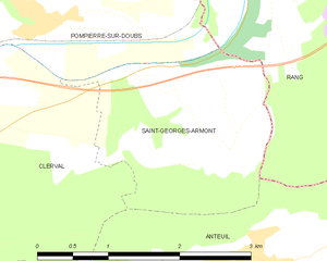
Saint-Georges-Armont
- коммуна во Франции
Hiking in Saint-Georges-Armont
Saint-Georges-Armont, located in the picturesque Vosges region of France, offers a unique hiking experience amidst beautiful landscapes. The area is characterized by rolling hills, dense forests, and panoramic views of the surrounding countryside. Here are some highlights and tips for hiking in this region:...
- Страна:
- Почтовый код: 25340
- Координаты: 47° 23' 56" N, 6° 33' 25" E
- GPS треки (wikiloc): [Ссылка]
- Площадь: 4.74 кв.км
- Население: 118
Граничит с регионами:


Верхняя Сона
- департамент Франции
Hiking in Верхняя Сона
Haute-Saône, located in the Bourgogne-Franche-Comté region of eastern France, offers a variety of beautiful hiking opportunities thanks to its diverse landscapes, which include rolling hills, forests, rivers, and charming villages. Here are some highlights of hiking in Haute-Saône:...
- Страна:
- Столица: Везуль
- Координаты: 47° 35' 0" N, 6° 0' 0" E
- GPS треки (wikiloc): [Ссылка]
- Площадь: 5360 кв.км
- Население: 237706
- Веб сайт: [Ссылка]
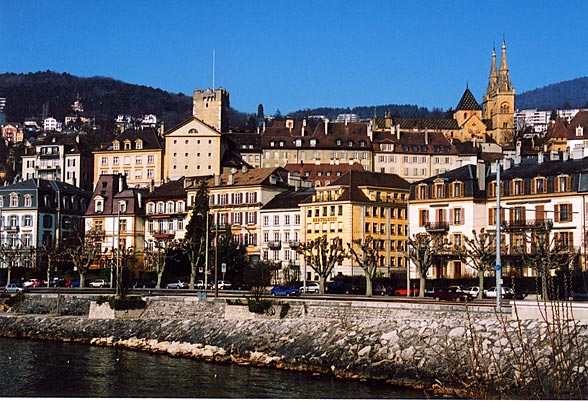

Невшатель
- кантон в Швейцарии
Hiking in Невшатель
The Canton of Neuchâtel, located in western Switzerland, is a stunning area for hiking, featuring a diverse landscape that ranges from rolling hills and deep forests to beautiful lakes and mountainous areas. Here are some highlights and tips for hiking in this picturesque region:...
- Страна:

- Столица: Невшатель
- Код автомобильного номера: NE
- Координаты: 46° 59' 0" N, 6° 47' 0" E
- GPS треки (wikiloc): [Ссылка]
- Высота над уровнем моря: 430 м m
- Площадь: 802.24 кв.км
- Веб сайт: [Ссылка]


Юра
- кантон в Швейцарии
Hiking in Юра
Hiking in the Canton of Jura, Switzerland, is a fantastic experience for outdoor enthusiasts. This region is known for its stunning landscapes, rolling hills, dense forests, and picturesque Jura mountains. Here are some key points to consider if you're planning to hike in the Canton of Jura:...
- Страна:
- Столица: Делемон
- Код автомобильного номера: JU
- Координаты: 47° 22' 0" N, 7° 9' 0" E
- GPS треки (wikiloc): [Ссылка]
- Высота над уровнем моря: 435 м m
- Площадь: 838.51 кв.км
- Население: 69100
- Веб сайт: [Ссылка]


Во
- кантон в Швейцарии
Hiking in Во
The Canton of Vaud, located in the French-speaking part of Switzerland, is a fantastic destination for hiking enthusiasts. It offers a diverse range of landscapes, from picturesque lakeside trails along Lake Geneva to challenging mountain hikes in the Alps. Here are some highlights of hiking in this beautiful region:...
- Страна:
- Столица: Лозанна
- Код автомобильного номера: VD
- Координаты: 46° 37' 0" N, 6° 33' 0" E
- GPS треки (wikiloc): [Ссылка]
- Высота над уровнем моря: 495 м m
- Площадь: 3212 кв.км
- Веб сайт: [Ссылка]
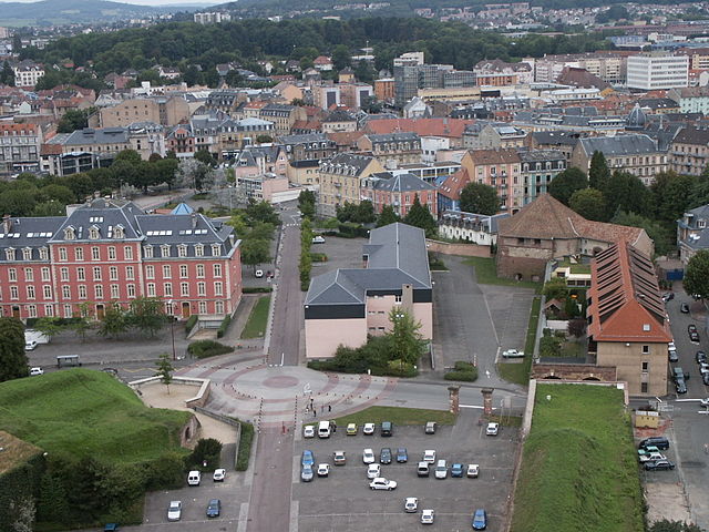

Территория Бельфор
- департамент Франции
Hiking in Территория Бельфор
The Territoire de Belfort, located in the Bourgogne-Franche-Comté region of eastern France, offers a variety of hiking opportunities amidst its diverse landscapes. Here are some key aspects of hiking in this area:...
- Страна:
- Столица: Бельфор
- Координаты: 47° 45' 0" N, 7° 0' 0" E
- GPS треки (wikiloc): [Ссылка]
- Площадь: 609.4 кв.км
- Население: 144483
- Веб сайт: [Ссылка]

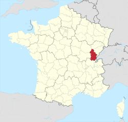
Юра
- департамент Франции
Hiking in Юра
Hiking in the Jura department, located in the Bourgogne-Franche-Comté region of eastern France, presents a remarkable opportunity to explore stunning natural landscapes, rich biodiversity, and charming villages. The Jura mountain range, characterized by its rolling hills, dense forests, and picturesque lakes, offers diverse hiking trails suitable for all levels of hikers....
- Страна:
- Столица: Лонс-ле-Сонье
- Координаты: 46° 40' 31" N, 5° 33' 16" E
- GPS треки (wikiloc): [Ссылка]
- Площадь: 4999 кв.км
- Население: 260587
- Веб сайт: [Ссылка]