
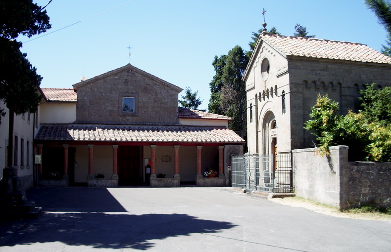
Арчидоссо (Arcidosso, Arcidosso)
.svg)
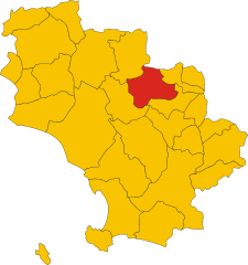
- коммуна Италии
 Hiking in Арчидоссо
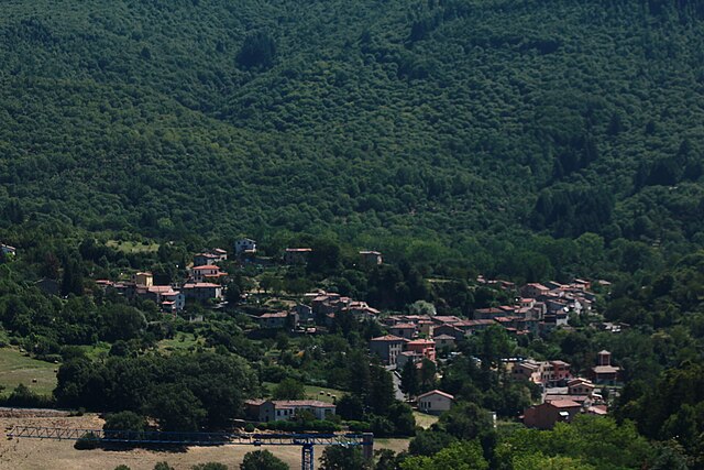
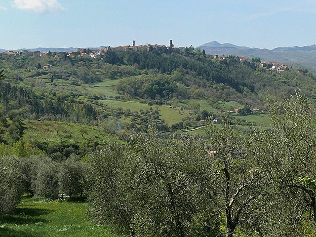
Arcidosso is a charming medieval village located in the province of Grosseto, Tuscany, Italy. It is surrounded by stunning landscapes, making it an excellent spot for hiking enthusiasts. The area features various trails that cater to different levels of experience and offer beautiful views of the surrounding hills, forests, and vineyards.
Popular Hiking Routes:
-
Monte Amiata Trails:
- Monte Amiata, an extinct volcano nearby, offers numerous hiking opportunities. There are various trails leading to its summit, where you can enjoy panoramic views of Tuscany. The trails vary in difficulty, so there’s something for everyone.
-
Ancient Path of the Etruscans:
- This historical trail allows hikers to explore ancient Etruscan ruins and landscapes. It combines both historical exploration and outdoor adventure, making it a unique experience.
-
The Municipal Park of Arcidosso:
- Close to the village, a park offers well-marked trails that wind through the local flora and fauna. It's an excellent option for a shorter, more leisurely hike.
Nature Highlights:
- Biodiversity: The area around Arcidosso is rich in biodiversity, with forests of chestnut trees, oak, and beech, as well as various wildlife.
- Scenic Views: Many trails provide breathtaking views of the surrounding countryside, including rolling hills and vineyards that are characteristic of Tuscany.
- Cultural Sites: In addition to natural beauty, you’ll find historic landmarks, including churches and castles worth visiting during your hikes.
Best Time to Hike:
- Spring (April to June) and Autumn (September to October) are ideal for hiking in this region. The weather is generally mild, and the landscapes are vibrant during these seasons.
Tips for Hiking in Arcidosso:
- Preparation: Make sure to wear proper hiking boots and bring plenty of water and snacks, particularly if you're planning a longer hike.
- Maps: Utilize trail maps or local guides, as some trails may not be well-marked.
- Local Regulations: Respect nature by staying on designated trails and following local guidelines.
Whether you're seeking a rigorous trek or a leisurely nature walk, Arcidosso has a little something for every hiking enthusiast, complemented by the charm and culture of Tuscany. Enjoy your hiking adventure!
- Страна:

- Почтовый код: 58031
- Телефонный код: 0564
- Код автомобильного номера: GR
- Координаты: 42° 52' 20" N, 11° 32' 15" E


- GPS треки (wikiloc): [Ссылка]
- Высота над уровнем моря: 679 м m
- Площадь: 93.26 кв.км
- Население: 4315
- Веб сайт: http://www.comune.arcidosso.gr.it/
- Википедия русская: wiki(ru)
- Википедия английская: wiki(en)
- Википедия национальная: wiki(it)
- Хранилище Wikidata: Wikidata: Q188471
- Катеория в википедии: [Ссылка]
- код Freebase: [/m/0gm15k]
- код GeoNames: Альт: [6540487]
- код VIAF: Альт: [168237864]
- ID отношения в OpenStreetMap: [42196]
- код GND: Альт: [4428367-2]
- идентификатор местоположения ArchINFORM: [6702]
- место в MusicBrainz: [84e4c83d-a8d5-4201-9442-2f98e902f3ac]
- UN/LOCODE: [ITACD]
- dmoz: Альт: [Regional/Europe/Italy/Tuscany/Localities/Arcidosso/]
- код ISTAT: 053001
- кадастровый код Италии: A369
Включает регионы:

Montelaterone
Hiking in Montelaterone
Montelaterone is a small, picturesque village situated in the province of Grosseto, in the Tuscany region of Italy. It is nestled in the beautiful landscape of the Maremma, surrounded by rolling hills, lush forests, and stunning views of the surrounding countryside. Here are some highlights of hiking in and around Montelaterone:...
- Страна:
- Почтовый код: 58030
- Телефонный код: 0564
- Координаты: 42° 53' 16" N, 11° 30' 47" E
- GPS треки (wikiloc): [Ссылка]
- Высота над уровнем моря: 670 м m

Zancona
Hiking in Zancona
Zancona is not one of the widely recognized hiking regions, and I couldn't find specific references to hiking areas or trails explicitly named Zancona. However, it's possible that "Zancona" refers to a local or lesser-known area that may have great outdoor opportunities....
- Страна:
- Почтовый код: 58031
- Телефонный код: 0564
- Координаты: 42° 51' 31" N, 11° 31' 28" E
- GPS треки (wikiloc): [Ссылка]
- Высота над уровнем моря: 775 м m
- Население: 83
San Lorenzo
Hiking in San Lorenzo
San Lorenzo, located in the Arcidosso area of Tuscany, Italy, offers a range of beautiful hiking opportunities amidst its stunning landscapes. This charming area is surrounded by the picturesque scenery of the Monte Amiata, which is a dormant volcano and offers diverse terrains ideal for hiking enthusiasts....
- Страна:
- Почтовый код: 58031
- Телефонный код: 0564
- Координаты: 42° 52' 49" N, 11° 32' 35" E
- GPS треки (wikiloc): [Ссылка]
- Высота над уровнем моря: 680 м m
Bagnoli
Hiking in Bagnoli
Bagnoli, located in the municipality of Arcidosso in the province of Grosseto, Tuscany, offers a wonderful setting for hiking enthusiasts. This area is part of the broader Amiata region, which is known for its picturesque landscapes, rich biodiversity, and scenic views....
- Страна:
- Почтовый код: 58031
- Телефонный код: 0564
- Координаты: 42° 52' 16" N, 11° 32' 59" E
- GPS треки (wikiloc): [Ссылка]
- Высота над уровнем моря: 672 м m

Salaiola
Hiking in Salaiola
Salaiola is a lesser-known hiking destination that boasts picturesque landscapes and serene natural environments. While it may not have the extensive trail systems found in more popular hiking areas, it offers a unique experience for those looking to connect with nature in a quieter setting....
- Страна:
- Почтовый код: 58031
- Телефонный код: 0564
- Координаты: 42° 52' 10" N, 11° 30' 4" E
- GPS треки (wikiloc): [Ссылка]
- Высота над уровнем моря: 740 м m

Stribugliano
Hiking in Stribugliano
Stribugliano is a quaint village located in the municipality of Montieri, in Tuscany, Italy. Surrounded by beautiful forests and rolling hills, it offers a range of hiking opportunities suitable for various skill levels. Here are a few highlights for hikers interested in exploring the area:...
- Страна:
- Почтовый код: 58030
- Телефонный код: 0564
- Координаты: 42° 50' 59" N, 11° 27' 40" E
- GPS треки (wikiloc): [Ссылка]
- Высота над уровнем моря: 775 м m
Граничит с регионами:


Кампаньятико
- коммуна Италии
Hiking in Кампаньятико
Campagnatico is a charming village located in the Tuscan province of Grosseto, Italy. It's nestled in the scenic Maremma region, known for its rolling hills, olive groves, and vineyards. Hiking in and around Campagnatico offers a variety of trails that allow you to experience the natural beauty and rich cultural heritage of the area....
- Страна:
- Почтовый код: 58042
- Телефонный код: 0564
- Код автомобильного номера: GR
- Координаты: 42° 53' 4" N, 11° 16' 17" E
- GPS треки (wikiloc): [Ссылка]
- Высота над уровнем моря: 275 м m
- Площадь: 162.25 кв.км
- Население: 2387
- Веб сайт: [Ссылка]

Кастель-дель-Пьяно
- коммуна Италии
Hiking in Кастель-дель-Пьяно
Castel del Piano is a beautiful area located in the Tuscany region of Italy, nestled within the Monte Amiata area. This region is known for its stunning landscapes, rich history, and diverse hiking opportunities. Here are some key points about hiking in Castel del Piano:...
- Страна:
- Почтовый код: 58033
- Телефонный код: 0564
- Код автомобильного номера: GR
- Координаты: 42° 53' 27" N, 11° 32' 22" E
- GPS треки (wikiloc): [Ссылка]
- Высота над уровнем моря: 637 м m
- Площадь: 67.77 кв.км
- Население: 4810
- Веб сайт: [Ссылка]

Чиниджано
- коммуна Италии
Hiking in Чиниджано
Cinigiano, located in the enchanting province of Grosseto in Tuscany, Italy, offers a wonderful experience for hiking enthusiasts. The area is characterized by its stunning landscapes, rolling hills, vineyards, olive groves, and picturesque medieval villages....
- Страна:
- Почтовый код: 58044
- Телефонный код: 0564
- Код автомобильного номера: GR
- Координаты: 42° 53' 26" N, 11° 23' 33" E
- GPS треки (wikiloc): [Ссылка]
- Высота над уровнем моря: 324 м m
- Площадь: 161.55 кв.км
- Население: 2536
- Веб сайт: [Ссылка]


Роккальбенья
- коммуна Италии
Hiking in Роккальбенья
Roccalbegna is a charming village located in the Maremma region of Tuscany, Italy. It is surrounded by stunning natural landscapes, making it an excellent destination for hiking enthusiasts. Here are some insights into hiking in and around Roccalbegna:...
- Страна:
- Почтовый код: 58053
- Телефонный код: 0564
- Код автомобильного номера: GR
- Координаты: 42° 47' 13" N, 11° 30' 36" E
- GPS треки (wikiloc): [Ссылка]
- Высота над уровнем моря: 522 м m
- Площадь: 124.86 кв.км
- Население: 984
- Веб сайт: [Ссылка]


Санта-Фьора
- коммуна Италии
Hiking in Санта-Фьора
Santa Fiora is a charming village located in the Tuscan region of Italy, known for its beautiful natural surroundings, rich history, and excellent hiking opportunities. Nestled on the slopes of Mount Amiata, it offers stunning views and a variety of trails suitable for hikers of different skill levels. Here are some highlights of hiking in Santa Fiora:...
- Страна:
- Почтовый код: 58037
- Телефонный код: 0564
- Код автомобильного номера: GR
- Координаты: 42° 49' 55" N, 11° 35' 7" E
- GPS треки (wikiloc): [Ссылка]
- Высота над уровнем моря: 687 м m
- Площадь: 63.45 кв.км
- Население: 2563
- Веб сайт: [Ссылка]