
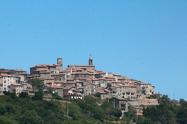
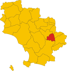
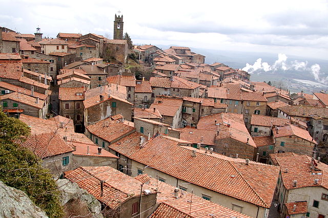
Санта-Фьора (Santa Fiora, Santa Fiora)
.svg)
- коммуна Италии
 Hiking in Санта-Фьора
Santa Fiora is a charming village located in the Tuscan region of Italy, known for its beautiful natural surroundings, rich history, and excellent hiking opportunities. Nestled on the slopes of Mount Amiata, it offers stunning views and a variety of trails suitable for hikers of different skill levels. Here are some highlights of hiking in Santa Fiora:
Scenic Trails
-
Monte Amiata: The nearby mountain, Monte Amiata, is the highest peak in southern Tuscany. There are numerous trails that lead to the summit, offering panoramic views and a chance to enjoy the unique flora and fauna of the area.
-
Forest Trails: The region is covered in lush forests, particularly beech and chestnut trees. Trails through these forests provide a serene hiking experience, and you might encounter local wildlife.
-
Historical Paths: Many trails also have historical significance, leading you to ancient ruins, hermitages, and churches that offer insights into the area's rich cultural heritage.
Amenities and Resources
-
Trail Maps: It's advisable to obtain trail maps from local tourist information centers or through online resources. Many trails are well-marked, but having a map is always a good practice.
-
Guided Tours: If you're unfamiliar with the area, consider joining a guided hike. Local guides can provide valuable information about the landscape, wildlife, and history.
Best Time to Hike
-
Spring and Fall: These seasons are often ideal for hiking in Santa Fiora due to mild temperatures and blooming nature in spring or the beautiful fall foliage.
-
Summer: It can get quite warm, so early morning or late afternoon hikes are recommended to avoid the heat.
Safety Tips
- Stay Hydrated: Always carry sufficient water, especially on warmer days.
- Footwear: Wear sturdy hiking boots for comfort and support on varying terrain.
- Weather Awareness: Check the weather before heading out, as conditions can change rapidly in the mountains.
Local Culture and Cuisine
After your hike, you can enjoy the local cuisine, which includes traditional Tuscan dishes. Be sure to sample local wines and perhaps enjoy a meal in one of the village's quaint restaurants.
Hiking in Santa Fiora presents a unique blend of natural beauty, cultural richness, and outdoor adventure, making it a rewarding destination for all hiking enthusiasts.
- Страна:

- Почтовый код: 58037
- Телефонный код: 0564
- Код автомобильного номера: GR
- Координаты: 42° 49' 55" N, 11° 35' 7" E


- GPS треки (wikiloc): [Ссылка]
- Высота над уровнем моря: 687 м m
- Площадь: 63.45 кв.км
- Население: 2563
- Веб сайт: http://www.comune.santafiora.gr.it/
- Википедия русская: wiki(ru)
- Википедия английская: wiki(en)
- Википедия национальная: wiki(it)
- Хранилище Wikidata: Wikidata: Q215008
- Галерея изображений в википедии: [Ссылка]
- Катеория в википедии: [Ссылка]
- код Freebase: [/m/0gm1kz]
- код GeoNames: Альт: [6541885]
- код VIAF: Альт: [155219740]
- ID отношения в OpenStreetMap: [42161]
- код GND: Альт: [4534821-2]
- код ISTAT: 053022
- кадастровый код Италии: I187
Граничит с регионами:

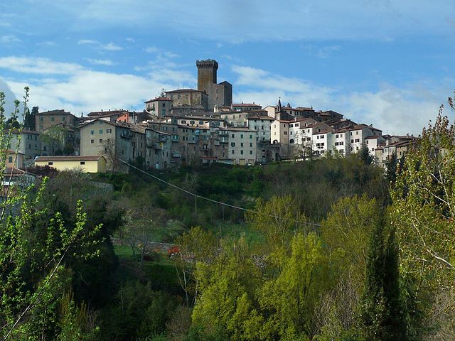
Кастелл'Аццара
- коммуна Италии
Hiking in Кастелл'Аццара
Castell'Azzara is a charming village located in the province of Grosseto, Tuscany, Italy. It's known for its scenic landscapes and rich natural beauty, making it a great destination for hiking enthusiasts. Here are some highlights and tips for hiking in the area:...
- Страна:
- Почтовый код: 58034
- Телефонный код: 0564
- Код автомобильного номера: GR
- Координаты: 42° 46' 21" N, 11° 41' 55" E
- GPS треки (wikiloc): [Ссылка]
- Высота над уровнем моря: 815 м m
- Площадь: 64.23 кв.км
- Население: 1414
- Веб сайт: [Ссылка]

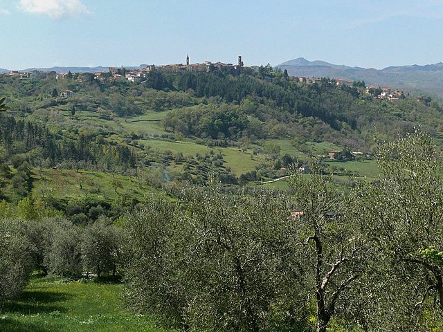
Арчидоссо
- коммуна Италии
Hiking in Арчидоссо
Arcidosso is a charming medieval village located in the province of Grosseto, Tuscany, Italy. It is surrounded by stunning landscapes, making it an excellent spot for hiking enthusiasts. The area features various trails that cater to different levels of experience and offer beautiful views of the surrounding hills, forests, and vineyards....
- Страна:
- Почтовый код: 58031
- Телефонный код: 0564
- Код автомобильного номера: GR
- Координаты: 42° 52' 20" N, 11° 32' 15" E
- GPS треки (wikiloc): [Ссылка]
- Высота над уровнем моря: 679 м m
- Площадь: 93.26 кв.км
- Население: 4315
- Веб сайт: [Ссылка]

Кастель-дель-Пьяно
- коммуна Италии
Hiking in Кастель-дель-Пьяно
Castel del Piano is a beautiful area located in the Tuscany region of Italy, nestled within the Monte Amiata area. This region is known for its stunning landscapes, rich history, and diverse hiking opportunities. Here are some key points about hiking in Castel del Piano:...
- Страна:
- Почтовый код: 58033
- Телефонный код: 0564
- Код автомобильного номера: GR
- Координаты: 42° 53' 27" N, 11° 32' 22" E
- GPS треки (wikiloc): [Ссылка]
- Высота над уровнем моря: 637 м m
- Площадь: 67.77 кв.км
- Население: 4810
- Веб сайт: [Ссылка]


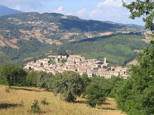
Роккальбенья
- коммуна Италии
Hiking in Роккальбенья
Roccalbegna is a charming village located in the Maremma region of Tuscany, Italy. It is surrounded by stunning natural landscapes, making it an excellent destination for hiking enthusiasts. Here are some insights into hiking in and around Roccalbegna:...
- Страна:
- Почтовый код: 58053
- Телефонный код: 0564
- Код автомобильного номера: GR
- Координаты: 42° 47' 13" N, 11° 30' 36" E
- GPS треки (wikiloc): [Ссылка]
- Высота над уровнем моря: 522 м m
- Площадь: 124.86 кв.км
- Население: 984
- Веб сайт: [Ссылка]
Семпрониано
- коммуна Италии
Hiking in Семпрониано
Semproniano is a charming village located in the Maremma region of Tuscany, Italy. It offers a unique set of opportunities for hiking enthusiasts, combining beautiful landscapes, rich history, and a tranquil environment....
- Страна:
- Почтовый код: 58055
- Телефонный код: 0564
- Код автомобильного номера: GR
- Координаты: 42° 43' 48" N, 11° 32' 28" E
- GPS треки (wikiloc): [Ссылка]
- Высота над уровнем моря: 622 м m
- Площадь: 81.65 кв.км
- Население: 1076
- Веб сайт: [Ссылка]


Аббадия-Сан-Сальваторе
- коммуна Италии
Hiking in Аббадия-Сан-Сальваторе
Abbadia San Salvatore is a picturesque town located in the province of Siena in Tuscany, Italy. It's nestled on the slopes of Mount Amiata, a dormant volcano that offers a variety of hiking opportunities through stunning landscapes, rich in natural beauty and history....
- Страна:
- Почтовый код: 53021
- Телефонный код: 0577
- Код автомобильного номера: SI
- Координаты: 42° 52' 59" N, 11° 40' 14" E
- GPS треки (wikiloc): [Ссылка]
- Высота над уровнем моря: 822 м m
- Площадь: 58.99 кв.км
- Население: 6325
- Веб сайт: [Ссылка]

Пьянкастаньяио
- коммуна Италии
Hiking in Пьянкастаньяио
Piancastagnaio is a charming town located in the province of Siena, Tuscany, Italy. It's situated in the Monte Amiata area, which offers a wealth of natural beauty and diverse hiking opportunities....
- Страна:
- Почтовый код: 53025
- Телефонный код: 0577
- Код автомобильного номера: SI
- Координаты: 42° 51' 0" N, 11° 41' 0" E
- GPS треки (wikiloc): [Ссылка]
- Высота над уровнем моря: 772 м m
- Площадь: 69.63 кв.км
- Население: 4181
- Веб сайт: [Ссылка]