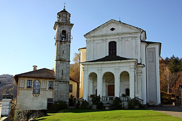
Арола (Arola, Arola)
- коммуна Италии
 Hiking in Арола
Arola is a beautiful destination for hiking enthusiasts, located in the heart of the Italian Alps. While specific trails and their conditions can vary, here are a few key aspects to consider when hiking in this region:
1.
Arola boasts a variety of trails that cater to different skill levels, ranging from beginner paths to more challenging routes. You'll find stunning views of the surrounding mountains, valleys, and pristine lakes.
2.
The area is rich in biodiversity. As you hike, you may encounter various plants, trees, and wildlife indigenous to the Alps. Keep an eye out for local fauna such as deer, chamois, and a variety of bird species.
3.
Before setting out, check local resources for current trail conditions, as they can change due to weather or maintenance. Some paths may be more difficult after rainfall or during spring thaw.
4.
The best time to hike in Arola is typically from late spring to early autumn, when the weather is most favorable and the trails are clear of snow. Summers can provide mild temperatures, while spring and early autumn showcase vibrant flora.
5.
- Footwear: Sturdy hiking boots are essential for the rocky and uneven terrain.
- Clothing: Layer your clothing to adapt to changing weather conditions. Bring a waterproof jacket.
- Navigation Tools: A map, compass, or GPS device can be crucial for navigating the trails, especially if they are less well-marked.
6.
- Always inform someone of your hiking plans and estimated return time.
- Carry enough water and snacks to keep your energy up.
- Be aware of your surroundings and respect local wildlife and nature.
7.
Arola has a rich cultural heritage, and taking a break from hiking to explore local villages and try traditional cuisine can enhance your experience.
Before you go, it's always a good idea to research specific hiking trails in Arola, as well as any local regulations or guidelines to ensure a safe and enjoyable adventure. Happy hiking!
- Страна:

- Почтовый код: 28010
- Телефонный код: 0323
- Код автомобильного номера: VB
- Координаты: 45° 48' 0" N, 8° 21' 0" E


- GPS треки (wikiloc): [Ссылка]
- Высота над уровнем моря: 615 м m
- Площадь: 6.61 кв.км
- Население: 239
- Веб сайт: http://www.comune.arola.vb.it/
- Википедия русская: wiki(ru)
- Википедия английская: wiki(en)
- Википедия национальная: wiki(it)
- Хранилище Wikidata: Wikidata: Q23219
- Катеория в википедии: [Ссылка]
- код Freebase: [/m/0gr7rp]
- код GeoNames: Альт: [6541399]
- ID отношения в OpenStreetMap: [46209]
- код темы Quora: [Arola]
- код ISTAT: 103004
- кадастровый код Италии: A427
Граничит с регионами:
Чезара
- коммуна Италии
Hiking in Чезара
Cesara is a charming village located in the Piedmont region of Italy, nestled in the scenic valleys of the Verbano-Cusio-Ossola province. This area offers a wealth of hiking opportunities thanks to its stunning landscapes, lush forests, and panoramic views of the surrounding mountains....
- Страна:
- Почтовый код: 28010
- Телефонный код: 0323
- Код автомобильного номера: VB
- Координаты: 45° 50' 0" N, 8° 22' 0" E
- GPS треки (wikiloc): [Ссылка]
- Высота над уровнем моря: 499 м m
- Площадь: 11.65 кв.км
- Население: 599
- Веб сайт: [Ссылка]
Мадонна-дель-Сассо
- коммуна Италии
Hiking in Мадонна-дель-Сассо
Madonna del Sasso is a picturesque area located in the Piedmont region of northern Italy, near Lake Orta. Known for its stunning landscapes, charming villages, and religious significance, it offers a variety of hiking opportunities suitable for different skill levels. Here are some key aspects to consider when hiking in this area:...
- Страна:
- Почтовый код: 28010
- Телефонный код: 0163; 0322
- Код автомобильного номера: VB
- Координаты: 45° 48' 0" N, 8° 22' 0" E
- GPS треки (wikiloc): [Ссылка]
- Высота над уровнем моря: 696 м m
- Площадь: 15.41 кв.км
- Население: 393
- Веб сайт: [Ссылка]
Чивьяско
- коммуна Италии
Hiking in Чивьяско
Civiasco is a charming village located in the province of Vercelli in the Piedmont region of northern Italy. It is nestled in the scenic landscapes of the Lombardy and Piedmont Alps, making it an excellent destination for hiking enthusiasts. The area offers a variety of trails that cater to different skill levels, from gentle walks to more challenging hikes....
- Страна:
- Почтовый код: 13010
- Телефонный код: 0163
- Код автомобильного номера: VC
- Координаты: 45° 48' 0" N, 8° 18' 0" E
- GPS треки (wikiloc): [Ссылка]
- Высота над уровнем моря: 716 м m
- Площадь: 7.39 кв.км
- Население: 249
- Веб сайт: [Ссылка]