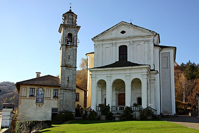
Чезара (Cesara, Cesara)
- коммуна Италии
 Hiking in Чезара
Cesara is a charming village located in the Piedmont region of Italy, nestled in the scenic valleys of the Verbano-Cusio-Ossola province. This area offers a wealth of hiking opportunities thanks to its stunning landscapes, lush forests, and panoramic views of the surrounding mountains.
Hiking Trails and Opportunities
-
Val Grande National Park: Close to Cesara, this park is known for its wild and rugged terrain. It features several trails that vary in difficulty, allowing hikers to explore deep valleys, rocky peaks, and dense forests.
-
Monte Faié: This peak provides a rewarding hike with breathtaking views of the surrounding valleys and lakes. The trail is moderately challenging, making it suitable for experienced hikers as well as those looking for a bit of a workout.
-
Local Trails: Numerous local paths weave through the village and its surroundings. Many of these trails are less traveled, allowing for a serene and intimate experience with nature.
-
Cultural Routes: Combine hiking with local culture by exploring trails that lead to nearby historical sites, churches, and traditional villages. This offers a chance to experience the local heritage along with the natural beauty.
Best Time to Hike
The best time to hike in Cesara is during the spring (April to June) and fall (September to October) when temperatures are mild, and the scenery is stunning with blooming wildflowers in the spring and colorful foliage in the fall.
Preparation and Safety
- Gear: Wear proper hiking boots, bring plenty of water, snacks, and avoid cotton clothing that doesn’t wick moisture.
- Maps: Always have a detailed map of the trails you plan to hike. Local tourist offices can provide useful resources.
- Weather: Check the weather forecast before heading out, as conditions can change rapidly in the mountains.
- Local Guides: If you're unfamiliar with the area, consider hiring a local guide who can provide insight into the natural environment and ensure safety.
Conclusion
Hiking in Cesara offers a delightful blend of natural beauty, physical challenge, and cultural exploration. Whether you're a seasoned hiker or a beginner, you'll find plenty of opportunities to enjoy the great outdoors in this scenic part of Italy. Make sure to take your time, enjoy the views, and immerse yourself in the tranquility of the region!
- Страна:

- Почтовый код: 28010
- Телефонный код: 0323
- Код автомобильного номера: VB
- Координаты: 45° 50' 0" N, 8° 22' 0" E


- GPS треки (wikiloc): [Ссылка]
- Высота над уровнем моря: 499 м m
- Площадь: 11.65 кв.км
- Население: 599
- Веб сайт: http://www.comune.cesara.vb.it
- Википедия русская: wiki(ru)
- Википедия английская: wiki(en)
- Википедия национальная: wiki(it)
- Хранилище Wikidata: Wikidata: Q23305
- Катеория в википедии: [Ссылка]
- код Freebase: [/m/0gr835]
- код GeoNames: Альт: [6539442]
- ID отношения в OpenStreetMap: [46206]
- UN/LOCODE: [ITCEN]
- код ISTAT: 103022
- кадастровый код Италии: C567
Граничит с регионами:

Пелла
- коммуна Италии
Hiking in Пелла
Pella, located in the Piedmont region of Italy, is surrounded by beautiful landscapes ideal for hiking enthusiasts. The area features rolling hills, scenic vineyards, and woodlands, offering a range of trails suitable for various skill levels. Here are some highlights and tips for hiking in the Pella area:...
- Страна:
- Почтовый код: 28010
- Телефонный код: 0322
- Код автомобильного номера: NO
- Координаты: 45° 48' 0" N, 8° 23' 0" E
- GPS треки (wikiloc): [Ссылка]
- Высота над уровнем моря: 305 м m
- Площадь: 8.13 кв.км
- Население: 985
- Веб сайт: [Ссылка]

Арола
- коммуна Италии
Hiking in Арола
Arola is a beautiful destination for hiking enthusiasts, located in the heart of the Italian Alps. While specific trails and their conditions can vary, here are a few key aspects to consider when hiking in this region:...
- Страна:
- Почтовый код: 28010
- Телефонный код: 0323
- Код автомобильного номера: VB
- Координаты: 45° 48' 0" N, 8° 21' 0" E
- GPS треки (wikiloc): [Ссылка]
- Высота над уровнем моря: 615 м m
- Площадь: 6.61 кв.км
- Население: 239
- Веб сайт: [Ссылка]
Мадонна-дель-Сассо
- коммуна Италии
Hiking in Мадонна-дель-Сассо
Madonna del Sasso is a picturesque area located in the Piedmont region of northern Italy, near Lake Orta. Known for its stunning landscapes, charming villages, and religious significance, it offers a variety of hiking opportunities suitable for different skill levels. Here are some key aspects to consider when hiking in this area:...
- Страна:
- Почтовый код: 28010
- Телефонный код: 0163; 0322
- Код автомобильного номера: VB
- Координаты: 45° 48' 0" N, 8° 22' 0" E
- GPS треки (wikiloc): [Ссылка]
- Высота над уровнем моря: 696 м m
- Площадь: 15.41 кв.км
- Население: 393
- Веб сайт: [Ссылка]
Нонио
- коммуна Италии
Hiking in Нонио
Nonio is a small municipality located in the Piedmont region of Italy, near Lake Orta, which is known for its stunning natural scenery and outdoor recreational opportunities, including hiking. Here are some highlights if you're considering hiking in Nonio:...
- Страна:
- Почтовый код: 28891
- Телефонный код: 0323
- Код автомобильного номера: VB
- Координаты: 45° 50' 46" N, 8° 22' 39" E
- GPS треки (wikiloc): [Ссылка]
- Высота над уровнем моря: 476 м m
- Площадь: 9.8 кв.км
- Население: 850
- Веб сайт: [Ссылка]
Чивьяско
- коммуна Италии
Hiking in Чивьяско
Civiasco is a charming village located in the province of Vercelli in the Piedmont region of northern Italy. It is nestled in the scenic landscapes of the Lombardy and Piedmont Alps, making it an excellent destination for hiking enthusiasts. The area offers a variety of trails that cater to different skill levels, from gentle walks to more challenging hikes....
- Страна:
- Почтовый код: 13010
- Телефонный код: 0163
- Код автомобильного номера: VC
- Координаты: 45° 48' 0" N, 8° 18' 0" E
- GPS треки (wikiloc): [Ссылка]
- Высота над уровнем моря: 716 м m
- Площадь: 7.39 кв.км
- Население: 249
- Веб сайт: [Ссылка]

Варалло
- коммуна Италии
Hiking in Варалло
Varallo Sesia is a charming town located in the Valsesia Valley in northern Italy, known for its stunning natural landscapes and rich cultural heritage. It's a fantastic destination for hiking enthusiasts, offering a variety of trails that cater to different skill levels, from easy walks to challenging treks....
- Страна:
- Почтовый код: 13019
- Телефонный код: 0163
- Код автомобильного номера: VC
- Координаты: 45° 48' 50" N, 8° 15' 29" E
- GPS треки (wikiloc): [Ссылка]
- Высота над уровнем моря: 456 м m
- Площадь: 88.12 кв.км
- Население: 7146
- Веб сайт: [Ссылка]