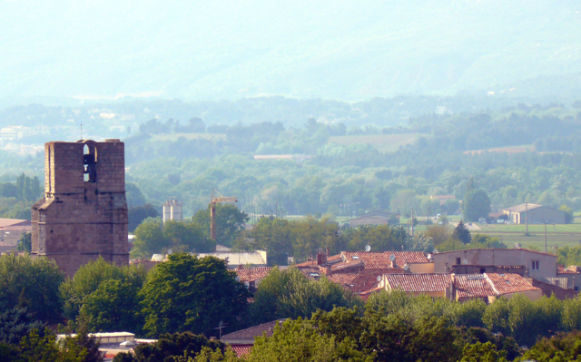
Экс-ан-Прованс (arrondissement of Aix-en-Provence, arrondissement d'Aix-en-Provence)

- округ Франции
 Hiking in Экс-ан-Прованс
The Arrondissement of Aix-en-Provence, located in the Provence-Alpes-Côte d'Azur region of southern France, offers a variety of stunning hiking trails set against a backdrop of picturesque landscapes, charming villages, and rich history. Here are some highlights for hiking in this area:
1.
- Description: This iconic mountain, often associated with the painter Cézanne, offers various trails that cater to different skill levels. The most popular routes lead to the summit, where hikers are rewarded with spectacular views of the surrounding countryside.
- Trail Information: The hike to the summit is moderately challenging and can take about 2–3 hours one-way. Be sure to carry plenty of water and snacks.
2.
- Description: A short drive from Aix-en-Provence, this regional park boasts diverse flora and fauna, as well as beautiful hilltop villages. The Luberon is home to a network of marked trails that traverse vineyards, lavender fields, and rocky outcrops.
- Trail Information: Accessible routes range from easy walks to more strenuous hikes, such as the trail to the Puy Vidal.
3.
- Description: Although slightly beyond Aix-en-Provence, this stunning coastal area features dramatic cliffs, hidden beaches, and crystal-clear waters. The park is a paradise for hiking enthusiasts and offers some breathtaking coastal trails.
- Trail Information: There are various trails, including the popular route from Cassis to Port-Miou. These paths can be challenging, with steep ascents and descents.
4.
- Description: This local route offers a chance to explore the beautiful surroundings of Aix-en-Provence itself. The trail links several historical and cultural sites within the city and its outskirts, making it perfect for those who want a mix of nature and culture.
- Trail Information: The circuit is generally easy and can be completed in a few hours.
5.
- Best Time to Hike: Spring (April to June) and fall (September to October) offer the most pleasant temperatures and beautiful scenery.
- Preparation: Always check trail conditions before you head out, as some paths may be closed due to weather or maintenance. Carry sufficient water, snacks, sunscreen, and a good map or GPS device.
- Local Regulations: Respect nature and local regulations; stick to marked trails and dispose of trash properly.
Conclusion:
Hiking in the Arrondissement of Aix-en-Provence offers an excellent opportunity to explore both nature and local culture. Whether you're climbing the famous Montagne Sainte-Victoire or wandering through the serene landscapes of the Luberon, you're bound to have a memorable experience!
- Страна:

- Столица: Экс-ан-Прованс
- Координаты: 43° 30' 0" N, 5° 20' 0" E


- GPS треки (wikiloc): [Ссылка]
- Площадь: 1532 кв.км
- Население: 433315
- Википедия русская: wiki(ru)
- Википедия английская: wiki(en)
- Википедия национальная: wiki(fr)
- Хранилище Wikidata: Wikidata: Q700364
- код Freebase: [/m/095kjv]
- код GeoNames: Альт: [3038353]
- код округа INSEE: [131]
- код GNS: -1406940
Включает регионы:


Гардан
Hiking in Гардан
The Canton of Gardanne, located in the Bouches-du-Rhône department in the south of France, offers a variety of hiking opportunities amidst picturesque landscapes and fascinating cultural sites. The region is characterized by its diverse terrain, which includes hills, forests, and striking limestone formations....
- Страна:
- Столица: Гардан
- Координаты: 43° 27' 19" N, 5° 28' 36" E
- GPS треки (wikiloc): [Ссылка]
- Население: 62048

Тре
Hiking in Тре
Hiking in the Canton of Trets, located in the Provence-Alpes-Côte d'Azur region of France, offers beautiful scenery and a variety of trails suitable for different skill levels. Here are some key points to consider when planning your hiking adventure in this area:...
- Страна:
- Столица: Тре
- Координаты: 43° 26' 51" N, 5° 41' 1" E
- GPS треки (wikiloc): [Ссылка]
- Население: 71436

Центральный Экс-ан-Прованс
Hiking in Центральный Экс-ан-Прованс
The Canton of Aix-en-Provence-Centre offers a delightful mix of natural beauty and cultural heritage, making it an attractive destination for hikers. Nestled in the heart of Provence, this area is characterized by its stunning landscapes, rolling hills, and picturesque vineyards, alongside historical sites....
- Страна:
- Столица: Экс-ан-Прованс
- Координаты: 43° 31' 52" N, 5° 27' 14" E
- GPS треки (wikiloc): [Ссылка]
Северо-восточный Экс-ан-Прованс
Hiking in Северо-восточный Экс-ан-Прованс
Canton d'Aix-en-Provence-Nord-Est, located in the Bouches-du-Rhône department in southern France, offers a fantastic setting for hiking enthusiasts. The region is characterized by its stunning landscapes that encompass rolling hills, vineyards, olive groves, and picturesque villages, along with a diverse range of flora and fauna....
- Страна:
- Столица: Экс-ан-Прованс
- Координаты: 43° 31' 52" N, 5° 27' 14" E
- GPS треки (wikiloc): [Ссылка]


Пелиссан
Hiking in Пелиссан
The Canton of Pélissanne, located in the Bouches-du-Rhône department in the Provence-Alpes-Côte d'Azur region of southern France, offers a variety of hiking opportunities that showcase the stunning landscapes and natural beauty of the area. Here are some aspects to consider:...
- Страна:
- Столица: Пелиссан
- Координаты: 43° 37' 56" N, 5° 9' 4" E
- GPS треки (wikiloc): [Ссылка]
- Население: 57657

Ламбеск
- кантон Франции
Hiking in Ламбеск
Canton de Lambesc, located in the Provence-Alpes-Côte d'Azur region of France, offers a range of hiking opportunities that highlight the beautiful landscapes, quaint villages, and rich history of the area. Here are some key points to consider if you're planning a hiking trip in this region:...


Ле-Пен-Мирабо (кантон)
Hiking in Ле-Пен-Мирабо (кантон)
Canton des Pennes-Mirabeau, located in the Bouches-du-Rhône department in the Provence-Alpes-Côte d'Azur region of France, offers a variety of hiking opportunities amid beautiful landscapes and a Mediterranean climate. Here are some key aspects of hiking in this area:...
- Страна:
- Столица: Ле-Пен-Мирабо
- Координаты: 43° 24' 38" N, 5° 18' 37" E
- GPS треки (wikiloc): [Ссылка]

Пейроль-ан-Прованс (кантон)
Hiking in Пейроль-ан-Прованс (кантон)
Canton de Peyrolles-en-Provence, nestled in the picturesque region of Provence in southern France, offers a variety of hiking opportunities that showcase the stunning landscapes, local flora and fauna, and charming villages. Here are some highlights you can expect when hiking in this area:...
- Страна:
- Столица: Пероль-ан-Прованс
- Координаты: 43° 38' 47" N, 5° 35' 9" E
- GPS треки (wikiloc): [Ссылка]

Салон-де-Прованс (кантон)
- Страна:
- Столица: Салон-де-Прованс
- Координаты: 43° 38' 26" N, 5° 5' 50" E
- GPS треки (wikiloc): [Ссылка]
Юго-западный Экс-ан-Прованс
Hiking in Юго-западный Экс-ан-Прованс
The Canton of Aix-en-Provence-Sud-Ouest, located in the Provence-Alpes-Côte d'Azur region of southern France, is a beautiful area that offers diverse hiking opportunities. Here are some key highlights to consider when planning your hike in this region:...
- Страна:
- Столица: Экс-ан-Прованс
- Координаты: 43° 31' 52" N, 5° 27' 14" E
- GPS треки (wikiloc): [Ссылка]