
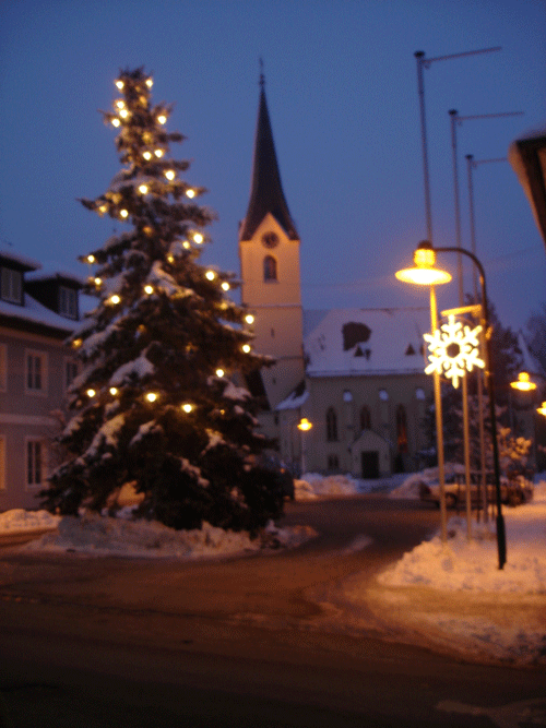
Атнанг-Пуххайм (Attnang-Puchheim, Attnang-Puchheim)
 Hiking in Атнанг-Пуххайм
Attnang-Puchheim is a charming town located in the Salzkammergut region of Austria, surrounded by beautiful landscapes, making it a great base for hikers. The area features various hiking trails that cater to different skill levels and preferences, showcasing stunning views of the surrounding mountains and lakes.
Popular Hiking Trails:
-
Almtal Valley: This area offers picturesque trails along the Alm River. You can enjoy the natural beauty and maybe even take a dip in the river during warmer months.
-
Schober Mountain: For those looking for a moderate challenge, hiking up Schober provides panoramic views of the region, especially if you start early in the morning.
-
Hiking to the Traunstein: A well-known hike that rewards you with spectacular views of the Traunsee lake and the surrounding mountains. This trail can be challenging, so be prepared with proper gear.
-
Gmundnerberg: This trail is suitable for families and beginners, offering a pleasant hike with lovely scenery, perfect for a leisurely day.
Tips for Hiking Around Attnang-Puchheim:
- Check the Weather: Mountain weather can change rapidly, so always check the forecast before heading out.
- Bring Proper Gear: Good hiking shoes and weather-appropriate clothing are essential. A backpack with water, snacks, and a first aid kit is also recommended.
- Local Maps and Guides: Consider getting a local hiking map or using trail apps; trail markings can vary in visibility.
- Stay Hydrated and Energized: Always carry enough water and some energy snacks, especially on longer hikes.
Best Time to Hike:
The best time for hiking in this region is generally from late spring to early autumn (May to October). During these months, the weather is more stable, and trails are accessible. However, some higher elevation trails may have snow until late spring.
Hiking in and around Attnang-Puchheim offers an excellent opportunity to immerse yourself in nature and experience the beauty of the Austrian mountains. Enjoy your hike!
- Страна:

- Почтовый код: 4800
- Телефонный код: 07674
- Код автомобильного номера: VB
- Координаты: 48° 1' 0" N, 13° 43' 0" E


- GPS треки (wikiloc): [Ссылка]
- Высота над уровнем моря: 416 м m
- Площадь: 1232 кв.км
- Население: 8944
- Веб сайт: http://www.attnang-puchheim.at
- Википедия русская: wiki(ru)
- Википедия английская: wiki(en)
- Википедия национальная: wiki(de)
- Хранилище Wikidata: Wikidata: Q261216
- Катеория в википедии: [Ссылка]
- код Freebase: [/m/027nqgt]
- код GeoNames: Альт: [3233832]
- код VIAF: Альт: [145552050]
- код GND: Альт: [4314408-1]
- идентификатор местоположения ArchINFORM: [10262]
- код LCNAF: Альт: [n91008807]
- место в MusicBrainz: [f509cd7b-625f-4b26-b5bf-ce0ee488d63c]
- код австрийского муниципалитета: [41703]
Граничит с регионами:

Фёклабрук
Hiking in Фёклабрук
Vöcklabruck, located in Upper Austria, offers a variety of hiking opportunities suitable for all skill levels, thanks to its beautiful natural surroundings and scenic landscapes. Here are some key aspects to consider when hiking in this area:...
- Страна:
- Почтовый код: 4840
- Телефонный код: 07672
- Код автомобильного номера: VB
- Координаты: 48° 0' 31" N, 13° 39' 21" E
- GPS треки (wikiloc): [Ссылка]
- Высота над уровнем моря: 433 м m
- Площадь: 16 кв.км
- Население: 12179
- Веб сайт: [Ссылка]
Регау
Hiking in Регау
Regau, located in Upper Austria, offers a range of beautiful hiking opportunities for nature enthusiasts. The region is characterized by rolling hills, lush forests, and scenic views of the surrounding countryside. Here are some key points to consider when hiking in Regau:...
- Страна:
- Почтовый код: 4844
- Телефонный код: 07672
- Код автомобильного номера: VB
- Координаты: 47° 59' 31" N, 13° 41' 17" E
- GPS треки (wikiloc): [Ссылка]
- Высота над уровнем моря: 429 м m
- Площадь: 34 кв.км
- Население: 6780
- Веб сайт: [Ссылка]
Редльхам
Hiking in Редльхам
It seems there might be a typo or a miscommunication regarding "Redlham," as it's not a widely recognized hiking destination. However, if you meant "Redlands," which is located in California, or a specific area within a region, I would be happy to provide information based on that....
- Страна:
- Почтовый код: 4846
- Код автомобильного номера: VB
- Координаты: 48° 1' 27" N, 13° 44' 41" E
- GPS треки (wikiloc): [Ссылка]
- Высота над уровнем моря: 403 м m
- Площадь: 8 кв.км
- Население: 1515
- Веб сайт: [Ссылка]

Дессельбрун
Hiking in Дессельбрун
Desselbrunn is a charming area located in Upper Austria, known for its picturesque landscapes and nature trails, making it a great destination for hiking enthusiasts. Here are some key points to consider if you’re planning a hiking trip in Desselbrunn:...
- Страна:
- Почтовый код: 4693
- Телефонный код: 07673
- Код автомобильного номера: VB
- Координаты: 48° 1' 22" N, 13° 46' 25" E
- GPS треки (wikiloc): [Ссылка]
- Высота над уровнем моря: 421 м m
- Площадь: 17 кв.км
- Население: 1857
- Веб сайт: [Ссылка]
Пюрет
Hiking in Пюрет
Pühret, located in Austria, offers a variety of hiking opportunities for enthusiasts of all levels. The region is characterized by its stunning landscapes, peaceful forests, and scenic views of the surrounding mountains....
- Страна:
- Почтовый код: 4690
- Телефонный код: 07674
- Код автомобильного номера: VB
- Координаты: 48° 1' 49" N, 13° 42' 25" E
- GPS треки (wikiloc): [Ссылка]
- Высота над уровнем моря: 440 м m
- Площадь: 7 кв.км
- Население: 613
- Веб сайт: [Ссылка]
Пильсбах
Hiking in Пильсбах
Pilsbach, located in Austria's beautiful Salzkammergut region, is a fantastic destination for hiking enthusiasts. The area is characterized by its stunning landscapes, picturesque lakes, and dramatic mountain scenery. Here are some aspects to consider when hiking in Pilsbach:...
- Страна:
- Код автомобильного номера: VB
- Координаты: 48° 2' 23" N, 13° 40' 6" E
- GPS треки (wikiloc): [Ссылка]
- Высота над уровнем моря: 475 м m
- Площадь: 10 кв.км
- Население: 629
- Веб сайт: [Ссылка]