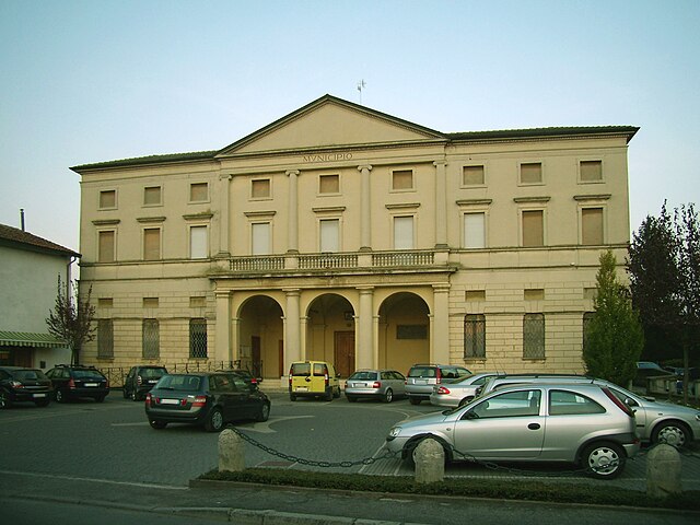
Аццанелло (Azzanello, Azzanello)
.svg)
- коммуна Италии
 Hiking in Аццанелло
Azzanello is a small town in the Lombardy region of Italy, situated near the banks of the Oglio River. While it may not be a widely recognized hiking destination, it offers opportunities for hiking and outdoor activities thanks to its picturesque natural surroundings and proximity to the river.
Hiking Opportunities:
-
Oglio River Park:
- The Oglio River Park (Parco dell'Oglio) stretches along the river and features a variety of trails. The park is known for its diverse flora and fauna, making it a great spot for nature lovers.
- Trails in the park can vary in difficulty, ranging from easy walks to more challenging routes. You can enjoy scenic views of the river, wetlands, and woodlands.
-
Surrounding Countryside:
- Azzanello is surrounded by beautiful farmland and rolling hills, providing opportunities for more rural hikes. Look for local paths that lead through vineyards and fields, offering a glimpse of the agricultural landscape.
-
Nearby Areas:
- If you're willing to travel a bit further, consider nearby hiking areas, such as the Oglio Sud Regional Park, which has more extensive trail networks and natural beauty.
Tips for Hiking in Azzanello:
- Prepare for the Weather: Check the weather conditions before you go, as the climate can vary significantly from season to season.
- Footwear: Wear appropriate hiking shoes or boots to ensure comfort and stability on varied terrain.
- Trail Maps: It’s a good idea to have a map or a GPS device, especially if you're venturing off the beaten path.
- Stay Hydrated: Make sure to bring enough water, especially if you're planning to hike for several hours.
- Local Cuisine: After your hike, enjoy some local cuisine at nearby restaurants or cafes.
While Azzanello may not have famous hiking trails, its charming landscapes and proximity to natural parks can offer a peaceful and enjoyable hiking experience for those looking to explore the Italian countryside.
- Страна:

- Почтовый код: 26010
- Телефонный код: 0374
- Код автомобильного номера: CR
- Координаты: 45° 18' 47" N, 9° 55' 11" E


- GPS треки (wikiloc): [Ссылка]
- Высота над уровнем моря: 68 м m
- Площадь: 11.12 кв.км
- Население: 635
- Веб сайт: http://www.comune.azzanello.gov.it/
- Википедия русская: wiki(ru)
- Википедия английская: wiki(en)
- Википедия национальная: wiki(it)
- Хранилище Wikidata: Wikidata: Q42161
- Катеория в википедии: [Ссылка]
- код Freebase: [/m/0gjycd]
- код GeoNames: Альт: [6541504]
- код VIAF: Альт: [283753156]
- ID отношения в OpenStreetMap: [44689]
- код GND: Альт: [1028584059]
- код ISTAT: 019004
- кадастровый код Италии: A526
Граничит с регионами:
Борго-Сан-Джакомо
- коммуна Италии
Hiking in Борго-Сан-Джакомо
Borgo San Giacomo is a charming municipality in the province of Brescia, located in northern Italy. It is surrounded by beautiful landscapes that offer a variety of hiking opportunities. The area features rolling hills, vineyards, and picturesque countryside, making it an enjoyable destination for nature lovers and outdoor enthusiasts....
- Страна:
- Почтовый код: 25022
- Телефонный код: 030
- Код автомобильного номера: BS
- Координаты: 45° 20' 53" N, 9° 58' 5" E
- GPS треки (wikiloc): [Ссылка]
- Высота над уровнем моря: 74 м m
- Площадь: 29.53 кв.км
- Население: 5455
- Веб сайт: [Ссылка]
Виллакьяра
- коммуна Италии
Hiking in Виллакьяра
Villachiara is a small, picturesque area in Italy that offers various hiking opportunities, particularly for those seeking beautiful landscapes and a peaceful environment. While it's not as widely known as some of the more famous hiking destinations, it can be an excellent place for nature lovers and hikers looking for a more off-the-beaten-path experience....
- Страна:
- Почтовый код: 25030
- Телефонный код: 030
- Код автомобильного номера: BS
- Координаты: 45° 21' 0" N, 9° 56' 0" E
- GPS треки (wikiloc): [Ссылка]
- Высота над уровнем моря: 75 м m
- Площадь: 16.87 кв.км
- Население: 1416
- Веб сайт: [Ссылка]
Кастельвисконти
- коммуна Италии
Hiking in Кастельвисконти
Castelvisconti is a small town located in the Lombardy region of Italy, known for its picturesque landscapes and charming countryside. While it may not be a widely recognized hiking destination, it can serve as a great base for exploring the surrounding areas, which feature numerous trails and scenic routes ideal for hiking....
- Страна:
- Почтовый код: 26010
- Телефонный код: 0374
- Код автомобильного номера: CR
- Координаты: 45° 18' 0" N, 9° 56' 0" E
- GPS треки (wikiloc): [Ссылка]
- Высота над уровнем моря: 66 м m
- Площадь: 9.76 кв.км
- Население: 301
- Веб сайт: [Ссылка]
Казальморано
- коммуна Италии
Hiking in Казальморано
Casalmorano is a charming municipality in the province of Cremona, Lombardy, Italy. While it may not be as widely known as some of the larger hiking destinations, the surrounding areas provide opportunities for enjoyable hikes and outdoor activities....
- Страна:
- Почтовый код: 26020
- Телефонный код: 0374
- Код автомобильного номера: CR
- Координаты: 45° 17' 0" N, 9° 53' 0" E
- GPS треки (wikiloc): [Ссылка]
- Высота над уровнем моря: 67 м m
- Площадь: 12.28 кв.км
- Население: 1635
- Веб сайт: [Ссылка]

Дженивольта
- коммуна Италии
Hiking in Дженивольта
Genivolta, located in Italy, is surrounded by beautiful landscapes ideal for hiking. The area boasts rolling hills, picturesque views, and various trails catering to different experience levels....
- Страна:
- Почтовый код: 26020
- Телефонный код: 0374
- Код автомобильного номера: CR
- Координаты: 45° 20' 0" N, 9° 53' 0" E
- GPS треки (wikiloc): [Ссылка]
- Высота над уровнем моря: 70 м m
- Площадь: 18.57 кв.км
- Население: 1196
- Веб сайт: [Ссылка]