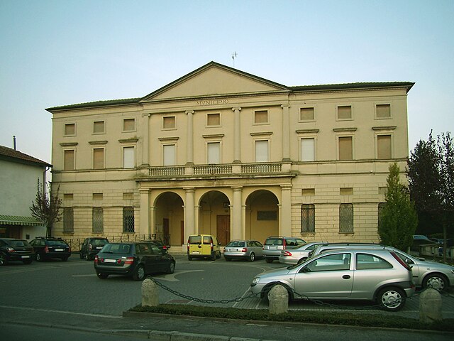
Казальморано (Casalmorano, Casalmorano)
.svg)
- коммуна Италии
 Hiking in Казальморано
Casalmorano is a charming municipality in the province of Cremona, Lombardy, Italy. While it may not be as widely known as some of the larger hiking destinations, the surrounding areas provide opportunities for enjoyable hikes and outdoor activities.
Hiking Opportunities Near Casalmorano:
-
Countryside Trails: The landscape around Casalmorano is predominantly rural, offering peaceful trails through farmlands, vineyards, and small woodlands. These paths are excellent for leisurely walks, running, or cycling.
-
Po River Park: Close to Casalmorano, the nearby Po River offers a natural habitat and beautiful scenery. You can find trails along the riverbanks, which provide opportunities for birdwatching and appreciating the local flora and fauna.
-
Monticelli D'Ongina: A bit further afield, you can explore trails around Monticelli D'Ongina, which is known for its picturesque landscapes and historical sites. This area can provide a mix of natural beauty and cultural exploration.
-
Oltrepò Pavese: If you're willing to travel a little further, the Oltrepò Pavese region features rolling hills, vineyards, and well-marked hiking trails. This area, known for its wine, offers both scenic views and the chance to taste local wines after your hike.
Tips for Hiking in the Area:
- Maps and Guides: Always carry a detailed map or a GPS device, as some trails may not be well-marked. Local tourist information centers can provide you with useful map resources.
- Weather Considerations: Check the weather before your hike, as conditions can change rapidly, especially in rural areas. Dress in layers and bring a rain jacket if necessary.
- Hydration and Snacks: Bring sufficient water and snacks, as there might not be many facilities on the trails.
- Respect Nature: Adhere to Leave No Trace principles. Be mindful of wildlife, and stay on marked paths to protect the environment.
Conclusion:
While Casalmorano may not be a major hiking destination, it offers a wonderful opportunity for those looking to enjoy Italy's serene countryside and outdoor beauty. Whether you’re after a leisurely stroll or a more vigorous hike, the surrounding areas have something to offer every nature enthusiast.
- Страна:

- Почтовый код: 26020
- Телефонный код: 0374
- Код автомобильного номера: CR
- Координаты: 45° 17' 0" N, 9° 53' 0" E


- GPS треки (wikiloc): [Ссылка]
- Высота над уровнем моря: 67 м m
- Площадь: 12.28 кв.км
- Население: 1635
- Веб сайт: http://www.casalmorano.com/
- Википедия русская: wiki(ru)
- Википедия английская: wiki(en)
- Википедия национальная: wiki(it)
- Хранилище Wikidata: Wikidata: Q42813
- Катеория в википедии: [Ссылка]
- код Freebase: [/m/0gjynw]
- код GeoNames: Альт: [6537210]
- код VIAF: Альт: [157824969]
- ID отношения в OpenStreetMap: [44599]
- код TGN: [1043935]
- UN/LOCODE: [ITCSW]
- код ISTAT: 019022
- кадастровый код Италии: B900
Граничит с регионами:
Аццанелло
- коммуна Италии
Hiking in Аццанелло
Azzanello is a small town in the Lombardy region of Italy, situated near the banks of the Oglio River. While it may not be a widely recognized hiking destination, it offers opportunities for hiking and outdoor activities thanks to its picturesque natural surroundings and proximity to the river....
- Страна:
- Почтовый код: 26010
- Телефонный код: 0374
- Код автомобильного номера: CR
- Координаты: 45° 18' 47" N, 9° 55' 11" E
- GPS треки (wikiloc): [Ссылка]
- Высота над уровнем моря: 68 м m
- Площадь: 11.12 кв.км
- Население: 635
- Веб сайт: [Ссылка]
Кастельвисконти
- коммуна Италии
Hiking in Кастельвисконти
Castelvisconti is a small town located in the Lombardy region of Italy, known for its picturesque landscapes and charming countryside. While it may not be a widely recognized hiking destination, it can serve as a great base for exploring the surrounding areas, which feature numerous trails and scenic routes ideal for hiking....
- Страна:
- Почтовый код: 26010
- Телефонный код: 0374
- Код автомобильного номера: CR
- Координаты: 45° 18' 0" N, 9° 56' 0" E
- GPS треки (wikiloc): [Ссылка]
- Высота над уровнем моря: 66 м m
- Площадь: 9.76 кв.км
- Население: 301
- Веб сайт: [Ссылка]


Анникко
- коммуна Италии
Hiking in Анникко
Annicco is a small town located in the Lombardy region of Italy. While it may not be as widely known for hiking as some other areas in Italy, it can serve as a gateway for exploring nearby regions that offer beautiful hiking opportunities....
- Страна:
- Почтовый код: 26021
- Телефонный код: 0374
- Код автомобильного номера: CR
- Координаты: 45° 15' 0" N, 9° 53' 0" E
- GPS треки (wikiloc): [Ссылка]
- Высота над уровнем моря: 60 м m
- Площадь: 19.2 кв.км
- Население: 2053
- Веб сайт: [Ссылка]
Казальбуттано-эд-Юнити
- коммуна Италии
Hiking in Казальбуттано-эд-Юнити
Casalbuttano ed Uniti is a charming municipality located in the province of Cremona in Lombardy, Italy. While it's not widely known as a major hiking destination, the surrounding countryside and nearby natural areas offer opportunities for hiking and outdoor exploration....
- Страна:
- Почтовый код: 26011
- Телефонный код: 0374
- Код автомобильного номера: CR
- Координаты: 45° 15' 0" N, 9° 58' 0" E
- GPS треки (wikiloc): [Ссылка]
- Высота над уровнем моря: 60 м m
- Площадь: 22.88 кв.км
- Население: 3907
- Веб сайт: [Ссылка]


Падерно-Понкьелли
- коммуна Италии
Hiking in Падерно-Понкьелли
Paderno Ponchielli, a small town in the Lombardy region of Italy, offers a charming backdrop for hiking enthusiasts. Nestled near the banks of the Adda River, it provides a blend of natural beauty and cultural heritage....
- Страна:
- Почтовый код: 26024
- Телефонный код: 0374
- Код автомобильного номера: CR
- Координаты: 45° 14' 0" N, 9° 56' 0" E
- GPS треки (wikiloc): [Ссылка]
- Высота над уровнем моря: 58 м m
- Площадь: 23.96 кв.км
- Население: 1434
- Веб сайт: [Ссылка]


Сорезина
- коммуна Италии
Hiking in Сорезина
Soresina, located in the Lombardy region of Italy, is primarily known for its agricultural landscape and historical significance rather than traditional hiking trails. However, there are several options for enjoying the outdoors and exploring the surrounding areas....
- Страна:
- Почтовый код: 26015
- Телефонный код: 0374
- Код автомобильного номера: CR
- Координаты: 45° 17' 17" N, 9° 51' 31" E
- GPS треки (wikiloc): [Ссылка]
- Высота над уровнем моря: 45 м m
- Площадь: 28.57 кв.км
- Население: 8948
- Веб сайт: [Ссылка]

Дженивольта
- коммуна Италии
Hiking in Дженивольта
Genivolta, located in Italy, is surrounded by beautiful landscapes ideal for hiking. The area boasts rolling hills, picturesque views, and various trails catering to different experience levels....
- Страна:
- Почтовый код: 26020
- Телефонный код: 0374
- Код автомобильного номера: CR
- Координаты: 45° 20' 0" N, 9° 53' 0" E
- GPS треки (wikiloc): [Ссылка]
- Высота над уровнем моря: 70 м m
- Площадь: 18.57 кв.км
- Население: 1196
- Веб сайт: [Ссылка]