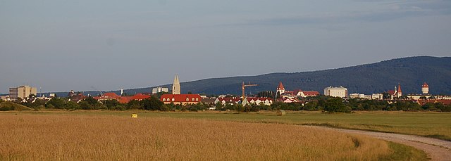
Бад-Фишау-Брун (Bad Fischau-Brunn, Bad Fischau-Brunn)
 Hiking in Бад-Фишау-Брун
Bad Fischau-Brunn, located in Austria, offers a variety of hiking opportunities that cater to both novice and experienced hikers. Nestled near the picturesque landscapes of the Wienerwald (Vienna Woods) and close to the northern foothills of the Alps, this area is characterized by its rolling hills, lush forests, and scenic views.
Hiking Trails
-
Local Trails: There are numerous well-marked hiking trails around Bad Fischau-Brunn. These trails vary in length and difficulty, making it a great spot for family hikes, leisurely walks, or challenging treks.
-
Voralpenweg: A longer hiking path that stretches across the region, offering stunning panoramas and the chance to explore the natural beauty of the Voralpen area. Portions of this trail pass through Bad Fischau-Brunn.
-
Cultural and Historical Trails: Some paths connect features of local history, such as old churches or landmarks. These trails can be integrated with cultural exploration for a well-rounded experience.
Natural Features
- Forests: The surrounding forests provide excellent shade during hikes, and they're rich in wildlife. Keep an eye out for local flora and fauna.
- Hills: The undulating terrain offers great views over the valley and surrounding areas.
Best Times to Hike
- Spring and Autumn: These seasons are particularly beautiful in this region, with wildflowers blooming in spring and colorful foliage in autumn.
- Summer: While hiking in summer can be pleasant, consider early morning or late afternoon hikes to avoid the heat.
Tips for Hiking in Bad Fischau-Brunn
- Gear: Wear comfortable hiking boots and bring plenty of water. A map or GPS device can be helpful, especially if exploring less-marked trails.
- Weather: Check the weather forecast before heading out, as conditions can change rapidly, especially in mountainous regions.
- Safety: Always let someone know your hiking plans and estimated return time, especially if you are hiking solo.
Facilities
- Accommodation: There are several hotels and guesthouses in and around Bad Fischau-Brunn for those looking to stay overnight.
- Food and Drink: Be sure to try local cuisine at nearby restaurants, which often serve authentic Austrian dishes.
In summary, Bad Fischau-Brunn offers a wonderful hiking experience with its natural beauty, variety of trails, and accessibility. Whether you are looking for a quick day hike or a longer exploration, you're likely to enjoy the serene landscapes and fresh air.
- Страна:

- Почтовый код: 2721
- Телефонный код: 02639
- Код автомобильного номера: WB
- Координаты: 47° 50' 0" N, 16° 10' 0" E


- GPS треки (wikiloc): [Ссылка]
- Высота над уровнем моря: 288 м m
- Площадь: 20.59 кв.км
- Население: 3440
- Веб сайт: http://www.bad-fischau-brunn.at/
- Википедия русская: wiki(ru)
- Википедия английская: wiki(en)
- Википедия национальная: wiki(de)
- Хранилище Wikidata: Wikidata: Q671253
- Катеория в википедии: [Ссылка]
- код Freebase: [/m/0414jx]
- код GeoNames: Альт: [7871925]
- код VIAF: Альт: [242314968]
- код GND: Альт: [4798877-0]
- идентификатор местоположения ArchINFORM: [42392]
- код австрийского муниципалитета: [32301]
Граничит с регионами:

Винер-Нойштадт
Hiking in Винер-Нойштадт
Wiener Neustadt, located in Lower Austria, offers several hiking opportunities for outdoor enthusiasts. The region is characterized by a mix of stunning natural landscapes, historical sites, and diverse trails suitable for various skill levels. Here are some highlights and tips for hiking in Wiener Neustadt:...
- Страна:
- Почтовый код: 2700
- Телефонный код: 02622
- Код автомобильного номера: WN
- Координаты: 47° 49' 0" N, 16° 15' 0" E
- GPS треки (wikiloc): [Ссылка]
- Высота над уровнем моря: 265 м m
- Площадь: 60.94 кв.км
- Население: 44461
- Веб сайт: [Ссылка]
Винцендорф-Мутманнсдорф
Hiking in Винцендорф-Мутманнсдорф
Winzendorf-Muthmannsdorf is a charming area in Austria that offers beautiful hiking opportunities, nestled in the scenic landscapes of the Lower Austria region. Known for its picturesque views of the surrounding mountains and lush greenery, this area is perfect for both novice and experienced hikers....
- Страна:
- Телефонный код: 02638
- Код автомобильного номера: WB
- Координаты: 47° 48' 0" N, 16° 7' 0" E
- GPS треки (wikiloc): [Ссылка]
- Высота над уровнем моря: 327 м m
- Площадь: 16.16 кв.км
- Население: 1877
- Веб сайт: [Ссылка]
Маркт-Пистинг
Hiking in Маркт-Пистинг
Markt Piesting is a charming area located in Lower Austria, known for its scenic landscapes and opportunities for outdoor activities, including hiking. The region boasts a variety of trails suitable for different skill levels, making it an excellent destination for both beginners and experienced hikers....
- Страна:
- Телефонный код: 02633
- Код автомобильного номера: WB
- Координаты: 47° 52' 22" N, 16° 7' 44" E
- GPS треки (wikiloc): [Ссылка]
- Высота над уровнем моря: 349 м m
- Площадь: 18.17 кв.км
- Население: 3007
- Веб сайт: [Ссылка]
Вёллерсдорф-Штайнабрюкль
Hiking in Вёллерсдорф-Штайнабрюкль
Wöllersdorf-Steinabrückl, located in Austria, offers some beautiful hiking opportunities, especially for those who appreciate natural landscapes and a touch of local history. This area is characterized by its rolling hills, lush forests, and picturesque villages....
- Страна:
- Код автомобильного номера: WB
- Координаты: 47° 52' 0" N, 16° 10' 0" E
- GPS треки (wikiloc): [Ссылка]
- Высота над уровнем моря: 315 м m
- Площадь: 14.53 кв.км
- Население: 4473
- Веб сайт: [Ссылка]

Вайкерсдорф-ам-Штайнфельде
Hiking in Вайкерсдорф-ам-Штайнфельде
Weikersdorf am Steinfelde is a charming village located in Austria, nestled within the scenic landscapes of Lower Austria. This area offers a variety of hiking opportunities that cater to different experience levels, with trails showcasing beautiful natural surroundings, rolling hills, and lush forests....
- Страна:
- Телефонный код: 02638
- Код автомобильного номера: WB
- Координаты: 47° 48' 20" N, 16° 8' 35" E
- GPS треки (wikiloc): [Ссылка]
- Высота над уровнем моря: 307 м m
- Площадь: 14.22 кв.км
- Население: 1066
- Веб сайт: [Ссылка]