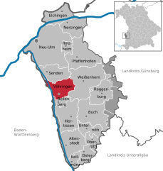
Белленберг (Bellenberg, Bellenberg)

 Hiking in Белленберг
Bellenberg is a quaint village in southern Germany, located near the city of Ulm in the state of Baden-Württemberg. Although not widely known as a hiking destination, it can serve as a good base for exploring the scenic trails in the surrounding region. Here are some key points to consider if you're interested in hiking in and around Bellenberg:
Nearby Hiking Trails
-
Swabian Jura (Schwäbische Alb): This nearby mountain range offers numerous hiking opportunities with varying levels of difficulty. The trails often lead through picturesque landscapes, including limestone cliffs, forests, and panoramic views.
-
Danube River Trails: The Danube runs not too far from Bellenberg, providing beautiful riverside walks and paths. You can follow the river and explore sections of the Danube Cycle Path, which is also suitable for walking.
-
Nature Reserves: The areas around Bellenberg are rich in natural reserves, where you can find numerous well-marked paths suitable for different skill levels.
Local Recommendations
-
Map and Guide: It’s advisable to pick up a local hiking map or guidebook. This will give you insight into trail lengths, elevations, and sights along the way.
-
Visitor Center: Local tourist information centers can provide brochures, trail maps, and advice on the best routes.
-
Seasonal Considerations: Spring and fall are ideal for hiking due to moderate temperatures, while summer months can be quite warm. Winter hiking can be beautiful, but be sure to check trail conditions.
Preparation Tips
- Appropriate Gear: Always wear sturdy hiking boots, and dress in layers to adjust to changing weather conditions.
- Hydration and Snacks: Bring enough water and snacks, especially if you'll be hiking for several hours.
- Safety: Inform someone about your hiking plans, and consider hiking with a buddy if you're venturing into less populated areas.
Conclusion
While Bellenberg itself may not have extensive hiking trails, its proximity to beautiful landscapes and outdoor opportunities makes it a good starting point for hiking adventures. Be sure to explore the local options and enjoy the natural beauty of the region!
- Страна:

- Почтовый код: 89287
- Телефонный код: 07306
- Код автомобильного номера: NU
- Координаты: 48° 15' 0" N, 10° 5' 0" E


- GPS треки (wikiloc): [Ссылка]
- Высота над уровнем моря: 504 м m
- Площадь: 5.07 кв.км
- Население: 3744
- Веб сайт: http://www.gemeinde-bellenberg.de/
- Википедия русская: wiki(ru)
- Википедия английская: wiki(en)
- Википедия национальная: wiki(de)
- Хранилище Wikidata: Wikidata: Q517456
- Катеория в википедии: [Ссылка]
- код Freebase: [/m/02q4y9_]
- код GeoNames: Альт: [6557185]
- ID отношения в OpenStreetMap: [941084]
- код GND: Альт: [4080337-5]
- код Historical Gazetteer: [BELER1JN58BG]
- Bavarikon ID: [ODB_A00000687]
- идентификатор муниципалитетов в Германии: 09775115
Граничит с регионами:


Auwald
Hiking in Auwald
Auwald, often known as floodplain forests or riparian forests, typically offers unique ecosystems dominated by water-loving trees and diverse wildlife. Although the term "Auwald" generally refers to these types of forests rather than a specific hiking area, many such regions provide excellent opportunities for outdoor adventures, especially in regions with well-marked trails....
- Страна:
- Координаты: 48° 15' 0" N, 10° 4' 0" E
- GPS треки (wikiloc): [Ссылка]


Иллертиссен
Hiking in Иллертиссен
Illertissen, located in the Bavarian region of Germany, offers a variety of scenic hiking opportunities that are perfect for both beginners and experienced hikers. Here are some highlights and tips for hiking in and around Illertissen:...
- Страна:
- Почтовый код: 89257
- Телефонный код: 07303
- Координаты: 48° 13' 0" N, 10° 5' 0" E
- GPS треки (wikiloc): [Ссылка]
- Высота над уровнем моря: 513 м m
- Площадь: 36.45 кв.км
- Население: 16694
- Веб сайт: [Ссылка]


Вайсенхорн
- город Баварии
Hiking in Вайсенхорн
Weißenhorn is a picturesque town located in Bavaria, Germany, and it's known for its beautiful landscapes and access to various hiking trails. Hiking in and around Weißenhorn offers a chance to explore the scenic beauty of the Swabian region, with its rolling hills, forests, and farmlands. Here are some highlights to consider when hiking in Weißenhorn:...
- Страна:
- Почтовый код: 89264
- Телефонный код: 07306; 07309
- Код автомобильного номера: NU
- Координаты: 48° 18' 16" N, 10° 9' 33" E
- GPS треки (wikiloc): [Ссылка]
- Высота над уровнем моря: 501 м m
- Площадь: 53.69 кв.км
- Население: 13329
- Веб сайт: [Ссылка]

Фёринген
Hiking in Фёринген
Vöhringen is a charming municipality located in Bavaria, Germany, offering various outdoor activities, including hiking. The region is characterized by its beautiful landscapes, including rolling hills, forests, and nearby rivers. Here are some highlights for hiking in and around Vöhringen:...
- Страна:
- Почтовый код: 89269
- Телефонный код: 07306
- Код автомобильного номера: NU
- Координаты: 48° 17' 0" N, 10° 5' 0" E
- GPS треки (wikiloc): [Ссылка]
- Высота над уровнем моря: 499 м m
- Площадь: 23.63 кв.км
- Население: 12168
- Веб сайт: [Ссылка]