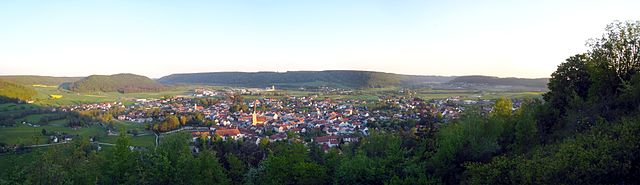
Берхинг (Berching, Berching)

 Hiking in Берхинг
Berching, located in Bavaria, Germany, is a charming town known for its medieval architecture and beautiful natural surroundings, making it an excellent destination for hiking and outdoor activities. Here are some highlights and tips for hiking in and around Berching:
Trails and Routes
-
Local Trails: Berching is situated along the Altmühl River, and there are several well-marked hiking trails that provide varying levels of difficulty. The trails often feature scenic views, historical landmarks, and opportunities to explore local flora and fauna.
-
Franconian Lake District: Just a short distance from Berching, the Franconian Lake District offers additional hiking routes. The area is known for its lakes, forests, and rolling hills, making it a great destination for both hikers and cyclists.
-
Naturpark Altmühtal: This nature park is just south of Berching and is home to numerous well-maintained trails. You can hike through natural landscapes, limestone cliffs, and charming villages. The region is particularly known for its diverse ecosystems and historical sites, including castles and ancient ruins.
Best Times to Visit
- Spring and Autumn: These seasons offer mild weather, vibrant foliage, and a pleasant atmosphere for hiking. The trails are often less crowded than in summer.
- Summer: While popular, summer can bring warmer temperatures, so early morning or late afternoon hikes might be more comfortable.
Equipment and Preparation
- Footwear: Wear sturdy hiking boots or shoes with good traction, as some trails may be uneven or rocky.
- Clothing: Dress in layers to accommodate changing weather conditions. Waterproof gear is also advisable.
- Navigation: Bring a map or a GPS device, as some trails may not have clear signage. Many trails in Germany are part of the extensive hiking network which is well-marked, but it’s always good to have a backup.
Safety Tips
- Stay Hydrated: Always carry enough water, especially on longer hikes.
- Wildlife: Be aware of local wildlife, and follow guidelines for any potential encounters.
- Emergency Plan: Let someone know your hiking plans and estimated return time, especially if you’re hiking alone.
Local Attractions
- Historic Town Center: After your hike, take time to explore Berching's old town with its well-preserved medieval buildings, city walls, and charming streets.
- Dining: Enjoy local Bavarian cuisine at one of the town's restaurants or cafes, where you can recharge after a day of hiking.
Hiking in Berching not only offers beautiful landscapes and trails but also a chance to immerse yourself in Bavarian culture and history. Whether you're an experienced hiker or a casual walker, there's something for everyone in this picturesque part of Germany.
- Страна:

- Почтовый код: 92334
- Телефонный код: 08462
- Код автомобильного номера: NM
- Координаты: 49° 6' 0" N, 11° 26' 0" E


- GPS треки (wikiloc): [Ссылка]
- Высота над уровнем моря: 385 м m
- Площадь: 131.18 кв.км
- Население: 7475
- Веб сайт: http://www.berching.eu/
- Википедия русская: wiki(ru)
- Википедия английская: wiki(en)
- Википедия национальная: wiki(de)
- Хранилище Wikidata: Wikidata: Q248062
- Катеория в википедии: [Ссылка]
- код Freebase: [/m/0f8nlk]
- код GeoNames: Альт: [2950882]
- код VIAF: Альт: [132645009]
- ID отношения в OpenStreetMap: [1028801]
- код GND: Альт: [4005573-5]
- идентификатор местоположения ArchINFORM: [3976]
- код LCNAF: Альт: [n89119186]
- место в MusicBrainz: [24e1d67a-06ee-47a3-a849-e8fda4833122]
- WOEID: [637821]
- код Historical Gazetteer: [BERIN1JN59RC]
- Bavarikon ID: [ODB_A00001771]
- код Pleiades: [118595]
- идентификатор муниципалитетов в Германии: 09373112
Граничит с регионами:
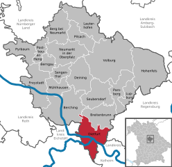
Дитфурт-ан-дер-Альтмюль
Hiking in Дитфурт-ан-дер-Альтмюль
Dietfurt, a charming town located in the Upper Palatinate region of Bavaria, Germany, offers some scenic hiking opportunities that cater to various skill levels. The area is characterized by beautiful landscapes, including rolling hills, forests, and meandering rivers, making it an excellent destination for nature lovers and hiking enthusiasts....
- Страна:
- Почтовый код: 92345
- Телефонный код: 08464
- Код автомобильного номера: NM
- Координаты: 49° 2' 0" N, 11° 35' 0" E
- GPS треки (wikiloc): [Ссылка]
- Высота над уровнем моря: 365 м m
- Площадь: 78.71 кв.км
- Население: 5257
- Веб сайт: [Ссылка]

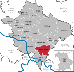
Брайтенбрунн
Hiking in Брайтенбрунн
Breitenbrunn, located in the Upper Palatinate region of Bavaria, Germany, is a lovely area for hiking enthusiasts. The landscape here features a mix of rolling hills, lush forests, and picturesque villages, making it an inviting destination for outdoor activities....
- Страна:
- Почтовый код: 92363
- Телефонный код: 09495
- Код автомобильного номера: NM
- Координаты: 49° 5' 1" N, 11° 37' 20" E
- GPS треки (wikiloc): [Ссылка]
- Высота над уровнем моря: 401 м m
- Площадь: 70.78 кв.км
- Население: 2965
- Веб сайт: [Ссылка]