
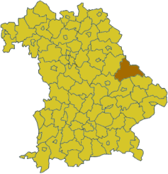
Верхний Пфальц (Upper Palatinate, Oberpfalz)


- административный округ Баварии
 Hiking in Верхний Пфальц
The Upper Palatinate (Oberpfalz) region in Bavaria, Germany, is known for its scenic landscapes, picturesque villages, and rich cultural heritage, making it an excellent destination for hiking enthusiasts. Here are some highlights and tips for hiking in the Upper Palatinate:
Scenic Landscapes
- Bavarian Forest National Park: This is one of the main attractions for hikers in the region. With its dense forests, diverse wildlife, and well-marked trails, the park offers a range of hiking options, from easy walks to challenging hikes.
- Fichtel Mountains: Located in the northern part of the Upper Palatinate, this mountain range features rugged terrain and striking rock formations, ideal for those looking for a more adventurous hike.
Trails and Routes
- Premium Hiking Trails: The region boasts several certified premium hiking trails, such as the “Goldsteig” trail which stretches over 660 kilometers. It offers varying landscapes, from flat farmland to challenging mountain terrain.
- Theme Trails: Explore various theme-based trails like the "Forest Experience Trail" or "Cultural Heritage Trails," which provide insight into the local environment and history.
Local Flora and Fauna
The Upper Palatinate is rich in biodiversity. Hikers may encounter a variety of plant species, beautiful wildflowers, and wildlife, including deer, boars, and many bird species. Spring and early summer are especially lovely for wildflower viewing.
Tips for Hiking in Upper Palatinate
- Proper Gear: Ensure you have suitable hiking boots, weather-appropriate clothing, and a good backpack with water and snacks.
- Stay on Marked Trails: To preserve the natural landscape and for your safety, always stick to marked hiking trails.
- Check the Weather: Mountain weather can change rapidly. Be prepared for sudden changes and check the forecast before heading out.
- Local Regulations: Be aware of any local rules regarding wildlife and vegetation, and always practice Leave No Trace principles.
- Guided Tours: If you're unfamiliar with the area, consider joining a guided hike. Local guides can help you discover hidden gems and provide insights into the region’s history and ecology.
Accommodations and Facilities
Many villages in the Upper Palatinate offer cozy guesthouses, hotels, and camping options. It's advisable to book accommodations in advance, especially during peak hiking seasons in spring and fall.
With its stunning natural beauty and a variety of trails to explore, the Upper Palatinate is a hiker's paradise waiting to be discovered. Enjoy your hiking adventure!
- Страна:

- Столица: Регенсбург
- Координаты: 49° 18' 0" N, 12° 12' 0" E


- GPS треки (wikiloc): [Ссылка]
- Высота над уровнем моря: 628 м m
- Площадь: 9691.03 кв.км
- Население: 1098378
- Веб сайт: http://www.bezirk-oberpfalz.de/
- Википедия русская: wiki(ru)
- Википедия английская: wiki(en)
- Википедия национальная: wiki(de)
- Хранилище Wikidata: Wikidata: Q10555
- Катеория в википедии: [Ссылка]
- Карты в википедии: [Ссылка]
- код GeoNames: Альт: [2859444]
- код BNF: [11985925j]
- код VIAF: Альт: [267383615]
- ID отношения в OpenStreetMap: [17596]
- код GND: Альт: [4042961-1]
- код LCNAF: Альт: [n82024314]
- код в энциклопедии «Британника онлайн»: [place/Oberpfalz]
- код ISNI: Альт: [0000 0004 1791 2321]
- код NUTS: [DE23]
- идентификатор Ringgold: [377601]
- код GAMEO: [Upper Palatinate (Freistaat Bayern, Germany)]
- код региона Германии: 093
Включает регионы:
Тиршенройт
- район Баварии
Hiking in Тиршенройт
Tirschenreuth is a district in Bavaria, Germany, known for its picturesque landscapes, forests, and numerous hiking trails. If you're planning to hike in this district, here's what you need to know:...
- Страна:
- Столица: Тиршенройт
- Код автомобильного номера: TIR; KEM
- Координаты: 49° 54' 0" N, 12° 12' 0" E
- GPS треки (wikiloc): [Ссылка]
- Высота над уровнем моря: 499 м m
- Площадь: 1085.08 кв.км
- Население: 77865
- Веб сайт: [Ссылка]

Нойштадт-на-Вальднабе
- район Баварии
Hiking in Нойштадт-на-Вальднабе
Neustadt an der Waldnaab, located in the Upper Palatinate region of Bavaria, Germany, is known for its picturesque scenery and natural beauty, making it an excellent destination for hiking enthusiasts. Here are some highlights and insights into hiking in this area:...
- Страна:
- Столица: Нойштадт-на-Вальднабе
- Код автомобильного номера: VOH; NEW; ESB
- Координаты: 49° 40' 12" N, 12° 0' 0" E
- GPS треки (wikiloc): [Ссылка]
- Высота над уровнем моря: 450 м m
- Площадь: 1430.00 кв.км
- Население: 94486
- Веб сайт: [Ссылка]
Амберг-Зульцбах
- район Баварии
Hiking in Амберг-Зульцбах
Amberg-Sulzbach, located in Bavaria, Germany, is a picturesque district known for its beautiful landscapes, rich culture, and numerous outdoor activities, including hiking. The area offers a variety of hiking trails that cater to different skill levels, from easy walks suitable for families to more challenging paths for experienced hikers....
- Страна:
- Столица: Амберг
- Код автомобильного номера: SUL; NAB; ESB; BUL; AS
- Координаты: 49° 30' 0" N, 11° 45' 0" E
- GPS треки (wikiloc): [Ссылка]
- Высота над уровнем моря: 380 м m
- Площадь: 1255.00 кв.км
- Население: 94617
- Веб сайт: [Ссылка]

Швандорф
- район Баварии
Hiking in Швандорф
Schwandorf district, located in Bavaria, Germany, is a great area for hiking enthusiasts looking for scenic routes and beautiful landscapes. The region is characterized by rolling hills, forests, and rivers, providing a mix of terrain that caters to various hiking levels....
- Страна:
- Столица: Швандорф
- Код автомобильного номера: SAD; ROD; OVI; NEN; NAB; BUL
- Координаты: 49° 22' 12" N, 12° 15' 0" E
- GPS треки (wikiloc): [Ссылка]
- Высота над уровнем моря: 465 м m
- Площадь: 1472.88 кв.км
- Население: 131260
- Веб сайт: [Ссылка]
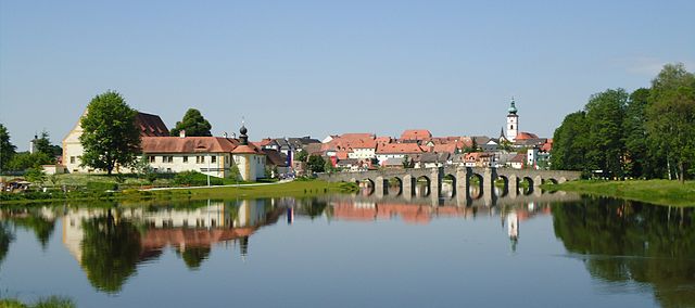
Кам
- район Баварии
Hiking in Кам
Cham District, located in the state of Bavaria, Germany, offers a variety of hiking opportunities amid beautiful landscapes, including forests, meadows, and rolling hills. Here are some highlights and tips for hiking in this area:...
- Страна:
- Столица: Кам
- Код автомобильного номера: WÜM; ROD; KÖZ; CHA
- Координаты: 49° 15' 0" N, 12° 40' 12" E
- GPS треки (wikiloc): [Ссылка]
- Высота над уровнем моря: 469 м m
- Площадь: 1510.00 кв.км
- Население: 121401
- Веб сайт: [Ссылка]

Ноймаркт-Верхний-Пфальц
- район Баварии
Hiking in Ноймаркт-Верхний-Пфальц
Neumarkt in der Oberpfalz, a district in Bavaria, Germany, is known for its picturesque landscapes and varied hiking opportunities. Set against a backdrop of rolling hills, lush forests, and charming villages, this area is ideal for both casual walkers and seasoned hikers....
- Страна:
- Столица: Ноймаркт
- Код автомобильного номера: PAR; NM
- Координаты: 49° 15' 0" N, 11° 30' 0" E
- GPS треки (wikiloc): [Ссылка]
- Высота над уровнем моря: 445 м m
- Площадь: 1344.00 кв.км
- Население: 105346
- Веб сайт: [Ссылка]

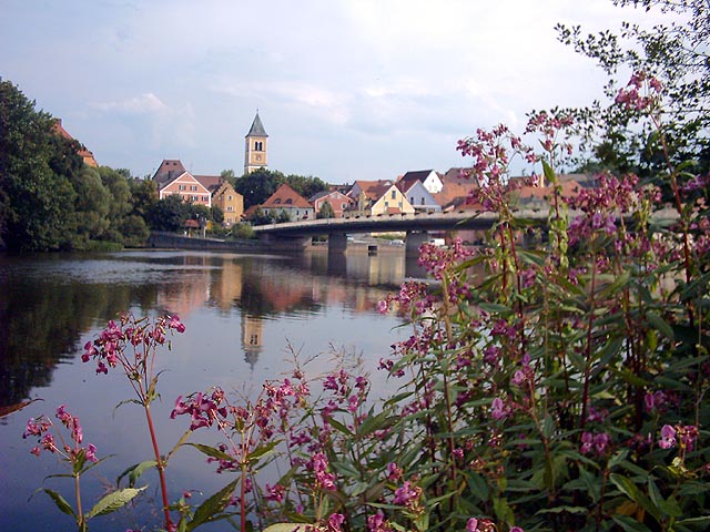
Регенсбург
- район Баварии
Hiking in Регенсбург
Regensburg is located in the state of Bavaria, Germany, and it offers a variety of hiking opportunities that showcase the region's natural beauty and historical significance. Here's what you can expect when hiking in and around the Regensburg district:...
- Страна:
- Столица: Регенсбург
- Код автомобильного номера: R
- Координаты: 49° 4' 48" N, 12° 10' 12" E
- GPS треки (wikiloc): [Ссылка]
- Высота над уровнем моря: 390 м m
- Площадь: 1396.00 кв.км
- Население: 144278
- Веб сайт: [Ссылка]

Вайден
Hiking in Вайден
Weiden in der Oberpfalz, located in Bavaria, Germany, is surrounded by beautiful landscapes that offer a variety of hiking opportunities. The region's natural beauty includes forests, hills, valleys, and rivers, making it a great destination for outdoor enthusiasts....
- Страна:
- Почтовый код: 92637
- Телефонный код: 0961
- Код автомобильного номера: WEN
- Координаты: 49° 40' 0" N, 12° 9' 0" E
- GPS треки (wikiloc): [Ссылка]
- Высота над уровнем моря: 397 м m
- Площадь: 70.57 кв.км
- Население: 42543
- Веб сайт: [Ссылка]
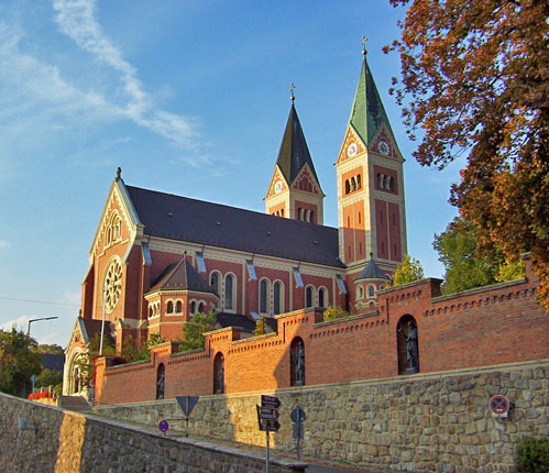
Регенсбург
- город в Германии
Hiking in Регенсбург
Regensburg, located in Bavaria, Germany, offers a variety of hiking opportunities, particularly due to its picturesque landscapes along the Danube River and the surrounding countryside. Here are some highlights and tips for hiking in and around Regensburg:...
- Страна:
- Почтовый код: 93057; 93055; 93053; 93051; 93049; 93047
- Телефонный код: 941
- Код автомобильного номера: R
- Координаты: 49° 1' 0" N, 12° 5' 0" E
- GPS треки (wikiloc): [Ссылка]
- Высота над уровнем моря: 343 м m
- Площадь: 80.85 кв.км
- Население: 150894
- Веб сайт: [Ссылка]

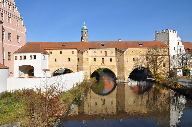
Амберг
- город в Германии
Hiking in Амберг
Amberg, located in Bavaria, Germany, offers picturesque landscapes ideal for hiking enthusiasts. The region is marked by its beautiful forests, rolling hills, and historical landmarks, making it a serene spot for both casual walkers and dedicated hikers....
- Почтовый код: 92224
- Телефонный код: 09621
- Код автомобильного номера: AM
- Координаты: 49° 26' 40" N, 11° 50' 54" E
- GPS треки (wikiloc): [Ссылка]
- Высота над уровнем моря: 374 м m
- Площадь: 5007 кв.км
- Население: 42248
- Веб сайт: [Ссылка]
Граничит с регионами:


Средняя Франкония
- административный округ Баварии
Hiking in Средняя Франкония
Middle Franconia, located in Bavaria, Germany, is a picturesque region known for its diverse landscapes, charming villages, and rich cultural heritage. It offers a variety of hiking opportunities suitable for all levels of experience. Here are some highlights regarding hiking in this area:...
- Страна:
- Столица: Ансбах
- Координаты: 49° 18' 0" N, 10° 35' 0" E
- GPS треки (wikiloc): [Ссылка]
- Высота над уровнем моря: 401 м m
- Площадь: 7245.70 кв.км
- Население: 1750059
- Веб сайт: [Ссылка]


Верхняя Франкония
- административный округ Баварии
Hiking in Верхняя Франкония
Upper Franconia, located in northern Bavaria, Germany, is a lesser-known but stunning hiking destination characterized by its diverse landscapes, charming villages, and rich cultural heritage. Here are some highlights and tips for hiking in the region:...
- Страна:
- Столица: Байройт
- Координаты: 49° 57' 0" N, 11° 35' 0" E
- GPS треки (wikiloc): [Ссылка]
- Высота над уровнем моря: 368 м m
- Площадь: 7230.19 кв.км
- Население: 1062398
- Веб сайт: [Ссылка]


Нижняя Бавария
- административный округ в Баварии
Hiking in Нижняя Бавария
Lower Bavaria, located in the southeastern part of Germany, is a fantastic region for hiking enthusiasts, offering a diverse landscape that includes rolling hills, dense forests, rivers, and picturesque villages. Here are some highlights and tips for hiking in Lower Bavaria:...
- Страна:
- Столица: Ландсхут
- Координаты: 48° 41' 25" N, 12° 44' 52" E
- GPS треки (wikiloc): [Ссылка]
- Высота над уровнем моря: 320 м m
- Площадь: 10329.87 кв.км
- Население: 1181472
- Веб сайт: [Ссылка]


Верхняя Бавария
- административный округ в земле Бавария, Германия
Hiking in Верхняя Бавария
Upper Bavaria is a beautiful region in southern Germany, known for its stunning landscapes, charming villages, and a wealth of outdoor activities, particularly hiking. Here are some highlights and tips for hiking in Upper Bavaria:...
- Страна:
- Столица: Мюнхен
- Координаты: 48° 8' 0" N, 11° 34' 0" E
- GPS треки (wikiloc): [Ссылка]
- Высота над уровнем моря: 647 м m
- Площадь: 17529.63 кв.км
- Население: 4588944
- Веб сайт: [Ссылка]