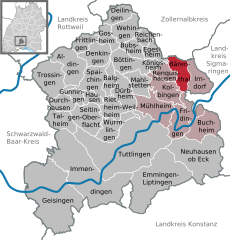
Бойрон (Beuron, Beuron)

 Hiking in Бойрон
Beuron is a picturesque village located in the Swabian Jura region of Germany, renowned for its stunning natural landscapes, rich history, and opportunities for hiking. Nestled along the banks of the Danube River, Beuron serves as an excellent starting point for various hiking trails that cater to different skill levels. Here are some key points about hiking in Beuron:
Scenic Trails
-
Danube Valley Trails: Many hiking routes wind along the Danube, offering beautiful views of the river and surrounding hills. These trails often include rolling hills, wooded areas, and riverbank paths.
-
Swabian Jura Trails: The Swabian Jura is known for its unique karst formations, caves, and diverse flora and fauna. More challenging hikes will lead you into the heart of the Jura, allowing you to explore its rugged terrain.
-
Beuron Abbey Circular Walk: A popular moderate hike that takes you around the historic Beuron Abbey, showcasing both natural beauty and cultural significance. The abbey itself is picturesque and worth a visit.
Difficulty Levels
- Easy Trails: Suitable for families and beginners, these often follow flat paths and scenic routes.
- Moderate Trails: These may involve some elevation gain and are ideal for those with a bit more hiking experience.
- Challenging Routes: For seasoned hikers, there are trails that include steep ascents and rugged terrain, offering a more intense experience.
Nature and Wildlife
Beuron is rich in biodiversity. As you hike, you may encounter various wildlife and plant species, including local flora unique to the Swabian Jura.
Tips for Hiking in Beuron
- Trail Maps: Before you go, pick up a map or use a reliable hiking app to help navigate.
- Weather Preparedness: Be mindful of weather changes, as conditions can vary significantly. Dress in layers and be prepared for rain.
- Hydration and Snacks: Always carry enough water and some snacks, especially on longer hikes.
- Local Insights: Consider engaging with local hiking groups or guides; they can offer valuable insights and enhance your experience with local knowledge.
Hiking in Beuron provides a perfect blend of breathtaking natural beauty and an opportunity to explore the cultural heritage of the area. Whether you're looking for a relaxing stroll or a challenging trek, there's something for every outdoor enthusiast.
- Страна:

- Почтовый код: 88631
- Телефонный код: 07579
- Код автомобильного номера: SIG
- Координаты: 48° 3' 0" N, 8° 58' 0" E


- GPS треки (wikiloc): [Ссылка]
- Высота над уровнем моря: 609 м m
- Площадь: 35.1 кв.км
- Население: 642
- Веб сайт: http://www.beuron.de/
- Википедия русская: wiki(ru)
- Википедия английская: wiki(en)
- Википедия национальная: wiki(de)
- Хранилище Wikidata: Wikidata: Q81075
- Катеория в википедии: [Ссылка]
- код Freebase: [/m/02q0328]
- код GeoNames: Альт: [2949551]
- код BNF: [11987821c]
- код VIAF: Альт: [144397829]
- ID отношения в OpenStreetMap: [2805752]
- код GND: Альт: [4006275-2]
- идентификатор местоположения ArchINFORM: [8541]
- место в MusicBrainz: [6414af44-e0f6-4fca-9a3f-60e0fe95c878]
- WOEID: [638619]
- код ISNI: Альт: [0000 0000 9755 8377]
- идентификатор Ringgold: [210425]
- идентификатор муниципалитетов в Германии: 08437005
Граничит с регионами:

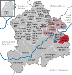
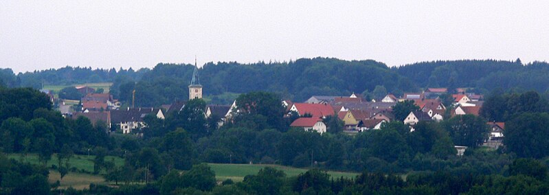
Бухгайм
Hiking in Бухгайм
Buchheim is a picturesque region located in Germany, known for its beautiful landscapes and serene hiking trails. While it's not as widely known as some larger hiking destinations, it offers various opportunities for outdoor enthusiasts to explore nature....
- Страна:
- Почтовый код: 78567; 88637
- Телефонный код: 07777
- Код автомобильного номера: TUT
- Координаты: 48° 0' 37" N, 8° 59' 12" E
- GPS треки (wikiloc): [Ссылка]
- Высота над уровнем моря: 793 м m
- Площадь: 18.3 кв.км
- Население: 667
- Веб сайт: [Ссылка]


Фридинген-на-Дунае
Hiking in Фридинген-на-Дунае
Fridingen is a picturesque town located in the Swabian Jura of Germany, along the banks of the Danube River. It's known for its stunning landscapes, making it an excellent destination for hiking enthusiasts. Here are some key aspects of hiking in and around Fridingen:...
- Страна:
- Почтовый код: 78567
- Телефонный код: 07463
- Код автомобильного номера: TUT
- Координаты: 48° 1' 14" N, 8° 55' 58" E
- GPS треки (wikiloc): [Ссылка]
- Высота над уровнем моря: 626 м m
- Площадь: 22.47 кв.км
- Население: 3122
- Веб сайт: [Ссылка]

Беренталь
Hiking in Беренталь
Bärenthal, located in the scenic region of Baden-Württemberg, Germany, offers several hiking opportunities that cater to different skill levels amidst beautiful landscapes. The area is characterized by its rolling hills, dense forests, and picturesque villages, making it a great destination for outdoor enthusiasts....
- Страна:
- Почтовый код: 78580
- Телефонный код: 07466
- Код автомобильного номера: TUT
- Координаты: 48° 4' 25" N, 8° 55' 40" E
- GPS треки (wikiloc): [Ссылка]
- Высота над уровнем моря: 778 м m
- Площадь: 12.69 кв.км
- Население: 467
- Веб сайт: [Ссылка]

Ирндорф
Hiking in Ирндорф
Irndorf is a small village located in the rural heart of Germany, known for its beautiful landscapes and serene environments that attract hikers and outdoor enthusiasts. While it may not be as well-known as larger hiking destinations, it offers a unique experience for those looking to explore the natural beauty of the region....
- Страна:
- Почтовый код: 78597
- Телефонный код: 07466
- Код автомобильного номера: TUT
- Координаты: 48° 4' 0" N, 8° 58' 0" E
- GPS треки (wikiloc): [Ссылка]
- Высота над уровнем моря: 838 м m
- Площадь: 14.56 кв.км
- Население: 689
- Веб сайт: [Ссылка]

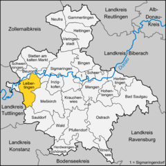
Лайбертинген
Hiking in Лайбертинген
Leibertingen is a quaint village located in the picturesque region of Baden-Württemberg, Germany. It is surrounded by beautiful landscapes that make it a great destination for hiking enthusiasts. Here are some highlights of hiking in and around Leibertingen:...
- Страна:
- Почтовый код: 88637
- Телефонный код: 07466
- Код автомобильного номера: SIG
- Координаты: 48° 2' 33" N, 9° 0' 47" E
- GPS треки (wikiloc): [Ссылка]
- Высота над уровнем моря: 797 м m
- Площадь: 47.20 кв.км
- Население: 2103
- Веб сайт: [Ссылка]


Штеттен-ам-Кальтен-Маркт
Hiking in Штеттен-ам-Кальтен-Маркт
Stetten am kalten Markt is a picturesque village located in the Swabian Jura region of Germany, which is known for its beautiful landscapes, dense forests, and variety of trails. Here are some key points to consider when hiking in and around Stetten am kalten Markt:...
- Страна:
- Почтовый код: 72510
- Телефонный код: 07573
- Код автомобильного номера: SIG
- Координаты: 48° 7' 23" N, 9° 4' 40" E
- GPS треки (wikiloc): [Ссылка]
- Высота над уровнем моря: 768 м m
- Площадь: 56.47 кв.км
- Население: 4818
- Веб сайт: [Ссылка]


Швеннинген
Hiking in Швеннинген
Schwenningen, located near Sigmaringen in Baden-Württemberg, Germany, is an excellent area for hiking enthusiasts. The region is known for its picturesque landscapes, varied terrain, and rich natural beauty, making it a great destination for both novice and experienced hikers....
- Страна:
- Почтовый код: 72477
- Телефонный код: 07579
- Код автомобильного номера: SIG
- Координаты: 48° 6' 16" N, 8° 59' 55" E
- GPS треки (wikiloc): [Ссылка]
- Высота над уровнем моря: 870 м m
- Площадь: 19.34 кв.км
- Население: 1595
- Веб сайт: [Ссылка]
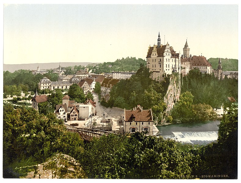

Зигмаринген
- город в земле Баден-Вюртемберг (Германия)
Hiking in Зигмаринген
Sigmaringen, located in the Baden-Württemberg region of Germany, offers a beautiful setting for hiking enthusiasts. The area is characterized by its picturesque landscapes, including rolling hills, dense forests, and the banks of the Danube River. Here are some highlights and tips for hiking in the Sigmaringen area:...
- Страна:
- Почтовый код: 72488
- Телефонный код: 07531
- Код автомобильного номера: SIG
- Координаты: 48° 5' 12" N, 9° 12' 59" E
- GPS треки (wikiloc): [Ссылка]
- Высота над уровнем моря: 584 м m
- Площадь: 92.84 кв.км
- Население: 15756
- Веб сайт: [Ссылка]