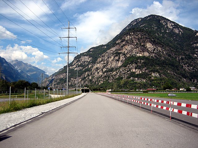
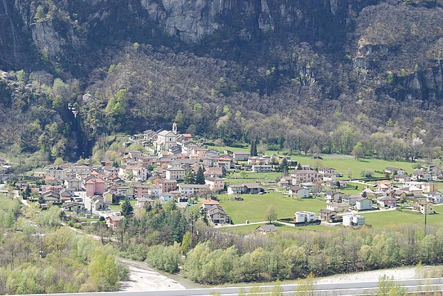
Biasca (Biasca)

 Hiking in Biasca
Biasca is a charming municipality located in the canton of Ticino, Switzerland, known for its stunning landscapes and rich natural beauty, making it an excellent destination for hiking enthusiasts. Here are some key points about hiking in and around Biasca:
Trails and Routes
-
Valle di Piottino: This is a popular area for hiking, offering trails that lead to scenic views of waterfalls, forests, and valleys. The paths can vary in difficulty, making it suitable for both beginners and experienced hikers.
-
San Pioo Trail: A lovely hike that can take you to the church of San Pioo. It’s a shorter trek but offers rewarding views and is perfect for families or those looking for a leisurely hike.
-
Aquila Waterfall: This is another hiking destination where you can experience the region's natural beauty. The trail leading to the waterfall provides a picturesque journey through lush landscapes.
-
Ritom Lake: While a bit further afield, the hike to Ritom Lake is well worth it for the panoramic views and the pristine lake waters.
-
Sentiero dell’Acqua: This “Water Trail” tells the story of the region's water sources and is a gentle, informative hike suitable for families.
Landscape
-
Scenic Views: The area around Biasca features a mix of mountainous terrain, lush forests, and charming valleys. The views can be breathtaking, especially if you venture to a higher elevation.
-
Flora and Fauna: Hikers can encounter diverse flora, including alpine flowers and various wildlife, making it a great location for nature lovers.
Weather and Best Time to Hike
- Climate: The best time for hiking in Biasca is typically from late spring to early autumn (May to October) when the weather is most stable. Be mindful of sudden changes in weather, especially in mountainous areas.
Preparation and Safety
-
Gear: Wear comfortable hiking boots, dress in layers, and carry enough water and snacks. A map or GPS device is also recommended, as some trails may not be well marked.
-
Trail Difficulty: Ensure to choose a trail appropriate for your skill level and physical condition. There are trails of varying difficulty, but it’s always best to start with easier ones if you are unfamiliar with the area.
Local Tips
-
Guided Tours: If you're unsure about the trails, consider joining a guided hike. Local guides can provide insight into the area’s flora, fauna, and history.
-
Transportation: Biasca is accessible by train, making it convenient for hikers coming from other parts of Switzerland.
In summary, Biasca offers a beautiful environment for hiking, with trails that cater to various skill levels while providing an opportunity to experience the natural beauty of the Swiss landscape. Enjoy your hiking adventures!
- Страна:

- Почтовый код: 6710
- Телефонный код: 091
- Код автомобильного номера: TI
- Координаты: 46° 21' 0" N, 8° 58' 0" E


- GPS треки (wikiloc): [Ссылка]
- Высота над уровнем моря: 305 м m
- Площадь: 59 кв.км
- Население: 6126
- Веб сайт: http://www.biasca.ch
- Википедия английская: wiki(en)
- Википедия национальная: wiki(de)
- Хранилище Wikidata: Wikidata: Q67523
- Катеория в википедии: [Ссылка]
- код Freebase: [/m/0gx018]
- код GeoNames: Альт: [2661524]
- код VIAF: Альт: [132597241]
- ID отношения в OpenStreetMap: [1684627]
- код GND: Альт: [4006404-9]
- идентификатор местоположения ArchINFORM: [1590]
- код LCNAF: Альт: [n85279695]
- идентификатор HDS: [2248]
- код швейцарского муниципалитета: [5281]
Граничит с регионами:


Кауко
Hiking in Кауко
Cauco, a beautiful and less-traveled area, offers a variety of hiking experiences characterized by stunning landscapes, diverse ecosystems, and rich cultural experiences. While specific trails can vary based on the exact location within Cauco, I can provide general information that may help you plan your hiking adventure in this region....
- Страна:
- Почтовый код: 6546
- Телефонный код: 091
- Код автомобильного номера: GR
- Координаты: 46° 20' 7" N, 9° 7' 15" E
- GPS треки (wikiloc): [Ссылка]
- Высота над уровнем моря: 1057 м m
- Площадь: 10.89 кв.км
- Веб сайт: [Ссылка]


Росса
Hiking in Росса
Rossa, located in the beautiful canton of Graubünden, is a charming village that offers a range of hiking opportunities amidst stunning alpine scenery. Here are some key points to consider if you're planning to hike in Rossa:...
- Страна:
- Почтовый код: 6548
- Телефонный код: 091
- Код автомобильного номера: GR
- Координаты: 46° 23' 17" N, 9° 7' 36" E
- GPS треки (wikiloc): [Ссылка]
- Высота над уровнем моря: 1194 м m
- Площадь: 58.88 кв.км
- Население: 152
- Веб сайт: [Ссылка]


Osogna
Hiking in Osogna
Osogna is a charming village located in the Ticino canton of Switzerland, known for its stunning natural landscapes, rich history, and proximity to various hiking trails. It's a great starting point for exploring the beautiful surrounding areas, including the scenic Ticino region. Here are some highlights of hiking in and around Osogna:...
- Страна:
- Почтовый код: 6703
- Телефонный код: 091
- Код автомобильного номера: TI
- Координаты: 46° 19' 34" N, 9° 1' 16" E
- GPS треки (wikiloc): [Ссылка]
- Высота над уровнем моря: 1196 м m
- Площадь: 18.97 кв.км
- Веб сайт: [Ссылка]

Iragna
Hiking in Iragna
Iragna is a charming village located in the canton of Ticino, Switzerland. It is well-known for its beautiful natural surroundings, making it a great destination for hiking enthusiasts. Here are some highlights and aspects of hiking in Iragna:...
- Страна:
- Почтовый код: 6707
- Телефонный код: 091
- Код автомобильного номера: TI
- Координаты: 46° 19' 29" N, 8° 56' 22" E
- GPS треки (wikiloc): [Ссылка]
- Высота над уровнем моря: 1168 м m
- Площадь: 18.32 кв.км
- Веб сайт: [Ссылка]


Pollegio
Hiking in Pollegio
Pollegio is a small municipality located in the Italian region of Lombardy, within the province of Como. While it may not be as widely recognized as some of the larger tourist destinations in Lombardy, it offers several opportunities for hiking and enjoying the natural beauty of the area....
- Страна:
- Почтовый код: 6742
- Телефонный код: 091
- Код автомобильного номера: TI
- Координаты: 46° 21' 0" N, 8° 56' 0" E
- GPS треки (wikiloc): [Ссылка]
- Высота над уровнем моря: 298 м m
- Площадь: 5.9 кв.км
- Население: 757
- Веб сайт: [Ссылка]

Lodrino
Hiking in Lodrino
Lodrino, located in the Italian-speaking region of Ticino, Switzerland, offers a variety of hiking opportunities set against a backdrop of stunning natural beauty. Nestled in the foothills of the Alps, the area features picturesque landscapes, charming villages, and diverse ecosystems....
- Страна:
- Почтовый код: 6527
- Телефонный код: 091
- Код автомобильного номера: TI
- Координаты: 46° 17' 18" N, 8° 56' 58" E
- GPS треки (wikiloc): [Ссылка]
- Высота над уровнем моря: 849 м m
- Площадь: 31.6 кв.км
Personico
Hiking in Personico
Personico is a charming village located in the southern part of Switzerland, in the canton of Ticino. This area is known for its stunning landscapes, rich biodiversity, and well-maintained hiking trails, making it a great destination for outdoor enthusiasts....
- Страна:
- Почтовый код: 6744
- Телефонный код: 091 864
- Код автомобильного номера: TI
- Координаты: 46° 22' 0" N, 8° 55' 0" E
- GPS треки (wikiloc): [Ссылка]
- Высота над уровнем моря: 325 м m
- Площадь: 39.1 кв.км
- Население: 344
- Веб сайт: [Ссылка]