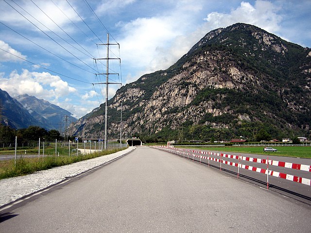
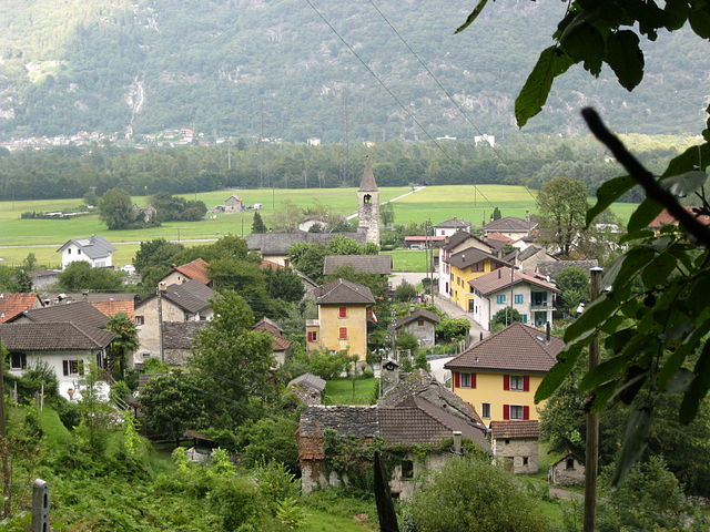
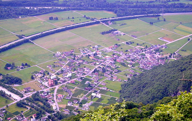
Lodrino (Lodrino TI)

 Hiking in Lodrino
Lodrino, located in the Italian-speaking region of Ticino, Switzerland, offers a variety of hiking opportunities set against a backdrop of stunning natural beauty. Nestled in the foothills of the Alps, the area features picturesque landscapes, charming villages, and diverse ecosystems.
Hiking Trails
-
Sentiero del Sole: This is a part of the long-distance trail that runs through the region. It offers breathtaking views of the surrounding mountains and valleys, making it a fantastic choice for day hikes.
-
Monte Tamaro: A bit further afield, this mountain offers numerous trails with varying difficulty levels. You can hike up to the summit for spectacular panoramic views or take easier trails that still showcase the stunning scenery.
-
Valle di Blenio: This valley features numerous hiking trails that range from easy to difficult, providing options for all skill levels. You can explore lush forests, alpine meadows, and picturesque villages along the way.
-
Panorama Trail: Various trails offer panoramic views of both the mountains and Lake Lugano. These trails are well-marked and cater to different levels, ensuring that hikers of all ages can enjoy the experience.
Tips for Hiking in Lodrino
- Weather: Always check the weather before heading out. Conditions can change quickly in the mountains.
- Gear: Wear appropriate hiking shoes and clothing. Layering is important to adjust to varying temperatures throughout the day.
- Maps and Signage: Many trails are well-marked, but bringing a map or GPS device is always a good idea.
- Local Regulations: Respect local wildlife and stay on marked trails. This helps preserve the natural beauty of the area.
- Hydration and Nutrition: Carry enough water and snacks for your hike, especially if you're planning to spend several hours on the trails.
Best Time to Visit
The best seasons for hiking in Lodrino are late spring through early autumn (May to October), when weather conditions are generally more favorable. Early fall can also be beautiful, with colorful foliage and clear skies.
Lodrino and its surrounding areas offer diverse hiking experiences for nature lovers and adventurers alike. Enjoy your hikes and the stunning scenery that Ticino has to offer!
- Страна:

- Почтовый код: 6527
- Телефонный код: 091
- Код автомобильного номера: TI
- Координаты: 46° 17' 18" N, 8° 56' 58" E


- GPS треки (wikiloc): [Ссылка]
- Высота над уровнем моря: 849 м m
- Площадь: 31.6 кв.км
- Википедия английская: wiki(en)
- Википедия национальная: wiki(de)
- Хранилище Wikidata: Wikidata: Q67752
- Катеория в википедии: [Ссылка]
- код Freebase: [/m/0gx09h]
- код GeoNames: Альт: [7286362]
- код VIAF: Альт: [155218462]
- ID отношения в OpenStreetMap: [1684698]
- код GND: Альт: [4319311-0]
- идентификатор HDS: [2252]
- код швейцарского муниципалитета: [5285]
Граничит с регионами:


Osogna
Hiking in Osogna
Osogna is a charming village located in the Ticino canton of Switzerland, known for its stunning natural landscapes, rich history, and proximity to various hiking trails. It's a great starting point for exploring the beautiful surrounding areas, including the scenic Ticino region. Here are some highlights of hiking in and around Osogna:...
- Страна:
- Почтовый код: 6703
- Телефонный код: 091
- Код автомобильного номера: TI
- Координаты: 46° 19' 34" N, 9° 1' 16" E
- GPS треки (wikiloc): [Ссылка]
- Высота над уровнем моря: 1196 м m
- Площадь: 18.97 кв.км
- Веб сайт: [Ссылка]


Biasca
Hiking in Biasca
Biasca is a charming municipality located in the canton of Ticino, Switzerland, known for its stunning landscapes and rich natural beauty, making it an excellent destination for hiking enthusiasts. Here are some key points about hiking in and around Biasca:...
- Страна:
- Почтовый код: 6710
- Телефонный код: 091
- Код автомобильного номера: TI
- Координаты: 46° 21' 0" N, 8° 58' 0" E
- GPS треки (wikiloc): [Ссылка]
- Высота над уровнем моря: 305 м m
- Площадь: 59 кв.км
- Население: 6126
- Веб сайт: [Ссылка]

Iragna
Hiking in Iragna
Iragna is a charming village located in the canton of Ticino, Switzerland. It is well-known for its beautiful natural surroundings, making it a great destination for hiking enthusiasts. Here are some highlights and aspects of hiking in Iragna:...
- Страна:
- Почтовый код: 6707
- Телефонный код: 091
- Код автомобильного номера: TI
- Координаты: 46° 19' 29" N, 8° 56' 22" E
- GPS треки (wikiloc): [Ссылка]
- Высота над уровнем моря: 1168 м m
- Площадь: 18.32 кв.км
- Веб сайт: [Ссылка]
Moleno
Hiking in Moleno
Moleno is a small village located in the picturesque region of the Val di Frapporta, in the province of Pavia, Italy. The area is known for its stunning natural landscapes, lush forests, and beautiful mountains, making it a fantastic destination for hiking enthusiasts....
- Страна:
- Почтовый код: 6524
- Телефонный код: 091
- Код автомобильного номера: TI
- Координаты: 46° 16' 6" N, 8° 59' 51" E
- GPS треки (wikiloc): [Ссылка]
- Высота над уровнем моря: 1156 м m
- Площадь: 7.49 кв.км


Lavertezzo
Hiking in Lavertezzo
Lavertezzo, located in the Val Verzasca region of Ticino, Switzerland, is a beautiful hiking destination known for its stunning natural landscapes, distinctive granite formations, and clear turquoise waters. Here are some highlights and tips for hiking in the area:...
- Страна:
- Почтовый код: 6633
- Телефонный код: 091
- Код автомобильного номера: TI
- Координаты: 46° 15' 35" N, 8° 50' 28" E
- GPS треки (wikiloc): [Ссылка]
- Высота над уровнем моря: 1087 м m
- Площадь: 58.1 кв.км
- Население: 1329
- Веб сайт: [Ссылка]
Preonzo
Hiking in Preonzo
Preonzo is a picturesque village located in the region of Ticino in southern Switzerland, nestled in the valley of the River Brenno. It's a fantastic area for hiking enthusiasts, offering a range of trails that cater to different skill levels. Here are some highlights and tips for hiking in Preonzo:...
- Страна:
- Почтовый код: 6523
- Телефонный код: 091
- Код автомобильного номера: TI
- Координаты: 46° 16' 0" N, 9° 0' 0" E
- GPS треки (wikiloc): [Ссылка]
- Высота над уровнем моря: 250 м m
- Площадь: 16.44 кв.км