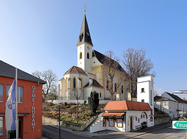
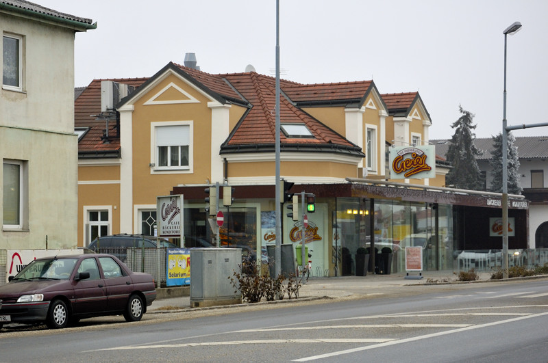
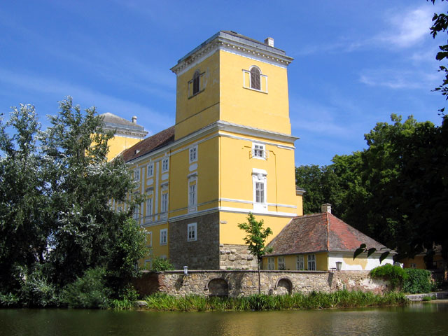
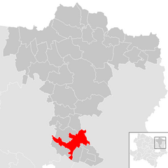
Бокфлис (Bockfließ, Bockfließ)
 Hiking in Бокфлис
Bockfließ is a charming village located in the Lower Austria region of Austria, known for its picturesque landscapes and tranquil environment, making it a great destination for hiking enthusiasts. While it may not be as widely known as some of Austria’s more mountainous areas, it offers several opportunities for nature lovers to explore the surrounding countryside.
Hiking Trails:
-
Local Trails: The region around Bockfließ features a variety of local trails that wind through forests, fields, and along rivers. Many of these paths are suitable for all skill levels, and they offer beautiful views of the countryside.
-
Surrounding Nature Areas: You can also explore nearby natural parks and reserves. These areas often have well-marked trails that range from easy walks to more challenging hikes.
-
Themed Trails: Some trails may focus on specific themes, such as the local flora and fauna, historical significance, or scenic viewpoints. Check local resources for maps and information.
Preparation:
- Seasonal Considerations: The best time to hike in this region is typically in late spring through early autumn when the weather is pleasant. However, always check the weather forecast and trail conditions before heading out.
- Equipment: Wear comfortable, supportive hiking shoes, and consider bringing trekking poles, especially for uneven terrain. A daypack with water, snacks, and a map is advisable.
Safety Tips:
- Stay on Marked Trails: To protect the environment and ensure your safety, stick to marked paths.
- Inform Someone: Always let a friend or family member know your hiking plans and estimated return time.
- Wildlife Awareness: Be respectful of local wildlife and maintain a safe distance if you encounter any animals.
Additional Activities:
Bockfließ and its surroundings may also offer other outdoor activities like cycling and birdwatching, making it a comprehensive outdoor destination. If you enjoy exploring local culture, look for nearby towns or villages where you can sample local cuisine or learn about the area's history.
Before your trip, consider checking with local tourist information for current trail maps, guided walks, or any special events that might be happening during your visit. Happy hiking!
- Страна:

- Почтовый код: 2213
- Телефонный код: 02288
- Код автомобильного номера: MI
- Координаты: 48° 21' 0" N, 16° 36' 0" E


- GPS треки (wikiloc): [Ссылка]
- Высота над уровнем моря: 168 м m
- Площадь: 22.87 кв.км
- Население: 1348
- Веб сайт: http://www.bockfliess.com/
- Википедия русская: wiki(ru)
- Википедия английская: wiki(en)
- Википедия национальная: wiki(de)
- Хранилище Wikidata: Wikidata: Q669550
- Катеория в википедии: [Ссылка]
- код Freebase: [/m/02qyg66]
- код GeoNames: Альт: [2781658]
- код VIAF: Альт: [168789464]
- код GND: Альт: [4451233-8]
- идентификатор местоположения ArchINFORM: [11154]
- код LCNAF: Альт: [n79035006]
- код австрийского муниципалитета: [31605]
Граничит с регионами:

Дойч-Ваграм
- город в Австрии
Hiking in Дойч-Ваграм
Deutsch-Wagram is a charming town located in Lower Austria, just northeast of Vienna. While it may not be as widely known for hiking as some of the larger national parks or mountainous regions in Austria, there are still opportunities for hiking and enjoying the natural surroundings....
- Страна:
- Почтовый код: 2232
- Телефонный код: 02247
- Код автомобильного номера: GF
- Координаты: 48° 17' 58" N, 16° 33' 52" E
- GPS треки (wikiloc): [Ссылка]
- Высота над уровнем моря: 159 м m
- Площадь: 30.61 кв.км
- Население: 8651
- Веб сайт: [Ссылка]
Ауэрсталь
Hiking in Ауэрсталь
Auersthal, located in Lower Austria, offers a quaint setting for outdoor enthusiasts who enjoy hiking. The region is nestled amidst beautiful landscapes, featuring rolling hills, vineyards, and picturesque views that are characteristic of the broader area....
- Страна:
- Почтовый код: 2214
- Телефонный код: 02288
- Код автомобильного номера: GF
- Координаты: 48° 22' 27" N, 16° 38' 10" E
- GPS треки (wikiloc): [Ссылка]
- Высота над уровнем моря: 178 м m
- Площадь: 15.18 кв.км
- Население: 1932
- Веб сайт: [Ссылка]

Пилликсдорф
Hiking in Пилликсдорф
Pillichsdorf is a small town located in Austria, nestled in the northeastern part of the country. While it may not be as widely known for hiking as some of the larger national parks or mountain areas in Austria, it offers some scenic trails and opportunities for outdoor enthusiasts to explore the beautiful countryside....
- Страна:
- Почтовый код: 2211
- Телефонный код: 02245
- Код автомобильного номера: MI
- Координаты: 48° 21' 47" N, 16° 32' 18" E
- GPS треки (wikiloc): [Ссылка]
- Высота над уровнем моря: 167 м m
- Площадь: 14.33 кв.км
- Население: 1157
- Веб сайт: [Ссылка]

Грос-Энгерсдорф
Hiking in Грос-Энгерсдорф
Groß-Engersdorf, located in Lower Austria, near the borders of Vienna, offers several hiking opportunities that cater to different skill levels and preferences. Here are some highlights about hiking in and around this area:...
- Страна:
- Почтовый код: 2212
- Телефонный код: 02245
- Код автомобильного номера: MI
- Координаты: 48° 21' 0" N, 16° 34' 0" E
- GPS треки (wikiloc): [Ссылка]
- Высота над уровнем моря: 164 м m
- Площадь: 15.57 кв.км
- Население: 1478
- Веб сайт: [Ссылка]
Штрасхоф-ан-дер-Нордбан
Hiking in Штрасхоф-ан-дер-Нордбан
Strasshof an der Nordbahn is a small town located north of Vienna, Austria, and while it may not be as famous as other hiking destinations, there is still potential for enjoyable outdoor activities in the surrounding areas....
- Страна:
- Почтовый код: 2231
- Телефонный код: 02587
- Код автомобильного номера: GF
- Координаты: 48° 19' 10" N, 16° 38' 51" E
- GPS треки (wikiloc): [Ссылка]
- Высота над уровнем моря: 165 м m
- Площадь: 11.63 кв.км
- Население: 10009
- Веб сайт: [Ссылка]
Волькерсдорф-им-Вайнфиртель
Hiking in Волькерсдорф-им-Вайнфиртель
Wolkersdorf im Weinviertel, located in the Lower Austria region, offers several charming hiking opportunities that showcase the beautiful landscapes of the Weinviertel wine region. Here are some key highlights and tips for hiking in this area:...
- Страна:
- Почтовый код: 2120
- Телефонный код: 02245
- Код автомобильного номера: MI
- Координаты: 48° 22' 0" N, 16° 31' 0" E
- GPS треки (wikiloc): [Ссылка]
- Высота над уровнем моря: 178 м m
- Площадь: 44.38 кв.км
- Население: 7201
- Веб сайт: [Ссылка]