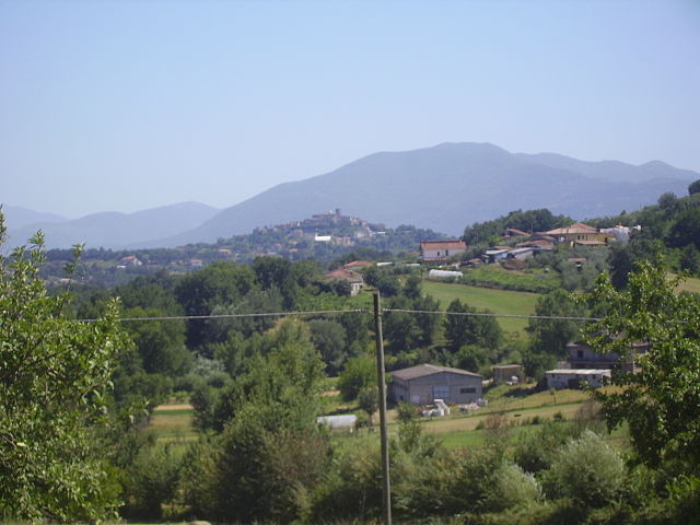
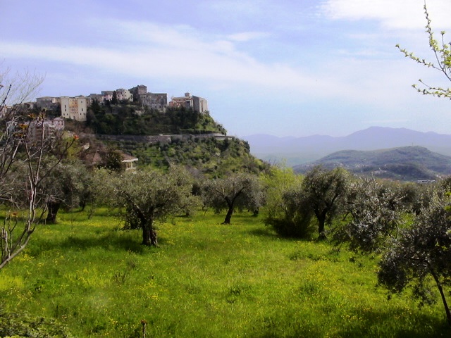
Бовилле-Эрника (Boville Ernica, Boville Ernica)
.svg)
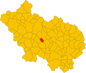
- коммуна Италии
 Hiking in Бовилле-Эрника
Boville Ernica is a charming town located in the province of Frosinone in the Lazio region of Italy. Nestled in the foothills of the Abruzzo Apennines, it offers not only historical sites but also a variety of outdoor activities, including hiking. Here are some highlights you might consider when hiking in and around Boville Ernica:
Scenic Trails
-
Sentiero della Valle di Comino: This trail offers beautiful views of the surrounding valleys and is suitable for different skill levels. The path winds through forests and open spaces, showcasing the area's natural beauty.
-
Monti Ernici: The nearby Monti Ernici range provides numerous trails that vary in difficulty. Here, you can explore more challenging hikes that lead to higher altitudes, offering stunning panoramas of the area.
-
Natural Reserves: Look out for the nearby nature reserves, such as the Valle dell'Inferno, which has well-marked hiking trails. These areas often feature diverse flora and fauna, making for a pleasant hiking experience.
Historical Sites
While hiking, you may encounter various historical landmarks:
- The Roman Aqueducts: Along some trails, you might come across remnants of ancient aqueducts, which provide a historical context to your hike.
- Castles and Churches: The region is dotted with historical churches and ruins that you can visit along the way, adding cultural depth to your hiking experience.
Best Time to Hike
- Spring and Fall: These seasons are ideal for hiking, as the weather is generally mild and the landscapes are particularly beautiful with blooming flowers or changing foliage.
- Summer: While summer hiking is feasible, it can get hot, so be sure to start early in the morning to avoid peak temperatures.
Preparation
- Gear: Wear suitable hiking boots and bring plenty of water, snacks, and sun protection. Always carry a map or a GPS device for navigation.
- Local Guidance: If you’re unfamiliar with the area, consider hiring a local guide or joining a hiking group to enhance your experience and ensure safety.
Local Amenities
After a day of hiking, you can enjoy the local cuisine at one of Boville Ernica's trattorias, trying out traditional dishes that the region is known for.
Conclusion
Boville Ernica offers hikers a delightful blend of nature, history, and Italian culture. Whether you're seeking a leisurely stroll through picturesque landscapes or a more challenging trek in the mountains, you'll find plenty of options to explore in this beautiful region. Enjoy your hiking adventure!
- Страна:

- Почтовый код: 03022
- Телефонный код: 0775
- Код автомобильного номера: FR
- Координаты: 41° 38' 33" N, 13° 28' 26" E


- GPS треки (wikiloc): [Ссылка]
- Высота над уровнем моря: 450 м m
- Площадь: 28.19 кв.км
- Население: 8525
- Веб сайт: http://www.boville.it/
- Википедия русская: wiki(ru)
- Википедия английская: wiki(en)
- Википедия национальная: wiki(it)
- Хранилище Wikidata: Wikidata: Q116552
- Катеория в википедии: [Ссылка]
- код Freebase: [/m/0fd4ml]
- код GeoNames: Альт: [6541143]
- код VIAF: Альт: [145864991]
- ID отношения в OpenStreetMap: [41425]
- WOEID: [711349]
- код Цифрового атласа Римской империи: [36728]
- код Pleiades: [998907993]
- код ISTAT: 060014
- кадастровый код Италии: A720
Граничит с регионами:


Монте-Сан-Джованни-Кампано
- коммуна Италии
Hiking in Монте-Сан-Джованни-Кампано
Monte San Giovanni Campano is a charming town located in the province of Frosinone, in the Lazio region of Italy. It is set in a picturesque landscape characterized by rolling hills, lush vegetation, and historical sites. Hiking in and around Monte San Giovanni Campano can provide an excellent opportunity for both nature lovers and those interested in exploring the historical backdrop of the region....
- Страна:
- Почтовый код: 03025
- Телефонный код: 0775
- Код автомобильного номера: FR
- Координаты: 41° 38' 0" N, 13° 31' 0" E
- GPS треки (wikiloc): [Ссылка]
- Высота над уровнем моря: 420 м m
- Площадь: 48.71 кв.км
- Население: 12706
- Веб сайт: [Ссылка]

Рипи
- коммуна Италии
Hiking in Рипи
Ripi is a small town located in the province of Frosinone in the Lazio region of Italy. While it may not be as famous for hiking as some larger areas or national parks, there are opportunities for outdoor enthusiasts to explore the beautiful landscapes and trails in and around the region....
- Страна:
- Почтовый код: 03027
- Телефонный код: 0775
- Код автомобильного номера: FR
- Координаты: 41° 37' 0" N, 13° 26' 0" E
- GPS треки (wikiloc): [Ссылка]
- Высота над уровнем моря: 300 м m
- Площадь: 31.61 кв.км
- Население: 5249
- Веб сайт: [Ссылка]

Странголагалли
- коммуна Италии
Hiking in Странголагалли
Strangolagalli is a charming locality nestled in the province of Frosinone in the Lazio region of Italy. While it may not be as well-known as some of Italy's larger hiking destinations, it offers serene landscapes and opportunities to explore the natural beauty of the area....
- Страна:
- Почтовый код: 03020
- Телефонный код: 0775
- Код автомобильного номера: FR
- Координаты: 41° 36' 0" N, 13° 29' 32" E
- GPS треки (wikiloc): [Ссылка]
- Высота над уровнем моря: 232 м m
- Площадь: 10.57 кв.км
- Население: 2414
- Веб сайт: [Ссылка]
Торриче
- коммуна Италии
Hiking in Торриче
Torrice, a charming town in Italy, may not be widely known for hiking compared to more prominent regions, but it is nestled in the beautiful province of Frosinone in Lazio, making it a great starting point for exploring the surrounding natural landscapes....
- Страна:
- Почтовый код: 03020
- Телефонный код: 0775
- Код автомобильного номера: FR
- Координаты: 41° 38' 0" N, 13° 24' 0" E
- GPS треки (wikiloc): [Ссылка]
- Высота над уровнем моря: 321 м m
- Площадь: 18.06 кв.км
- Население: 4843
- Веб сайт: [Ссылка]

Вероли
- коммуна Италии
Hiking in Вероли
Veroli, a charming town situated in the province of Frosinone in the Lazio region of Italy, offers excellent opportunities for hiking enthusiasts. Nestled in the beautiful hills of the Ciociaria area, Veroli boasts stunning landscapes, rich history, and a variety of trails suitable for different experience levels....
- Страна:
- Почтовый код: 03029
- Телефонный код: 0775
- Код автомобильного номера: FR
- Координаты: 41° 41' 0" N, 13° 25' 0" E
- GPS треки (wikiloc): [Ссылка]
- Высота над уровнем моря: 594 м m
- Площадь: 119.65 кв.км
- Население: 20414
- Веб сайт: [Ссылка]