Bréry (Bréry)

- коммуна во Франции
 Hiking in Bréry
Bréry is not a widely recognized hiking destination, so there might be some confusion regarding its specific location. However, if you're referring to a region or area with that name, it's best to consider general hiking tips and recommendations that apply to most hiking locations.
If there is a specific trail, mountain, or region named Bréry, please provide further details, and I can give more tailored information.
General Hiking Tips
-
Research Trails: Look for maps and information on local trails. Websites like AllTrails and local hiking forums can provide valuable insights.
-
Prepare for Weather: Check the weather forecast before you head out. Dress in layers and pack rain gear if necessary.
-
Pack Essentials: Always carry water, snacks, a first aid kit, navigation tools (like a GPS or map), and emergency supplies.
-
Know Your Limits: Choose trails that match your fitness level and experience. It's okay to start with easier trails and gradually work up to more challenging hikes.
-
Leave No Trace: Respect the environment by packing out what you bring in and staying on designated trails.
-
Stay Safe: Inform someone about your hiking plans and expected return time. Hike with a buddy if possible.
-
Wildlife Awareness: Familiarize yourself with any wildlife in the area, including what to do if you encounter animals like bears or snakes.
If Bréry does have specific trails, landmarks, or features of interest, any additional details will help provide more focused advice!
- Страна:

- Почтовый код: 39230
- Координаты: 46° 47' 2" N, 5° 34' 45" E


- GPS треки (wikiloc): [Ссылка]
- Площадь: 4.85 кв.км
- Население: 229
- Википедия английская: wiki(en)
- Википедия национальная: wiki(fr)
- Хранилище Wikidata: Wikidata: Q540392
- Катеория в википедии: [Ссылка]
- код Freebase: [/m/03nnz6h]
- код Freebase: [/m/03nnz6h]
- код GeoNames: Альт: [6448805]
- код GeoNames: Альт: [6448805]
- номер SIREN: [213900756]
- номер SIREN: [213900756]
- код муниципалитета INSEE: 39075
- код муниципалитета INSEE: 39075
Граничит с регионами:


Mantry
- коммуна во Франции
Hiking in Mantry
Hiking in Mantry can be a wonderful experience, as it offers a variety of trails and natural beauty. However, please note that "Mantry" may refer to different locations depending on the context. If you mean a specific region or trail system, it would be helpful to clarify that....
- Страна:
- Почтовый код: 39230
- Координаты: 46° 47' 47" N, 5° 33' 33" E
- GPS треки (wikiloc): [Ссылка]
- Площадь: 10.83 кв.км
- Население: 443
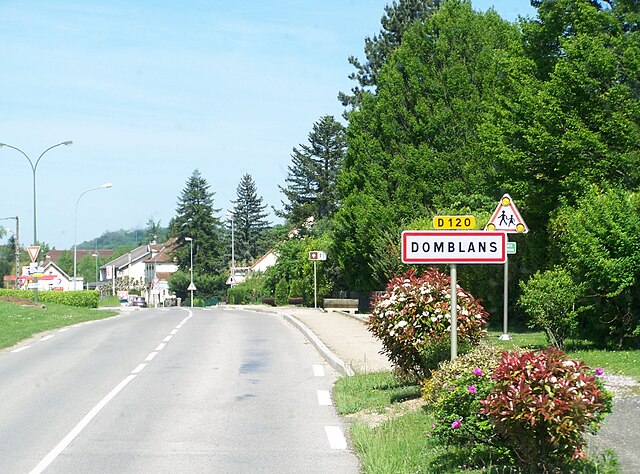

Domblans
- коммуна во Франции
Hiking in Domblans
Domblans, a charming village located in the Jura region of France, offers beautiful landscapes and scenic hiking opportunities. Its proximity to the Jura mountains ensures a variety of hiking trails suitable for different skill levels, from leisurely walks to more challenging hikes....
- Страна:
- Почтовый код: 39210
- Координаты: 46° 45' 50" N, 5° 35' 50" E
- GPS треки (wikiloc): [Ссылка]
- Площадь: 10.01 кв.км
- Население: 963
- Веб сайт: [Ссылка]


Saint-Lamain
- коммуна во Франции
Hiking in Saint-Lamain
Saint-Lamain is a charming destination for hiking enthusiasts, offering picturesque landscapes and a variety of trails suitable for all levels of hikers. While it's not one of the most well-known hiking spots, it can be a hidden gem for those who seek tranquil nature experiences....
- Страна:
- Почтовый код: 39230
- Координаты: 46° 47' 44" N, 5° 36' 9" E
- GPS треки (wikiloc): [Ссылка]
- Площадь: 4.16 кв.км
- Население: 117


Saint-Germain-lès-Arlay
- коммуна во Франции
Hiking in Saint-Germain-lès-Arlay
Saint-Germain-lès-Arlay is a charming village located in the Jura region of France, known for its natural beauty and proximity to various hiking trails. This area offers a mix of gentle walks and more challenging routes, making it suitable for hikers of all skill levels....
- Страна:
- Почтовый код: 39210
- Координаты: 46° 45' 36" N, 5° 33' 37" E
- GPS треки (wikiloc): [Ссылка]
- Площадь: 6.08 кв.км
- Население: 469
- Веб сайт: [Ссылка]


Фронтене
- коммуна во Франции
Hiking in Фронтене
Frontenay, located in France's Nouvelle-Aquitaine region, is not widely recognized for hiking specifically, but the surrounding areas and landscapes offer beautiful opportunities for outdoor activities, including hiking. Here are some insights on hiking in and around Frontenay:...
- Страна:
- Почтовый код: 39210
- Координаты: 46° 47' 8" N, 5° 36' 51" E
- GPS треки (wikiloc): [Ссылка]
- Площадь: 8.13 кв.км
- Население: 178