
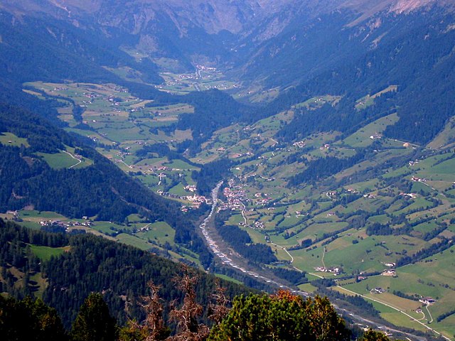
Бреннеро (Brenner, Brennero)
.svg)
- коммуна Италии
 Hiking in Бреннеро
Brenner, located in South Tyrol, Italy, is a beautiful area for hiking, characterized by its stunning alpine landscapes, diverse flora and fauna, and well-marked trails suitable for all levels of hikers. Here are some key highlights about hiking in Brenner:
Scenic Trails
- Panoramic Views: The Brenner Pass area offers breathtaking views of the surrounding mountains, including the nearby Dolomites, making it a haven for nature lovers and photographers.
- Variety of Trails: There are numerous trails ranging from easy walks to challenging climbs, catering to different skill levels. The trails often wind through forests, meadows, and alpine pastures.
Popular Hiking Routes
- Wipptal Valley: This valley features many trails along the rivers and through picturesque villages. Hikes here often lead to scenic viewpoints and local attractions.
- Pfunderer Höhenweg: A stunning high-altitude trail that provides fantastic views of the surrounding peaks and can be accessed from several starting points in the region.
- Jaufen Pass: This area includes trails that offer historical insights, including old military routes and fortifications from World War I.
Flora and Fauna
The South Tyrol region is rich in biodiversity, featuring unique alpine plants and wildlife. Keep an eye out for ibex, chamois, and many bird species while hiking.
Practical Considerations
- Season: The best hiking season is typically from late spring to early autumn (May to October), with summer being the most popular time to explore.
- Weather: Weather can change rapidly in the mountains, so it's essential to check forecasts and prepare for varying conditions.
- Equipment: Good hiking shoes, weather-appropriate clothing, water, and snacks are essential. Depending on the trail, trekking poles might also be beneficial.
Getting There
Brenner is accessible by public transportation and car, making it a convenient starting point for many hiking adventures. The area is well-connected to other parts of South Tyrol, and you can find local transport options like buses that can take you to various trailheads.
Local Culture
While hiking, don’t miss the chance to experience the local culture, including traditional Tyrolean cuisine at huts and restaurants along the trails. It's a perfect opportunity to recharge and enjoy local specialties!
Whether you're a novice hiker or a seasoned trekker, Brenner in South Tyrol offers a rich blend of natural beauty and cultural experiences that make for an unforgettable hiking experience. Make sure to plan your hikes and check local guides for trail conditions and safety information. Happy hiking!
- Страна:

- Почтовый код: 39041
- Телефонный код: 0472
- Код автомобильного номера: BZ
- Координаты: 47° 0' 3" N, 11° 30' 14" E


- GPS треки (wikiloc): [Ссылка]
- Высота над уровнем моря: 1374 м m
- Площадь: 114.29 кв.км
- Население: 2184
- Веб сайт: http://www.comunebrennero.eu
- Википедия русская: wiki(ru)
- Википедия английская: wiki(en)
- Википедия национальная: wiki(it)
- Хранилище Wikidata: Wikidata: Q375769
- Галерея изображений в википедии: [Ссылка]
- Катеория в википедии: [Ссылка]
- код Freebase: [/m/0g9fxj]
- код GeoNames: Альт: [6536007]
- код VIAF: Альт: [304912650]
- ID отношения в OpenStreetMap: [47337]
- код GND: Альт: [4997784-2]
- идентификатор местоположения ArchINFORM: [44815]
- код ISTAT: 021010
- кадастровый код Италии: B145
Граничит с регионами:
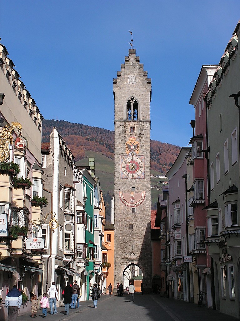

Випитено
- коммуна в Италии
Hiking in Випитено
Sterzing, or Vipiteno, is a charming town located in the South Tyrol region of Italy, surrounded by the stunning Dolomite mountains. It’s an excellent base for hiking enthusiasts due to its breathtaking scenery and diverse trail options. Here’s a rundown of what you can expect when hiking in Sterzing:...
- Страна:
- Почтовый код: 39049
- Телефонный код: 0472
- Код автомобильного номера: BZ
- Координаты: 46° 53' 35" N, 11° 25' 47" E
- GPS треки (wikiloc): [Ссылка]
- Высота над уровнем моря: 2714 м m
- Площадь: 32.97 кв.км
- Население: 6956
- Веб сайт: [Ссылка]

Рачинес
- коммуна в Италии
Hiking in Рачинес
Ratschings, located in the South Tyrol region of northern Italy, is a fantastic destination for hiking enthusiasts. The area is known for its stunning alpine scenery, diverse trails, and a variety of outdoor activities. Here are some highlights of hiking in Ratschings:...
- Страна:
- Почтовый код: 39040
- Телефонный код: 0472
- Код автомобильного номера: BZ
- Координаты: 46° 52' 0" N, 11° 18' 0" E
- GPS треки (wikiloc): [Ссылка]
- Высота над уровнем моря: 976 м m
- Площадь: 203.29 кв.км
- Население: 4471
- Веб сайт: [Ссылка]


Валь-ди-Вицце
- коммуна в Италии
Hiking in Валь-ди-Вицце
Pfitsch is a beautiful valley located in South Tyrol, Italy, known for its stunning landscapes, charming villages, and excellent hiking opportunities. The area is part of the larger Stubai Valley and offers a variety of trails suitable for different skill levels, from gentle walks to challenging hikes....
- Страна:
- Почтовый код: 39040
- Телефонный код: 0472
- Код автомобильного номера: BZ
- Координаты: 46° 54' 0" N, 11° 28' 0" E
- GPS треки (wikiloc): [Ссылка]
- Высота над уровнем моря: 948 м m
- Площадь: 142.12 кв.км
- Население: 3071
- Веб сайт: [Ссылка]

Нойштифт
Hiking in Нойштифт
Neustift im Stubaital is a beautiful alpine village located in the Tyrol region of Austria, and it serves as an excellent base for hiking enthusiasts. Nestled in the Stubai Valley, this area is known for its stunning mountain scenery, rich flora and fauna, and a wide range of hiking trails suitable for various skill levels. Here’s an overview of what you can expect when hiking in Neustift im Stubaital:...
- Страна:

- Почтовый код: 6167
- Телефонный код: 05226
- Код автомобильного номера: IL
- Координаты: 47° 6' 37" N, 11° 18' 21" E
- GPS треки (wikiloc): [Ссылка]
- Высота над уровнем моря: 994 м m
- Площадь: 248.99 кв.км
- Население: 4747
- Веб сайт: [Ссылка]


Грис-на-Бреннере
Hiking in Грис-на-Бреннере
Gries am Brenner is a picturesque village located in the Austrian Alps, offering a variety of hiking opportunities for outdoor enthusiasts. Nestled at an elevation of about 1,000 meters, it serves as a great starting point for various hiking trails suitable for different skill levels....
- Страна:
- Почтовый код: 6156
- Телефонный код: 05274
- Код автомобильного номера: IL
- Координаты: 47° 2' 0" N, 11° 28' 0" E
- GPS треки (wikiloc): [Ссылка]
- Высота над уровнем моря: 1165 м m
- Площадь: 55.8 кв.км
- Население: 1361
- Веб сайт: [Ссылка]


Гшниц
Hiking in Гшниц
Gschnitz is a picturesque village located in the Tyrol region of Austria, nestled in the beautiful Stubai Valley. The area is known for its stunning natural scenery, making it a popular destination for hiking enthusiasts. Here are some highlights and tips for hiking in Gschnitz:...
- Страна:
- Почтовый код: 6150
- Телефонный код: 05276
- Код автомобильного номера: IL
- Координаты: 47° 2' 39" N, 11° 20' 58" E
- GPS треки (wikiloc): [Ссылка]
- Высота над уровнем моря: 1242 м m
- Площадь: 59.1 кв.км
- Население: 434
- Веб сайт: [Ссылка]

Обернберг-на-Бреннере
Hiking in Обернберг-на-Бреннере
Obernberg am Brenner is a scenic destination located in the Tyrol region of Austria, close to the Italian border. It offers a variety of hiking opportunities suitable for different skill levels, making it an excellent choice for both beginners and experienced hikers....
- Страна:
- Почтовый код: 6157
- Телефонный код: 05274
- Код автомобильного номера: IL
- Координаты: 47° 0' 59" N, 11° 25' 10" E
- GPS треки (wikiloc): [Ссылка]
- Высота над уровнем моря: 1380 м m
- Площадь: 38.66 кв.км
- Население: 363
- Веб сайт: [Ссылка]