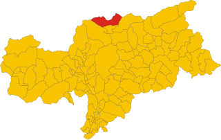
Валь-ди-Вицце (Pfitsch, Val di Vizze)
.svg)
- коммуна в Италии
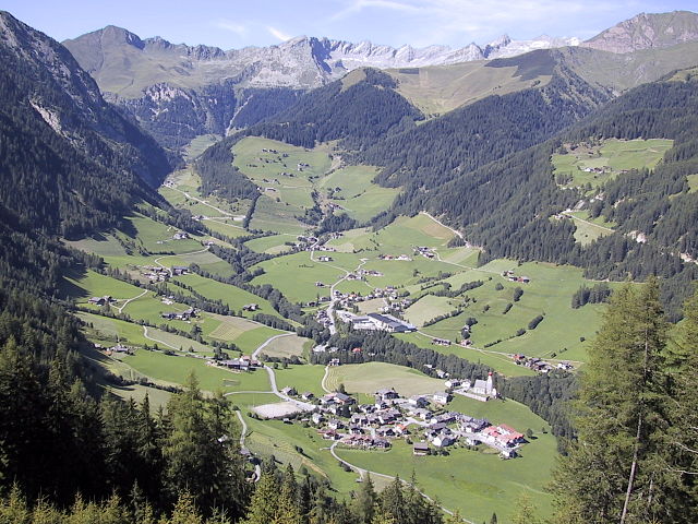
 Hiking in Валь-ди-Вицце
Pfitsch is a beautiful valley located in South Tyrol, Italy, known for its stunning landscapes, charming villages, and excellent hiking opportunities. The area is part of the larger Stubai Valley and offers a variety of trails suitable for different skill levels, from gentle walks to challenging hikes.
Key Highlights for Hiking in Pfitsch:
-
Scenic Trails: Pfitsch is surrounded by impressive mountain ranges, including the Zillertal Alps. You'll find trails that lead to breathtaking viewpoints, alpine meadows, and pristine lakes. Popular routes include paths that follow the Pfitscherbach river, leading to picturesque spots.
-
Difficulty Levels: There are hikes suitable for all levels, from easy walks perfect for families to more strenuous trails for experienced hikers. Be sure to check the trail maps for difficulty ratings and plan accordingly.
-
Wildlife and Flora: As you hike, keep an eye out for local wildlife and diverse plant species. The region is rich in biodiversity, and you may encounter various birds, deer, and alpine flowers, especially during the spring and summer months.
-
Seasonal Hiking: The best seasons for hiking in Pfitsch are late spring through early autumn. Winter can provide opportunities for snowshoe hiking or winter walking, but be prepared for cold weather and ensure you're equipped for snowy conditions.
-
Cultural Aspects: Hiking in Pfitsch also offers a cultural experience, as you pass by traditional villages and historic sites. Consider stopping for a break at a local hut to enjoy regional dishes, such as speck and cheese, or a hearty alpine meal.
-
Guided Tours: If you’re new to the area or want to make the most of your experience, consider joining a guided hiking tour. Local guides can provide valuable insights into the region’s ecology, geology, and cultural history.
Practical Tips:
- Maps and Trails: Make sure to obtain up-to-date trail maps from local tourist information centers or online resources.
- Weather: Always check the weather forecast before heading out, as conditions can change rapidly in the mountains.
- Safety: Carry plenty of water, snacks, and a basic first aid kit. Let someone know your planned route and estimated return time.
- Respect Nature: Follow the Leave No Trace principles to protect the beautiful landscapes for future hikers.
Whether you're seeking adventure or a serene escape into nature, Pfitsch offers a charming hiking experience in the heart of the Alps. Enjoy your hike!
- Страна:

- Почтовый код: 39040
- Телефонный код: 0472
- Код автомобильного номера: BZ
- Координаты: 46° 54' 0" N, 11° 28' 0" E


- GPS треки (wikiloc): [Ссылка]
- Высота над уровнем моря: 948 м m
- Площадь: 142.12 кв.км
- Население: 3071
- Веб сайт: http://www.gvcc.net/system/web/default.aspx?menuonr=218264968
- Википедия русская: wiki(ru)
- Википедия английская: wiki(en)
- Википедия национальная: wiki(it)
- Хранилище Wikidata: Wikidata: Q504607
- Галерея изображений в википедии: [Ссылка]
- Катеория в википедии: [Ссылка]
- код Freebase: [/m/0g9kwd]
- код GeoNames: Альт: [3164932]
- код VIAF: Альт: [150183567]
- ID отношения в OpenStreetMap: [47336]
- код GND: Альт: [4045536-1]
- код LCNAF: Альт: [n86137270]
- код в Итальянской энциклопедии онлайн: [val-di-vizze]
- код ISTAT: 021107
- кадастровый код Италии: L564
Граничит с регионами:
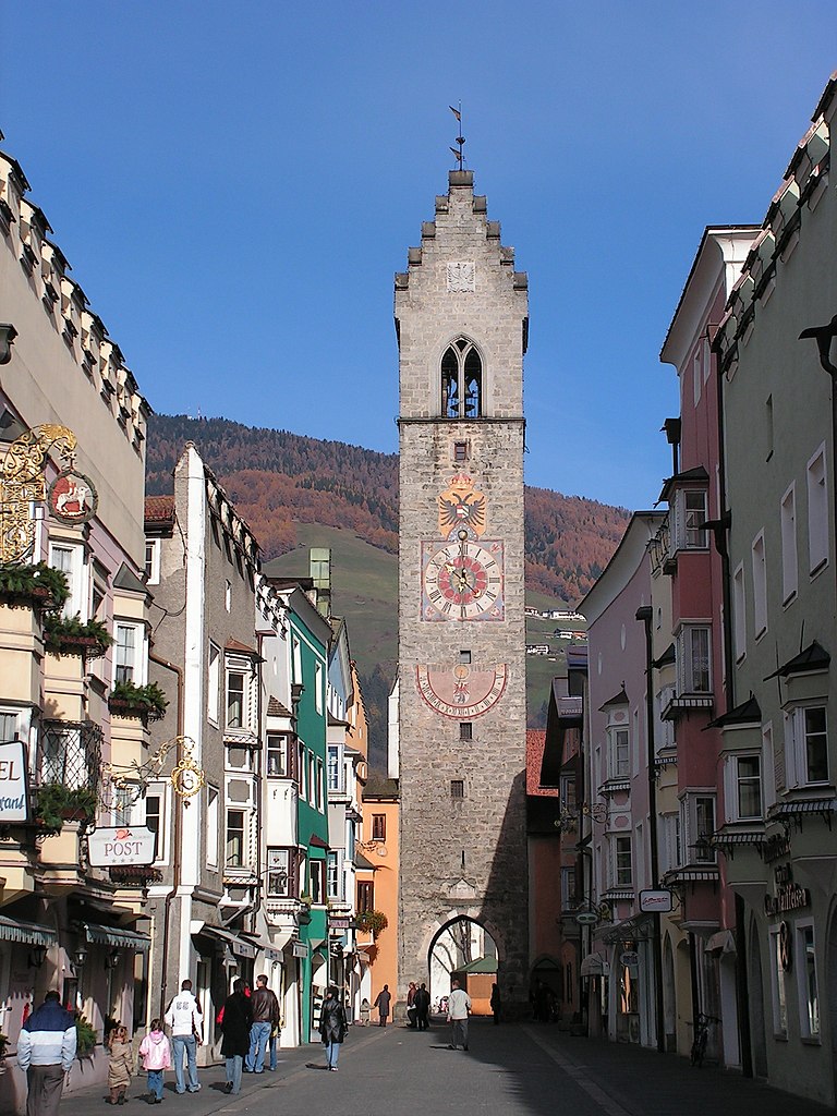

Випитено
- коммуна в Италии
Hiking in Випитено
Sterzing, or Vipiteno, is a charming town located in the South Tyrol region of Italy, surrounded by the stunning Dolomite mountains. It’s an excellent base for hiking enthusiasts due to its breathtaking scenery and diverse trail options. Here’s a rundown of what you can expect when hiking in Sterzing:...
- Страна:
- Почтовый код: 39049
- Телефонный код: 0472
- Код автомобильного номера: BZ
- Координаты: 46° 53' 35" N, 11° 25' 47" E
- GPS треки (wikiloc): [Ссылка]
- Высота над уровнем моря: 2714 м m
- Площадь: 32.97 кв.км
- Население: 6956
- Веб сайт: [Ссылка]

Вандойес
- коммуна в Италии
Hiking in Вандойес
Vintl, or Vintl in German, is a scenic village located in South Tyrol, northern Italy. It's an excellent base for hiking enthusiasts, as the surrounding area offers a variety of trails ranging from easy strolls to challenging mountain hikes....
- Страна:
- Почтовый код: 39030
- Телефонный код: 0472
- Код автомобильного номера: BZ
- Координаты: 46° 48' 54" N, 11° 43' 14" E
- GPS треки (wikiloc): [Ссылка]
- Высота над уровнем моря: 755 м m
- Площадь: 110.82 кв.км
- Население: 3336
- Веб сайт: [Ссылка]

Бреннеро
- коммуна Италии
Hiking in Бреннеро
Brenner, located in South Tyrol, Italy, is a beautiful area for hiking, characterized by its stunning alpine landscapes, diverse flora and fauna, and well-marked trails suitable for all levels of hikers. Here are some key highlights about hiking in Brenner:...
- Страна:
- Почтовый код: 39041
- Телефонный код: 0472
- Код автомобильного номера: BZ
- Координаты: 47° 0' 3" N, 11° 30' 14" E
- GPS треки (wikiloc): [Ссылка]
- Высота над уровнем моря: 1374 м m
- Площадь: 114.29 кв.км
- Население: 2184
- Веб сайт: [Ссылка]


Кампо-ди-Тренс
- коммуна Италии
Hiking in Кампо-ди-Тренс
Freienfeld, located in South Tyrol, Italy, is a beautiful area known for its stunning alpine scenery and excellent hiking opportunities. The region offers a mix of gentle walks and challenging trails, catering to hikers of all levels. Here are some highlights you can expect when hiking in Freienfeld:...
- Страна:
- Почтовый код: 39040
- Телефонный код: 0472
- Код автомобильного номера: BZ
- Координаты: 46° 52' 27" N, 11° 29' 10" E
- GPS треки (wikiloc): [Ссылка]
- Высота над уровнем моря: 937 м m
- Площадь: 95.39 кв.км
- Население: 2645
- Веб сайт: [Ссылка]


Рио-ди-Пустерия
- коммуна в Италии
Hiking in Рио-ди-Пустерия
Mühlbach, located in South Tyrol, Italy, is a charming village that serves as an excellent gateway for hiking enthusiasts. The region is characterized by stunning landscapes, picturesque mountain views, and a well-connected network of trails that cater to various hiking abilities. Here are some highlights for hiking in the Mühlbach area:...
- Страна:
- Почтовый код: 39037
- Телефонный код: 0472
- Код автомобильного номера: BZ
- Координаты: 46° 47' 48" N, 11° 40' 3" E
- GPS треки (wikiloc): [Ссылка]
- Высота над уровнем моря: 777 м m
- Площадь: 83.82 кв.км
- Население: 3081
- Веб сайт: [Ссылка]

Сельва-дей-Молини
- коммуна в Италии
Hiking in Сельва-дей-Молини
Mühlwald, located in South Tyrol, Italy, offers beautiful hiking opportunities set against a stunning backdrop of the Eastern Alps. The region is known for its lush landscapes, diverse flora and fauna, and well-marked trails that cater to various skill levels, from easy walks to challenging mountain hikes. Here are some highlights of hiking in Mühlwald:...
- Страна:
- Почтовый код: 39030
- Телефонный код: 0474
- Код автомобильного номера: BZ
- Координаты: 46° 53' 25" N, 11° 51' 30" E
- GPS треки (wikiloc): [Ссылка]
- Высота над уровнем моря: 1229 м m
- Площадь: 104.79 кв.км
- Население: 1437
- Веб сайт: [Ссылка]
Фальс
Hiking in Фальс
Vals, located in Tyrol, Austria, is a picturesque destination that offers stunning alpine landscapes, unique geological formations, and a variety of hiking trails suitable for all skill levels. Here’s what you need to know about hiking in this beautiful region:...
- Страна:

- Почтовый код: 6154
- Телефонный код: 05279
- Код автомобильного номера: IL
- Координаты: 47° 3' 45" N, 11° 30' 2" E
- GPS треки (wikiloc): [Ссылка]
- Высота над уровнем моря: 1129 м m
- Площадь: 48.7 кв.км
- Население: 532
- Веб сайт: [Ссылка]


Грис-на-Бреннере
Hiking in Грис-на-Бреннере
Gries am Brenner is a picturesque village located in the Austrian Alps, offering a variety of hiking opportunities for outdoor enthusiasts. Nestled at an elevation of about 1,000 meters, it serves as a great starting point for various hiking trails suitable for different skill levels....
- Страна:
- Почтовый код: 6156
- Телефонный код: 05274
- Код автомобильного номера: IL
- Координаты: 47° 2' 0" N, 11° 28' 0" E
- GPS треки (wikiloc): [Ссылка]
- Высота над уровнем моря: 1165 м m
- Площадь: 55.8 кв.км
- Население: 1361
- Веб сайт: [Ссылка]

Финкенберг
Hiking in Финкенберг
Finkenberg is a picturesque village located in the Zillertal Valley of Tyrol, Austria, known for its stunning alpine scenery and a variety of hiking opportunities. Here are some key points about hiking in Finkenberg:...
- Страна:
- Почтовый код: 6292
- Телефонный код: 05285
- Код автомобильного номера: SZ
- Координаты: 47° 9' 10" N, 11° 49' 18" E
- GPS треки (wikiloc): [Ссылка]
- Высота над уровнем моря: 839 м m
- Площадь: 171.6 кв.км
- Население: 1421
- Веб сайт: [Ссылка]