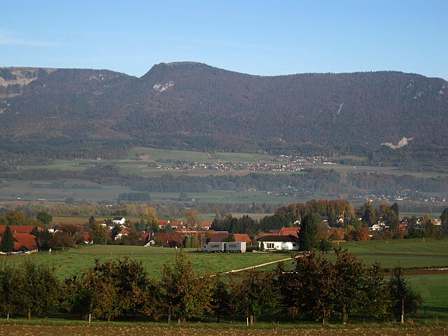
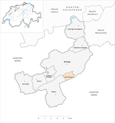
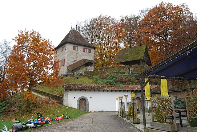
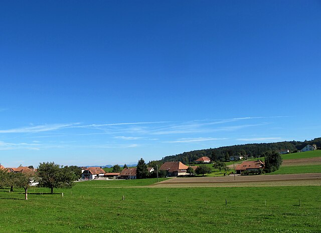
Бухегберг (Bucheggberg District, Bezirk Bucheggberg)

 Hiking in Бухегберг
Bucheggberg District, located in the canton of Solothurn in Switzerland, offers a beautiful landscape for hiking enthusiasts. This charming region is characterized by rolling hills, lovely vineyards, and picturesque villages. Here’s what you can expect when hiking in Bucheggberg:
Scenic Trails
-
Varied Terrain: The district features a mix of gentle hills and more challenging areas, suitable for all levels of hikers. You can find trails that lead through lush forests, along vineyards, and past charming rural landscapes.
-
Well-marked Paths: Hiking routes in the Bucheggberg are generally well-marked, making navigation easier for both novice and experienced hikers. Be sure to carry a local hiking map or use GPS apps to help find your way.
Highlights
-
Nature and Wildlife: The area is rich in biodiversity, providing opportunities to spot various bird species and enjoy the local flora. Certain seasons might offer wildflowers in bloom, enhancing the natural beauty.
-
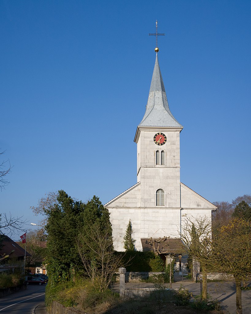
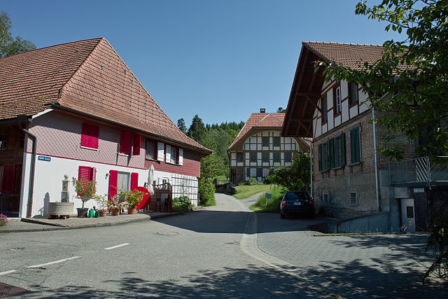
Cultural Sites: While hiking, you may encounter historical sites, including quaint churches and traditional Swiss architecture. Some trails connect small villages where you can experience local culture.
-
Panoramic Views: Higher points in the district provide breathtaking views of the surrounding landscapes, including the Aare River valley and the distant Jura Mountains, making for great photo opportunities.
Popular Hiking Routes
- Aare Trail: This trail follows the Aare River and is ideal for those looking for a leisurely hike with scenic water views.
- Vineyard Trails: Explore routes that wind through the local vineyards, perfect for wine lovers looking to understand the region’s viticulture.
Seasonal Considerations
- Spring and Autumn: These seasons are particularly beautiful for hiking due to the moderate weather and vibrant scenery.
- Summer: Expect warmer temperatures; be sure to bring plenty of water and sun protection.
- Winter: Some trails may be accessible for winter hiking or snowshoeing, but check local conditions.
Practical Tips
- Footwear: Wear sturdy hiking boots for comfort and support, especially on uneven terrain.
- Check Weather: Always check the local weather forecast before heading out, as conditions can change rapidly in the mountains.
- Sustainability: Respect the natural environment by sticking to marked paths and carrying out any litter.
Whether you are seeking a peaceful walk through the countryside or a more vigorous hike, Bucheggberg District has something to offer for everyone. Enjoy your hiking adventure!
- Страна:

- Код автомобильного номера: SO
- Координаты: 47° 8' 0" N, 7° 28' 0" E


- GPS треки (wikiloc): [Ссылка]
- Высота над уровнем моря: 616 м m
- Площадь: 62.86 кв.км
- Википедия русская: wiki(ru)
- Википедия английская: wiki(en)
- Википедия национальная: wiki(de)
- Хранилище Wikidata: Wikidata: Q660846
- Катеория в википедии: [Ссылка]
- код Freebase: [/m/0g5c7f]
- код GeoNames: Альт: [6458841]
- идентификатор местоположения ArchINFORM: [42760]
- идентификатор HDS: [7725]
Включает регионы:

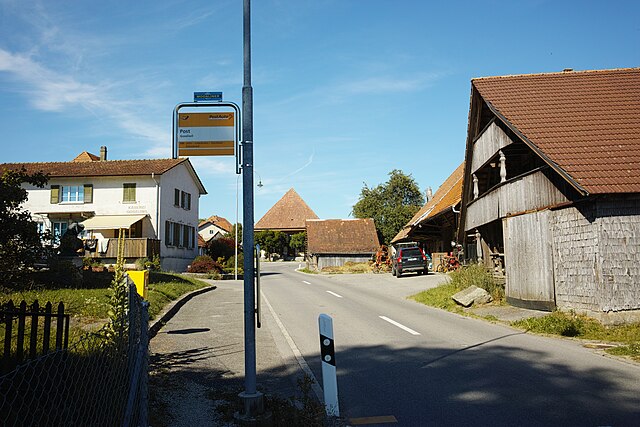
Lüsslingen-Nennigkofen
Hiking in Lüsslingen-Nennigkofen
Lüsslingen-Nennigkofen is a quaint municipality in the canton of Solothurn, Switzerland, offering picturesque landscapes and a peaceful atmosphere that makes it an excellent destination for hiking enthusiasts. Here are some highlights and tips for hiking in this area:...
- Страна:
- Почтовый код: 4574
- Телефонный код: 032
- Код автомобильного номера: SO
- Координаты: 47° 11' 25" N, 7° 30' 5" E
- GPS треки (wikiloc): [Ссылка]
- Высота над уровнем моря: 439 м m
- Площадь: 7.81 кв.км
- Население: 1057
- Веб сайт: [Ссылка]

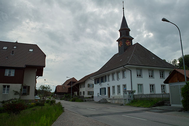
Мюледорф
Hiking in Мюледорф
Mühledorf, located in the Solothurn region of Switzerland, offers a variety of hiking opportunities that showcase the beautiful landscape and serene natural surroundings of the area. Here are some key points about hiking in and around Mühledorf:...
- Страна:
- Почтовый код: 4583
- Телефонный код: 032
- Код автомобильного номера: SO
- Координаты: 47° 8' 10" N, 7° 28' 35" E
- GPS треки (wikiloc): [Ссылка]
- Высота над уровнем моря: 557 м m
- Площадь: 3.32 кв.км
- Веб сайт: [Ссылка]


Этинген
Hiking in Этинген
Aetingen, located in Switzerland, is a charming area that offers beautiful landscapes and hiking opportunities, particularly for those looking to experience the natural beauty of the region. While it might not be as well-known as some of the larger hiking destinations in Switzerland, it provides a serene atmosphere that can be perfect for day hikes or nature walks....
- Страна:
- Почтовый код: 4587
- Телефонный код: 032
- Код автомобильного номера: SO
- Координаты: 47° 7' 59" N, 7° 30' 20" E
- GPS треки (wikiloc): [Ссылка]
- Высота над уровнем моря: 480 м m
- Площадь: 2.85 кв.км
- Население: 297
- Веб сайт: [Ссылка]


Шнотвиль
Hiking in Шнотвиль
Schnottwil, located in the canton of Lucerne in Switzerland, offers a range of scenic hiking opportunities for outdoor enthusiasts. The area is characterized by beautiful landscapes, lush forests, and serene countryside views. Here are some highlights and tips for hiking in and around Schnottwil:...
- Страна:
- Почтовый код: 3253
- Телефонный код: 032
- Код автомобильного номера: SO
- Координаты: 47° 6' 32" N, 7° 23' 28" E
- GPS треки (wikiloc): [Ссылка]
- Высота над уровнем моря: 511 м m
- Площадь: 7.16 кв.км
- Население: 1123
- Веб сайт: [Ссылка]


Кюттигофен
Hiking in Кюттигофен
Küttigkofen is a small village located in Switzerland, and while it may not be as widely recognized as some of the larger hiking destinations, it offers scenic beauty and access to various hiking trails. Hiking in this region can provide a unique experience, as it typically features picturesque landscapes, rolling hills, and a peaceful environment....
- Страна:
- Почтовый код: 4581
- Телефонный код: 032
- Код автомобильного номера: SO
- Координаты: 47° 9' 9" N, 7° 31' 0" E
- GPS треки (wikiloc): [Ссылка]
- Высота над уровнем моря: 481 м m
- Площадь: 2.17 кв.км
- Веб сайт: [Ссылка]

Брюглен
Hiking in Брюглен
Brügglen is a beautiful area in the Swiss region of the canton of Aargau, known for its scenic landscapes and outdoor recreational opportunities. While specific hiking trails in Brügglen may not be widely documented, the broader region offers a variety of trails that cater to different skill levels....
- Страна:
- Почтовый код: 4582
- Телефонный код: 032
- Код автомобильного номера: SO
- Координаты: 47° 8' 39" N, 7° 29' 50" E
- GPS треки (wikiloc): [Ссылка]
- Высота над уровнем моря: 547 м m
- Площадь: 1.70 кв.км
- Веб сайт: [Ссылка]


Бицвиль
Hiking in Бицвиль
Biezwil, a small village in Switzerland, is surrounded by beautiful landscapes and nature, making it a lovely spot for hiking enthusiasts. The region is characterized by rolling hills, lush forests, and scenic views of the Swiss countryside. Here are some key points to consider when planning a hiking trip in and around Biezwil:...
- Страна:
- Почтовый код: 4585
- Телефонный код: 032
- Код автомобильного номера: SO
- Координаты: 47° 6' 54" N, 7° 25' 5" E
- GPS треки (wikiloc): [Ссылка]
- Высота над уровнем моря: 586 м m
- Площадь: 4.18 кв.км
- Население: 323
- Веб сайт: [Ссылка]


Мессен
Hiking in Мессен
Messen is a beautiful area in Switzerland known for its picturesque landscapes, charming villages, and well-marked hiking trails. Here are some aspects of hiking in Messen that you might find appealing:...
- Страна:
- Почтовый код: 3254, 3307, 4588
- Телефонный код: 031
- Код автомобильного номера: SO
- Координаты: 47° 5' 29" N, 7° 26' 55" E
- GPS треки (wikiloc): [Ссылка]
- Высота над уровнем моря: 505 м m
- Площадь: 11.88 кв.км
- Население: 1493
- Веб сайт: [Ссылка]

Унтеррамзерн
Hiking in Унтеррамзерн
Unterramsern is a picturesque area in the heart of nature that offers various hiking opportunities, especially for those looking to experience the beauty of the Swiss countryside. While the specifics of trails can change, here’s a general overview of what you might expect when hiking in and around Unterramsern:...
- Страна:
- Почтовый код: 4588
- Код автомобильного номера: SO
- Координаты: 47° 7' 11" N, 7° 29' 0" E
- GPS треки (wikiloc): [Ссылка]
- Высота над уровнем моря: 475 м m
- Площадь: 1.54 кв.км
- Население: 211
- Веб сайт: [Ссылка]


Лютерсвиль-Гехливиль
Hiking in Лютерсвиль-Гехливиль
Lüterswil-Gächliwil, located in the Canton of Bern in Switzerland, offers a variety of hiking opportunities that cater to different skill levels and preferences. The region is characterized by its picturesque landscapes, featuring rolling hills, lush meadows, dense forests, and stunning views of the surrounding Alps....
- Страна:
- Почтовый код: 4584
- Телефонный код: 032
- Код автомобильного номера: SO
- Координаты: 47° 7' 15" N, 7° 26' 20" E
- GPS треки (wikiloc): [Ссылка]
- Высота над уровнем моря: 582 м m
- Площадь: 3.09 кв.км
- Население: 328
- Веб сайт: [Ссылка]

Кибург-Бухег
Hiking in Кибург-Бухег
Kyburg-Buchegg is a picturesque region in Switzerland that offers a variety of hiking opportunities for outdoor enthusiasts. Nestled in the Aargau and Thurgau cantons, the area is characterized by beautiful landscapes, rolling hills, and charming villages, making it a wonderful destination for both casual walkers and serious hikers....
- Страна:
- Почтовый код: 4586
- Телефонный код: 032
- Код автомобильного номера: SH
- Координаты: 47° 8' 35" N, 7° 30' 45" E
- GPS треки (wikiloc): [Ссылка]
- Высота над уровнем моря: 545 м m
- Площадь: 1.61 кв.км
- Веб сайт: [Ссылка]

Хессигофен
Hiking in Хессигофен
Hessigkofen, situated in Switzerland, is known for its picturesque landscapes and hiking opportunities. The region offers a combination of lush greenery, charming trails, and scenic views, making it an excellent destination for hikers of all levels....
- Страна:
- Почтовый код: 4577
- Телефонный код: 032
- Код автомобильного номера: SO
- Координаты: 47° 8' 29" N, 7° 28' 0" E
- GPS треки (wikiloc): [Ссылка]
- Высота над уровнем моря: 589 м m
- Площадь: 2.25 кв.км
- Веб сайт: [Ссылка]

Госливиль
Hiking in Госливиль
Gossliwil is a charming village located in the canton of Aargau, Switzerland. While it may not be as well-known as some of the larger hiking destinations in Switzerland, it offers a variety of beautiful hiking opportunities that can appeal to both beginners and experienced hikers....
- Страна:
- Почтовый код: 4579
- Телефонный код: 032
- Код автомобильного номера: SO
- Координаты: 47° 8' 15" N, 7° 26' 5" E
- GPS треки (wikiloc): [Ссылка]
- Высота над уровнем моря: 539 м m
- Площадь: 1.98 кв.км
- Веб сайт: [Ссылка]


Лютеркофен-Ихертсвиль
Hiking in Лютеркофен-Ихертсвиль
Lüterkofen-Ichertswil is a picturesque municipality located in the canton of Solothurn, Switzerland. This area offers beautiful landscapes, rolling hills, and scenic trails, making it an excellent location for hiking enthusiasts. Here are some key points to consider if you’re planning a hiking trip in this region:...
- Страна:
- Почтовый код: 4571
- Телефонный код: 032
- Код автомобильного номера: SO
- Координаты: 47° 9' 44" N, 7° 30' 20" E
- GPS треки (wikiloc): [Ссылка]
- Высота над уровнем моря: 473 м m
- Площадь: 4.40 кв.км
- Население: 786
- Веб сайт: [Ссылка]

Биберн
Hiking in Биберн
Bibern is a charming village located in the region of Solothurn, Switzerland, which is known for its stunning landscapes and outdoor activities, including hiking. The area around Bibern offers various trails that cater to different skill levels, making it suitable for both novice and experienced hikers....
- Страна:
- Телефонный код: 032
- Код автомобильного номера: SO
- Координаты: 47° 8' 50" N, 7° 27' 30" E
- GPS треки (wikiloc): [Ссылка]
- Высота над уровнем моря: 512 м m
- Площадь: 2.99 кв.км
- Веб сайт: [Ссылка]


Этигофен
Hiking in Этигофен
Aetigkofen, located in the canton of Bern, Switzerland, is a charming destination for hikers looking to explore the natural beauty of the region. While Aetigkofen itself may not be as widely known as other hiking areas in Switzerland, the surrounding landscape has a lot to offer for outdoor enthusiasts....
- Страна:
- Почтовый код: 4583
- Телефонный код: 032
- Код автомобильного номера: SO
- Координаты: 47° 7' 35" N, 7° 28' 0" E
- GPS треки (wikiloc): [Ссылка]
- Высота над уровнем моря: 610 м m
- Площадь: 2.03 кв.км
- Веб сайт: [Ссылка]

Чеппах
Hiking in Чеппах
Tscheppach, located in Bavaria, Germany, offers a variety of hiking opportunities in a picturesque setting. The region is characterized by its beautiful landscapes, including rolling hills, dense forests, and scenic views. Here are some key highlights for hiking in Tscheppach:...
- Страна:
- Почтовый код: 4576
- Телефонный код: 032
- Код автомобильного номера: SO
- Координаты: 47° 8' 49" N, 7° 28' 45" E
- GPS треки (wikiloc): [Ссылка]
- Высота над уровнем моря: 558 м m
- Площадь: 1.86 кв.км
- Веб сайт: [Ссылка]
Граничит с регионами:

Золотурн
Hiking in Золотурн
Bezirk Solothurn, located in the canton of Solothurn in Switzerland, is a beautiful region that offers a variety of hiking trails suitable for both beginners and experienced hikers. The landscape is characterized by rolling hills, forests, and picturesque views of the surrounding mountains. Here are some highlights and tips for hiking in this area:...
- Страна:
- Столица: Золотурн
- Код автомобильного номера: SO
- Координаты: 47° 12' 30" N, 7° 32' 15" E
- GPS треки (wikiloc): [Ссылка]
- Высота над уровнем моря: 434 м m
- Площадь: 6.29 кв.км

Вассерамт
Hiking in Вассерамт
Wasseramt District is located in the canton of Solothurn in Switzerland, known for its picturesque landscapes, rolling hills, and access to various hiking trails. Here are some highlights and tips for hiking in the Wasseramt District:...
- Страна:
- Столица: Кригштеттен
- Код автомобильного номера: SO
- Координаты: 47° 10' 0" N, 7° 35' 0" E
- GPS треки (wikiloc): [Ссылка]
- Высота над уровнем моря: 444 м m
- Площадь: 76.62 кв.км

Леберн
Hiking in Леберн
Lebern District, located in Switzerland, is well-known for its stunning landscapes and a variety of hiking trails suitable for different skill levels. Here are some highlights for hiking in this region:...
- Страна:
- Столица: Гренхен
- Код автомобильного номера: SO
- Координаты: 47° 11' 0" N, 7° 23' 0" E
- GPS треки (wikiloc): [Ссылка]
- Высота над уровнем моря: 532 м m
- Площадь: 117.34 кв.км