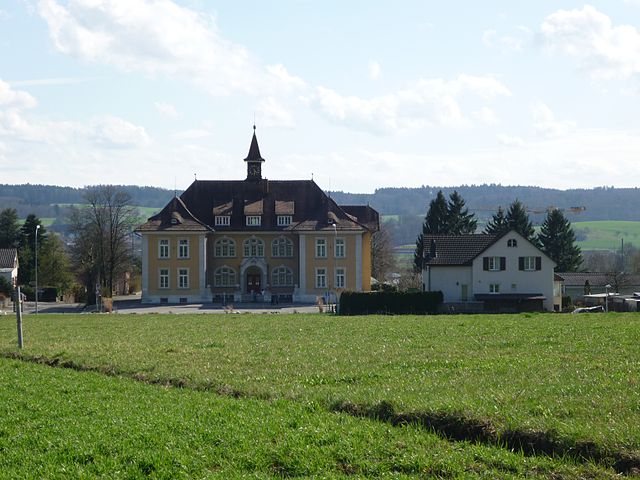
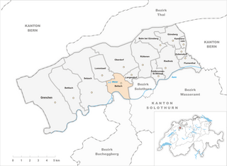
Леберн (Lebern District, Bezirk Lebern)
 Hiking in Леберн
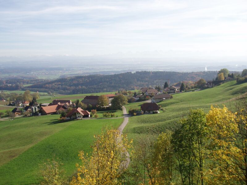
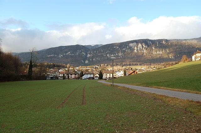
Lebern District, located in Switzerland, is well-known for its stunning landscapes and a variety of hiking trails suitable for different skill levels. Here are some highlights for hiking in this region:
Scenic Trails
-
Hinteres Lebern Trail: This trail takes you through beautiful forests and offers panoramic views of the surrounding mountains. It’s a moderate hike, making it accessible for most hikers.
-
Thun Lake Trail: Following the shores of Lake Thun, this easy-to-moderate trail features breathtaking views of the lake and surrounding peaks. It's perfect for a leisurely hike.
-
Wilderswil to Schynige Platte: Though a bit challenging, this trail rewards hikers with stunning views and opportunities to see local flora and fauna. The Schynige Platte itself offers a fantastic viewpoint.
Preparation Tips
- Gear: Wear sturdy hiking boots and dress in layers. Weather can change quickly in the mountains.
- Navigation: Consider using a map or GPS device, as some trails might not be well-marked.
- Water and Snacks: Always bring plenty of water and energy-boosting snacks, especially for longer hikes.
Local Attractions
- Cultural Stops: Consider visiting local towns and villages along your hike. Many have historical sites and local eateries to explore.
- Wildlife Watching: Keep an eye out for local wildlife such as chamois and various birds that inhabit the region.
Safety Considerations
- Always check the weather forecast before heading out and be prepared for sudden changes.
- Inform someone about your hiking plans and estimated return time.
- Stay on marked trails to protect the local ecosystem and ensure your safety.
Conclusion
Lebern District offers a diverse range of hiking opportunities for both novice and experienced hikers. Whether you are looking for a leisurely stroll or a challenging trek, the area's natural beauty and cultural richness make for an unforgettable experience. Remember to respect nature and leave no trace behind!
- Страна:

- Столица: Гренхен
- Код автомобильного номера: SO
- Координаты: 47° 11' 0" N, 7° 23' 0" E


- GPS треки (wikiloc): [Ссылка]
- Высота над уровнем моря: 532 м m
- Площадь: 117.34 кв.км
- Википедия русская: wiki(ru)
- Википедия английская: wiki(en)
- Википедия национальная: wiki(de)
- Хранилище Wikidata: Wikidata: Q661119
- Катеория в википедии: [Ссылка]
- код Freebase: [/m/0g5g03]
- код GeoNames: Альт: [6458829]
- идентификатор местоположения ArchINFORM: [2489]
- идентификатор HDS: [7717]
Включает регионы:
Беллах
Hiking in Беллах
Bellach is a charming municipality located in the canton of Solothurn, Switzerland, offering a variety of hiking opportunities for outdoor enthusiasts. The region around Bellach features beautiful landscapes, including rolling hills, forests, and stunning views of the surrounding mountains, making it a great base for hiking....
- Страна:
- Почтовый код: 4512
- Телефонный код: 032
- Код автомобильного номера: SO
- Координаты: 47° 12' 54" N, 7° 30' 0" E
- GPS треки (wikiloc): [Ссылка]
- Высота над уровнем моря: 450 м m
- Площадь: 5.31 кв.км
- Население: 5272
- Веб сайт: [Ссылка]


Бетлах
Hiking in Бетлах
Bettlach is a small municipality in the Canton of Solothurn, Switzerland, and while it may not be as widely known as some larger hiking destinations, it offers some lovely trails for outdoor enthusiasts. The area is characterized by its picturesque scenery, rolling hills, and nearby natural attractions, making it a good spot for hiking and enjoying the Swiss countryside....
- Страна:
- Почтовый код: 2544
- Телефонный код: 032
- Код автомобильного номера: SO
- Координаты: 47° 12' 14" N, 7° 25' 30" E
- GPS треки (wikiloc): [Ссылка]
- Высота над уровнем моря: 479 м m
- Площадь: 12.20 кв.км
- Население: 4940
- Веб сайт: [Ссылка]

Бальм-Гюнсберг
- община в Швейцарии
Hiking in Бальм-Гюнсберг
Balm bei Günsberg is a charming area in Switzerland, known for its natural beauty and hiking opportunities. Nestled in the foothills of the Jura mountains, it offers scenic trails that cater to various skill levels and backgrounds. Here are some highlights regarding hiking in the region:...
- Страна:
- Почтовый код: 4525
- Телефонный код: 032
- Код автомобильного номера: SO
- Координаты: 47° 15' 10" N, 7° 33' 29" E
- GPS треки (wikiloc): [Ссылка]
- Высота над уровнем моря: 655 м m
- Площадь: 5.46 кв.км
- Население: 204
- Веб сайт: [Ссылка]


Фельдбруннен-Санкт-Никлаус
Hiking in Фельдбруннен-Санкт-Никлаус
Feldbrunnen-St. Niklaus is a picturesque area in Switzerland, known for its stunning natural landscapes and variety of hiking trails. It is situated near the city of Solothurn and offers access to beautiful views of the Jura Mountains and the surrounding countryside....
- Страна:
- Почтовый код: 4532
- Телефонный код: 032
- Код автомобильного номера: SO
- Координаты: 47° 13' 15" N, 7° 33' 20" E
- GPS треки (wikiloc): [Ссылка]
- Высота над уровнем моря: 452 м m
- Площадь: 2.47 кв.км
- Население: 975
- Веб сайт: [Ссылка]


Ломмисвиль
Hiking in Ломмисвиль
Lommiswil, located in the picturesque region of Switzerland, is surrounded by beautiful landscapes, making it an excellent destination for hiking enthusiasts. Here are some highlights to consider when hiking in and around Lommiswil:...
- Страна:
- Почтовый код: 4514
- Телефонный код: 032
- Код автомобильного номера: SO
- Координаты: 47° 13' 18" N, 7° 28' 16" E
- GPS треки (wikiloc): [Ссылка]
- Высота над уровнем моря: 564 м m
- Площадь: 5.76 кв.км
- Население: 1528
- Веб сайт: [Ссылка]


Ридхольц
Hiking in Ридхольц
Riedholz is a charming municipality located in the Canton of Solothurn in Switzerland. While it may not be as widely known as some of the larger hiking destinations in Switzerland, it offers lovely trails and beautiful scenery for outdoor enthusiasts....
- Страна:
- Почтовый код: 4533
- Телефонный код: 032
- Код автомобильного номера: SO
- Координаты: 47° 13' 55" N, 7° 34' 12" E
- GPS треки (wikiloc): [Ссылка]
- Высота над уровнем моря: 474 м m
- Площадь: 7.20 кв.км
- Население: 2322
- Веб сайт: [Ссылка]


Хуберсдорф
Hiking in Хуберсдорф
Hubersdorf is a charming locality in Switzerland, surrounded by beautiful landscapes ideal for hiking enthusiasts. While specific marked trails can vary, the general area tends to offer a range of hiking opportunities, from easy walks to more challenging treks....
- Страна:
- Почтовый код: 4535
- Телефонный код: 032
- Код автомобильного номера: SO
- Координаты: 47° 14' 36" N, 7° 35' 26" E
- GPS треки (wikiloc): [Ссылка]
- Высота над уровнем моря: 480 м m
- Площадь: 1.40 кв.км
- Население: 742
- Веб сайт: [Ссылка]


Лангендорф
Hiking in Лангендорф
Langendorf, located in the Canton of Bern, Switzerland, is a charming village that serves as a great base for hiking enthusiasts looking to explore the surrounding natural beauty of the region. Here are some key highlights and tips for hiking in and around Langendorf:...
- Страна:
- Почтовый код: 4513
- Телефонный код: 032
- Код автомобильного номера: SO
- Координаты: 47° 13' 14" N, 7° 30' 52" E
- GPS треки (wikiloc): [Ссылка]
- Высота над уровнем моря: 496 м m
- Площадь: 1.93 кв.км
- Население: 3772
- Веб сайт: [Ссылка]


Гюнсберг
Hiking in Гюнсберг
Günsberg is a charming village located in the Swiss canton of Solothurn, known for its scenic landscapes and numerous hiking opportunities. The area around Günsberg offers a range of trails suitable for hikers of various skill levels, making it an excellent destination for outdoor enthusiasts....
- Страна:
- Почтовый код: 4524
- Телефонный код: 032
- Код автомобильного номера: SO
- Координаты: 47° 15' 24" N, 7° 34' 34" E
- GPS треки (wikiloc): [Ссылка]
- Высота над уровнем моря: 624 м m
- Площадь: 5.28 кв.км
- Население: 1166
- Веб сайт: [Ссылка]

Рюттенен
Hiking in Рюттенен
Rüttenen is a small municipality located in the canton of Solothurn in Switzerland, known for its beautiful landscapes and access to nature. Hiking in Rüttenen offers a variety of trails that cater to different skill levels, making it a great destination for both novice and experienced hikers....
- Страна:
- Почтовый код: 4522
- Телефонный код: 032
- Код автомобильного номера: SO
- Координаты: 47° 13' 49" N, 7° 31' 47" E
- GPS треки (wikiloc): [Ссылка]
- Высота над уровнем моря: 516 м m
- Площадь: 8.80 кв.км
- Население: 1495
- Веб сайт: [Ссылка]


Флументаль
Hiking in Флументаль
Flumenthal is a charming area located in the canton of Bern in Switzerland. While it may not be as well-known as other hiking destinations, it offers beautiful landscapes and is a great place for both leisurely walks and more challenging hikes....
- Страна:
- Почтовый код: 4534
- Телефонный код: 032
- Код автомобильного номера: SO
- Координаты: 47° 14' 14" N, 7° 35' 55" E
- GPS треки (wikiloc): [Ссылка]
- Высота над уровнем моря: 430 м m
- Площадь: 3.09 кв.км
- Население: 947
- Веб сайт: [Ссылка]


Каммерсрор
Hiking in Каммерсрор
Kammersrohr is a lesser-known hiking area in Austria, often sought out by local enthusiasts who want to experience the beauty of the Austrian countryside without the crowds. While detailed trail maps and reviews might not be as readily available as for more popular national parks or reserves, here's a general idea of what you can expect when hiking in this region:...
- Страна:
- Почтовый код: 4535
- Телефонный код: 032
- Код автомобильного номера: SO
- Координаты: 47° 15' 12" N, 7° 35' 36" E
- GPS треки (wikiloc): [Ссылка]
- Высота над уровнем моря: 600 м m
- Площадь: 0.94 кв.км
- Население: 29


Зельцах
Hiking in Зельцах
Selzach is a charming village located in the canton of Solothurn in Switzerland. While it may not be as popular as some larger Swiss hiking destinations, it offers a number of scenic trails and opportunities for outdoor enthusiasts to explore the beautiful Swiss landscape....
- Страна:
- Почтовый код: 2545
- Телефонный код: 032
- Код автомобильного номера: SO
- Координаты: 47° 13' 2" N, 7° 26' 54" E
- GPS треки (wikiloc): [Ссылка]
- Высота над уровнем моря: 584 м m
- Площадь: 19.51 кв.км
- Население: 3453
- Веб сайт: [Ссылка]


Гренхен
Hiking in Гренхен
Grenchen, located in the canton of Solothurn in Switzerland, offers some beautiful hiking opportunities that showcase the stunning Swiss landscape. Here are some highlights of hiking in and around Grenchen:...
- Страна:
- Почтовый код: 2540
- Телефонный код: 032
- Код автомобильного номера: SO
- Координаты: 47° 11' 35" N, 7° 23' 45" E
- GPS треки (wikiloc): [Ссылка]
- Высота над уровнем моря: 451 м m
- Площадь: 26.08 кв.км
- Население: 17140
- Веб сайт: [Ссылка]


Обердорф
- община в Швейцарии, Золотурн
Hiking in Обердорф
Oberdorf, located in the Solothurn region of Switzerland, is an excellent destination for hiking enthusiasts. Nestled amidst picturesque landscapes, it offers a variety of trails that cater to different skill levels, making it suitable for beginners and experienced hikers alike....
- Страна:
- Почтовый код: 4515
- Телефонный код: 032
- Код автомобильного номера: SO
- Координаты: 47° 13' 55" N, 7° 30' 15" E
- GPS треки (wikiloc): [Ссылка]
- Высота над уровнем моря: 798 м m
- Площадь: 11.9 кв.км
- Население: 1703
- Веб сайт: [Ссылка]
Граничит с регионами:

Золотурн
Hiking in Золотурн
Bezirk Solothurn, located in the canton of Solothurn in Switzerland, is a beautiful region that offers a variety of hiking trails suitable for both beginners and experienced hikers. The landscape is characterized by rolling hills, forests, and picturesque views of the surrounding mountains. Here are some highlights and tips for hiking in this area:...
- Страна:
- Столица: Золотурн
- Код автомобильного номера: SO
- Координаты: 47° 12' 30" N, 7° 32' 15" E
- GPS треки (wikiloc): [Ссылка]
- Высота над уровнем моря: 434 м m
- Площадь: 6.29 кв.км

Таль
Hiking in Таль
Thal District, located in Pakistan, is known for its stunning landscapes and diverse terrain, making it a great destination for hiking enthusiasts. The district is part of the broader Khyber Pakhtunkhwa province and offers unique opportunities to experience natural beauty, rich culture, and historical sites....
- Страна:
- Столица: Бальсталь
- Код автомобильного номера: SO
- Координаты: 47° 19' 0" N, 7° 41' 40" E
- GPS треки (wikiloc): [Ссылка]
- Высота над уровнем моря: 525 м m
- Площадь: 139.33 кв.км

Вассерамт
Hiking in Вассерамт
Wasseramt District is located in the canton of Solothurn in Switzerland, known for its picturesque landscapes, rolling hills, and access to various hiking trails. Here are some highlights and tips for hiking in the Wasseramt District:...
- Страна:
- Столица: Кригштеттен
- Код автомобильного номера: SO
- Координаты: 47° 10' 0" N, 7° 35' 0" E
- GPS треки (wikiloc): [Ссылка]
- Высота над уровнем моря: 444 м m
- Площадь: 76.62 кв.км


Бухегберг
Hiking in Бухегберг
Bucheggberg District, located in the canton of Solothurn in Switzerland, offers a beautiful landscape for hiking enthusiasts. This charming region is characterized by rolling hills, lovely vineyards, and picturesque villages. Here’s what you can expect when hiking in Bucheggberg:...
- Страна:
- Код автомобильного номера: SO
- Координаты: 47° 8' 0" N, 7° 28' 0" E
- GPS треки (wikiloc): [Ссылка]
- Высота над уровнем моря: 616 м m
- Площадь: 62.86 кв.км